Hundred, West Virginia

Last updated

Hundred, West Virginia
Hundred Cleveland Street.jpg
Cleveland Street houses
Logo of Hundred, West Virginia.png
Wetzel County West Virginia Incorporated and Unincorporated areas Hundred Highlighted.svg
Location of Hundred in Wetzel County, West Virginia.
Coordinates: 39°41′3″N80°27′26″W / 39.68417°N 80.45722°W / 39.68417; -80.45722
Country United States
State West Virginia
County Wetzel
Area
[1]
  Total0.50 sq mi (1.30 km2)
  Land0.50 sq mi (1.30 km2)
  Water0.00 sq mi (0.00 km2)
Elevation
1,027 ft (313 m)
Population
 (2020) [2]
  Total257
  Estimate 
(2021) [2]
248
  Density521.91/sq mi (201.45/km2)
Time zone UTC-5 (Eastern (EST))
  Summer (DST) UTC-4 (EDT)
ZIP code
26575
Area code 304
FIPS code 54-39340 [3]
GNIS feature ID1540584 [4]
Website https://www.townofhundred.org/
Sign in Hundred, WV HundredWVASign.jpg
Sign in Hundred, WV

Hundred is a town in Wetzel County, West Virginia, United States. The population was 257 at the 2020 census. [2] It was named for the fact that local resident Henry "Old Hundred" Church was a centenarian. [5] Hundred is the only place in the United States with this name.

Contents

Routes

Hundred lies on three main routes, two of them being West Virginia state routes. U.S. Route 250 spreads across the entire length of the town.

West Virginia Route 69 intersects from U.S. 250 and leads to the Pennsylvania state line where it becomes Pennsylvania Route 18, and West Virginia Route 7 intersects from U.S. 250 towards other areas in the county and the state.

History

The community was named in honor of Henry "Old Hundred" Church (1751-1860) and his wife Hannah Church (1754-1860), who were both local centenarians. [6]

Geography

According to the United States Census Bureau, the town has a total area of 0.50 square miles (1.29 km2), all land. [7]

Demographics

Historical population
CensusPop.Note
1900 261
1910 557113.4%
1920 71027.5%
1930 78811.0%
1940 706−10.4%
1950 587−16.9%
1960 475−19.1%
1970 4750.0%
1980 4852.1%
1990 386−20.4%
2000 344−10.9%
2010 299−13.1%
2020 257−14.0%
2021 (est.)248 [2] −3.5%
U.S. Decennial Census [8]

2010 census

At the 2010 census there were 299 people, 136 households, and 80 families living in the town. The population density was 598.0 inhabitants per square mile (230.9/km2). There were 186 housing units at an average density of 372.0 per square mile (143.6/km2). The racial makeup of the town was 99.0% White and 1.0% from two or more races. Hispanic or Latino of any race were 1.3%. [9]

Of the 136 households 25.7% had children under the age of 18 living with them, 41.2% were married couples living together, 10.3% had a female householder with no husband present, 7.4% had a male householder with no wife present, and 41.2% were non-families. 37.5% of households were one person and 17.6% were one person aged 65 or older. The average household size was 2.20 and the average family size was 2.86.

The median age in the town was 44.1 years. 21.4% of residents were under the age of 18; 9.4% were between the ages of 18 and 24; 20.4% were from 25 to 44; 30.1% were from 45 to 64; and 18.7% were 65 or older. The gender makeup of the town was 50.2% male and 49.8% female.

2000 census

At the 2000 census there were 344 people, 146 households, and 83 families living in the town. The population density was 735.8 inhabitants per square mile (282.6/km2). There were 178 housing units at an average density of 380.7 per square mile (146.2/km2). The racial makeup of the town was 97.67% White, 0.87% African American, and 1.45% from two or more races. [3]

Hundred High School Hundred High School from highway.jpg
Hundred High School

Of the 146 households 30.1% had children under the age of 18 living with them, 42.5% were married couples living together, 11.6% had a female householder with no husband present, and 42.5% were non-families. 37.7% of households were one person and 20.5% were one person aged 65 or older. The average household size was 2.36 and the average family size was 3.11.

The age distribution was 25.6% under the age of 18, 6.1% from 18 to 24, 24.1% from 25 to 44, 24.7% from 45 to 64, and 19.5% 65 or older. The median age was 43 years. For every 100 females there were 85.9 males. For every 100 females age 18 and over, there were 86.9 males.

The median household income was $25,192 and the median family income was $26,731. Males had a median income of $31,250 versus $18,750 for females. The per capita income for the town was $12,395. About 26.3% of families and 33.6% of the population were below the poverty line, including 30.0% of those under age 18 and 35.2% of those age 65 or over.

Education

Hundred has two schools that serve the town, as well as other neighboring areas. These schools are Long Drain School, which serves as the elementary and middle schools, and Hundred High School, which serves as the high school. Hundred recognizes themselves as the Hundred Hornets, which is Hundred's team name for sports-related activities.

Notable people

See also

Related Research Articles

<span class="mw-page-title-main">Hedgesville, West Virginia</span> Town in West Virginia, United States

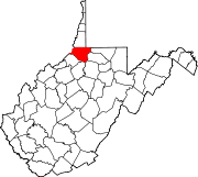
Hedgesville is a town in Berkeley County, West Virginia, United States, in the state's Eastern Panhandle region. The population was 318 at the 2010 census. The town sits on WV 9, roughly 13 miles east of Berkeley Springs. In addition to its legal definition, Hedgesville has come to be the common name for the large and sparsely inhabited area of West Virginia's Eastern Panhandle bordered by the Potomac River to the North and East, a southern border defined roughly by an imaginary line from the city of Martinsburg to the tip of Virginia, and Berkeley Springs to the West.

<span class="mw-page-title-main">Danville, West Virginia</span> Town in West Virginia, United States

Danville is a town in Boone County, West Virginia, United States. The population was 660 at the 2020 census. Danville was incorporated in 1911 and named for Dan Rock, the town's first postmaster. Danville was formerly known as Newport and Red House.

<span class="mw-page-title-main">Sylvester, West Virginia</span> Town in West Virginia, United States

Sylvester is a town in Boone County, West Virginia, United States, along the Big Coal River. The population was 166 at the 2020 census. Sylvester was incorporated on April 11, 1952, by the Boone County Circuit Court. Sylvester bears the name of a family of settlers.

<span class="mw-page-title-main">Whitesville, West Virginia</span> Town in West Virginia, United States

Whitesville is a town and former coal town in Boone County, West Virginia, United States, along the Big Coal River. The population was 361 at the 2020 census. Whitesville was incorporated on August 15, 1935, by the Boone County Circuit Court. The town derives its name from B. W. White, a pioneer settler. Whitesville was formerly known as Jarrold's Valley and Pritchard City.

<span class="mw-page-title-main">Gauley Bridge, West Virginia</span> Town in West Virginia, United States

Gauley Bridge is a town in Fayette County, West Virginia, United States. The population was 614 at the 2010 census. The Kanawha River is formed at Gauley Bridge by the confluence of the New and Gauley Rivers. Two miles to the southwest of Gauley Bridge, in Glen Ferris, is Kanawha Falls, a popular stopping point on Midland Trail Scenic Highway.

<span class="mw-page-title-main">Bayard, West Virginia</span> Town in West Virginia, United States

Bayard is a town in Grant County, West Virginia, United States. The population was 200 at the 2020 census. Bayard was incorporated in 1893 and named in honor of Thomas F. Bayard, Jr., who later became a United States senator from Delaware (1923–1929). Bayard was founded on the West Virginia Central and Pittsburgh Railroad as a coal mining community. Coal mining has remained the town's chief industry.

<span class="mw-page-title-main">Capon Bridge, West Virginia</span> Town in West Virginia, United States

Capon Bridge is a town in eastern Hampshire County, West Virginia, United States, along the Northwestern Turnpike, approximately 20 miles (32 km) west of Winchester, Virginia. The population was 418 at the 2020 census. Originally known as "Glencoe", Capon Bridge was incorporated in 1902 by the Hampshire County Circuit Court. It is named because of the construction of the bridge over the Cacapon River at that place, the name of the river being derived from the Shawnee Cape-cape-de-hon, meaning "river of medicine water".

<span class="mw-page-title-main">Bolivar, West Virginia</span> Town in West Virginia, United States

Bolivar is a town in Jefferson County, West Virginia, United States. The population was 1,072 at the 2020 census. The town is named for South American revolutionary leader Simón Bolívar. Located in West Virginia's Eastern Panhandle, it is part of the northwestern fringes of the Washington metropolitan area.

<span class="mw-page-title-main">Mitchell Heights, West Virginia</span> Town in West Virginia, United States

Mitchell Heights is a town in Logan County, West Virginia, United States. The population was 315 at the 2020 census. The town was named for an early farm on which it was established.

<span class="mw-page-title-main">West Logan, West Virginia</span> Town in West Virginia, United States

West Logan is a town along the Guyandotte River in Logan County, West Virginia, United States. The population was 400 at the 2020 census. For unknown reasons, some sources report West Logan to lay west of the county seat at Logan, attributing to this fact the name.

<span class="mw-page-title-main">Worthington, West Virginia</span> Town in West Virginia, United States

Worthington is a town in Marion County, West Virginia, United States. The population was 158 at the 2010 census. Worthington was incorporated in 1893 and named for Colonel George Worthington, an early settler. U.S. Route 19 passes through the town.

<span class="mw-page-title-main">Northfork, West Virginia</span> Town in West Virginia, United States

Northfork is a town in McDowell County, West Virginia, United States, located on U.S. Route 52 between Welch and Bluefield.

<span class="mw-page-title-main">Oakvale, West Virginia</span> Town in West Virginia, United States

Oakvale is a town in Mercer County, West Virginia, United States, along the East River. The population was 137 at the 2020 census. It is part of the Bluefield, WV-VA micropolitan area which has a population of 107,578.

<span class="mw-page-title-main">Carpendale, West Virginia</span> Town in West Virginia, United States

Carpendale is a town in Mineral County, West Virginia, United States, and part of the Cumberland, MD-WV Metropolitan Statistical Area'. The population was 861 at the 2020 census. Carpendale was incorporated on January 2, 1990, by the Circuit Court. The town is a combination of three subdivisions of which its name reflects: Carpenters Addition, Millerdale I, and Millerdale II. There are no stores in Carpendale and there is only one road in and out of the town.

<span class="mw-page-title-main">Elk Garden, West Virginia</span> Town in West Virginia, United States

Elk Garden is a town in Mineral County, West Virginia, United States. It is part of the 'Cumberland, MD-WV Metropolitan Statistical Area'. The population was 211 at the 2020 census. Elk Garden High School was consolidated into Keyser High School in 1997. However the Primary School is still in session, offering classes from Pre-Kindergarten through the fifth grade. The school mascot is the Elk Garden Stags. Elk Garden was incorporated in 1890 by the Mineral County Circuit Court. It is named for an elk lick near the original town site.

<span class="mw-page-title-main">Lester, West Virginia</span> Town in West Virginia, United States

Lester is a town in Raleigh County, West Virginia, United States. The population was 337 at the 2020 census. The community was named after Champ Lester, a local pioneer.

<span class="mw-page-title-main">Harman, West Virginia</span> Town in West Virginia, United States

Harman is a town in Randolph County, West Virginia, United States. The population was 96 at the 2020 census.

<span class="mw-page-title-main">Cairo, West Virginia</span> Town in West Virginia, United States

Cairo is a town in Ritchie County, West Virginia, United States, along West Virginia Route 31, the North Fork of the Hughes River, and the North Bend Rail Trail. The population was 174 at the 2020 census.

<span class="mw-page-title-main">Ellenboro, West Virginia</span> Town in West Virginia, United States

Ellenboro is a town in Ritchie County, West Virginia, United States. The population was 222 at the 2020 census. The town is located at the junction of U.S. Route 50 and West Virginia Route 16; the North Bend Rail Trail also passes through the town. The town was named for Ellen Mariah Williamson, the eldest daughter of the family that granted a right of way for the Baltimore and Ohio Railroad to build their line through the town; an earlier name for the community was Shumley. Ellenboro was incorporated in 1903.

<span class="mw-page-title-main">Pennsboro, West Virginia</span> City in West Virginia, United States

Pennsboro is a city in Ritchie County, West Virginia, United States. The population was 1,050 at the 2020 census. The city is located at the junction of U.S. Route 50 and West Virginia Route 74; the North Bend Rail Trail also passes through the city.

References

  1. "2019 U.S. Gazetteer Files". United States Census Bureau. Retrieved August 7, 2020.
  2. 1 2 3 4 Bureau, US Census. "City and Town Population Totals: 2020-2021". Census.gov. US Census Bureau. Retrieved July 2, 2022.
  3. 1 2 "U.S. Census website". United States Census Bureau . Retrieved January 31, 2008.
  4. "US Board on Geographic Names". United States Geological Survey. October 25, 2007. Retrieved January 31, 2008.
  5. Kenny, Hamill (1945). West Virginia Place Names: Their Origin and Meaning, Including the Nomenclature of the Streams and Mountains. Piedmont, WV: The Place Name Press. p. 317.
  6. Moyer, Armond; Moyer, Winifred (1958). The origins of unusual place-names. Keystone Pub. Associates. p. 65.
  7. "US Gazetteer files 2010". United States Census Bureau. Archived from the original on January 12, 2012. Retrieved January 24, 2013.
  8. "Census of Population and Housing". Census.gov. Retrieved June 4, 2015.
  9. "U.S. Census website". United States Census Bureau . Retrieved January 24, 2013.
  10. "Lee King Statistics and History". Baseball-Reference.com. Retrieved September 10, 2016.