Lester, West Virginia

Last updated

Lester, West Virginia
Lester-City-Hall-wv.jpg
City Hall in Lester
Logo of Lester, West Virginia.svg
Raleigh County West Virginia Incorporated and Unincorporated areas Lester Highlighted.svg
Location of Lester in Raleigh County, West Virginia.
Coordinates: 37°44′06″N81°18′05″W / 37.73500°N 81.30139°W / 37.73500; -81.30139
Country United States
State West Virginia
County Raleigh
Area
[1]
  Total0.50 sq mi (1.30 km2)
  Land0.50 sq mi (1.30 km2)
  Water0.00 sq mi (0.00 km2)
Elevation
[2]
2,031 ft (619 m)
Population
 (2020) [3]
  Total337
  Estimate 
(2021) [3]
333
  Density626.75/sq mi (241.86/km2)
Time zone UTC-5 (Eastern (EST))
  Summer (DST) UTC-4 (EDT)
ZIP code
25865
Area code 304
FIPS code 54-46468 [4]
GNIS feature ID2391270 [2]

Lester is a town in Raleigh County, West Virginia, United States. The population was 337 at the 2020 census. [3] The community was named after Champ Lester, a local pioneer. [5]

Contents

Geography

Lester is located at 37°44′5″N81°18′4″W / 37.73472°N 81.30111°W / 37.73472; -81.30111 (37.734740, -81.300985). [6] The town is situated along Surveyor Creek, which is part of the Coal River watershed, and is concentrated around the intersection of state routes 97 and 305. The latter highway connects the town with the Beckley area a few miles to the east.

According to the United States Census Bureau, the town has a total area of 0.50 square miles (1.29 km2), all land. [7]

Demographics

Historical population
CensusPop.Note
1920 412
1930 60947.8%
1940 90949.3%
1950 780−14.2%
1960 626−19.7%
1970 507−19.0%
1980 62623.5%
1990 420−32.9%
2000 322−23.3%
2010 3488.1%
2020 337−3.2%
2021 (est.)333 [3] −1.2%
U.S. Decennial Census [8]

2010 census

At the 2010 census there were 348 people, 143 households, and 95 families living in the town. The population density was 696.0 inhabitants per square mile (268.7/km2). There were 175 housing units at an average density of 350.0 per square mile (135.1/km2). The racial makeup of the town was 83.9% White, 13.8% African American, 0.3% Native American, and 2.0% from two or more races. Hispanic or Latino of any race were 0.3%. [9]

Of the 143 households 31.5% had children under the age of 18 living with them, 51.0% were married couples living together, 8.4% had a female householder with no husband present, 7.0% had a male householder with no wife present, and 33.6% were non-families. 28.7% of households were one person and 15.4% were one person aged 65 or older. The average household size was 2.43 and the average family size was 2.89.

The median age in the town was 40.1 years. 25.3% of residents were under the age of 18; 6.3% were between the ages of 18 and 24; 25% were from 25 to 44; 25.3% were from 45 to 64; and 18.1% were 65 or older. The gender makeup of the town was 49.1% male and 50.9% female.

2000 census

At the 2000 census there were 322 people, 142 households, and 89 families living in the town. The population density was 650.5 inhabitants per square mile (248.6/km2). There were 168 housing units at an average density of 339.4 per square mile (129.7/km2). The racial makeup of the town was 79.81% White, 19.88% African American, and 0.31% from two or more races. [4] Of the 142 households 23.9% had children under the age of 18 living with them, 47.2% were married couples living together, 11.3% had a female householder with no husband present, and 37.3% were non-families. 33.1% of households were one person and 19.0% were one person aged 65 or older. The average household size was 2.27 and the average family size was 2.91.

The age distribution was 20.2% under the age of 18, 9.3% from 18 to 24, 26.1% from 25 to 44, 27.3% from 45 to 64, and 17.1% 65 or older. The median age was 42 years. For every 100 females, there were 86.1 males. For every 100 females age 18 and over, there were 79.7 males.

The median household income was $24,375 and the median family income was $30,938. Males had a median income of $25,208 versus $18,125 for females. The per capita income for the town was $11,026. About 14.6% of families and 15.7% of the population were below the poverty line, including 19.7% of those under age 18 and 19.7% of those age 65 or over.

Related Research Articles

<span class="mw-page-title-main">Linden, Alabama</span> City in Alabama, United States

Linden is a city in and the county seat of Marengo County, Alabama, United States. The population was 1,930 at the 2020 census, down from 2,123 at the 2010 census.

<span class="mw-page-title-main">Astatula, Florida</span> Town in the state of Florida, United States

Astatula is a town in Lake County, Florida, United States. The population was 1,889 at the 2020 census. It is part of the Orlando–Kissimmee–Sanford Metropolitan Statistical Area.

<span class="mw-page-title-main">Chesterville, Maine</span> Town in Maine, United States

Chesterville is a town in Franklin County, Maine, United States. The population was 1,328 at the 2020 census.

New Vineyard is a town in Franklin County, Maine, United States. The population was 721 at the 2020 census.

Otis is a town in Hancock County, Maine, United States. The population was 673 at the 2020 census.

Moose River is a town in Somerset County, Maine, United States. The population was 188 at the 2020 census. It was first settled by Capt. Samuel Holden who in 1820 opened an inn as a stop for cattle drivers en route from Boston to Quebec.

<span class="mw-page-title-main">Brooks, Maine</span> Town in the state of Maine, United States

Brooks is a town in Waldo County, Maine, United States. The population was 1,010 at the 2020 census.

<span class="mw-page-title-main">Richville, Minnesota</span> City in Minnesota, United States

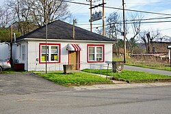
Richville is a city in Otter Tail County, Minnesota, United States. The population was 77 as of the 2020 census.

Amity Gardens is a census-designated place (CDP) in Amity Township, Berks County, Pennsylvania. As of the 2020 census, the CDP had a total population of 3,715. The town lends its name to a Fountains of Wayne song.

<span class="mw-page-title-main">Whitesville, West Virginia</span> Town in West Virginia, United States

Whitesville is a town and former coal town in Boone County, West Virginia, United States, along the Big Coal River. The population was 361 at the 2020 census. Whitesville was incorporated on August 15, 1935, by the Boone County Circuit Court. The town derives its name from B. W. White, a pioneer settler. Whitesville was formerly known as Jarrold's Valley and Pritchard City.

<span class="mw-page-title-main">Mitchell Heights, West Virginia</span> Town in West Virginia, United States

Mitchell Heights is a town in Logan County, West Virginia, United States. The population was 315 at the 2020 census. The town was named for an early farm on which it was established.

<span class="mw-page-title-main">West Logan, West Virginia</span> Town in West Virginia, United States

West Logan is a town along the Guyandotte River in Logan County, West Virginia, United States. The population was 400 at the 2020 census. For unknown reasons, some sources report West Logan to lay west of the county seat at Logan, attributing to this fact the name.

<span class="mw-page-title-main">Leon, West Virginia</span> Town in West Virginia, United States

Leon is a town in Mason County, West Virginia, United States, situated along the Kanawha River. The population was 137 at the 2020 census. It is part of the Point Pleasant, WV–OH Micropolitan Statistical Area.

<span class="mw-page-title-main">New Haven, West Virginia</span> Town in West Virginia, United States

New Haven is a town in Mason County, West Virginia, United States, along the Ohio River. The population was 1,485 at the 2020 census. It is part of the Point Pleasant, WV–OH Micropolitan Statistical Area.

<span class="mw-page-title-main">Matoaka, West Virginia</span> Census-designated place in West Virginia, United States

Matoaka is a census-designated place in Mercer County, West Virginia, United States. The population was 173 at the 2020 census. It is part of the Bluefield, WV-VA micropolitan area which has a population of 100,093. This town is named for Chief Powhatan's daughter Matoaka who was better known by her nickname "Pocahontas". Matoaka became an unincorporated town when it voted to dissolve its charter in May 2018.

<span class="mw-page-title-main">Granville, West Virginia</span> Town in West Virginia

Granville is a town in Monongalia County, West Virginia, United States. The population was 1,355 at the 2020 census. It is included in the Morgantown metropolitan area.

<span class="mw-page-title-main">Bancroft, West Virginia</span> Town in West Virginia, United States

Bancroft is a town in Putnam County, West Virginia, United States, along the Kanawha River. The population was 389 at the 2020 census. It is part of the Huntington–Ashland metropolitan area.

<span class="mw-page-title-main">Friendly, West Virginia</span> Town in West Virginia, United States

Friendly is a town in Tyler County, West Virginia, United States. The population was 100 at the 2020 census.

<span class="mw-page-title-main">Elizabeth, West Virginia</span> Town in West Virginia, United States

Elizabeth is a town in and the county seat of Wirt County, West Virginia, United States, situated along the Little Kanawha River. The population was 724 as of the 2020 census.

<span class="mw-page-title-main">Oceana, West Virginia</span> Town in West Virginia, United States

Oceana is a town in Wyoming County, West Virginia. The population was 1,462 at the time of the 2020 census. Oceana is the oldest city in Wyoming County and was the county seat until 1907.

References

  1. "2019 U.S. Gazetteer Files". United States Census Bureau. Retrieved August 7, 2020.
  2. 1 2 U.S. Geological Survey Geographic Names Information System: Lester, West Virginia
  3. 1 2 3 4 "City and Town Population Totals: 2020-2021". Census.gov. US Census Bureau. Retrieved July 3, 2022.
  4. 1 2 "U.S. Census website". United States Census Bureau . Retrieved January 31, 2008.
  5. Kenny, Hamill (1945). West Virginia Place Names: Their Origin and Meaning, Including the Nomenclature of the Streams and Mountains. Piedmont, WV: The Place Name Press. p. 369.
  6. "US Gazetteer files: 2010, 2000, and 1990". United States Census Bureau. February 12, 2011. Retrieved April 23, 2011.
  7. "US Gazetteer files 2010". United States Census Bureau. Archived from the original on January 12, 2012. Retrieved January 24, 2013.
  8. "Census of Population and Housing". Census.gov. Retrieved June 4, 2015.
  9. "U.S. Census website". United States Census Bureau . Retrieved January 24, 2013.