Middlebourne, West Virginia

Last updated

Middlebourne, West Virginia
Middlebourne West Virginia.jpg
Main Street in Middlebourne in 2006
Seal of Middlebourne, West Virginia.png
Tyler County West Virginia Incorporated and Unincorporated areas Middlebourne Highlighted.svg
Location of Middlebourne in Tyler County, West Virginia.
Coordinates: 39°29′38″N80°54′21″W / 39.49389°N 80.90583°W / 39.49389; -80.90583
Country United States
State West Virginia
County Tyler
Area
[1]
  Total0.38 sq mi (0.98 km2)
  Land0.36 sq mi (0.93 km2)
  Water0.02 sq mi (0.04 km2)
Elevation
735 ft (224 m)
Population
 (2020) [2]
  Total715
  Estimate 
(2021) [2]
700
  Density2,044.32/sq mi (789.98/km2)
Time zone UTC-5 (Eastern (EST))
  Summer (DST) UTC-4 (EDT)
ZIP code
26149
Area code 304
FIPS code 54-53572 [3]
GNIS feature ID1543226 [4]
Website middlebourne.wv.gov/Pages/default.aspx
The Tyler County Courthouse in Middlebourne in 2006 Tyler County Courthouse WV.jpg
The Tyler County Courthouse in Middlebourne in 2006

Middlebourne is a town and the county seat of Tyler County, West Virginia, United States. [5] The population was 715 at the 2020 census. [2]

Contents

History

Middlebourne was established by an enactment of the Virginia General Assembly in 1813. [6] Two explanations have been given for the name of the town: One is that it was located halfway between Pennsylvania and a series of salt wells along the Kanawha River upstream of Charleston; the other is that it is located midway between the source and the mouth of Middle Island Creek, [6] which flows through the town. [7]

The Tyler County Courthouse and Jail is listed on the National Register of Historic Places.

Geography

Middlebourne is located at 39°29′38″N80°54′21″W / 39.49389°N 80.90583°W / 39.49389; -80.90583 (39.493966, -80.905751). [8]

According to the United States Census Bureau, the town has a total area of 0.38 square miles (0.98 km2), of which 0.36 square miles (0.93 km2) is land and 0.02 square miles (0.05 km2) is water. [9]

Climate

The climate in this area is characterized by hot, humid summers and cold winters. According to the Köppen Climate Classification system, Middlebourne has a humid continental climate, abbreviated "Cfd" on climate maps. [10]

Climate data for Middlebourne, West Virginia (1991–2020 normals, extremes 1941–present)
MonthJanFebMarAprMayJunJulAugSepOctNovDecYear
Record high °F (°C)79
(26)
80
(27)
87
(31)
92
(33)
96
(36)
98
(37)
103
(39)
101
(38)
103
(39)
93
(34)
85
(29)
78
(26)
103
(39)
Mean maximum °F (°C)64.8
(18.2)
66.9
(19.4)
76.3
(24.6)
84.1
(28.9)
87.2
(30.7)
90.5
(32.5)
91.9
(33.3)
90.9
(32.7)
89.2
(31.8)
82.2
(27.9)
75.0
(23.9)
65.7
(18.7)
92.9
(33.8)
Mean daily maximum °F (°C)39.1
(3.9)
42.7
(5.9)
52.4
(11.3)
65.4
(18.6)
73.8
(23.2)
80.8
(27.1)
84.1
(28.9)
83.2
(28.4)
77.4
(25.2)
66.0
(18.9)
53.7
(12.1)
43.5
(6.4)
63.5
(17.5)
Daily mean °F (°C)29.3
(−1.5)
31.9
(−0.1)
40.1
(4.5)
51.2
(10.7)
60.7
(15.9)
68.6
(20.3)
72.6
(22.6)
71.4
(21.9)
64.8
(18.2)
53.0
(11.7)
41.9
(5.5)
34.1
(1.2)
51.6
(10.9)
Mean daily minimum °F (°C)19.4
(−7.0)
21.1
(−6.1)
27.8
(−2.3)
36.9
(2.7)
47.6
(8.7)
56.4
(13.6)
61.1
(16.2)
59.6
(15.3)
52.1
(11.2)
39.9
(4.4)
30.1
(−1.1)
24.8
(−4.0)
39.7
(4.3)
Mean minimum °F (°C)−2.5
(−19.2)
2.2
(−16.6)
11.4
(−11.4)
22.9
(−5.1)
32.6
(0.3)
43.4
(6.3)
50.9
(10.5)
50.0
(10.0)
39.2
(4.0)
26.8
(−2.9)
16.6
(−8.6)
7.2
(−13.8)
−6.2
(−21.2)
Record low °F (°C)−34
(−37)
−18
(−28)
−14
(−26)
10
(−12)
22
(−6)
31
(−1)
37
(3)
38
(3)
28
(−2)
15
(−9)
−1
(−18)
−21
(−29)
−34
(−37)
Average precipitation inches (mm)3.67
(93)
3.28
(83)
4.03
(102)
3.92
(100)
4.51
(115)
4.87
(124)
5.10
(130)
4.02
(102)
3.68
(93)
3.28
(83)
3.07
(78)
3.84
(98)
47.27
(1,201)
Average snowfall inches (cm)11.0
(28)
7.7
(20)
4.1
(10)
0.1
(0.25)
0.0
(0.0)
0.0
(0.0)
0.0
(0.0)
0.0
(0.0)
0.0
(0.0)
0.0
(0.0)
0.5
(1.3)
3.9
(9.9)
27.3
(69)
Average precipitation days (≥ 0.01 in)15.212.812.613.013.412.311.710.39.210.210.814.0145.5
Average snowy days (≥ 0.1 in)7.45.32.20.20.00.00.00.00.00.10.74.120.0
Source: NOAA [11] [12]

Demographics

Historical population
CensusPop.Note
1860 247
1870 182−26.3%
1880 24132.4%
1900 403
1910 54034.0%
1920 92972.0%
1930 769−17.2%
1940 733−4.7%
1950 7411.1%
1960 711−4.0%
1970 81414.5%
1980 94115.6%
1990 922−2.0%
2000 870−5.6%
2010 815−6.3%
2020 715−12.3%
2021 (est.)700 [2] −2.1%
U.S. Decennial Census [13]

2010 census

At the 2010 census there were 815 people, 360 households, and 228 families living in the town. The population density was 2,263.9 inhabitants per square mile (874.1/km2). There were 405 housing units at an average density of 1,125.0 per square mile (434.4/km2). The racial makeup of the town was 99.3% White and 0.7% from two or more races. Hispanic or Latino of any race were 0.2%. [14]

Of the 360 households 27.8% had children under the age of 18 living with them, 47.2% were married couples living together, 11.7% had a female householder with no husband present, 4.4% had a male householder with no wife present, and 36.7% were non-families. 35.3% of households were one person and 14.2% were one person aged 65 or older. The average household size was 2.25 and the average family size was 2.87.

The median age in the town was 42.5 years. 23.7% of residents were under the age of 18; 6.4% were between the ages of 18 and 24; 22.7% were from 25 to 44; 29% were from 45 to 64; and 18% were 65 or older. The gender makeup of the town was 46.0% male and 54.0% female.

2000 census

At the 2000 census there were 870 people, 370 households, and 247 families living in the town. The population density was 2,320.0 inhabitants per square mile (907.9/km2). There were 402 housing units at an average density of 1,072.0 per square mile (419.5/km2). The racial makeup of the town was 99.54% White, and 0.46% from two or more races. [3] Of the 370 households 30.0% had children under the age of 18 living with them, 51.9% were married couples living together, 11.9% had a female householder with no husband present, and 33.2% were non-families. 31.4% of households were one person and 16.8% were one person aged 65 or older. The average household size was 2.31 and the average family size was 2.89.

The age distribution was 23.3% under the age of 18, 7.5% from 18 to 24, 25.1% from 25 to 44, 28.7% from 45 to 64, and 15.4% 65 or older. The median age was 42 years. For every 100 females, there were 85.1 males. For every 100 females age 18 and over, there were 80.3 males.

The median household income was $128,704 and the median family income was $40,893. Males had a median income of $35,000 versus $19,167 for females. The per capita income for the town was $14,673. About 12.6% of families and 13.9% of the population were below the poverty line, including 18.3% of those under age 18 and 11.9% of those age 65 or over.

Related Research Articles

<span class="mw-page-title-main">Tyler County, West Virginia</span> County in West Virginia, United States

Tyler County is a county in the U.S. state of West Virginia. As of the 2020 census, the population was 8,313. Its county seat is Middlebourne. The county was founded in 1814 and is named after John Tyler, Sr., father of President John Tyler.

<span class="mw-page-title-main">Pembroke, Virginia</span> Town in Virginia, United States

Pembroke is a town in Giles County, Virginia, United States. The population was 1,128 at the 2010 census. It is part of the Blacksburg–Christiansburg Metropolitan Statistical Area.

<span class="mw-page-title-main">Wakefield, Virginia</span> Town in Virginia, United States

Wakefield is an incorporated town in Sussex County, Virginia, United States. Per the 2020 census, the population was 729.

<span class="mw-page-title-main">Grantsville, West Virginia</span> Town in West Virginia, United States

Grantsville is a town in Calhoun County, West Virginia, United States. The population was 482 at the 2020 census. It is the county seat of Calhoun County. The town was established along the Little Kanawha River in 1865 and named for Ulysses S. Grant. Grantsville is home to Wayne Underwood Park, which includes a .25-mile-long (0.40 km) walking trail, and to the annual West Virginia Wood Festival.

<span class="mw-page-title-main">Bayard, West Virginia</span> Town in West Virginia, United States

Bayard is a town in Grant County, West Virginia, United States. The population was 200 at the 2020 census. Bayard was incorporated in 1893 and named in honor of Thomas F. Bayard, Jr., who later became a United States senator from Delaware (1923–1929). Bayard was founded on the West Virginia Central and Pittsburgh Railroad as a coal mining community. Coal mining has remained the town's chief industry.

<span class="mw-page-title-main">West Milford, West Virginia</span> Town in West Virginia, United States

West Milford is a town in Harrison County, West Virginia, United States. The population was 452 at the 2020 census.

<span class="mw-page-title-main">Hamlin, West Virginia</span> Town in West Virginia, United States

Hamlin is a town in and the county seat of Lincoln County, West Virginia, United States, along the Mud River. The population was recorded as 1,040 at the 2020 census. It is part of the Huntington–Ashland metropolitan area.

<span class="mw-page-title-main">Man, West Virginia</span> Town in West Virginia, United States

Man is a town in Logan County, West Virginia, United States. The population was 772 at the 2020 census. The town is located along the Guyandotte River at the mouth of Buffalo Creek, which was the site of the 1972 Buffalo Creek Flood following a dam collapse. The name of the town reportedly derives from the last syllable of the surname of Ulysses Hinchman, who was a member of the House of Delegates from Logan County between 1866 and 1869.

<span class="mw-page-title-main">Worthington, West Virginia</span> Town in West Virginia, United States

Worthington is a town in Marion County, West Virginia, United States. The population was 158 at the 2010 census. Worthington was incorporated in 1893 and named for Colonel George Worthington, an early settler. U.S. Route 19 passes through the town.

<span class="mw-page-title-main">Athens, West Virginia</span> Town in West Virginia, United States

Athens is a town in Mercer County, West Virginia, United States. The population was 944 at the 2020 census. It is part of the Bluefield, WV-VA micropolitan area which has a population of 107,578. Athens is the home of Concord University.

<span class="mw-page-title-main">Matoaka, West Virginia</span> Census-designated place in West Virginia, United States

Matoaka is a census-designated place in Mercer County, West Virginia, United States. The population was 173 at the 2020 census. It is part of the Bluefield, WV-VA micropolitan area which has a population of 100,093. This town is named for Chief Powhatan's daughter Matoaka who was better known by her nickname "Pocahontas". Matoaka became an unincorporated town when it voted to dissolve its charter in May 2018.

<span class="mw-page-title-main">Albright, West Virginia</span> Town in West Virginia, United States

Albright is a town in central Preston County, West Virginia, United States, along the Cheat River. The population was 260 at the 2020 census. A former coal town, it is part of the Morgantown metropolitan area.

<span class="mw-page-title-main">Bruceton Mills, West Virginia</span> Town in West Virginia, United States

Bruceton Mills is a town in northern Preston County, West Virginia, United States, along Big Sandy Creek. The population was 64 at the 2020 census, making it the second-least populous town in West Virginia, after Thurmond. It is part of the Morgantown metropolitan area.

<span class="mw-page-title-main">Rowlesburg, West Virginia</span> Town in West Virginia, United States

Rowlesburg is a town in southern Preston County, West Virginia, United States, along the Cheat River. The population was 438 at the 2020 census. It is part of the Morgantown metropolitan area. A former railroad town, it is home to the Downtown Rowlesburg Historic District, and was the site of action during the American Civil War.

<span class="mw-page-title-main">Eleanor, West Virginia</span> Town in West Virginia, United States

Eleanor is a town in Putnam County, West Virginia, United States, along the Kanawha River. Its population was 1,548 at the 2020 census. It is part of the Huntington–Ashland metropolitan area. The town, named for Eleanor Roosevelt, was established as a New Deal project in the 1930s like other Franklin D. Roosevelt towns around the nation.

<span class="mw-page-title-main">Huttonsville, West Virginia</span> Town in West Virginia, United States

Huttonsville is a town in Randolph County, West Virginia, United States, along the Tygart Valley River. The population was 163 at the 2020 census.

<span class="mw-page-title-main">Cairo, West Virginia</span> Town in West Virginia, United States

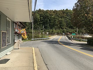
Cairo is a town in Ritchie County, West Virginia, United States, along West Virginia Route 31, the North Fork of the Hughes River, and the North Bend Rail Trail. The population was 174 at the 2020 census.

<span class="mw-page-title-main">Davis, West Virginia</span> Town in West Virginia, United States

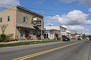
Davis is a town in Tucker County, West Virginia, United States, situated along the Blackwater River. The population was 595 at the 2020 census.

<span class="mw-page-title-main">Hambleton, West Virginia</span> Town in West Virginia, United States

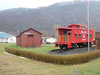
Hambleton is a town in Tucker County, West Virginia, United States. The population was 216 at the 2020 census. Hambleton was established in 1889, but not incorporated until 1905. It was named by then United States Senator Stephen B. Elkins in honor of a stockholder by this name in the West Virginia Central Railroad Company. The town was previously known as Hulings.

<span class="mw-page-title-main">Elizabeth, West Virginia</span> Town in West Virginia, United States

Elizabeth is a town in and the county seat of Wirt County, West Virginia, United States, situated along the Little Kanawha River. The population was 724 as of the 2020 census.

References

  1. "2019 U.S. Gazetteer Files". United States Census Bureau. Retrieved August 7, 2020.
  2. 1 2 3 4 Bureau, US Census. "City and Town Population Totals: 2020-2021". Census.gov. US Census Bureau. Retrieved July 2, 2022.
  3. 1 2 "U.S. Census website". United States Census Bureau . Retrieved January 31, 2008.
  4. "US Board on Geographic Names". United States Geological Survey. October 25, 2007. Retrieved January 31, 2008.
  5. "Find a County". National Association of Counties. Retrieved June 7, 2011.
  6. 1 2 Kenny, Hamill (1945). West Virginia Place Names: Their Origin and Meaning, Including the Nomenclature of the Streams and Mountains. Piedmont, West Virginia: The Place Name Press. pp. 412–413.
  7. West Virginia Atlas & Gazetteer. Yarmouth, Me.: DeLorme. 1997. p. 24. ISBN   0-89933-246-3.
  8. "US Gazetteer files: 2010, 2000, and 1990". United States Census Bureau. February 12, 2011. Retrieved April 23, 2011.
  9. "US Gazetteer files 2010". United States Census Bureau. Archived from the original on January 25, 2012. Retrieved January 24, 2013.
  10. Climate Summary for Middlebourne, West Virginia
  11. "NOWData – NOAA Online Weather Data". National Oceanic and Atmospheric Administration. Retrieved November 13, 2023.
  12. "Summary of Monthly Normals 1991–2020". National Oceanic and Atmospheric Administration. Retrieved November 13, 2023.
  13. "Census of Population and Housing". Census.gov. Retrieved June 4, 2015.
  14. "U.S. Census website". United States Census Bureau . Retrieved January 24, 2013.