Mitchell Heights, West Virginia

Last updated

Mitchell Heights, West Virginia
Mitchell-Heights-view-wv.jpg
Town Hall in Mitchell Heights
Logan County West Virginia Incorporated and Unincorporated areas Mitchell Heights Highlighted.svg
Location of Mitchell Heights in Logan County, West Virginia.
Coordinates: 37°54′25″N81°58′59″W / 37.90694°N 81.98306°W / 37.90694; -81.98306
Country United States
State West Virginia
County Logan
Area
[1]
  Total0.34 sq mi (0.87 km2)
  Land0.34 sq mi (0.87 km2)
  Water0.00 sq mi (0.00 km2)
Elevation
669 ft (204 m)
Population
 (2020) [2]
  Total315
  Estimate 
(2021) [2]
310
  Density812.50/sq mi (313.73/km2)
Time zone UTC-5 (Eastern (EST))
  Summer (DST) UTC-4 (EDT)
Area code 304
FIPS code 54-54892 [3]
GNIS feature ID1555140 [4]

Mitchell Heights is a town in Logan County, West Virginia, United States. The population was 315 at the 2020 census. [2] The town was named for an early farm on which it was established. [5]

Contents

Geography

Mitchell Heights is located at 37°54′25″N81°58′59″W / 37.90694°N 81.98306°W / 37.90694; -81.98306 (37.906889, -81.982981). [6] The town is situated along the west bank of the Guyandotte River in north-central Logan County. Chief Logan State Park borders the town to the west. The community of Henlawson lies to the south, and Pecks Mill lies to the north. West Virginia Route 10 traverses Mitchell Heights, connecting the town with Chapmanville to the north and Logan to the south.

According to the United States Census Bureau, the town has a total area of 0.34 square miles (0.88 km2), all land. [7]

Demographics

Historical population
CensusPop.Note
1950 185
1960 29056.8%
1970 52480.7%
1980 342−34.7%
1990 265−22.5%
2000 30113.6%
2010 3237.3%
2020 315−2.5%
2021 (est.)310 [2] −1.6%
U.S. Decennial Census [8]

2010 census

At the 2010 census there were 323 people, 143 households, and 101 families living in the town. The population density was 950.0 inhabitants per square mile (366.8/km2). There were 154 housing units at an average density of 452.9 per square mile (174.9/km2). The racial makeup of the town was 97.8% White, 0.3% African American, 1.5% Asian, and 0.3% from two or more races. Hispanic or Latino of any race were 0.3%. [9]

Of the 143 households 18.9% had children under the age of 18 living with them, 57.3% were married couples living together, 11.2% had a female householder with no husband present, 2.1% had a male householder with no wife present, and 29.4% were non-families. 25.2% of households were one person and 19.6% were one person aged 65 or older. The average household size was 2.26 and the average family size was 2.70.

The median age in the town was 50.2 years. 14.9% of residents were under the age of 18; 5% were between the ages of 18 and 24; 24.4% were from 25 to 44; 27.2% were from 45 to 64; and 28.5% were 65 or older. The gender makeup of the town was 44.6% male and 55.4% female.

2000 census

At the 2000 census there were 301 people, 134 households, and 99 families living in the town. The population density was 915.2 inhabitants per square mile (352.2/km2). There were 143 housing units at an average density of 434.8 per square mile (167.3/km2). The racial makeup of the town was 97.01% White and 2.99% Asian. Hispanic or Latino of any race were 0.33%. [3]

Of the 134 households 19.4% had children under the age of 18 living with them, 64.9% were married couples living together, 8.2% had a female householder with no husband present, and 25.4% were non-families. 24.6% of households were one person and 17.2% were one person aged 65 or older. The average household size was 2.25 and the average family size was 2.65.

The age distribution was 15.9% under the age of 18, 4.7% from 18 to 24, 21.6% from 25 to 44, 32.9% from 45 to 64, and 24.9% 65 or older. The median age was 50 years. For every 100 females, there were 78.1 males. For every 100 females age 18 and over, there were 74.5 males.

The median household income was $52,500 and the median family income was $78,404. Males had a median income of $61,250 versus $33,750 for females. The per capita income for the town was $39,603. About 2.4% of families and 3.9% of the population were below the poverty line, including none of those under the age of eighteen and 1.9% of those sixty five or over.

Related Research Articles

<span class="mw-page-title-main">Woodlawn Heights, Indiana</span> Town in Indiana, United States

Woodlawn Heights is a town in Anderson Township, Madison County, Indiana, United States. It is part of the Indianapolis–Carmel–Anderson metropolitan statistical area. The population was 91 at the 2020 census.

<span class="mw-page-title-main">Haviland, New York</span> Census-designated place in New York, United States

Haviland is a community and census-designated place (CDP) in Dutchess County, New York, United States. The population was 4,174 at the 2020 census. It is part of the Poughkeepsie–Newburgh–Middletown, NY Metropolitan Statistical Area as well as the larger New York–Newark–Bridgeport, NY-NJ-CT-PA Combined Statistical Area.

<span class="mw-page-title-main">Port Ewen, New York</span> CDP in New York, United States

Port Ewen is a hamlet in Ulster County, New York, United States. The population was 3,678 at the 2020 census. Port Ewen is in the Town of Esopus, south of Kingston, along U.S. Route 9W.

<span class="mw-page-title-main">Berwick Township, Pennsylvania</span> Township in Pennsylvania, United States

Berwick Township is a township in Adams County, Pennsylvania, United States. The population was 2,403 at the 2020 census. Berwick Township is one of 21 townships in Adams County.

<span class="mw-page-title-main">Millstone Township, Pennsylvania</span> Township in Pennsylvania, United States

Millstone Township is a township in Elk County, Pennsylvania, United States. The population was 95 at the 2020 census, up from 82 in 2010.

<span class="mw-page-title-main">Cass Township, Huntingdon County, Pennsylvania</span> Township in Pennsylvania, United States

Cass Township is a township in Huntingdon County, Pennsylvania, United States. The population was 1,014 at the 2020 census.

<span class="mw-page-title-main">Clay Township, Huntingdon County, Pennsylvania</span> Township in Pennsylvania, United States

Clay Township is a township in Huntingdon County, Pennsylvania, United States. The population was 872 at the 2020 census.

<span class="mw-page-title-main">Franklin Township, Huntingdon County, Pennsylvania</span> Township in Pennsylvania, United States

Franklin Township is a township in Huntingdon County, Pennsylvania, United States. The population was 492 at the 2020 census.

<span class="mw-page-title-main">Logan Township, Huntingdon County, Pennsylvania</span> Township in Pennsylvania, United States

Logan Township is a township that is located in Huntingdon County, Pennsylvania, United States. The population was 614 at the time of the 2020 census.

<span class="mw-page-title-main">Knox Township, Jefferson County, Pennsylvania</span> Township in Pennsylvania, United States

Knox Township is a township in Jefferson County, Pennsylvania, in the United States. As of the 2020 census, the township population was 1,008. It was named for John C. Knox, then President Judge of the judicial district.

<span class="mw-page-title-main">Oswayo Township, Pennsylvania</span> Township in Pennsylvania, United States

Oswayo Township is a township in Potter County, Pennsylvania, United States. The population was 224 at the 2020 census.

<span class="mw-page-title-main">Sylvania Township, Pennsylvania</span> Township in Pennsylvania, United States

Sylvania Township is a township in Potter County, Pennsylvania, United States. The population was 76 at the 2020 census.

<span class="mw-page-title-main">Buffalo Township, Union County, Pennsylvania</span> Township in Pennsylvania, United States

Buffalo Township is a township in Union County, Pennsylvania, United States. The population was 3,536 at the 2020 census.

<span class="mw-page-title-main">Glade Township, Warren County, Pennsylvania</span> Township in Pennsylvania, United States

Glade Township is a township in Warren County, Pennsylvania, United States. The population was 2,039 at the 2020 census, down from 2,308 at the 2010 census. 2,319 at the 2000 census.

<span class="mw-page-title-main">Sheffield Township, Pennsylvania</span> Township in Pennsylvania, United States

Sheffield Township is a township in Warren County, Pennsylvania, United States. The population was 1,849 at the 2020 census, down from 2,121 at the 2010 census. 2,346 at the 2000 census.

<span class="mw-page-title-main">West Logan, West Virginia</span> Town in West Virginia, United States

West Logan is a town along the Guyandotte River in Logan County, West Virginia, United States. The population was 400 at the 2020 census. For unknown reasons, some sources report West Logan to lay west of the county seat at Logan, attributing to this fact the name.

<span class="mw-page-title-main">Wheeler, Wisconsin</span> Village in Wisconsin, United States

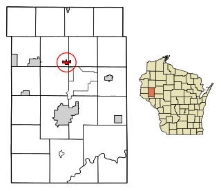
Wheeler is a village in Dunn County, Wisconsin, United States, along the Hay River. The population was 348 at the 2010 census.

<span class="mw-page-title-main">Osage, Wyoming</span> CDP in Wyoming, United States

Osage is a census-designated place (CDP) in Weston County, Wyoming, United States. The population was 151 at the 2020 census. The CDP is named after the town of Osage, which is included within its boundaries. The CDP was established by the United States Census Bureau in time for the 2000 census.

<span class="mw-page-title-main">Brownville (village), New York</span> Village in New York, United States

Brownville is a village in Jefferson County, New York, United States. The population was 1,119 at the 2010 census, up from 1,022 in 2000. The village is named after Jacob Brown, an early settler and developer.

<span class="mw-page-title-main">Milo (CDP), Maine</span> CDP in Maine, United States

Milo is a census-designated place (CDP) in the town of Milo in Piscataquis County, Maine, United States. The population was 1,898 at the 2000 census.

References

  1. "2019 U.S. Gazetteer Files". United States Census Bureau. Retrieved August 7, 2020.
  2. 1 2 3 4 "City and Town Population Totals: 2020-2021". Census.gov. US Census Bureau. Retrieved July 3, 2022.
  3. 1 2 "U.S. Census website". United States Census Bureau . Retrieved January 31, 2008.
  4. "US Board on Geographic Names". United States Geological Survey. October 25, 2007. Retrieved January 31, 2008.
  5. Capace, Nancy (1999). Encyclopedia of West Virginia. North American Book Dist LLC. p. 168. ISBN   978-0-403-09843-9.
  6. "US Gazetteer files: 2010, 2000, and 1990". United States Census Bureau. February 12, 2011. Retrieved April 23, 2011.
  7. "US Gazetteer files 2010". United States Census Bureau. Archived from the original on January 25, 2012. Retrieved January 24, 2013.
  8. "Census of Population and Housing". Census.gov. Retrieved June 4, 2015.
  9. "U.S. Census website". United States Census Bureau . Retrieved January 24, 2013.