Brandonville, West Virginia

Last updated

Brandonville, West Virginia
Hagans Homestead.jpg
Preston County West Virginia Incorporated and Unincorporated areas Brandonville Highlighted.svg
Location of Brandonville in Preston County, West Virginia.
Coordinates: 39°39′59″N79°37′17″W / 39.66639°N 79.62139°W / 39.66639; -79.62139
Country United States
State West Virginia
County Preston
Area
[1]
  Total0.39 sq mi (1.00 km2)
  Land0.39 sq mi (1.00 km2)
  Water0.00 sq mi (0.00 km2)
Elevation
[2]
1,805 ft (550 m)
Population
 (2020) [3]
  Total136
  Estimate 
(2021) [3]
136
  Density272.73/sq mi (105.19/km2)
Time zone UTC-5 (Eastern (EST))
  Summer (DST) UTC-4 (EDT)
ZIP code
26525
Area code 304
FIPS code 54-09844 [4]
GNIS feature ID1553965 [2]
Website https://local.wv.gov/brandonville/Pages/default.aspx

Brandonville is a town in northern Preston County, West Virginia, United States. The population was 136 at the 2020 census. [3] It is part of the Morgantown metropolitan area.

Contents

History

Brandonville was laid out in 1827 by Jonathan Brandon, and named for him. [5]

The Hagans Homestead was listed on the National Register of Historic Places in 1993. [6]

Geography

Brandonville is located at 39°39′59″N79°37′17″W / 39.66639°N 79.62139°W / 39.66639; -79.62139 (39.666321, -79.621517). [7]

According to the United States Census Bureau, the town has a total area of 0.39 square miles (1.01 km2), all land. [8]

Demographics

Historical population
CensusPop.Note
1860 165
1870 100−39.4%
1880 1077.0%
1890 82−23.4%
1900 68−17.1%
1910 9641.2%
1920 67−30.2%
1930 8222.4%
1940 11337.8%
1950 100−11.5%
1960 1099.0%
1970 82−24.8%
1980 9212.2%
1990 73−20.7%
2000 10239.7%
2010 101−1.0%
2020 13634.7%
2021 (est.)136 [3] 0.0%
U.S. Decennial Census [9]

2010 census

At the 2010 census there were 101 people, 47 households, and 29 families living in the town. The population density was 259.0 inhabitants per square mile (100.0/km2). There were 57 housing units at an average density of 146.2 per square mile (56.4/km2). The racial makeup of the town was 95.0% White and 5.0% from other races. Hispanic or Latino of any race were 5.0%. [10]

Of the 47 households 23.4% had children under the age of 18 living with them, 42.6% were married couples living together, 14.9% had a female householder with no husband present, 4.3% had a male householder with no wife present, and 38.3% were non-families. 31.9% of households were one person and 17.1% were one person aged 65 or older. The average household size was 2.15 and the average family size was 2.62.

The median age in the town was 41.9 years. 17.8% of residents were under the age of 18; 6% were between the ages of 18 and 24; 28.7% were from 25 to 44; 23.8% were from 45 to 64; and 23.8% were 65 or older. The gender makeup of the town was 47.5% male and 52.5% female.

2000 census

At the 2000 census there were 102 people, 41 households, and 28 families living in the town. The population density was 259.3 inhabitants per square mile (101.0/km2). There were 46 housing units at an average density of 116.9 per square mile (45.5/km2). The racial makeup of the town was 97.06% White, and 2.94% from two or more races. [4] Of the 41 households 26.8% had children under the age of 18 living with them, 46.3% were married couples living together, 17.1% had a female householder with no husband present, and 31.7% were non-families. 29.3% of households were one person and 17.1% were one person aged 65 or older. The average household size was 2.49 and the average family size was 3.04.

The age distribution was 25.5% under the age of 18, 6.9% from 18 to 24, 23.5% from 25 to 44, 21.6% from 45 to 64, and 22.5% 65 or older. The median age was 39 years. For every 100 females, there were 85.5 males. For every 100 females age 18 and over, there were 85.4 males.

The median household income was $28,125 and the median family income was $25,000. Males had a median income of $61,875 versus $17,917 for females. The per capita income for the town was $22,118. There were 17.6% of families and 24.5% of the population living below the poverty line, including 58.8% of under eighteens and 32.0% of those over 64.

Notable people

Related Research Articles

<span class="mw-page-title-main">Franklin, Iowa</span> City in Iowa, United States

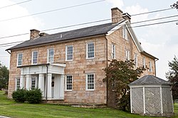
Franklin is a city in Lee County, Iowa, United States. Franklin is noted for its stone and brick Federal architecture, uncommon in Iowa. The population was 131 at the time of the 2020 census. It is part of the Fort Madison–Keokuk, IA-IL-MO Micropolitan Statistical Area.

<span class="mw-page-title-main">Whitneyville, Maine</span> Town in the state of Maine, United States

Whitneyville is a town in Washington County, Maine, United States. The town was named after Colonel Joseph Whitney, a mill owner. The population was 202 at the 2020 census.

<span class="mw-page-title-main">Howard Township, Centre County, Pennsylvania</span> Township in Pennsylvania, United States

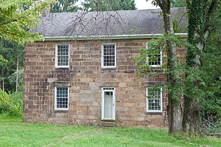
Howard Township is a township in Centre County, Pennsylvania, United States. It is part of the State College, Pennsylvania Metropolitan Statistical Area. The population was 878 at the 2020 census. Part of Bald Eagle State Park is in Howard Township.

<span class="mw-page-title-main">Liberty Township, Centre County, Pennsylvania</span> Township in Pennsylvania, United States

Liberty Township is a township in Centre County, Pennsylvania, United States. It is part of the State College, Pennsylvania Metropolitan Statistical Area. The population was 1,825 at the 2020 census, an increase over the figure of 2,118 tabulated in 2010. Part of Bald Eagle State Park is in Liberty Township.

<span class="mw-page-title-main">Potter Township, Centre County, Pennsylvania</span> Township in Pennsylvania, United States

Potter Township is a township in Centre County, Pennsylvania, United States. It is part of the State College, Pennsylvania Metropolitan Statistical Area. The population was 3,614 at the 2020 census.

<span class="mw-page-title-main">Walker Township, Centre County, Pennsylvania</span> Township in Pennsylvania, United States

Walker Township is a township in Centre County, Pennsylvania, United States. It is part of the State College, Pennsylvania Metropolitan Statistical Area. The population was 4,639 at the 2020 census, an increase over the figure of 3,433 tabulated in 2010.

<span class="mw-page-title-main">Greenwood Township, Clearfield County, Pennsylvania</span> Township in Pennsylvania, United States

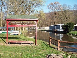
Greenwood Township is a township in Clearfield County, Pennsylvania, United States. The township has a population of 363 people, according to the 2020 United States census. Between Mahaffey and Grampian on U.S. Route 219, Greenwood Township contains the villages of Curry Run and Bells Landing. The West Branch of the Susquehanna River passes through it, along with several abandoned and presently used railroad grades.

<span class="mw-page-title-main">Granville Township, Mifflin County, Pennsylvania</span> Township in Pennsylvania, United States

Granville Township is a township in Mifflin County, Pennsylvania, United States. The population was 4,625 at the 2020 census.

<span class="mw-page-title-main">Brandonville, Pennsylvania</span> CDP in Pennsylvania, United States

Brandonville is a census-designated place (CDP) in East Union Township in Schuylkill County, Pennsylvania. The population was 180 at the 2020 census.

<span class="mw-page-title-main">Dickens, Texas</span> City in Texas, United States

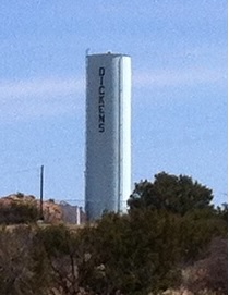
Dickens is a city in and the county seat of Dickens County, Texas, United States. The population was 286 at the 2010 census, down from 332 at the 2000 census.

<span class="mw-page-title-main">West Milford, West Virginia</span> Town in West Virginia, United States

West Milford is a town in Harrison County, West Virginia, United States. The population was 452 at the 2020 census.

<span class="mw-page-title-main">Fairview, West Virginia</span> Town in West Virginia, United States

Fairview is a town in Marion County, West Virginia, United States. The population was 374 at the 2020 census.

<span class="mw-page-title-main">White Hall, West Virginia</span> Town in West Virginia, United States

White Hall is a town in Marion County, West Virginia, United States. The population was 706 at the 2020 census. Incorporated in 1989, White Hall is adjacent to the county seat, Fairmont, and is part of the Fairmont, West Virginia, Micropolitan Statistical Area. White Hall has many different stores and restaurants.

<span class="mw-page-title-main">Newburg, West Virginia</span> Town in West Virginia, United States

Newburg is a town in western Preston County, West Virginia, United States. The population was 275 at the 2020 census. It is part of the Morgantown metropolitan area.

<span class="mw-page-title-main">Reedsville, West Virginia</span> Town in West Virginia, United States

Reedsville is a town in western Preston County, West Virginia, United States. The population was 530 at the 2020 census. It is part of the Morgantown metropolitan area.

<span class="mw-page-title-main">Montrose, West Virginia</span> Town in West Virginia, United States

Montrose is a town in Randolph County, West Virginia, United States. The population was 141 at the 2020 census.

<span class="mw-page-title-main">Auburn, West Virginia</span> Town in West Virginia, United States

Auburn is a town in Ritchie County, West Virginia, United States. The population was 80 at the 2020 census.

<span class="mw-page-title-main">Cairo, West Virginia</span> Town in West Virginia, United States

Cairo is a town in Ritchie County, West Virginia, United States, along West Virginia Route 31, the North Fork of the Hughes River, and the North Bend Rail Trail. The population was 174 at the 2020 census.

<span class="mw-page-title-main">Hambleton, West Virginia</span> Town in West Virginia, United States

Hambleton is a town in Tucker County, West Virginia, United States. The population was 216 at the 2020 census. Hambleton was established in 1889, but not incorporated until 1905. It was named by then United States Senator Stephen B. Elkins in honor of a stockholder by this name in the West Virginia Central Railroad Company. The town was previously known as Hulings.

<span class="mw-page-title-main">Pine Grove, West Virginia</span> Town in West Virginia, United States

Pine Grove is a town in Wetzel County, West Virginia, United States. The population was 363 at the 2020 census. The community was named for a grove of pine trees near the original town site.

References

  1. "2019 U.S. Gazetteer Files". United States Census Bureau. Retrieved August 7, 2020.
  2. 1 2 U.S. Geological Survey Geographic Names Information System: Brandonville, West Virginia
  3. 1 2 3 4 Bureau, US Census. "City and Town Population Totals: 2020-2021". Census.gov. US Census Bureau. Retrieved July 3, 2022.
  4. 1 2 "U.S. Census website". United States Census Bureau . Retrieved January 31, 2008.
  5. Morton, Oren Frederic; Cole, J. R. (1914). A History of Preston County, West Virginia. Journal Publishing Company. p. 243.
  6. "National Register Information System". National Register of Historic Places . National Park Service. July 9, 2010.
  7. "US Gazetteer files: 2010, 2000, and 1990". United States Census Bureau. February 12, 2011. Retrieved April 23, 2011.
  8. "US Gazetteer files 2010". United States Census Bureau. Archived from the original on January 25, 2012. Retrieved January 24, 2013.
  9. "Census of Population and Housing". Census.gov. Retrieved June 4, 2015.
  10. "U.S. Census website". United States Census Bureau . Retrieved January 24, 2013.