Kermit, West Virginia

Last updated

Kermit, West Virginia
Kermit-from-High-wv.jpg
Mingo County West Virginia Incorporated and Unincorporated areas Kermit Highlighted.svg
Location of Kermit in Mingo County, West Virginia.
USA West Virginia location map.svg
Red pog.svg
Kermit
Usa edcp location map.svg
Red pog.svg
Kermit
Coordinates: 37°50′27″N82°24′34″W / 37.84083°N 82.40944°W / 37.84083; -82.40944
Country Flag of the United States (23px).png  United States
State Flag of West Virginia.svg  West Virginia
County Mingo
Area
[1]
  Total0.39 sq mi (1.02 km2)
  Land0.39 sq mi (1.02 km2)
  Water0.00 sq mi (0.00 km2)
Elevation
633 ft (193 m)
Population
 (2010) [2]
  Total406
  Estimate 
(2019) [3]
349
  Density890.31/sq mi (343.71/km2)
Time zone UTC-5 (Eastern (EST))
  Summer (DST) UTC-4 (EDT)
ZIP code
25674
Area code 304
FIPS code 54-43300 [4]
GNIS feature ID1541162 [5]
Website https://local.wv.gov/kermit/Pages/default.aspx

Kermit is a town in Mingo County, West Virginia, United States. The population was 406 at the 2010 census. Kermit is located along the Tug Fork, opposite Warfield, Kentucky. [6] The Norfolk Southern Railway's Kenova District runs through town.

Contents

The community was earlier known by the names "Lower Burning Creek", "East Warfield," and "Warfield." The name was changed to "Kermit" when a post office was established in 1906. Kermit was named for Kermit Roosevelt, son of President Theodore Roosevelt, and incorporated in 1909. [7] [8]

Geography

Kermit is located in the northwestern corner of Mingo County at 37°50′27″N82°24′34″W / 37.84083°N 82.40944°W / 37.84083; -82.40944 (37.840783, -82.409465). [9] It primarily occupies bottomland along the eastern bank of the Tug Fork, opposite Warfield, Kentucky. Many of the town's primary municipal buildings and other public buildings lie in a hollow in the northeastern part of town along Main Street and High Street.

The Tug Fork Valley, with Kermit lying on the right side of the river at the top of the photo. Tug Fork towns aerial view.jpg
The Tug Fork Valley, with Kermit lying on the right side of the river at the top of the photo.

U.S. Route 52 (Logan Avenue) traverses Kermit, connecting the town with Williamson to the south and Kenova to the north. A vehicular and pedestrian bridge connects Kermit with Kentucky Route 292 across the Tug Fork in Warfield. The Norfolk Southern railroad tracks run roughly parallel to US-52.

According to the United States Census Bureau, the town has a total area of 0.39 square miles (1.01 km2), all land. [10]

Climate

The climate in this area is characterized by hot, humid summers and generally mild to cool winters. According to the Köppen Climate Classification system, Kermit has a humid subtropical climate, abbreviated "Cfa" on climate maps. [11]

Demographics

Historical population
CensusPop.Note
1920 636
1930 74016.4%
1940 8119.6%
1950 96418.9%
1960 743−22.9%
1970 716−3.6%
1980 705−1.5%
1990 342−51.5%
2000 209−38.9%
2010 40694.3%
2019 (est.)349 [3] −14.0%
U.S. Decennial Census [12]

The median income for a household in the town was $31,500, and the median income for a family was $40,000. Males had a median income of $36,250 versus $16,250 for females. The per capita income for the town was $14,695. About 4.0% of families and 10.1% of the population were below the poverty line, including 7.0% of those under the age of eighteen and 7.9% of those 65 or over.

2010 census

As of the census [2] of 2010, there were 406 people, 152 households, and 110 families living in the town. The population density was 1,041.0 inhabitants per square mile (401.9/km2). There were 164 housing units at an average density of 420.5 per square mile (162.4/km2). The racial makeup of the town was 98.8% White, 0.2% African American, 0.2% Native American, 0.2% Pacific Islander, and 0.5% from two or more races. Hispanic or Latino of any race were 1.2% of the population.

There were 152 households, of which 40.8% had children under the age of 18 living with them, 52.0% were married couples living together, 13.8% had a female householder with no husband present, 6.6% had a male householder with no wife present, and 27.6% were non-families. 24.3% of all households were made up of individuals, and 12.5% had someone living alone who was 65 years of age or older. The average household size was 2.67 and the average family size was 3.20.

The median age in the town was 37.5 years. 26.1% of residents were under the age of 18; 8.2% were between the ages of 18 and 24; 28.4% were from 25 to 44; 24.7% were from 45 to 64; and 12.8% were 65 years of age or older. The gender makeup of the town was 52.5% male and 47.5% female.

See also

Related Research Articles

<span class="mw-page-title-main">Wayne County, West Virginia</span> County in West Virginia, United States

Wayne County is the westernmost county in the U.S. state of West Virginia. As of the 2020 census, the population was 38,982. Its county seat is Wayne. The county was founded in 1842 and named for General "Mad" Anthony Wayne. Wayne County is part of the Huntington–Ashland, WV–KY–OH Metropolitan Statistical Area.

<span class="mw-page-title-main">Mingo County, West Virginia</span> County in West Virginia, United States

Mingo County is a county in the U.S. state of West Virginia. As of the 2020 census, the population was 23,568. Its county seat and largest city is Williamson. Created in 1895, Mingo is West Virginia's newest county, named for the historic Iroquoian Mingo people.

<span class="mw-page-title-main">Martin County, Kentucky</span> County in Kentucky, United States

Martin County is a county located in the U.S. state of Kentucky. As of the 2020 census, the population was 11,287. Its county seat is Inez. The county was founded in 1870 and is named for Congressman John Preston Martin. Warfield, Kentucky, is the only non-dry city in the county.

<span class="mw-page-title-main">Louisa, Kentucky</span> City in Kentucky, United States

Louisa is a home-rule class city located in eastern Kentucky at the merger of the Levisa and Tug Forks into the Big Sandy River, which forms part of the state's border with West Virginia. It is the seat of Lawrence County. The population was 2,467 at the 2010 census and an estimated 2,375 in 2018.

<span class="mw-page-title-main">Hyden, Kentucky</span> City in Kentucky, United States

Hyden is a home rule-class city in and the county seat of Leslie County, Kentucky, United States. The population was 365 at the 2010 census. It is located at the junction of U.S. Route 421 and Kentucky Route 80, along the Middle Fork of the Kentucky River.

<span class="mw-page-title-main">Warfield, Kentucky</span> City in Kentucky, United States

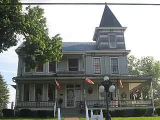
Warfield is a home rule-class city in Martin County, Kentucky, United States. The population was 264 at the 2020 census.

<span class="mw-page-title-main">Clinchco, Virginia</span> Town in Virginia, United States

Clinchco is a town in Dickenson County, Virginia, United States. The town, formerly known as Moss, was named for both the Clinchfield Railroad and the Clinchfield Coal Corporation. The population was 337 at the 2010 census, down from 424 at the 2000 census. The Clinchco post office was established in 1917.

<span class="mw-page-title-main">Glen Lyn, Virginia</span> Town in Virginia, United States

Glen Lyn is a town in Giles County, Virginia, United States, at the confluence of the East and New rivers. The population was 115 at the 2010 census, down from 151 at the 2000 census. It is part of the Blacksburg–Christiansburg Metropolitan Statistical Area.

<span class="mw-page-title-main">West Milford, West Virginia</span> Town in West Virginia, United States

West Milford is a town in Harrison County, West Virginia, United States. The population was 452 at the 2020 census.

<span class="mw-page-title-main">Matoaka, West Virginia</span> Census-designated place in West Virginia, United States

Matoaka is a census-designated place in Mercer County, West Virginia, United States. The population was 173 at the 2020 census. It is part of the Bluefield, WV-VA micropolitan area which has a population of 100,093. This town is named for Chief Powhatan's daughter Matoaka who was better known by her nickname "Pocahontas". Matoaka became an unincorporated town when it voted to dissolve its charter in May 2018.

<span class="mw-page-title-main">Williamson, West Virginia</span> City in West Virginia, United States

Williamson is a city in Mingo County, West Virginia, United States, situated along the Tug Fork River. The population was 3,042 at the 2020 census. It is the county seat of Mingo County, and is the county's largest and most populous city. Williamson is home to Southern West Virginia Community and Technical College. The Tug Fork River separates Williamson from South Williamson, Kentucky.

<span class="mw-page-title-main">Cairo, West Virginia</span> Town in West Virginia, United States

Cairo is a town in Ritchie County, West Virginia, United States, along West Virginia Route 31, the North Fork of the Hughes River, and the North Bend Rail Trail. The population was 174 at the 2020 census.

<span class="mw-page-title-main">Hambleton, West Virginia</span> Town in West Virginia, United States

Hambleton is a town in Tucker County, West Virginia, United States. The population was 216 at the 2020 census. Hambleton was established in 1889, but not incorporated until 1905. It was named by then United States Senator Stephen B. Elkins in honor of a stockholder by this name in the West Virginia Central Railroad Company. The town was previously known as Hulings.

<span class="mw-page-title-main">Parsons, West Virginia</span> City in West Virginia, United States

Parsons is the largest city in and county seat of Tucker County, West Virginia, United States. The population was 1,322 at the 2020 census. Parsons is located at the confluence of the Shavers Fork and the Black Fork, forming the head of the Cheat River.

<span class="mw-page-title-main">Fort Gay, West Virginia</span> Town in West Virginia, United States

Fort Gay is a town in Wayne County, West Virginia, United States, situated along the Tug Fork and Big Sandy rivers. The town adjoins Louisa, Kentucky. The population was 677 at the 2020 census.

<span class="mw-page-title-main">Kenova, West Virginia</span> City in West Virginia, United States

Kenova is a city in Wayne County, West Virginia, United States, situated at the confluence of the Ohio and Big Sandy rivers. The city's name is a portmanteau of Kentucky, Ohio, and Virginia (Va), owing to its location where the three states met before the creation of West Virginia. The population was 3,030 at the 2020 census. It is part of the Huntington–Ashland metropolitan area.

<span class="mw-page-title-main">Wayne, West Virginia</span> Town in West Virginia, United States

Wayne is a town in and the county seat of Wayne County, West Virginia, United States. The population was 1,441 at the 2020 census. It is part of the Huntington–Ashland metropolitan area.

<span class="mw-page-title-main">Mullens, West Virginia</span> City in West Virginia, United States

Mullens is a city in Wyoming County, West Virginia. The population was 1,475 at the time of the 2020 census.

<span class="mw-page-title-main">Oceana, West Virginia</span> Town in West Virginia, United States

Oceana is a town in Wyoming County, West Virginia. The population was 1,462 at the time of the 2020 census. Oceana is the oldest city in Wyoming County and was the county seat until 1907.

Crum is a census-designated place (CDP) in southern Wayne County, West Virginia, United States. As of the 2010 census, its population was 182. It is the home to Crum Pre K-8 school opened in 2017. It is a part of the Huntington-Ashland Metropolitan Statistical Area (MSA).

References

  1. "2019 U.S. Gazetteer Files". United States Census Bureau. Retrieved August 7, 2020.
  2. 1 2 "U.S. Census website". United States Census Bureau . Retrieved January 24, 2013.
  3. 1 2 "Population and Housing Unit Estimates". United States Census Bureau. May 24, 2020. Retrieved May 27, 2020.
  4. "U.S. Census website". United States Census Bureau . Retrieved January 31, 2008.
  5. "US Board on Geographic Names". United States Geological Survey. October 25, 2007. Retrieved January 31, 2008.
  6. West Virginia Atlas & Gazetteer. Yarmouth, Me.: DeLorme. 1997. p. 50. ISBN   0-89933-246-3.
  7. West Virginia Blue Book. Published annually by the Clerk's Office of the West Virginia Senate.
  8. Kenny, Hamill (1945). West Virginia Place Names: Their Origin and Meaning, Including the Nomenclature of the Streams and Mountains. Piedmont, WV: The Place Name Press. pp. 347–348.
  9. "US Gazetteer files: 2010, 2000, and 1990". United States Census Bureau. February 12, 2011. Retrieved April 23, 2011.
  10. "US Gazetteer files 2010". United States Census Bureau. Archived from the original on July 2, 2012. Retrieved January 24, 2013.
  11. Climate Summary for Kermit, West Virginia
  12. "Census of Population and Housing". Census.gov. Retrieved June 4, 2015.