City of Dunbar | |
---|---|
Coordinates: 38°21′52″N81°44′22″W / 38.36444°N 81.73944°W | |
Country | United States |
State | West Virginia |
County | Kanawha |
Government | |
• Mayor | Scott Elliott |
Area | |
• Total | 2.81 sq mi (7.27 km2) |
• Land | 2.80 sq mi (7.26 km2) |
• Water | 0.00 sq mi (0.01 km2) |
Elevation | 594 ft (181 m) |
Population | |
• Total | 7,479 |
• Estimate (2021) [2] | 7,330 |
• Density | 2,531.41/sq mi (977.26/km2) |
Time zone | UTC-5 (Eastern (EST)) |
• Summer (DST) | UTC-4 (EDT) |
ZIP code | 25064 |
Area code | 304 |
FIPS code | 54-22564 [3] |
GNIS feature ID | 1538426 [4] |
Website | www |
Dunbar is a city in Kanawha County, West Virginia, United States, situated along the Kanawha River. The population was 7,479 at the 2020 census. [2]
Dunbar was incorporated on April 19, 1921, by an Act of the West Virginia Legislature. Dunbar is on land that was originally occupied by Native Americans with 11 mounds identified in the residential areas. The land was granted to George Washington for his military service and was named for Mary Dunbar after she inherited the land from Washington, although other sources say it was named for Dunbar Baines, a prominent area banker. [5]
Dunbar was a farming community until industries began to evolve in the city with the opening of glass and bottling plants in 1912. The Gravely Plow was invented in Dunbar in 1916. [6]
Located at Dunbar is the Dutch Hollow Wine Cellars, listed on the National Register of Historic Places in 1970. [7] The park is listed on the Register due to the walk-in wine cellars located within the Park. In the past the area was known for its vineyards and the cellars were used to store wine made from the grapes grown in the vineyards. The cellars were thought to be built around 1860 due to the popularity of wine-making. The wine was then hauled to Charleston and Cincinnati. After the Civil War, wine making was no longer profitable and the vineyards were abandoned. The popularity of wine in neighboring Virginia and Ohio also had an impact on grape growing in West Virginia. The wine cellars are preserved and protected for future generations due to the foresight of Dunbar to develop the area into a City park. [8]
Dunbar is located at 38°21′52″N81°44′22″W / 38.36444°N 81.73944°W (38.364319, -81.739539). [9] Dunbar is served by Interstate 64 and WV 25.
According to the United States Census Bureau, the city has a total area of 2.81 square miles (7.28 km2), of which 2.80 square miles (7.25 km2) is land and 0.01 square miles (0.03 km2) is water. [10]
In the past, Dunbar was home to a glass industry, through the Dunbar Glass and Kanawha Glass companies. Dunbar was also home to the Gravely Tractor company.
Census | Pop. | Note | %± |
---|---|---|---|
1930 | 4,189 | — | |
1940 | 5,266 | 25.7% | |
1950 | 8,032 | 52.5% | |
1960 | 11,006 | 37.0% | |
1970 | 9,151 | −16.9% | |
1980 | 9,285 | 1.5% | |
1990 | 8,697 | −6.3% | |
2000 | 8,154 | −6.2% | |
2010 | 7,907 | −3.0% | |
2020 | 7,479 | −5.4% | |
2021 (est.) | 7,330 | [2] | −2.0% |
U.S. Decennial Census [11] |
As of the census [12] of 2010, there were 7,907 people, 3,795 households, and 2,000 families living in the city. The population density was 2,823.9 inhabitants per square mile (1,090.3/km2). There were 4,175 housing units at an average density of 1,491.1 per square mile (575.7/km2). The racial makeup of the city was 82.7% White, 12.2% African American, 0.2% Native American, 1.7% Asian, 0.4% from other races, and 2.7% from two or more races. Hispanic or Latino of any race were 1.0% of the population.
There were 3,795 households, of which 23.2% had children under the age of 18 living with them, 33.8% were married couples living together, 14.8% had a female householder with no husband present, 4.1% had a male householder with no wife present, and 47.3% were non-families. 40.7% of all households were made up of individuals, and 16.2% had someone living alone who was 65 years of age or older. The average household size was 2.05 and the average family size was 2.75.
The median age in the city was 43.2 years. 18.4% of residents were under the age of 18; 7.8% were between the ages of 18 and 24; 25.9% were from 25 to 44; 27.8% were from 45 to 64; and 20.1% were 65 years of age or older. The gender makeup of the city was 45.7% male and 54.3% female.
As of the census [3] of 2000, there were 8,154 people, 3,744 households, and 2,167 families living in the city. The population density was 2,874.5 people per square mile (1,108.5/km2). There were 4,128 housing units at an average density of 1,455.2 per square mile (561.2/km2). The racial makeup of the city was 85.65% White, 10.72% African American, 0.09% Native American, 1.80% Asian, 0.01% Pacific Islander, 0.18% from other races, and 1.55% from two or more races. Hispanic or Latino of any race were 0.55% of the population.
There were 3,744 households, out of which 21.8% had children under the age of 18 living with them, 41.5% were married couples living together, 13.5% had a female householder with no husband present, and 42.1% were non-families. 37.8% of all households were made up of individuals, and 15.4% had someone living alone who was 65 years of age or older. The average household size was 2.07 and the average family size was 2.72.
In the city, the population was spread out, with 18.1% under the age of 18, 10.3% from 18 to 24, 27.2% from 25 to 44, 23.2% from 45 to 64, and 21.3% who were 65 years of age or older. The median age was 41 years. For every 100 females, there were 82.8 males. For every 100 females age 18 and over, there were 77.0 males.
The median income for a household in the city was $35,117, and the median income for a family was $42,665. Males had a median income of $34,816 versus $24,184 for females. The per capita income for the city was $19,030. About 13.2% of families and 15.3% of the population were below the poverty line, including 26.5% of those under age 18 and 10.1% of those age 65 or over.
Dunbar is served by the following schools:
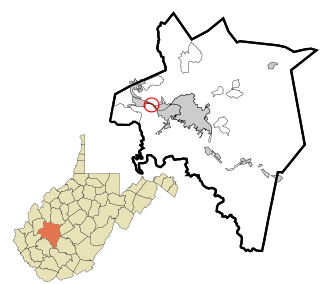
Kanawha County is a county in the U.S. state of West Virginia. As of the 2020 census, the population was 180,745, making it West Virginia's most populous county. The county seat is Charleston, which is also the state capital and most populous city. Kanawha County is part of the Charleston, WV Metropolitan Statistical Area.
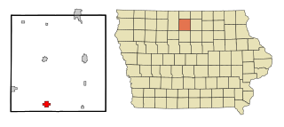
Kanawha is a city in Hancock County, Iowa, United States. The population was 658 at the time of the 2020 census.
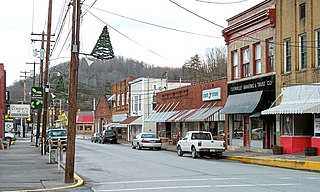
Burnsville is a town in Braxton County, West Virginia, United States, at the confluence of the Little Kanawha River and Saltlick Creek. The population was 401 at the 2020 census. Burnsville was incorporated in 1902 by the Circuit Court and named for Captain John Burns who operated the first sawmill in that section of the state and who established the town shortly after the close of the American Civil War. It was named "All West Virginia City" in 1976.
Gauley Bridge is a town in Fayette County, West Virginia, United States. The population was 614 at the 2010 census. The Kanawha River is formed at Gauley Bridge by the confluence of the New and Gauley Rivers. Two miles to the southwest of Gauley Bridge, in Glen Ferris, is Kanawha Falls, a popular stopping point on Midland Trail Scenic Highway.
Glenville is a town in and the county seat of Gilmer County, West Virginia, United States, along the Little Kanawha River. The population was 1,128 at the 2020 census. It is the home of Glenville State University.
Sand Fork is a town in Gilmer County, West Virginia, United States. The population was 182 at the 2020 census. It is located along the Little Kanawha River, at the mouth of the Sand Fork.
Belle is a town in Kanawha County, West Virginia, United States, situated along the Kanawha River. The population was 1,171 at the 2020 census. Belle was incorporated on December 13, 1958, by the Kanawha County Circuit Court. It is the home of the Belle Bulldogs Elementary School.
Chesapeake is a town in Kanawha County, West Virginia, United States. The population was 1,336 at the 2020 census. The town is situated on the Kanawha River.
East Bank is a town in Kanawha County, West Virginia, United States, situated along the Kanawha River. The population was 820 at the 2020 census. East Bank was incorporated in 1889 by special charter enacted by the West Virginia Legislature. It is so named on account of the town's location on the east side of the Kanawha River.
Glasgow is a town in Kanawha County, West Virginia, United States, situated along the Kanawha River. The population was 708 at the 2020 census. Glasgow was incorporated on June 20, 1920. Folk etymology derives its name from a combination of the word "glass" with the word "company" for a glass factory that was built there many years ago, but the presence of many Scottish immigrants to this part of Appalachia, particularly from the Strathclyde region, indicates that the town was most likely named after the Scottish city of Glasgow in Strathclyde. Other Virginia and West Virginia locations named for places in Strathclyde include Dumbarton, Argyle, Loudoun County, Hamilton in Loudoun County, Lanark and Renfrew.
Jefferson is a census-designated place (CDP) in Kanawha County, West Virginia, United States, along the Kanawha River. The population was 676 at the 2010 census. Jefferson was incorporated on March 22, 1997, but was disincorporated less than a decade later on February 21, 2007.
Pratt is a town in Kanawha County, West Virginia, United States, along the Kanawha River. The population was 482 at the 2020 census.
St. Albans is a city in western Kanawha County, West Virginia, United States, at the confluence of the Kanawha and Coal rivers. The population was 10,861 at the 2020 census. It is part of the Charleston metropolitan area.
Henderson is an unincorporated community and former town in Mason County, West Virginia, United States, at the confluence of the Ohio and Kanawha Rivers. The population was 231 at the 2020 census. It is part of the Point Pleasant, WV–OH Micropolitan Statistical Area. The town was incorporated in 1893 and named for Samuel Bruce Henderson, who owned the townsite at the time. The town was unincorporated following a public hearing on August 11, 2022.
Leon is a town in Mason County, West Virginia, United States, situated along the Kanawha River. The population was 137 at the 2020 census. It is part of the Point Pleasant, WV–OH Micropolitan Statistical Area.
Bancroft is a town in Putnam County, West Virginia, United States, along the Kanawha River. The population was 389 at the 2020 census. It is part of the Huntington–Ashland metropolitan area.
Buffalo is a town in Putnam County, West Virginia, United States, located along the Kanawha River. The population was 1,211 at the time of the 2020 census It is part of the Huntington–Ashland metropolitan area.
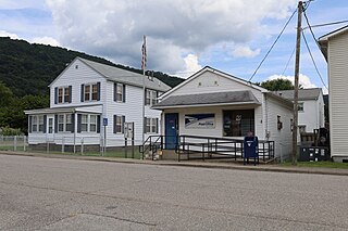
Reedy is a town in Roane County, West Virginia, United States. The population was 152 at the 2020 census.
Montgomery is a city in West Virginia, along the Kanawha River. Most of the city is in Fayette County, with the remainder in Kanawha County. The population was 1,280 at the 2020 census.
Smithers is a city in Fayette and Kanawha counties in the U.S. state of West Virginia. Located along the Kanawha River, it lies almost entirely in Fayette County. The population was 751 at the 2020 census. The city most likely takes its name from Smithers Creek. The small river city is noted for having a rich cultural history related to both its coal mining and Italian-American heritages.