
The Ohio River is a 981-mile (1,579 km) long river in the United States. It is located at the boundary of the Midwestern and Southern United States, flowing in a southwesterly direction from western Pennsylvania to its mouth on the Mississippi River at the southern tip of Illinois. It is the third largest river by discharge volume in the United States and the largest tributary by volume of the north-south flowing Mississippi River that divides the eastern from western United States. It is also the 6th oldest river on the North American continent. The river flows through or along the border of six states, and its drainage basin includes parts of 14 states. Through its largest tributary, the Tennessee River, the basin includes several states of the southeastern U.S. It is the source of drinking water for five million people.

West Virginia is a state in the Southern United States. It is bordered by Pennsylvania to the north and east, Maryland to the east and northeast, Virginia to the southeast, Kentucky to the southwest, and Ohio to the northwest. West Virginia is the 10th-smallest state by area and ranks as the 12th-least populous state, with a population of 1,793,716 residents. The capital and largest city is Charleston which has a population of 49,055.

Charleston is the capital and most populous city of the U.S. state of West Virginia and the seat of Kanawha County. Located at the confluence of the Elk and Kanawha rivers, the city had a population of 48,864 at the 2020 census and an estimated population of 48,018 in 2021. The Charleston metropolitan area as a whole had an estimated 255,020 residents in 2021.
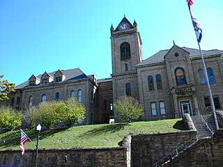
McDowell County is a county in the U.S. state of West Virginia. As of the 2020 census, the population was 19,111. Its county seat is Welch. McDowell County is the southernmost county in the state. It was created in 1858 by the Virginia General Assembly and named for Virginia Governor James McDowell. It became a part of West Virginia in 1863, when several Union-affiliated counties seceded from the state of Virginia during the American Civil War. McDowell County is located in the Cumberland Mountains, part of the Appalachia region.

Jefferson County is located in the Shenandoah Valley in the Eastern Panhandle of West Virginia. It is the easternmost county of the U.S. state of West Virginia. As of the 2020 census, the population was 57,701. Its county seat is Charles Town. The county was founded in 1801, and today is part of the Washington metropolitan area.

Romney is a town in and the county seat of Hampshire County, West Virginia, United States. The population was 1,722 at the 2020 census. It is part of the Winchester, Virginia metropolitan area. Established in 1762 along with Shepherdstown, they are the oldest towns in West Virginia.

Morgantown is a city in and the county seat of Monongalia County, West Virginia, United States, situated along the Monongahela River. The largest city in North Central West Virginia and the third-largest city in the state, Morgantown is best known as the home of West Virginia University. The population was 30,347 at the 2020 census. The city serves as the anchor of the Morgantown metropolitan area, which had a population of 138,176 in 2020.

Beckley is a city in and the county seat of Raleigh County, West Virginia, United States. The population was 17,286 at the 2020 census, making it the ninth-largest city in the state. It is the principal city of the Beckley metropolitan area of Southern West Virginia, home to 115,079 residents in 2020. Beckley was founded on April 4, 1838, and was long known for its ties to the coal mining industry. It is the home of the West Virginia University Institute of Technology, as well as campuses of Concord University and the University of Charleston.

The Southeastern United States, also referred to as the American Southeast, the Southeast, or simply the South, is a geographical region of the United States. It is located broadly on the eastern portion of the Southern United States and the southern portion of the Eastern United States. It comprises at least a core of states on the lower East Coast of the United States and eastern Gulf Coast. Expansively, it reaches as far north as West Virginia and Maryland, which borders the Ohio River and Mason–Dixon line, and stretches as far west as Arkansas and Louisiana. There is no official U.S. government definition of the region, though various agencies and departments use different definitions.

These are tables of congressional delegations from West Virginia to the United States House of Representatives and the United States Senate.

The Eastern Panhandle is the eastern of the two panhandles in the U.S. state of West Virginia; the other is the Northern Panhandle. It is a small stretch of territory in the northeast of the state, bordering Maryland and Virginia. Some sources and regional associations only identify the Eastern Panhandle as being composed of Morgan, Berkeley, and Jefferson counties. Berkeley and Jefferson counties are geographically located in the Shenandoah Valley. West Virginia is the only U.S. state with two panhandles.
The Bluefield Micropolitan Statistical Area, as defined by the United States Census Bureau, is an area consisting of two counties – one in West Virginia and one in Virginia – anchored by the town of Bluefield, West Virginia.

The 2020 United States presidential election in West Virginia was held on Tuesday, November 3, 2020, as part of the 2020 United States presidential election in which all 50 states plus the District of Columbia participated. West Virginia voters chose electors to represent them in the Electoral College via a popular vote, pitting the Republican Party's nominee, incumbent President Donald Trump, and running mate Vice President Mike Pence against Democratic Party nominee, former Vice President Joe Biden, and his running mate California Senator Kamala Harris. West Virginia had five electoral votes in the Electoral College.


