
Charleston is the capital and most populous city of the U.S. state of West Virginia. Located at the confluence of the Elk and Kanawha rivers, the city had a population of 51,400 at the 2010 census and an estimated population of 46,536 in 2019. The Charleston metropolitan area as a whole had an estimated 208,089 residents in 2019. Charleston is the center of government, commerce, and industry for Kanawha County, of which it is the county seat.

Mason County is a county in the U.S. state of West Virginia. As of the 2010 census, the population was 27,324. Its county seat is Point Pleasant. The county was founded in 1804 and named for George Mason, delegate to the U.S. Constitutional Convention. Before the Civil War, the county was in the State of Virginia.

Kanawha County is a county in the U.S. state of West Virginia. As of the 2019 American Community Survey, the population was 183,279. This was a decrease of 9,784 since the 2010 Census making it West Virginia's most populous county. The county seat is Charleston, also the state capital. Kanawha County is part of the Charleston, WV Metropolitan Statistical Area.

The Kanawha River is a tributary of the Ohio River, approximately 97 mi (156 km) long, in the U.S. state of West Virginia. The largest inland waterway in West Virginia, its valley has been a significant industrial region of the state since early in the 19th century.

The Little Kanawha River is a tributary of the Ohio River, 169 mi (269 km) long, in western West Virginia in the United States. Via the Ohio, it is part of the watershed of the Mississippi River, draining an area of 2,320 mi² (6,009 km²) on the unglaciated portion of the Allegheny Plateau. It served as an important commercial water route in the early history of West Virginia, particularly in the logging and petroleum industries.

Deep Water, also known historically as Deepwater, is a census-designated place on the Kanawha River in Fayette County, West Virginia, United States. As of the 2010 census, its population was 280. It is best known as the starting point of the Deepwater Railway founded in 1898 by William N. Page, which was merged to create the Virginian Railway in 1907.

The James River and Kanawha Canal was a partially built canal in Virginia intended to facilitate shipments of passengers and freight by water between the western counties of Virginia and the coast. Ultimately its towpath became the roadbed for a rail line following the same course.

The West Virginia Air National Guard is the aerial militia of the State of West Virginia, United States of America. It is, along with the West Virginia Army National Guard, an element of the West Virginia National Guard.
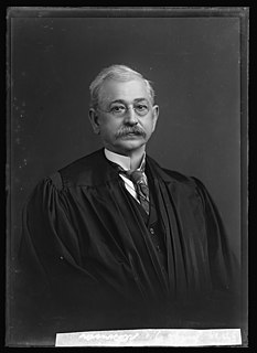
George Wesley Atkinson, a cavalryman, lawyer, politician, judge and scholar, became the 10th Governor of West Virginia after running as the candidate of the Republican Party. He also served in the West Virginia House of Delegates, as well as in the U.S. Congress from West Virginia and ended his career of public service as a United States federal judge of the Court of Claims.

Amherst-Plymouth Wildlife Management Area is a 7,061-acre (2,857 ha) protected area located in Putnam County, West Virginia. The site is along the banks of the Kanawha River and is popular for hunting Canada geese in the fall. Access is from West Virginia Route 62 between Bancroft and Hometown and from Manilla Creek Road and Heizer Creek Road off WV 62 north of Poca, West Virginia. Manilla Creek Road cuts across the north side of the Amherst-Plymouth WMA, and WV 62 follows the southern edge of the area alongside the Kanawha River.

Plymouth is an unincorporated community in Putnam County, West Virginia, United States.
Hansford is an unincorporated community in Kanawha County, West Virginia, United States. Hansford is located along the Kanawha River and West Virginia Route 61 adjacent to Pratt. Hansford has a post office with ZIP code 25103.

Kanawha Falls is an unincorporated community in Fayette County, West Virginia, United States. Kanawha Falls is located on the east bank of the Kanawha River 2 miles (3.2 km) southwest of Gauley Bridge. Kanawha Falls had a post office, which opened on March 26, 1856, and closed on November 2, 2002.
Diamond is an unincorporated community in Kanawha County, West Virginia, United States. Diamond is located on the north bank of the Kanawha River 1.5 miles (2.4 km) southeast of Belle. The community is served by U.S. Route 60.
Dickinson, also known as Quincy, is an unincorporated community in Kanawha County, West Virginia, United States. Dickinson is located on the north bank of the Kanawha River 3 miles (4.8 km) southeast of Belle. The community is served by U.S. Route 60.
Tyler Heights, also known as Flatwoods, is an unincorporated community in Kanawha County, West Virginia, United States. Tyler Heights is located along West Virginia Route 622 at its junction with West Virginia Route 501, 5 miles (8.0 km) east-northeast of Nitro.
Tyler Mountain is an unincorporated community in Kanawha County, West Virginia, United States. Tyler Mountain is located at the junction of West Virginia Route 62 and West Virginia Route 501 5.5 miles (8.9 km) west-northwest of Charleston.
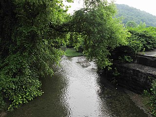
Campbells Creek is a tributary of the Kanawha River, 18.5 miles (29.8 km) long, in West Virginia in the United States. Via the Kanawha and Ohio rivers, it is part of the watershed of the Mississippi River, draining an area of 39.3 square miles (102 km2) on the unglaciated portion of the Allegheny Plateau, in the Charleston metropolitan area.

Booker T. Washington State Park is a former state park near the community of Institute in the U.S. state of West Virginia. The park was operated by the West Virginia Conservation Commission, Division of State Parks, from 1949 until the late 1950s.

Arbuckle Magisterial District is one of ten magisterial districts in Mason County, West Virginia. The district was originally established as a civil township in 1863, and converted into a magisterial district in 1872. In 2010, Arbuckle District was home to 1,121 people.


