East Beckley was an unincorporated community located in Raleigh County, West Virginia. Its post office was reopened in February 2014. East Beckley comprised parts of the unincorporated communities of Sylvia and Atkinsville.
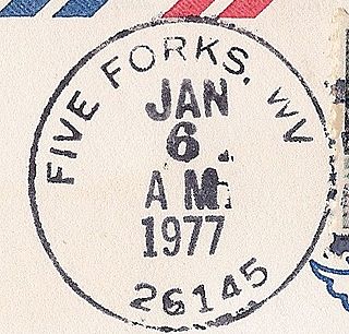
Five Forks is an unincorporated community in Calhoun County, West Virginia, United States. It lies along West Virginia Route 16 to the north of the town of Grantsville, the county seat of Calhoun County. Its elevation is 1,106 feet (337 m). The Five Forks Post Office is closed.
Belva is an unincorporated community and census-designated place in west Nicholas County and north Fayette County, West Virginia, United States; while the CDP only includes the Nicholas County portion, the Fayette County portion is considered part of the community. The town is situated at the bottomland surrounding the convergence of Bells Creek with Twentymile Creek and, subsequently, Twenty Mile Creek with the Gauley River. Belva is also the location of the convergence of two state highways: West Virginia Route 16 and West Virginia Route 39.

Sullivan is an unincorporated community in Raleigh County, West Virginia, United States. Sullivan is 3 miles (4.8 km) east of Sophia. The Sullivan post office has been closed.
Turtle Creek is an unincorporated community in Boone County, West Virginia, United States. Turtle Creek is located along U.S. Route 119, 3.5 miles (5.6 km) southwest of Madison. Turtle Creek has a post office with ZIP code 25203.
Dorothy is an unincorporated community in Raleigh County, West Virginia, United States. Dorothy is 4.5 miles (7.2 km) east-southeast of Whitesville. Dorothy has a post office with ZIP code 25060. At one time, it was also called Lawson.
Clear Creek is an unincorporated community in Raleigh County, West Virginia, United States. Clear Creek is 4.5 miles (7.2 km) west of Pax. Clear Creek has a post office with ZIP code 25044.
Davin is an unincorporated community in Logan County, West Virginia, United States. Davin is located on West Virginia Route 10 and Huff Creek, 3 miles (4.8 km) east-southeast of Man. Davin has a post office with ZIP code 25617. Davin's population is counted as part of the Mallory census-designated place.

Saxman was an unincorporated community in Nicholas County, West Virginia, United States. Saxman is 3.5 miles (5.6 km) west-southwest of Richwood. It has ceased existing totally. The Saxman post office is also gone.
Pleasant View is an unincorporated community in Jackson County, West Virginia, United States. Pleasant View is located on the Ohio River and West Virginia Route 2, 2.3 miles (3.7 km) southwest of Ravenswood. Pleasant View once had a post office, which is now closed.
Ward is an unincorporated community and coal town in Kanawha County, West Virginia, United States. Its post office is closed. Ward is approximately 3 miles (4.8 km) northeast of Cedar Grove, along Kellys Creek.
Ben Lomond is an unincorporated community in Mason County, West Virginia, United States. It is located on the eastern bank of the Ohio River at the junction of West Virginia Route 2 and County Route 56,, some 9.7 miles (15.6 km) south-southwest of Point Pleasant.
Carney was an unincorporated community in Kanawha County, West Virginia, United States. Its post office is closed.
Notomine is an unincorporated community in Kanawha County, West Virginia, United States. Its post office is closed.
Copenhaver was an unincorporated community in Kanawha County, West Virginia, United States. Its post office is closed.
Republic is an unincorporated community in Kanawha County, West Virginia, United States, along Cabin Creek. It was also known as Jochin. Its post office is closed.
Jordan Run is an unincorporated community in Grant County, West Virginia, United States. Its post office is closed. It was also known as Jordon Run.
Wevaco is an unincorporated community and former coal town in Kanawha County, West Virginia, United States. It had a post office but is now closed.
Kanauga is an unincorporated community and census-designated place (CDP) in Gallia County, Ohio, United States. As of the 2020 census it had a population of 185.
Spilman is an unincorporated community on the Ohio River in Mason County, West Virginia, United States. The village is located along Spilman Lane, Mason County Route 62/24, parallel to West Virginia Route 62 in Waggener District, about three quarters of a mile southeast of West Columbia.


