Chesapeake, West Virginia

Last updated

Chesapeake, West Virginia
Chesapeake, West Virginia.jpg
Maccorkle Avenue in Chesapeake
Kanawha County West Virginia Incorporated and Unincorporated areas Chesapeake Highlighted.svg
Location of Chesapeake in Kanawha County, West Virginia.
Coordinates: 38°13′21″N81°32′10″W / 38.22250°N 81.53611°W / 38.22250; -81.53611
Country United States
State West Virginia
County Kanawha
Area
[1]
  Total0.64 sq mi (1.66 km2)
  Land0.48 sq mi (1.25 km2)
  Water0.16 sq mi (0.42 km2)
Elevation
607 ft (185 m)
Population
 (2020) [2]
  Total1,336
  Estimate 
(2021) [2]
1,313
  Density2,939.71/sq mi (1,134.12/km2)
Time zone UTC-5 (Eastern (EST))
  Summer (DST) UTC-4 (EDT)
Area code 304
FIPS code 54-15028 [3]
GNIS feature ID1554120 [4]
Website https://chesapeake.wv.gov/Pages/default.aspx

Chesapeake is a town in Kanawha County, West Virginia, United States. The population was 1,336 at the 2020 census. [2] The town is situated on the Kanawha River.

Contents

History

Chesapeake was incorporated on November 1, 1948, and was named for the Chesapeake and Ohio Railway, [5] which has served the community since 1873.

Geography

According to the United States Census Bureau, the town has a total area of 0.64 square miles (1.66 km2), of which 0.48 square miles (1.24 km2) is land and 0.16 square miles (0.41 km2) is water. [6]

Demographics

Historical population
CensusPop.Note
1950 2,566
1960 2,6995.2%
1970 2,428−10.0%
1980 2,364−2.6%
1990 1,896−19.8%
2000 1,643−13.3%
2010 1,554−5.4%
2020 1,336−14.0%
2021 (est.)1,313 [2] −1.7%
U.S. Decennial Census [7]

2020 Census

At the 2020 Census there were 1,336 people, 617 occupied households, and 117 vacant properties in the town. The population density was 2,939.71 inhabitants per square mile (1,135.0/km2). [8]

2010 census

At the 2010 census there were 1,554 people, 691 households, and 425 families living in the town. The population density was 3,237.5 inhabitants per square mile (1,250.0/km2). There were 809 housing units at an average density of 1,685.4 per square mile (650.7/km2). The racial makeup of the town was 88.7% White, 9.6% African American, 0.2% Native American, 0.2% from other races, and 1.4% from two or more races. Hispanic or Latino of any race were 0.5%. [9]

Of the 691 households 26.6% had children under the age of 18 living with them, 38.9% were married couples living together, 18.4% had a female householder with no husband present, 4.2% had a male householder with no wife present, and 38.5% were non-families. 33.6% of households were one person and 14.3% were one person aged 65 or older. The average household size was 2.25 and the average family size was 2.84.

The median age in the town was 43.5 years. 20.8% of residents were under the age of 18; 7.3% were between the ages of 18 and 24; 23.6% were from 25 to 44; 30.9% were from 45 to 64; and 17.4% were 65 or older. The gender makeup of the town was 47.1% male and 52.9% female.

2000 census

At the 2000 census there were 1,643 people, 750 households, and 480 families living in the town. The population density was 3,487.3 inhabitants per square mile (1,349.7/km2). There were 851 housing units at an average density of 1,806.3 per square mile (699.1/km2). The racial makeup of the town was 88.19% White, 10.04% African American, 0.06% Native American, 0.12% Asian, 0.06% Pacific Islander, 0.37% from other races, and 1.16% from two or more races. Hispanic or Latino of any race were 0.37%. [3]

Of the 750 households 22.8% had children under the age of 18 living with them, 42.3% were married couples living together, 16.9% had a female householder with no husband present, and 35.9% were non-families. 31.5% of households were one person and 15.6% were one person aged 65 or older. The average household size was 2.19 and the average family size was 2.71.

The age distribution was 19.7% under the age of 18, 6.9% from 18 to 24, 25.9% from 25 to 44, 27.1% from 45 to 64, and 20.3% 65 or older. The median age was 43 years. For every 100 females, there were 83.2 males. For every 100 females age 18 and over, there were 80.2 males.

The median household income was $29,526 and the median family income was $35,703. Males had a median income of $30,588 versus $21,458 for females. The per capita income for the town was $16,307. About 14.3% of families and 19.1% of the population were below the poverty line, including 38.9% of those under age 18 and 10.9% of those age 65 or over.

Government

The current Mayor of Chesapeake is Melissa J. Hill, effective July 1, 2023. [10] [11]

Notable people

Related Research Articles

<span class="mw-page-title-main">Westbrook, Connecticut</span> Town in Connecticut, United States

Westbrook is a town in Middlesex County, Connecticut, United States. The town is part of the Lower Connecticut River Valley Planning Region. The population was 6,769 at the 2020 census. The town center is classified by the U.S. Census Bureau as a census-designated place (CDP).

<span class="mw-page-title-main">Houston, Delaware</span> Town in Delaware, United States

Houston is a town in Kent County, Delaware, United States. It is part of the Dover metropolitan area. The population was 381 in 2020. It was named for John W. Houston.

<span class="mw-page-title-main">Monroe, Adams County, Indiana</span> Town in Indiana, United States

Monroe is a town in Washington and Monroe townships, Adams County, Indiana, United States. The population of the town was 945 residents at the 2019 census. Adams Central Community Schools is located in Monroe.

<span class="mw-page-title-main">Earlham, Iowa</span> City in Iowa, United States

Earlham is a city in Madison County, Iowa, United States. The population was 1,410 at the time of the 2020 census. It is part of the Des Moines–West Des Moines Metropolitan Statistical Area.

<span class="mw-page-title-main">Hoyt, Kansas</span> City in Jackson County, Kansas

Hoyt is a city in Jackson County, Kansas, United States. As of the 2020 census, the population of the city was 593.

Bradley is a town in Penobscot County, Maine, United States. It is part of the Bangor Metropolitan Statistical Area. The population was 1,532 at the 2020 census. The village of Bradley is in the northwestern corner of the town.

<span class="mw-page-title-main">North Beach, Maryland</span> Town in Maryland

North Beach is a town in Calvert County, Maryland, United States. The population was 1,978 at the 2010 U.S. Census.

<span class="mw-page-title-main">Chesapeake City, Maryland</span> Town in Maryland, United States

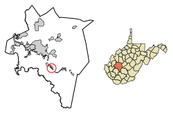
Chesapeake City is a town in Cecil County, Maryland, United States. The population was 736 at the 2020 census.

<span class="mw-page-title-main">Isanti, Minnesota</span> City in the United States

Isanti is a city in Isanti County, Minnesota, United States. The population was 6,804 at the 2020 census. The name Isanti is composed of two Dakota words: isan ("knife") and ati ("camp"), and refers to the Santee Dakota people.

<span class="mw-page-title-main">Mountain Iron, Minnesota</span> City in Minnesota, United States

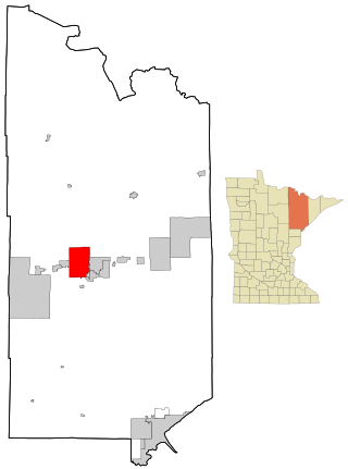
Mountain Iron is a city in Saint Louis County, Minnesota, United States, in the heart of the Mesabi Range. The population was 2,878 at the 2020 census.

<span class="mw-page-title-main">Chaffee, Missouri</span> City in Missouri, United States

Chaffee is a city in Scott County, Missouri, United States. The population was 3,057 at the 2020 census.

<span class="mw-page-title-main">Dellwood, Missouri</span> City in Missouri, United States

Dellwood is a city in the north St. Louis County, Missouri, United States. The population was 5,025 at the 2010 census. The center of Dellwood or the city of Dellwood was located at the intersections of West Florissant Ave. and Chambers Road.

<span class="mw-page-title-main">Bridgeport, Ohio</span> Village in Ohio, United States

Bridgeport is a village in eastern Belmont County, Ohio, United States. It lies across the Ohio River from Wheeling, West Virginia, at the mouth of Wheeling Creek and is connected by two bridges to Wheeling Island. The population was 1,582 at the 2020 census. It is part of the Wheeling metropolitan area.

<span class="mw-page-title-main">Chesapeake, Ohio</span> Village in Ohio, United States

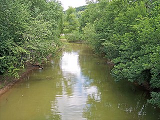
Chesapeake is a village in Lawrence County, Ohio, United States. The population was 691 as of the 2020 census. It lies across the Ohio River from Huntington, West Virginia, at the mouth of Symmes Creek.

<span class="mw-page-title-main">Hanging Rock, Ohio</span> Village in Ohio, United States

Hanging Rock is a village in Lawrence County, Ohio, United States, along the Ohio River. The population was 204 at the 2020 census.

<span class="mw-page-title-main">Handley, West Virginia</span> Town in West Virginia, United States

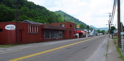
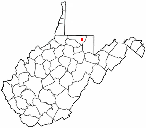
Handley is a town in Kanawha County, West Virginia, United States. The population was 224 at the 2020 census. Handley was first established in 1877 and known as Upper Creek until July 29, 1881, when its name was changed to Handley for pioneer settlers who farmed the area. Handley has the distinction of bearing a name like no other town in the United States. The town was incorporated November 1972.

<span class="mw-page-title-main">Brookhaven, West Virginia</span> CDP in West Virginia

Brookhaven is a census-designated place (CDP) in Monongalia County, West Virginia, United States. The population was 5,707 at the 2020 census. It is included in the Morgantown, West Virginia Metropolitan Statistical Area.

<span class="mw-page-title-main">Buffalo, West Virginia</span> Town in West Virginia, United States

Buffalo is a town in Putnam County, West Virginia, United States, located along the Kanawha River. The population was 1,211 at the time of the 2020 census It is part of the Huntington–Ashland metropolitan area.

<span class="mw-page-title-main">Pine Grove, West Virginia</span> Town in West Virginia, United States

Pine Grove is a town in Wetzel County, West Virginia, United States. The population was 363 at the 2020 census. The community was named for a grove of pine trees near the original town site.

<span class="mw-page-title-main">East Millinocket, Maine</span> Town in the state of Maine, United States

East Millinocket is a town in Penobscot County, Maine, United States. The population was 1,572 at the 2020 census.

References

  1. "2019 U.S. Gazetteer Files". United States Census Bureau. Retrieved August 7, 2020.
  2. 1 2 3 4 "City and Town Population Totals: 2020-2021". Census.gov. US Census Bureau. Retrieved July 3, 2022.
  3. 1 2 "U.S. Census website". United States Census Bureau . Retrieved January 31, 2008.
  4. "US Board on Geographic Names". United States Geological Survey. October 25, 2007. Retrieved January 31, 2008.
  5. Kenny, Hamill (1945). West Virginia Place Names: Their Origin and Meaning, Including the Nomenclature of the Streams and Mountains. Piedmont, WV: The Place Name Press. p. 169.
  6. "US Gazetteer files 2010". United States Census Bureau. Archived from the original on January 25, 2012. Retrieved January 24, 2013.
  7. "Census of Population and Housing". Census.gov. Retrieved June 4, 2015.
  8. "Explore Census Data". data.census.gov. Retrieved August 23, 2023.
  9. "U.S. Census website". United States Census Bureau . Retrieved January 24, 2013.
  10. SAUNDERS, ANNA (June 14, 2023). "New mayors elected in Cedar Grove, Chesapeake". WCHS. Retrieved August 23, 2023.
  11. Stone, Greg (June 15, 2023). "Hill becomes Chesapeake's first Black mayor". Charleston Gazette-Mail. Retrieved August 23, 2023.
  12. DatabaseFootball Archived February 5, 2010, at the Wayback Machine
  13. Thomas, Clint (September 10, 2008). "East Bank graduate country powerhouse". The Charleston Gazette. p. 1. ProQuest   331599726.