Nutter Fort, West Virginia

Last updated

Nutter Fort, West Virginia
Flag of Nutter Fort, West Virginia.svg
Motto: 
Progress With a Small Town Atmosphere
Harrison County West Virginia Incorporated and Unincorporated areas Nutter Fort Highlighted.svg
Location of Nutter Fort in Harrison County, West Virginia.
Coordinates: 39°15′44″N80°19′21″W / 39.26222°N 80.32250°W / 39.26222; -80.32250
Country United States
State West Virginia
County Harrison
Government
  MayorSam Maxson
  Police ChiefR.W. Godwin
Area
[1]
  Total0.89 sq mi (2.30 km2)
  Land0.89 sq mi (2.30 km2)
  Water0.00 sq mi (0.00 km2)
Elevation
1,056 ft (322 m)
Population
 (2020) [2]
  Total1,497
  Estimate 
(2021) [2]
1,478
  Density1,700.79/sq mi (656.40/km2)
Time zone UTC-5 (Eastern (EST))
  Summer (DST) UTC-4 (EDT)
ZIP code
26301
Area code 304
FIPS code 54-59836 [3]
GNIS feature ID1555248 [4]
Website townofnutterfort.com

Nutter Fort is a town in Harrison County, West Virginia, United States, incorporated in 1923. The town is a southeastern suburb of Clarksburg.

Contents

History

In the 1770s, brothers, Thomas Nutter, Matthew, John, and Christopher, arrived, securing a 1,400-acre land grant along the Elk Creek in what was then Monongalia County. Seeking refuge from the conflicts, they hew logs and erected a formidable fort in 1772 with the help of settlers Obadiah and Daniel Davisson. This bastion, later known as Nutter's Fort, offered sanctuary to settlers fleeing Native American raids. The original fort is no longer standing; only its foundation remains. [5]

The construction of the West Virginia Central and Pittsburgh Railroad in the 1880s facilitated the transportation of Nutter Fort's newly discovered coal resources to Clarksburg. The town is now more focused on education and community development.

West Virginia Blackberry Festival

The West Virginia Blackberry Festival, held from 1996 to 2019, showcased the region's agricultural heritage and the preservation of its historical landmarks, including the old Roosevelt-Wilson High School. The festival ended with COVID-19 as the main reason for cancellation in 2019 but has not continued since up to 2024.

Geography

Nutter Fort is located at 39°15′44″N80°19′21″W / 39.26222°N 80.32250°W / 39.26222; -80.32250 (39.262163, −80.322389), [6] along Elk Creek. [7]

According to the United States Census Bureau, the town has a total area of 0.85 square miles (2.20 km2), all land. [8]

Demographics

Historical population
CensusPop.Note
1930 1,825
1940 1,803−1.2%
1950 2,28526.7%
1960 2,4406.8%
1970 2,379−2.5%
1980 2,078−12.7%
1990 1,819−12.5%
2000 1,686−7.3%
2010 1,593−5.5%
2020 1,497−6.0%
2021 (est.)1,478 [2] −1.3%
U.S. Decennial Census [9]

2010 census

As of the 2010 census [10] there were 1,593 people, 743 households, and 436 families living in the town. The population density was 1,874.1 inhabitants per square mile (723.6/km2). There were 826 housing units at an average density of 971.8 per square mile (375.2/km2). The racial makeup of the town was 96.4% White, 0.8% African American, 0.2% Native American, 0.5% Asian, 0.3% from other races, and 1.9% from two or more races. Hispanic or Latino of any race were 1.3% of the population.

There were 743 households, of which 25.8% had children under the age of 18 living with them, 39.0% were married couples living together, 14.0% had a female householder with no husband present, 5.7% had a male householder with no wife present, and 41.3% were non-families. 36.6% of all households were made up of individuals, and 15.7% had someone living alone who was 65 years of age or older. The average household size was 2.13 and the average family size was 2.74.

The median age in the town was 41.8 years. 19.1% of residents were under the age of 18; 6.8% were between the ages of 18 and 24; 28.2% were from 25 to 44; 26.4% were from 45 to 64; and 19.3% were 65 years of age or older. The gender makeup of the town was 47.5% male and 52.5% female.

2000 census

As of the census [3] of 2000, there were 1,686 people, 793 households, and 470 families living in the town. The population density was 1,902.9 inhabitants per square mile (731.4/km2). There were 860 housing units at an average density of 970.6 per square mile (373.1/km2). The racial makeup of the town was 97.75% White, 0.89% African American, 0.06% Native American, 0.30% Asian, and 1.01% from two or more races. Hispanic or Latino of any race were 1.01% of the population.

There were 793 households, out of which 21.7% had children under the age of 18 living with them, 44.9% were married couples living together, 11.1% had a female householder with no husband present, and 40.7% were non-families. 35.6% of all households were made up of individuals, and 16.6% had someone living alone who was 65 years of age or older. The average household size was 2.12 and the average family size was 2.72.

In the town, the population was spread out, with 18.2% under the age of 18, 8.1% from 18 to 24, 27.5% from 25 to 44, 26.3% from 45 to 64, and 20.0% who were 65 years of age or older. The median age was 42 years. For every 100 females, there were 88.6 males. For every 100 females age 18 and over, there were 85.6 males.

The median income for a household in the town was $30,163, and the median income for a family was $39,318. Males had a median income of $26,855 versus $18,816 for females. The per capita income for the town was $18,431. About 11.6% of families and 14.3% of the population were below the poverty line, including 24.5% of those under age 18 and 1.5% of those age 65 or over.

Notable locations

Transportation

Related Research Articles

<span class="mw-page-title-main">Grantsville, West Virginia</span> Town in West Virginia, United States

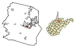
Grantsville is a town in Calhoun County, West Virginia, United States. The population was 482 at the 2020 census. It is the county seat of Calhoun County. The town was established along the Little Kanawha River in 1865 and named for Ulysses S. Grant. Grantsville is home to Wayne Underwood Park, which includes a .25-mile-long (0.40 km) walking trail, and to the annual West Virginia Wood Festival.

<span class="mw-page-title-main">Bayard, West Virginia</span> Town in West Virginia, United States

Bayard is a town in Grant County, West Virginia, United States. The population was 200 at the 2020 census. Bayard was incorporated in 1893 and named in honor of Thomas F. Bayard, Jr., who later became a United States senator from Delaware (1923–1929). Bayard was founded on the West Virginia Central and Pittsburgh Railroad as a coal mining community. Coal mining has remained the town's chief industry.

<span class="mw-page-title-main">West Milford, West Virginia</span> Town in West Virginia, United States

West Milford is a town in Harrison County, West Virginia, United States. The population was 452 at the 2020 census.

<span class="mw-page-title-main">West Hamlin, West Virginia</span> Town in West Virginia, United States

West Hamlin is a town in Lincoln County, West Virginia, United States, along the Guyandotte River. The population was 519 at the 2020 census, and is now down to 509, according to the 2021 census. West Hamlin is a part of the Huntington-Ashland, WV-KY-OH, Metropolitan Statistical Area (MSA). West Hamlin is west of the county seat at Hamlin, hence the name.

<span class="mw-page-title-main">Worthington, West Virginia</span> Town in West Virginia, United States

Worthington is a town in Marion County, West Virginia, United States. The population was 158 at the 2010 census. Worthington was incorporated in 1893 and named for Colonel George Worthington, an early settler. U.S. Route 19 passes through the town.

<span class="mw-page-title-main">Cameron, West Virginia</span> City in West Virginia

Cameron is a city in Marshall County, West Virginia, United States. It is part of the Wheeling metropolitan area. The population was 849 at the 2020 census.

<span class="mw-page-title-main">Glen Dale, West Virginia</span> Town in West Virginia

Glen Dale is a city in Marshall County, West Virginia, United States, along the Ohio River. It is part of the Wheeling, West Virginia Metropolitan Statistical Area. The population was 1,514 at the 2020 census. Glen Dale was incorporated in 1924. It is in the northwest part of the county, which is above the Mason–Dixon line and forms the base of the Northern Panhandle of West Virginia.

<span class="mw-page-title-main">Mason, West Virginia</span> Town in West Virginia, United States

Mason, also known as Mason City, is a town in Mason County, West Virginia, United States. The population was 865 at the 2020 census. It is part of the Point Pleasant, WV–OH Micropolitan Statistical Area.

<span class="mw-page-title-main">Anawalt, West Virginia</span> Town in West Virginia, United States

Anawalt is a town in McDowell County, West Virginia, United States. At one time it was known as Jeanette. It is named in honor of James White Anawalt, who was then manager of Union Supply Company, a subsidiary of the United States Steel Company. The population was 186 at the 2020 census. Coal mining was the town's chief industry.

<span class="mw-page-title-main">Iaeger, West Virginia</span> Town in West Virginia, United States

Iaeger is a town in McDowell County, West Virginia, United States. The population was 257 at the 2020 census.

<span class="mw-page-title-main">Reedsville, West Virginia</span> Town in West Virginia, United States

Reedsville is a town in western Preston County, West Virginia, United States. The population was 530 at the 2020 census. It is part of the Morgantown metropolitan area.

<span class="mw-page-title-main">Tunnelton, West Virginia</span> Town in West Virginia, United States

Tunnelton is a town in southwestern Preston County, West Virginia, United States. The population was 307 at the 2020 census. It is part of the Morgantown metropolitan area.

<span class="mw-page-title-main">Mabscott, West Virginia</span> Town in West Virginia, United States

Mabscott is a town in Raleigh County, West Virginia, United States. The population was 1,333 at the 2020 census. The town's name is a contraction of the name Mabel Scott, wife of local coal operator Cyrus H. Scott.

<span class="mw-page-title-main">Cairo, West Virginia</span> Town in West Virginia, United States

Cairo is a town in Ritchie County, West Virginia, United States, along West Virginia Route 31, the North Fork of the Hughes River, and the North Bend Rail Trail. The population was 174 at the 2020 census.

<span class="mw-page-title-main">Ellenboro, West Virginia</span> Town in West Virginia, United States

Ellenboro is a town in Ritchie County, West Virginia, United States. The population was 222 at the 2020 census. The town is located at the junction of U.S. Route 50 and West Virginia Route 16; the North Bend Rail Trail also passes through the town. The town was named for Ellen Mariah Williamson, the eldest daughter of the family that granted a right of way for the Baltimore and Ohio Railroad to build their line through the town; an earlier name for the community was Shumley. Ellenboro was incorporated in 1903.

<span class="mw-page-title-main">Pennsboro, West Virginia</span> City in West Virginia, United States

Pennsboro is a city in Ritchie County, West Virginia, United States. The population was 1,050 at the 2020 census. The city is located at the junction of U.S. Route 50 and West Virginia Route 74; the North Bend Rail Trail also passes through the city.

<span class="mw-page-title-main">Flemington, West Virginia</span> Town in West Virginia, United States

Flemington is a town in Taylor County, West Virginia, United States. The population was 311 at the 2020 census. Flemington was incorporated in 1922 by the West Virginia Circuit Court, and named for James Fleming, an early settler in the area originally from Hampshire County.

<span class="mw-page-title-main">Fort Gay, West Virginia</span> Town in West Virginia, United States

Fort Gay is a town in Wayne County, West Virginia, United States, situated along the Tug Fork and Big Sandy rivers. The town adjoins Louisa, Kentucky. The population was 677 at the 2020 census.

<span class="mw-page-title-main">Elizabeth, West Virginia</span> Town in West Virginia, United States

Elizabeth is a town in and the county seat of Wirt County, West Virginia, United States, situated along the Little Kanawha River. The population was 724 as of the 2020 census.

<span class="mw-page-title-main">Oceana, West Virginia</span> Town in West Virginia, United States

Oceana is a town in Wyoming County, West Virginia. The population was 1,462 at the time of the 2020 census. Oceana is the oldest city in Wyoming County and was the county seat until 1907.

References

  1. "2019 U.S. Gazetteer Files". United States Census Bureau. Retrieved August 7, 2020.
  2. 1 2 3 "City and Town Population Totals: 2020-2021". Census.gov. US Census Bureau. Retrieved July 2, 2022.
  3. 1 2 "U.S. Census website". United States Census Bureau . Retrieved January 31, 2008.
  4. "US Board on Geographic Names". United States Geological Survey. October 25, 2007. Archived from the original on February 12, 2012. Retrieved January 31, 2008.
  5. "Nutter Fort History". Archived from the original on September 16, 2009. Retrieved December 1, 2008.
  6. "US Gazetteer files: 2010, 2000, and 1990". United States Census Bureau. February 12, 2011. Retrieved April 23, 2011.
  7. DeLorme (1997). West Virginia Atlas & Gazetteer. Yarmouth, Maine: DeLorme. p.36. ISBN   0-89933-246-3.
  8. "US Gazetteer files 2010". United States Census Bureau. Archived from the original on January 25, 2012. Retrieved January 24, 2013.
  9. "Census of Population and Housing". Census.gov. Retrieved June 4, 2015.
  10. "U.S. Census website". United States Census Bureau . Retrieved January 24, 2013.