Pennsboro, West Virginia

Last updated

Pennsboro, West Virginia
Ritchie County West Virginia Incorporated and Unincorporated areas Pennsboro Highlighted.svg
Location of Pennsboro in Ritchie County, West Virginia.
Coordinates: 39°17′1″N80°58′2″W / 39.28361°N 80.96722°W / 39.28361; -80.96722
Country United States
State West Virginia
County Ritchie
Area
[2]
  Total2.72 sq mi (7.05 km2)
  Land2.70 sq mi (6.99 km2)
  Water0.03 sq mi (0.06 km2)
Elevation
866 ft (264 m)
Population
 (2020) [3]
  Total1,050
  Estimate 
(2021) [3]
1,040
  Density371.76/sq mi (143.52/km2)
Time zone UTC-5 (Eastern (EST))
  Summer (DST) UTC-4 (EDT)
ZIP code
26415
Area code 304
FIPS code 54-62764 [4]
GNIS feature ID1544704 [5]
Website local.wv.gov/Pennsboro

Pennsboro is a city [1] in Ritchie County, West Virginia, United States. The population was 1,050 at the 2020 census. [3] The city is located at the junction of U.S. Route 50 and West Virginia Route 74; the North Bend Rail Trail also passes through the city. [6]

Contents

The town was platted circa 1820 by Charles Penn, and named for him. [7]

Geography

Pennsboro is located at 39°17′1″N80°58′2″W / 39.28361°N 80.96722°W / 39.28361; -80.96722 (39.283528, -80.967097). [8]

According to the United States Census Bureau, the city has a total area of 2.73 square miles (7.07 km2), of which 2.70 square miles (6.99 km2) is land and 0.03 square miles (0.08 km2) is water. [9]

Demographics

Historical population
CensusPop.Note
1880 330
1890 57072.7%
1900 73829.5%
1910 93026.0%
1920 1,65477.8%
1930 1,616−2.3%
1940 1,7387.5%
1950 1,7530.9%
1960 1,660−5.3%
1970 1,614−2.8%
1980 1,6522.4%
1990 1,282−22.4%
2000 1,199−6.5%
2010 1,171−2.3%
2020 1,050−10.3%
2021 (est.)1,040 [3] −1.0%
U.S. Decennial Census [10]

2010 census

At the 2010 census there were 1,171 people, 522 households, and 312 families living in the city. The population density was 433.7 inhabitants per square mile (167.5/km2). There were 590 housing units at an average density of 218.5 per square mile (84.4/km2). The racial makeup of the city was 97.9% White, 0.3% African American, 0.5% Native American, 0.1% Asian, 0.4% from other races, and 0.9% from two or more races. Hispanic or Latino of any race were 1.0%. [11]

Of the 522 households 27.0% had children under the age of 18 living with them, 41.6% were married couples living together, 14.0% had a female householder with no husband present, 4.2% had a male householder with no wife present, and 40.2% were non-families. 34.5% of households were one person and 14.1% were one person aged 65 or older. The average household size was 2.24 and the average family size was 2.85.

The median age was 41.7 years. 21.7% of residents were under the age of 18; 8% were between the ages of 18 and 24; 24.8% were from 25 to 44; 28.5% were from 45 to 64; and 16.9% were 65 or older. The gender makeup of the city was 46.9% male and 53.1% female.

2000 census

At the 2000 census there were 1,199 people, 515 households, and 340 families living in the city. The population density was 550.8 inhabitants per square mile (212.7/km2). There were 604 housing units at an average density of 277.5 per square mile (107.1/km2). The racial makeup of the city was 98.67% White, 0.25% African American, 0.42% Native American, and 0.67% from two or more races. Hispanic or Latino of any race were 0.75%. [4]

Of the 515 households 28.5% had children under the age of 18 living with them, 51.5% were married couples living together, 10.9% had a female householder with no husband present, and 33.8% were non-families. 30.3% of households were one person and 16.3% were one person aged 65 or older. The average household size was 2.33 and the average family size was 2.89.

The age distribution was 22.9% under the age of 18, 7.8% from 18 to 24, 26.5% from 25 to 44, 25.9% from 45 to 64, and 16.9% 65 or older. The median age was 40 years. For every 100 females, there were 92.1 males. For every 100 females age 18 and over, there were 88.8 males.

The median household income was $24,120 and the median family income was $30,313. Males had a median income of $26,964 versus $20,714 for females. The per capita income for the city was $14,325. About 16.5% of families and 21.4% of the population were below the poverty line, including 33.1% of those under age 18 and 10.2% of those age 65 or over.

Related Research Articles

<span class="mw-page-title-main">Webb, Alabama</span> Town in Alabama, United States

Webb is a town in Houston County, Alabama, United States. It is named for plantation owner B. F. Webb, who settled in the area around 1890. The town was incorporated in 1903. It is part of the Dothan, Alabama Metropolitan Statistical Area. As of the 2010 census, the population was 1,430, up from 1,298 in 2000.

<span class="mw-page-title-main">Luther, Iowa</span> City in Iowa, United States

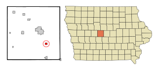
Luther is a city in Worth Township, Boone County, Iowa, United States. The population was 152 at the time of the 2020 census. It is part of the Boone, Iowa Micropolitan Statistical Area, which is a part of the larger Ames-Boone, Iowa Combined Statistical Area.

<span class="mw-page-title-main">Vermillion, Minnesota</span> City in Minnesota, United States

Vermillion is a city in Dakota County, Minnesota, United States. The population was 441 at the 2020 census.

<span class="mw-page-title-main">East Pennsboro Township, Cumberland County, Pennsylvania</span> Township in Pennsylvania, United States

East Pennsboro Township is a township in Cumberland County, Pennsylvania, United States. The population was 20,228 at the 2010 census, up from 18,254 at the 2000 census. East Pennsboro is the second most populous municipality in Cumberland County. The township is located along the western banks of the Susquehanna River, across from Harrisburg. There are many large corporations based in East Pennsboro Township that use the Camp Hill postal address, including the Rite Aid Corporation and Gannett Fleming.

<span class="mw-page-title-main">Westdale, Texas</span> Census-designated place in Texas, United States

Westdale is a census-designated place (CDP) in Jim Wells County, Texas, United States. The population was 372 at the 2010 census, up from 295 at the 2000 census.

<span class="mw-page-title-main">Follansbee, West Virginia</span> City in West Virginia, United States

Follansbee is a city in Brooke County, West Virginia, United States, located along the Ohio River. The population was 2,853 at the 2020 census, a decrease from 2,986 at the 2010 census. It is part of the Weirton–Steubenville metropolitan area. The city was named after the Follansbee brothers, the proprietors of a local steel mill.

<span class="mw-page-title-main">Windsor Heights, West Virginia</span> Village in West Virginia, United States

Windsor Heights is a village in Brooke County, West Virginia, United States. It is part of the Wheeling, West Virginia Metropolitan Statistical Area. The population was 423 at the 2010 census. Grace Davis was the mayor as of June, 2017.

<span class="mw-page-title-main">Worthington, West Virginia</span> Town in West Virginia, United States

Worthington is a town in Marion County, West Virginia, United States. The population was 158 at the 2010 census. Worthington was incorporated in 1893 and named for Colonel George Worthington, an early settler. U.S. Route 19 passes through the town.

<span class="mw-page-title-main">Hartford City, West Virginia</span> Town in West Virginia, United States

Hartford City, also known as Hartford, is a town in Mason County, West Virginia, United States. The population was 509 at the 2020 census. It is part of the Point Pleasant, WV–OH Micropolitan Statistical Area.

<span class="mw-page-title-main">War, West Virginia</span> City in West Virginia, United States

War is a city in McDowell County, West Virginia, United States. The population was 690 at the 2020 census. War was incorporated in 1920 by the Circuit Court of McDowell County. Its name is derived from War Creek, whose confluence with Dry Fork is located within the city. War is the only place in the United States with this name. War was formerly known as Miner's City. It is also known for being a setting in the movie October Sky; as writer Homer Hickam's Big Creek High School.

<span class="mw-page-title-main">Chattaroy, West Virginia</span> Census-designated place in West Virginia, United States

Chattaroy is a census-designated place (CDP) in Mingo County, West Virginia, United States. The population was 756 at the 2010 census.

<span class="mw-page-title-main">Peterstown, West Virginia</span> Town in West Virginia, United States

Peterstown is a town in Monroe County, West Virginia, United States. The population was 456 at the 2020 census.

<span class="mw-page-title-main">Belmont, West Virginia</span> Town in West Virginia, United States

Belmont is a town in Pleasants County, West Virginia, United States. It is part of the Parkersburg–Vienna metropolitan area. The population was 872 at the 2020 census. Belmont was incorporated on April 19, 1946 by the Circuit Court of Pleasants County. The city was named for the beautiful hills in the area.

<span class="mw-page-title-main">Albright, West Virginia</span> Town in West Virginia, United States

Albright is a town in central Preston County, West Virginia, United States, along the Cheat River. The population was 260 at the 2020 census. A former coal town, it is part of the Morgantown metropolitan area.

<span class="mw-page-title-main">Brandonville, West Virginia</span> Town in West Virginia, United States

Brandonville is a town in northern Preston County, West Virginia, United States. The population was 136 at the 2020 census. It is part of the Morgantown metropolitan area.

<span class="mw-page-title-main">Newburg, West Virginia</span> Town in West Virginia, United States

Newburg is a town in western Preston County, West Virginia, United States. The population was 275 at the 2020 census. It is part of the Morgantown metropolitan area.

<span class="mw-page-title-main">Lester, West Virginia</span> Town in West Virginia, United States

Lester is a town in Raleigh County, West Virginia, United States. The population was 337 at the 2020 census. The community was named after Champ Lester, a local pioneer.

<span class="mw-page-title-main">Ellenboro, West Virginia</span> Town in West Virginia, United States

Ellenboro is a town in Ritchie County, West Virginia, United States. The population was 222 at the 2020 census. The town is located at the junction of U.S. Route 50 and West Virginia Route 16; the North Bend Rail Trail also passes through the town. The town was named for Ellen Mariah Williamson, the eldest daughter of the family that granted a right of way for the Baltimore and Ohio Railroad to build their line through the town; an earlier name for the community was Shumley. Ellenboro was incorporated in 1903.

<span class="mw-page-title-main">Harrisville, West Virginia</span> Town in West Virginia, United States

Harrisville is a town in Ritchie County, West Virginia, United States. It is the county seat of Ritchie County. Harrisville is located at the junction of State Routes 31 and 16, five miles south of U.S. 50. Within the community are an elementary school, the county board of education, many businesses, three banks, a library, offices of the Ritchie Gazette and The Pennsboro News, a municipal park, and North Bend Golf Course. North Bend Lake and North Bend State Park are located just outside town limits. Municipal elections are held every two years.

<span class="mw-page-title-main">Hendricks, West Virginia</span> Town in West Virginia, United States

Hendricks is a town in Tucker County, West Virginia, United States. The population was 226 at the 2020 census. The Blackwater River and the Dry Fork join at Hendricks to form the Black Fork, a principal tributary of the Cheat River.

References

  1. 1 2 Welcome to the City of Pennsboro, West Virginia Retrieved 2018-12-28.
  2. "2019 U.S. Gazetteer Files". United States Census Bureau. Retrieved August 7, 2020.
  3. 1 2 3 4 "City and Town Population Totals: 2020-2021". Census.gov. US Census Bureau. Retrieved July 3, 2022.
  4. 1 2 "U.S. Census website". United States Census Bureau . Retrieved January 31, 2008.
  5. "US Board on Geographic Names". United States Geological Survey. October 25, 2007. Retrieved January 31, 2008.
  6. DeLorme (1997). West Virginia Atlas & Gazetteer. Yarmouth, Maine: DeLorme. ISBN   0-89933-246-3.
  7. Kenny, Hamill (1945). West Virginia Place Names: Their Origin and Meaning, Including the Nomenclature of the Streams and Mountains. Piedmont, WV: The Place Name Press. p. 479.
  8. "US Gazetteer files: 2010, 2000, and 1990". United States Census Bureau. February 12, 2011. Retrieved April 23, 2011.
  9. "US Gazetteer files 2010". United States Census Bureau. Archived from the original on January 25, 2012. Retrieved January 24, 2013.
  10. "Census of Population and Housing". Census.gov. Retrieved June 4, 2015.
  11. "U.S. Census website". United States Census Bureau . Retrieved January 24, 2013.