
North Lanarkshire is one of the 32 council areas of Scotland. It borders the north-east of the Glasgow City council area and contains many of Glasgow's suburbs, commuter towns, and villages. It also borders East Dunbartonshire, Falkirk, Stirling, South Lanarkshire, and West Lothian. The council area covers parts of the historic counties of Dunbartonshire, Lanarkshire, and Stirlingshire. The council is based in Motherwell.

Coatbridge is a town in North Lanarkshire, Scotland, about 8+1⁄2 miles east of Glasgow city centre, set in the central Lowlands. Along with neighbouring town Airdrie, Coatbridge forms the area known as the Monklands, often considered to be part of the Greater Glasgow urban area – although officially they have not been included in population figures since 2016 due to small gaps between the Monklands and Glasgow built-up areas.

Cleland is a village near Motherwell and Wishaw in North Lanarkshire, Scotland,. As of 2018, it has a population of about 3,000. The village has a strong coal mining heritage, and is a typical example of a working class village in North Lanarkshire and the Glasgow area. Due to its location, despite being at the heart of North Lanarkshire, the village is isolated, geographically and culturally, from surrounding towns such as Motherwell, Shotts and Wishaw.
Burnbank is an area in the town of Hamilton, South Lanarkshire, Scotland. It was formerly a separate mining village before being absorbed into the town.

Whifflet railway station is located in the Whifflet area of Coatbridge. Train services are provided by ScotRail. Until December 2014, it was the terminal station on the Whifflet Line, since when it is served by Argyle Line services.

Coatbridge, Chryston and Bellshill is a constituency of the House of Commons of the Parliament of the United Kingdom. It elects one Member of Parliament (MP) using the first-past-the-post voting system.
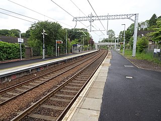
Hartwood railway station is a railway station serving Hartwood in North Lanarkshire, Scotland. It is on the Shotts Line, 19 miles (31 km) east of Glasgow Central towards Edinburgh Waverley. The station has two platforms, connected by a stairway footbridge. It is managed by ScotRail.

Carmyle railway station is located in the Carmyle area of Glasgow. It is on the Whifflet Line, 5.5 miles (8.9 km) east of Glasgow Central railway station. Services are provided by ScotRail.

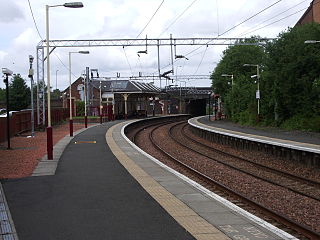
Holytown railway station is a railway station serving both Holytown and New Stevenston in North Lanarkshire, Scotland. It is located on the Shotts Line, 13 miles (21 km) south east of Glasgow Central towards Edinburgh Waverley and is also on the Argyle Line. It was opened in 1880 at the same time as the Wishaw Deviation Line from Law Junction, though the line on which it actually stands is considerably older.

Hyndland railway station serves Hyndland in Glasgow, Scotland. The station is 3+1⁄4 miles (5.2 km) west of Glasgow Central and 2+3⁄4 miles (4.4 km) west of Glasgow Queen Street on the Argyle and North Clyde Lines. It is managed by ScotRail.
Coatbridge Sunnyside railway station serves the town of Coatbridge in North Lanarkshire, Scotland. The railway station is managed by ScotRail and is located on the North Clyde Line, 9 miles (14 km) east of Glasgow Queen Street.

Caldercruix railway station serves the village of Caldercruix in North Lanarkshire, Scotland. It is managed by ScotRail and is on the North Clyde Line. Originally opened by the Bathgate and Coatbridge Railway in 1862, it was closed in 1956 then reopened in 2011 as part of the reopening of the Airdrie–Bathgate rail link.
The Rutherglen and Coatbridge Railway was a railway line in Scotland built by the Caledonian Railway to shorten the route from the Coatbridge area to Glasgow. It opened in 1865. It was later extended to Airdrie in 1886, competing with the rival North British Railway. Soon after a further extension was built from Airdrie to Calderbank and Newhouse.
The history of Coatbridge, Scotland, is one of dramatic change. The town transformed from an obscure group of 18th century Lanarkshire hamlets strung out on the road between Glasgow and Airdrie to a world leading centre of iron production in the 19th century. Development took off at an incredible rate in the 19th century and led to massive changes to the landscape and an explosion in the population.
Though Coatbridge is a most interesting seat of industry, it is anything but beautiful. Dense clouds of smoke roll over it incessantly, and impart to all the buildings a peculiarly dingy aspect. A coat of black dust overlies everything, and in a few hours the visitor finds his complexion considerably deteriorated by the flakes of soot which fill the air, and settle on his face. To experience Coatbridge it must be visited at night when it presents a most extraordinary spectacle.... From the steeple of the parish church the flames of no fewer than fifty blast furnaces may be seen.... The flames have a positively fascinating effect. Now they shoot far upward, and breaking off short, expire among the smoke; again spreading outward, they curl over the lips of the furnace, and dart through the doorways, as if determined to annihilate the bounds within which they are confined; then they sink low into the crater, and come forth with renewed strength in the shape of great tongues of fire, which sway backward and forward, as if seeking with a fierce eagerness something to devour. The Scotsman, 1869
The Glasgow, Bothwell, Hamilton and Coatbridge Railway was a railway company in Scotland, built to serve coal and ironstone pits in the Hamilton and Bothwell areas, and convey the mineral to Glasgow and to ironworks in the Coatbridge area. It was allied to the North British Railway, and it opened in 1877. Passenger services followed.
Elections to North Lanarkshire Council were held on 3 May 2012 on the same day as the 31 other local authorities in Scotland. The election used the twenty wards created under the Local Governance (Scotland) Act 2004, with 70 Councillors being elected. Each ward elected either 3 or 4 members, using the STV electoral system.

Morningside is a small village in North Lanarkshire, Scotland. It is located around 3⁄4 mile (1.2 km) south of Newmains, and 2+1⁄4 miles (3.6 km) east of Wishaw. Morningside's population is 1,090 people. It is a former coal mining village, and formerly had two railway stations. Today, Morningside mainly consists of a modern housing estate with more older houses along the main road.
The Caledonian Railway branches in North Lanarkshire built on the Caledonian Railway main line, which opened in 1848. In the following years the considerable increase of iron production and coal extraction in North Lanarkshire led to a progressive expansion of branch lines in the area between the eastern margin of Glasgow and Bellside in the east, and between Coatbridge, Airdrie and Motherwell. Mineral traffic was dominant and for some years passenger operation followed the construction of some of the mineral connections. In 1861 the Rutherglen and Coatbridge line was opened, extended later to Airdrie, rivalling the established Monkland Railways route. In 1869 the connection from Cleland to Midcalder was opened, connecting mineral sites but also forming a new passenger route to Edinburgh.
2017 Elections to North Lanarkshire Council were held on 4 May 2017, on the same day as the 31 other local authorities in Scotland. The election utilised twenty-one wards with 77 Councillors being elected. This represented an increase of 7 seats and 1 additional ward when compared to 2012. Each ward elected either 3 or 4 members, using the STV electoral system.

Coatbridge South is one of the twenty-one wards used to elect members of the North Lanarkshire Council. Covering neighbourhoods in the south-east of Coatbridge, it currently elects four councillors. A boundary review in 2017 caused the addition of an area between Langloan Street, the A725 and the A89, with a small increase in the electorate and an additional seat from the original three. The ward had a population of 16,889 in 2019.
