| Winhall River | |
| River | |
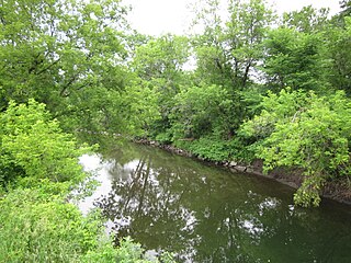
 Winhall River, West River Trail | |
| Country | United States |
|---|---|
| State | Vermont |
| Counties | Windham, Bennington |
| Towns/Cities | Stratton, Winhall, Jamaica, Londonderry |
| Source | |
| - location | Stratton, Vermont |
| - elevation | 788 m (2,585 ft) |
| - coordinates | 43°04′57″N72°59′36″W / 43.08237°N 72.99325°W |
| Mouth | West River |
| - location | Londonderry, Vermont |
| - elevation | 290 m (951 ft) |
| - coordinates | 43°09′26″N72°47′52″W / 43.15736°N 72.79764°W Coordinates: 43°09′26″N72°47′52″W / 43.15736°N 72.79764°W |
| Length | 29.5 km (18 mi) |
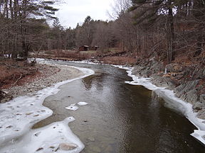
The Winhall River is an 18.3-mile-long (29.5 km) [1] tributary of the West River in Windham and Bennington counties, Vermont, in the United States.

The West River is a tributary of the Connecticut River, about 53.8 miles (86.6 km) long, in southern Vermont in the United States. According to the Geographic Names Information System, it has also been known historically as "Wantastiquet" and as "Waters of the Lonely Way". Its watershed covers 423 square miles; land use is about 90% forested and 3% agricultural, and the upper river supports wild native brook and wild brown trout, while Atlantic salmon occur in most of the river.
Windham County is a county located in the U.S. state of Vermont. As of the 2010 census, the population was 44,513. The county's shire town (seat) is Newfane, and the largest municipality is the town of Brattleboro.

Bennington County is a county in the U.S. state of Vermont. As of the 2010 census, the population was 37,125. The shire towns are jointly Bennington and Manchester. Its largest municipality is the town of Bennington. The county was created in 1778.
The Winhall River rises near the western boundary of the town of Stratton near the crest of the Green Mountains. The river flows north, forming the eastern boundary of the Lye Brook Wilderness of the Green Mountain National Forest. It is crossed by the Appalachian Trail along this section. The river then turns east, dropping out of the high ground of the Green Mountains and passing through the town of Winhall. The river flows through the northern corner of the town of Jamaica, then enters Londonderry, where it enters the West River in Ball Mountain Reservoir.
Stratton is a town in Windham County, Vermont, United States. The population was 136 at the 2000 census and 216 in 2010.

The Green Mountains are a mountain range in the U.S. state of Vermont. The range runs primarily south to north and extends approximately 250 miles (400 km) from the border with Massachusetts to the border with Quebec, Canada. The part of the same range that is in Massachusetts and Connecticut is known as The Berkshires or the Berkshire Hills and the Quebec portion is called the Sutton Mountains, or Monts Sutton in French.

Green Mountain National Forest is a national forest located in Vermont, a forest area typical of the New England/Acadian forests ecoregion. The forest supports a variety of wildlife, including beaver, moose, coyote, black bear, and white tailed deer. It also supports an abundant variety of bird species, such as wild turkey and ruffed grouse. The forest, being situated in Vermont's Green Mountains, has been referred to as the 'granite backbone' of the state.