The Modified Mercalli intensity scale measures the effects of an earthquake at a given location. This is in contrast with the seismic magnitude usually reported for an earthquake.
The 1929 Grand Banks earthquake occurred on November 18, 1929. The shock had a moment magnitude of 7.2 and a maximum Rossi–Forel intensity of VI and was centered in the Atlantic Ocean off the south coast of Newfoundland in the Laurentian Slope Seismic Zone.

Many major earthquakes have occurred in the region of the Kamchatka Peninsula in far eastern Russia. Events in 1737, 1923 and 1952, were megathrust earthquakes and caused tsunamis. There are many more earthquakes and tsunamis originating from the region.

The 2006 Greece earthquake – also known as the Kythira earthquake – occurred on January 8 at 13:34:53 local time and was felt throughout the entire eastern Mediterranean basin. The earthquake an magnitude 6.7 and a maximum Mercalli intensity of VII. Its epicentre was located just off the island of Kythira about 200 kilometres (120 mi) south of Athens.

The 2007 Kent earthquake registered 4.3 on the Richter scale and struck south east Kent, South East England on 28 April 2007 at 07:18:12 UTC, at a shallow depth of 5.3 km.
The 1990 Bishop's Castle earthquake occurred near the town of Bishop's Castle, Shropshire, England on 2 April.

On 27 February 2008 at 00:56:47.8s GMT an earthquake occurred at Market Rasen, Lincolnshire. According to the British Geological Survey the earthquake registered a reading of 5.2 on the Richter scale, with its epicentre 2.5 miles (4 km) north of Market Rasen and 15 miles (24 km) south-west of Grimsby.
The 2009 Andaman Islands earthquake occurred on August 11 at in the Andaman Islands of India. The earthquake magnitude was recorded as 7.5 Mw, and was the strongest in the region since the 2004 Indian Ocean earthquake and tsunami. The epicentre was 260 km north of Port Blair, and tremors were felt in south-east India, Bangladesh, Myanmar, and Thailand. The Pacific Tsunami Warning Center issued a tsunami watch to India, Myanmar, Bangladesh, Indonesia and Thailand, but it was later lifted. No casualties or injuries were reported, although there were complaints about minor damage to buildings.

The 2010 Chile earthquake and tsunami occurred off the coast of central Chile on Saturday, 27 February at 03:34:12 local time, having a magnitude of 8.8 on the moment magnitude scale, with intense shaking lasting for about three minutes. It was felt strongly in six Chilean regions that together make up about 80 percent of the country's population. According to the United States Geological Survey (USGS) the cities experiencing the strongest shaking—VIII (Severe) on the Mercalli intensity scale (MM)—were Concepción, Arauco, and Coronel. According to Chile's Seismological Service, Concepción experienced the strongest shaking at MM IX (Violent). The earthquake was felt in the capital Santiago at MM VII or MM VIII. Tremors were felt in many Argentine cities, including Buenos Aires, Córdoba, Mendoza, and La Rioja. Tremors were felt as far north as the city of Ica in southern Peru. It is the largest earthquake to hit Chile since the 1960 Valdivia earthquake.
A potent magnitude 6.6 Mw intraplate aftershock occurred at 17:16 JST (08:16 UTC) on 11 April, in the Hamadōri region of Fukushima, Japan. With a shallow focus of 13 km (8.1 mi), the earthquake was centred inland about 36 km (22 mi) west of Iwaki, causing widespread strong to locally severe shaking. It was one of many aftershocks to follow the 11 March Tōhoku earthquake, and the strongest to have its epicentre located inland.
The 1906 Swansea earthquake hit near the town of Swansea, Glamorgan, Wales on 27 June. It was one of the most damaging to hit Britain during the twentieth century, with a small area reaching an intensity of VII on the Medvedev–Sponheuer–Karnik scale.
The 2012 Haida Gwaii earthquake occurred just after . The shock had a moment magnitude of 7.8 and a maximum Mercalli Intensity of V (Moderate). The earthquake's epicentre was on Moresby Island of the Haida Gwaii archipelago. This was the second largest Canadian earthquake ever recorded by a seismometer, after the 1949 Queen Charlotte Islands earthquake, about 135 kilometres (84 mi) away. One person died due to a car crash related to the tsunami in Oahu, Hawaii.
The 1901 Black Sea earthquakewas a 7.2 magnitude earthquake, the most powerful earthquake ever recorded in the Black Sea. The earthquake epicenter was located in the east of Cape Kaliakra, 30 kilometres (19 mi) off northeast coast of Bulgaria. The mainshock occurred at a depth of 15 km (9.3 mi) and generated a 4–5-metre (13–16 ft) high tsunami that devastated the coastal areas of Romania and Bulgaria. In Romania, the earthquake was felt not only throughout Northern Dobruja, but also in Oltenia and Muntenia, and even in southern Moldova.
The 2017 Surigao earthquake occurred on February 10, 2017, at 10:03 PM (PST), with a surface wave magnitude of 6.7 off the coast of Surigao del Norte in the Philippines. According to the PHIVOLCS Earthquake Intensity Scale the earthquake was an Intensity VII (Destructive) earthquake at maximum. In the past Surigao province has been hit by a magnitude 7.2 tremor in both 1879 and 1893.

On August 21, 2018 a magnitude 7.3 earthquake struck just off the northern coast of Venezuela, near Cariaco, Sucre. The earthquake is thought to be the largest in the country since the 1900 San Narciso earthquake. It prompted evacuations in Caracas, and caused shaking in Colombia, Guyana, Brazil, Grenada, Dominica, Barbados, St. Vincent and the Grenadines, St. Lucia, and Trinidad and Tobago, the last of which also suffered damage and brief phone and power outages from about 100 miles away. A tsunami was not expected, though the Pacific Tsunami Warning Center warned of wave potential, and an alert had been broadcast for tsunami waves along coastlines. In terms of damage, concrete fell from the unfinished Tower of David skyscraper, blocking the sidewalk and closing traffic.
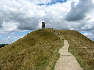
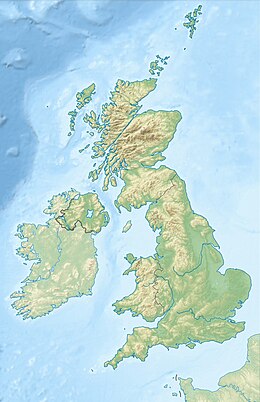
On 11 September 1275, an earthquake struck the south of Great Britain. The epicentre is unknown, although it may have been in the Portsmouth/Chichester area on the south coast of England or in Glamorgan, Wales. The earthquake is known for causing the destruction of St Michael's Church on Glastonbury Tor in Somerset.
The Lompoc earthquake of 1927 occurred at 5:49 a.m. Pacific Standard Time (PST), on November 4 with an epicenter off the coast of Lompoc, Santa Barbara County in Southern California. It is one of the largest earthquakes to have occurred off the coast of California, measuring a surface-wave magnitude of 7.3. The earthquake may have originated along the Hosgri Fault, an entirely offshore structure. Shaking from the earthquake and an unusually large tsunami caused some damage to communities near the earthquake. Due to its location and the area being sparsely populated at the time, there were no human fatalities reported. It is the only California-generated tsunami recorded in Hawaii.
An earthquake struck approximately 53 kilometres SSE of the town of Mansfield, in the Victorian Alps of Australia on 22 September 2021, at 09:15 local time. The earthquake measured 5.9 on the moment magnitude scale. The earthquake caused minor structural damage in parts of Melbourne and left one person injured. The earthquake was also felt in New South Wales, Australian Capital Territory, South Australia and Tasmania. The earthquake was substantially stronger than the 1989 Newcastle earthquake that measured 5.6 and killed 13 people.

