47th parallel north

Last updated
World location map (equirectangular 180).svg
47°
47th parallel north
Map all coordinates using: OpenStreetMap  
Download coordinates as: KML

The 47th parallel north is a circle of latitude that is 47 degrees north of the Earth's equatorial plane. It crosses Europe, Asia, the Pacific Ocean, North America, and the Atlantic Ocean.

Contents

At this latitude the sun is visible for 15 hours, 54 minutes during the summer solstice and 8 hours, 31 minutes during the winter solstice. [1] This is the northern limit of the visibility of the star θ Scorpii and thus of the 'tail' of the constellation Scorpius.

Around the world

Starting at the Prime Meridian and heading eastwards, the parallel 47° north passes through:

Co-ordinatesCountry, territory or seaNotes
47°0′N0°0′E / 47.000°N 0.000°E / 47.000; 0.000 (Prime Meridian) Flag of France.svg  France Passing just south of Nantes, Montsoreau and Bourges
47°0′N6°38′E / 47.000°N 6.633°E / 47.000; 6.633 (Switzerland) Flag of Switzerland (Pantone).svg  Switzerland Passing just north of Bern
47°0′N9°53′E / 47.000°N 9.883°E / 47.000; 9.883 (Austria) Flag of Austria.svg  Austria
47°0′N10°23′E / 47.000°N 10.383°E / 47.000; 10.383 (Switzerland) Flag of Switzerland (Pantone).svg  Switzerland For roughly 300 meters at Grübelekopf
47°0′N10°23′E / 47.000°N 10.383°E / 47.000; 10.383 (Austria) Flag of Austria.svg  Austria
47°0′N11°27′E / 47.000°N 11.450°E / 47.000; 11.450 (Italy) Flag of Italy.svg  Italy For about 4 km
47°0′N11°31′E / 47.000°N 11.517°E / 47.000; 11.517 (Austria) Flag of Austria.svg  Austria For about 3 km
47°0′N11°34′E / 47.000°N 11.567°E / 47.000; 11.567 (Italy) Flag of Italy.svg  Italy For about 7 km
47°0′N11°39′E / 47.000°N 11.650°E / 47.000; 11.650 (Austria) Flag of Austria.svg  Austria For about 14 km
47°0′N11°50′E / 47.000°N 11.833°E / 47.000; 11.833 (Italy) Flag of Italy.svg  Italy
47°0′N12°8′E / 47.000°N 12.133°E / 47.000; 12.133 (Austria) Flag of Austria.svg  Austria
47°0′N16°17′E / 47.000°N 16.283°E / 47.000; 16.283 (Hungary) Flag of Hungary.svg  Hungary Passing through Lake Balaton
47°0′N21°42′E / 47.000°N 21.700°E / 47.000; 21.700 (Romania) Flag of Romania.svg  Romania Passing just south of Oradea and Iași
47°0′N28°5′E / 47.000°N 28.083°E / 47.000; 28.083 (Moldova) Flag of Moldova.svg  Moldova Passing through Chișinău
Passing through Transnistria
47°0′N29°36′E / 47.000°N 29.600°E / 47.000; 29.600 (Ukraine) Flag of Ukraine.svg  Ukraine Odesa Oblast
Mykolaiv Oblast — passing through Mykolaiv
Kherson Oblast — passing through Kakhovka Reservoir
Zaporizhzhia Oblast — passing just north of Melitopol
Donetsk Oblast — passing through Bilosarayska Spit
47°0′N37°27′E / 47.000°N 37.450°E / 47.000; 37.450 (Sea of Azov) Sea of Azov Taganrog Bay
47°0′N39°1′E / 47.000°N 39.017°E / 47.000; 39.017 (Russia) Flag of Russia.svg  Russia
47°0′N48°47′E / 47.000°N 48.783°E / 47.000; 48.783 (Kazakhstan) Flag of Kazakhstan.svg  Kazakhstan Just passing through the northern end of the Caspian Sea
47°0′N82°56′E / 47.000°N 82.933°E / 47.000; 82.933 (China) Flag of the People's Republic of China.svg  People's Republic of China Xinjiang
47°0′N83°53′E / 47.000°N 83.883°E / 47.000; 83.883 (Kazakhstan) Flag of Kazakhstan.svg  Kazakhstan
47°0′N84°19′E / 47.000°N 84.317°E / 47.000; 84.317 (China) Flag of the People's Republic of China.svg  People's Republic of China Xinjiang - for about 11 km
47°0′N84°27′E / 47.000°N 84.450°E / 47.000; 84.450 (Kazakhstan) Flag of Kazakhstan.svg  Kazakhstan
47°0′N85°10′E / 47.000°N 85.167°E / 47.000; 85.167 (China) Flag of the People's Republic of China.svg  People's Republic of China Xinjiang
47°0′N90°44′E / 47.000°N 90.733°E / 47.000; 90.733 (Mongolia) Flag of Mongolia.svg  Mongolia
47°0′N119°48′E / 47.000°N 119.800°E / 47.000; 119.800 (China) Flag of the People's Republic of China.svg  People's Republic of China Inner Mongolia
Heilongjiang
47°0′N134°5′E / 47.000°N 134.083°E / 47.000; 134.083 (Russia) Flag of Russia.svg  Russia
47°0′N138°33′E / 47.000°N 138.550°E / 47.000; 138.550 (Sea of Japan) Sea of Japan
47°0′N142°1′E / 47.000°N 142.017°E / 47.000; 142.017 (Russia) Flag of Russia.svg  Russia Sakhalin island
47°0′N143°4′E / 47.000°N 143.067°E / 47.000; 143.067 (Sea of Okhotsk) Sea of Okhotsk
47°0′N152°4′E / 47.000°N 152.067°E / 47.000; 152.067 (Russia) Flag of Russia.svg  Russia Island of Simushir, Kuril Islands
47°0′N152°10′E / 47.000°N 152.167°E / 47.000; 152.167 (Pacific Ocean) Pacific Ocean
47°0′N120°5′W / 47.000°N 120.083°W / 47.000; -120.083 (United States) Flag of the United States.svg  United States Washington - Ellensburg
47°0′N96°49′W / 47.000°N 96.817°W / 47.000; -96.817 (Red River of the North) Red River of the North North Dakota - crosses state line with Minnesota
on the Red River of the North near Fargo
47°0′N92°0′W / 47.000°N 92.000°W / 47.000; -92.000 (United States) Flag of the United States.svg  United States Minnesota - intersects 92nd Meridian W near Duluth
47°0′N91°41′W / 47.000°N 91.683°W / 47.000; -91.683 (Lake Superior) Lake Superior Minnesota - crosses over North Shore of
Lake Superior at Two Harbors
47°0′N90°46′W / 47.000°N 90.767°W / 47.000; -90.767 (United States) Flag of the United States.svg  United States Wisconsin - Apostle Islands
47°0′N90°25′W / 47.000°N 90.417°W / 47.000; -90.417 (Lake Superior) Lake Superior
47°0′N88°57′W / 47.000°N 88.950°W / 47.000; -88.950 (United States) Flag of the United States.svg  United States Michigan - Keweenaw Peninsula
47°0′N88°23′W / 47.000°N 88.383°W / 47.000; -88.383 (Lake Superior) Lake Superior
47°0′N84°47′W / 47.000°N 84.783°W / 47.000; -84.783 (Canada) Flag of Canada (Pantone).svg  Canada Ontario
Quebec - passing just north of Montmagny
47°0′N69°41′W / 47.000°N 69.683°W / 47.000; -69.683 (United States) Flag of the United States.svg  United States Maine
47°0′N67°47′W / 47.000°N 67.783°W / 47.000; -67.783 (Canada) Flag of Canada (Pantone).svg  Canada New Brunswick
47°0′N64°49′W / 47.000°N 64.817°W / 47.000; -64.817 (Gulf of Saint Lawrence) Gulf of Saint Lawrence Northumberland Strait
47°0′N64°4′W / 47.000°N 64.067°W / 47.000; -64.067 (Canada) Flag of Canada (Pantone).svg  Canada Prince Edward Island
47°0′N64°0′W / 47.000°N 64.000°W / 47.000; -64.000 (Gulf of Saint Lawrence) Gulf of Saint Lawrence
47°0′N60°40′W / 47.000°N 60.667°W / 47.000; -60.667 (Canada) Flag of Canada (Pantone).svg  Canada Nova Scotia - Cape Breton Island
47°0′N60°25′W / 47.000°N 60.417°W / 47.000; -60.417 (Cabot Strait) Cabot Strait
47°0′N59°28′W / 47.000°N 59.467°W / 47.000; -59.467 (Atlantic Ocean) Atlantic Ocean
47°0′N56°22′W / 47.000°N 56.367°W / 47.000; -56.367 (St Pierre & Miquelon) Flag of France.svg  Saint Pierre and Miquelon Miquelon Island
47°0′N56°17′W / 47.000°N 56.283°W / 47.000; -56.283 (Atlantic Ocean) Atlantic Ocean
47°0′N55°59′W / 47.000°N 55.983°W / 47.000; -55.983 (Canada) Flag of Canada (Pantone).svg  Canada Newfoundland and Labrador - Burin Peninsula, Newfoundland Island
47°0′N55°12′W / 47.000°N 55.200°W / 47.000; -55.200 (Placentia Bay) Placentia Bay
47°0′N54°10′W / 47.000°N 54.167°W / 47.000; -54.167 (Canada) Flag of Canada (Pantone).svg  Canada Newfoundland and Labrador - Avalon Peninsula, Newfoundland Island
47°0′N52°54′W / 47.000°N 52.900°W / 47.000; -52.900 (Atlantic Ocean) Atlantic Ocean
47°0′N2°17′W / 47.000°N 2.283°W / 47.000; -2.283 (France) Flag of France.svg  France Belle-Île-en-Mer and Île de Noirmoutier and mainland

See also

Related Research Articles

The 17th parallel north is a circle of latitude that is 17 degrees north of the Earth's equatorial plane. It crosses Africa, Asia, the Indian Ocean, the Pacific Ocean, Central America, the Caribbean and the Atlantic Ocean.

<span class="mw-page-title-main">33rd parallel north</span> Circle of latitude

The 33rd parallel north is a circle of latitude that is 33 degrees north of the Earth's equatorial plane. It is approximate at the midpoint between the equator and the Arctic Circle It crosses North Africa, Asia, the Pacific Ocean, North America and the Atlantic Ocean.

The 30th parallel north is a circle of latitude that is 30 degrees north of the Earth's equatorial plane. It stands one-third of the way between the equator and the North Pole and crosses Africa, Asia, the Pacific Ocean, North America and the Atlantic Ocean. The parallel is used in some contexts to delineate Europe or what is associated with the continent of Europe as a southernmost limit, e.g. to qualify for membership of the European Broadcasting Union.

The 44th parallel north is a circle of latitude that is 44 degrees north of the Earth's equatorial plane. It crosses Europe, the Mediterranean Sea, Asia, the Pacific Ocean, North America, and the Atlantic Ocean.

The 35th parallel north is a circle of latitude that is 35 degrees north of the Earth's equatorial plane. It crosses Africa, the Mediterranean Sea, Asia, the Pacific Ocean, North America and the Atlantic Ocean.

The 55th parallel north is a circle of latitude that is 55 degrees north of the Earth's equatorial plane. It crosses Europe, Asia, the Pacific Ocean, North America, and the Atlantic Ocean.

<span class="mw-page-title-main">10th parallel north</span> Circle of Latitude

The 10th parallel north is a circle of latitude that is 10 degrees north of the Earth's equatorial plane. It crosses Africa, the Indian Ocean, the Indian Subcontinent, Southeast Asia, the Pacific Ocean, Central America, South America and the Atlantic Ocean.

<span class="mw-page-title-main">20th parallel north</span> Circle of latitude

The 20th parallel north is a circle of latitude that is 20 degrees north of the Earth's equatorial plane. It crosses Africa, Asia, the Indian Ocean, the Pacific Ocean, North America, the Caribbean and the Atlantic Ocean.

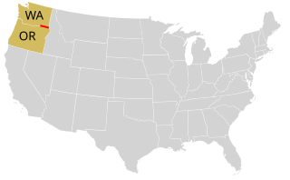
The 50th parallel north is a circle of latitude that is 50 degrees north of the Earth's equatorial plane. It crosses Europe, Asia, the Pacific Ocean, North America, and the Atlantic Ocean.

The 15th parallel north is a circle of latitude that is 15 degrees north of the Earth's equatorial plane. It crosses the Saharan fringe in Africa, three key peninsulas of Asia, the Pacific Ocean, an isthmus of Central America, the southern Caribbean and the Atlantic Ocean.

<span class="mw-page-title-main">25th parallel north</span> Circle of latitude

The 25th parallel north is a circle of latitude that is 25 degrees north of the Earth's equatorial plane. It crosses Africa, Asia, the Indian Ocean, the Pacific Ocean, North America and the Atlantic Ocean.

<span class="mw-page-title-main">22nd parallel north</span> Circle of latitude in the Northern Hemisphere

The 22nd parallel north is a circle of latitude that is 22 degrees north of the Earth's equatorial plane. It crosses Africa, Asia, the Indian Ocean, the Pacific Ocean, North America, the Caribbean and the Atlantic Ocean.

<span class="mw-page-title-main">26th parallel north</span> Circle of latitude

The 26th parallel north is a circle of latitude that is 26 degrees north of the Earth's equatorial plane. It crosses Africa, Asia, the Indian Ocean, the Pacific Ocean, North America and the Atlantic Ocean.

The 66th parallel north is a circle of latitude that is 66 degrees north of the Earth's equatorial plane, about 61 km south of the Arctic Circle. It crosses the Atlantic Ocean, Europe, Asia and North America.

<span class="mw-page-title-main">46th parallel north</span> Circle of latitude

The 46th parallel north is a circle of latitude that is 46 degrees north of the Earth's equatorial plane. It crosses Europe, Asia, the Pacific Ocean, North America, and the Atlantic Ocean.

The 13th parallel north is a circle of latitude that is 13 degrees north of the Earth's equatorial plane. It crosses Africa, Asia, the Indian Ocean, the Pacific Ocean, Central America, the Caribbean and the Atlantic Ocean.

The 48th parallel north is a circle of latitude that is 48 degrees north of the Earth's equatorial plane. It crosses Europe, Asia, the Pacific Ocean, North America, and the Atlantic Ocean.

The 18th parallel north is a circle of latitude that is 18 degrees north of the Earth's equatorial plane. It crosses Africa, Asia, the Indian Ocean, the Pacific Ocean, Central America, the Caribbean and the Atlantic Ocean.

The 12th parallel north is a circle of latitude that is 12 degrees north of the Earth's equatorial plane. It crosses Africa, the Indian Ocean, South Asia, Southeast Asia, the Pacific Ocean, Central America, South America and the Atlantic Ocean.

The 19th parallel north is a circle of latitude that is 19 degrees north of the Earth's equatorial plane. It crosses Africa, Asia, the Indian Ocean, the Pacific Ocean, North America, the Caribbean and the Atlantic Ocean.

References

  1. "Duration of Daylight/Darkness Table for One Year". U.S. Naval Observatory. 2019-09-24. Archived from the original on 2019-10-12. Retrieved 2021-03-10.