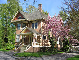
Laidlaw is an unincorporated settlement in the Upper Fraser Valley region of British Columbia, Canada, located just west of the westernmost boundary of Hope, British Columbia on the south side of the Fraser River and along the Trans-Canada Highway.

Bridal Veil Falls Provincial Park is a BC Park situated on the Trans-Canada Highway just east of Rosedale, British Columbia, Canada, within of the City of Chilliwack. The community of Bridal Falls is located adjacent to the falls and park, as well as the interchange between the Trans-Canada and BC Highway 9, offering a variety of highway-based tourism services. Access to the falls requires a short hike from the parking lot and well-groomed trails, taking most groups 15-25 minutes.

Harrison Hot Springs is a village located at the southern end of Harrison Lake in the Fraser Valley of British Columbia. It is a member of the Fraser Valley Regional District; its immediate neighbour is the District of Kent, which includes the town of Agassiz. It is a resort community known for its hot springs and has a population of just over 1500 people. It is named after Benjamin Harrison, a former deputy governor for the Hudson's Bay Company.

Boston Bar is an unincorporated community in the Fraser Canyon of the Canadian province of British Columbia.
Nicolum River Provincial Park, formerly Nicolum Provincial Park, is a provincial park in British Columbia, Canada, located at the confluence of the Nicolum and Coquihalla Rivers near the town of Hope. The park is a Class A, category 6 Provincial Park.

Deas Island is a peninsula in the south arm of the Fraser River between Delta, British Columbia and Richmond, British Columbia, Canada. It is home to a regional park approximately 300 acres (120 ha) in size; and has three historic buildings: Burrvilla, a stately Victorian home; Inverholme, a one-room schoolhouse; and the Delta Agricultural Hall. Between 1895 and the 1940s, the peninsula had a small Greek settlement with a population of about 80 at its peak.
Rosedale is a farming-based community located east of Chilliwack, British Columbia. This small community is based alongside the Fraser River. It serves as a base for many tourists, both in summer and winter. The hills and valleys of British Columbia are popular for tourists who enjoy outdoor activities such as skiing, snowboarding and dogsledding locations. In summer, rockclimbing and whitewater rafting are the primary activities in the Fraser Valley.
Ruby Creek is a locality on the Fraser River in the District of Kent, British Columbia, Canada, in the Upper Fraser Valley region, located on BC Highway 7 and the mainline of the Canadian Pacific Railway, near the confluence of Ruby Creek with the Fraser, northeast of Sea Bird Island. Ruby Creek Indian Reserve No. 2 of the Skawahlook First Nation is nearby, as is also Skawahlook Indian Reserve No. 1, one mile northeast of the mouth of Ruby Creek. Also in the locality is Lukseetsissum Indian Reserve No. 9 of the Yale First Nation.
North Bend is an unincorporated community in the Fraser Canyon region of British Columbia, Canada, located across the Fraser River from the town of Boston Bar. North Bend was originally known as Boston Bar, but that name moved across the Fraser River when the site was renamed North Bend.
Sea Bird Island is an island in the Fraser River just east of Agassiz, British Columbia, Canada, in the Upper Fraser Valley region of that province, about 75 miles east of Vancouver. Though within the District of Kent, most of the island is part of the Seabird Island Indian reserve and is the community of the Seabird Island First Nation, a member government of the Sto:lo Tribal Council.

The Skagit Range is a subrange of the Cascade Range in southwestern British Columbia, Canada and northwestern Washington, United States, which are known in Canada as the Canadian Cascades or, officially, the Cascade Mountains. It is also known in the Nooksack language as Nexwx̠ex̠tsán. The Skagit Range lies to the west of the Skagit River and east and north of the Chilliwack River and flanks the Upper Fraser Valley region of British Columbia's Lower Mainland.
Flood is a rural community in the District of Hope, British Columbia, Canada, located west of the town of Hope on the south bank of the Fraser River in the far eastern end of the Fraser Valley region. It is primarily agricultural in nature. Its official name is Floods, though it is usually referred to by its post office name in the singular, Flood.
Ruby Creek is a tributary of the Fraser River in the Lower Mainland of British Columbia, Canada, rising in the southern Lillooet Ranges and joining the Fraser east of Sea Bird Island at the locality of Ruby Creek and the associated Ruby Creek Indian Reserve No. 2. It is the largest tributary along the north side of the Fraser between Hope and Agassiz.
The Sq'éwlets First Nation (Scowlitz) is the band government of Skaulits subgroup of the Stó:lō people located on Harrison Bay in the Upper Fraser Valley region between Chehalis (E) and Lake Errock, British Columbia, Canada (W). They are a member government of the Stó:lō Tribal Council.
Yale First Nation is a First Nations government located at Yale, British Columbia. Yale has 16 distinct reserves stretching from near Sawmill Creek to American Creek, with the most southern reserve situated at Ruby Creek in the District of Kent.
Harrison Hill (622m) is a small mountain located at the confluence of the Harrison and Fraser Rivers in the Lower Mainland region of British Columbia, Canada. Harrison Knob (~225m) is a prominent shoulder to the east of the main peak of Harrison Hill. Harrison Hill and Harrison Knob are on the north side of the Fraser opposite Chilliwack, Harrison Knob overlooks the confluence directly, Harrison Hill itself separates the Fraser downstream from that confluence and overlooks on its north Harrison Bay, a large, shallow lake-like sidewater of the Harrison River, while at its western foot is the community of Lake Errock. At its eastern foot, just below Harrison Knob, had been the formerly large sawmill town of Harrison Mills, which spanned both sides of the Harrison and was served by the mainline of the Canadian Pacific Railway, which runs along the north side of the mountain's base. The Indian Reserves of the Scowlitz First Nation are at the western end of Harrison Bay and at its outlet at its eastern end, while the reserve of the Chehalis First Nation is along its north shore, and Kilby is on its east shore.
The Leq'á:mel First Nation, formerly known as Lakahahmen First Nation, is a First Nations band government whose community and offices are located in the area near Deroche, British Columbia in the Fraser Valley region in Canada, about 12 kilometres east of the District of Mission. They are a member government of the Sto:lo Nation Chiefs Council, which is one of two tribal councils of the Sto:lo.

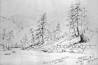
Hill's Bar is a long-abandoned ghost town located in the Fraser Canyon region of British Columbia, Canada. The site of the former boomtown is situated near the right bank of the Fraser River, between Yale and the mouth of Emory Creek. The eponymous bar was the first active placer mining site at the onset of the Fraser Canyon Gold Rush, and was the scene of the Boatmakers of San Francisco claim, which included Ned McGowan of McGowan's War, and involved a dispute with Kowpelst, chief of the Spuzzum people.
Squeah is a locality in the lower Fraser Canyon of British Columbia, Canada, located between the unincorporated town of Yale (N) and the district municipality of Hope on the Fraser River. Squeah Indian Reserve No. 6 of the Yale First Nation, is located here, at the mouth of Suka Creek. Tiny Squeah Lake is on the south side of the locality at 49°28′51″N121°24′21″W. The mountain above the community on the east side of the canyon, at 49°31′18″N121°23′14″W is called Squeah Mountain by the members of the Yale First Nation.


