Areas of York

Last updated

York and its district, the City of York, has many distinct localities, suburbs and villages.

Contents

Centre

Squares

Exhibition Square York City Art Gallery - geograph.org.uk - 893969.jpg
Exhibition Square

York's squares are:

Middle

Parliament Street in Winter Parliament Street - geograph.org.uk - 2791972.jpg
Parliament Street in Winter

Parliament Street is wide, pedestrian and lined with large London plane-trees. It is the city centre's main-street, central to the network of gates, snickelways and squares. It was created in the early Victorian Era merging two marketplaces, St Sampson's Square and Pavement. [3]

York Castle is to the north of a peninsula formed by the Foss flowing into the Ouse. It is an area with multiple parts such as the Eye of York green, Clifford's Tower, Tower Gardens, the crown court and York Castle Museum.

North West

The Hospitium The Hospitium, York - geograph.org.uk - 5322965.jpg
The Hospitium

North west of the centre is the walled Museum Gardens, the Hospitum, St Olave's Church and ruins of St Mary's Abbey. North west of the gardens is Bootham. The city's medical facilities are concentrated at Bootham with Bootham Park Hospital and York Hospital. The latter hospital borders Bootham Stray and Bootham itself borders Clifton.

North east

Treasurer's House Treasurers House, York - panoramio.jpg
Treasurer's House

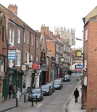
North-east from Foss Bridge to Bootham Bar is a quieter area of the city. On the Bootham Bar end is Petergate with the green space of Dean's Park, York Minster and the Treasurer's House. North east of this, outside the walls, is York St John University's Campus.

Halfway down is Goodramgate with shops on the gate and on Monkgate, other streets in the area are for housing. The walls end at Layerthorpe, King's Fishpool formerly existed here, this meant that walls in the area were not needed. [4]

Near the bridge is Fossgate. Apart from Fossgate, the area is high density housing and offices, including the Government's DEFRA. The DIG centre is based here.

South east

The Barbican Centre The Barbican Centre (geograph 5053201).jpg
The Barbican Centre

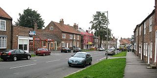
The walled centre's area east of the River Foss is centred upon Piccadilly, Walmgate; after the walls Fishergate and Lawrence Street. Walmgate and Lawrence Street have small shops on both sides creating a main shopping thoroughfare through the area while Piccadilly has hotels.

From just north of Walmgate bar, the area outside the walls is light industrial with a number of supermarkets. From Red Tower to the Layerthorpe, along the Foss, the city walls have been removed. Near Fishergate Bar is York Barbican.

The centre reaches from Walmgate Stray to Monk Stray; neighbouring Fulford, Heslington, Osbaldwick and Heworth.

South west

Lower Priory Street Lower Priory Street - geograph.org.uk - 673448.jpg
Lower Priory Street

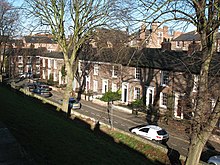
Bishophill is the walled centre's area west of the River Ouse. The area is residential to the south, Micklegate is the main thoroughfare for trade and offices are found along the Ouse (off Skeldergate) and north of Micklegate (off Toft Green and Tanner Row). [5]

North and east of Bishophill is Bishops Fields. The north of Bishophill and Bishops Fields are dominated by the railway; multiple offices, York station and the National Railway Museum.

Micklegate becomes Blossom Street which goes towards the Micklegate Stray, which includes the Knavesmire. This part of the centre neighbours Holgate, Dringhouses, South Bank and Middlethorpe.

Outer

The York Built-up area is defined by the Office for National Statistics for census purposes. [6]

PlacenameCouncil wardParliamentPopulation (2001)Population (2011)Postcode
Acomb Acomb, Westfield York Central 21,41922,215 YO24
Bishophill Micklegate York Central YO1
Bootham Guildhall York Central YO30
Clifton Clifton, Rawcliffe & Clifton Without (part) York Central 12,01713,548 YO30
Clifton Without Rawcliffe & Clifton Without York Outer 5,1135,246 YO30
Dringhouses Dringhouses & Woodthorpe York Outer 10,73311,084 YO24
Earswick Strensall York Outer 819876 YO32
Fishergate Fishergate York Central 7,9219,844 YO10
Fulford Fulford & Heslington York Outer 2,5952,785 YO10
Groves Guildhall York Central YO31
Heslington Fulford & Heslington (part), Hull Road (part) York Outer 4,1224,792 YO10
Heworth Heworth, Heworth Without (part) York Central (part), York Outer (part)13,72515,434 YO31
Heworth Without Heworth Without York Outer 2,2832,191 YO31
Holgate Holgate York Central 11,56412,832 YO24
Huntington Huntington & New Earswick York Outer 9,2779,371 YO31
Layerthorpe Heworth York Central YO31
New Earswick Huntington & New Earswick York Outer 2,8122,737 YO32
Osbaldwick Osbaldwick & Derwent York Outer 2,7262,902 YO10
Rawcliffe Rawcliffe and Clifton Without York Outer 5,4076,511 YO30
South Bank Micklegate York Central YO23
Tang Hall Heworth York Central YO31
Woodthorpe Dringhouses & Woodthorpe York Outer YO24
York City Centre Guildhall, Micklegate York Central YO1

District

The individual areas of the City of York are all within the Unitary Authority area as defined by the Fifth Periodical Report, Volume 4, "Mapping for the Non-Metropolitan Counties and the Unitary Authorities as published by the Boundary Commission For England", specifically on pages 106–109. [7] Population details are taken from the UK Census of 2001 and 2011. [8] [9] Some areas that have a population for 2001 are taken from local ecclesiastical parish information and has not been updated for 2011. Other areas without any population information is due to a lack of ecclesiastical parish information, mostly because the area has never been one and is included only due to it being an identifiable and distinct area according to Ordnance Survey maps.

PlacenameCouncil wardParliamentPopulation (2001)Population (2011)Postcode
Acaster Malbis Bishopthorpe York Outer 578669 YO23
Askham Bryan Rural West York York Outer 582564 YO23
Askham Richard Rural West York York Outer 273351 YO23
Bishopthorpe Bishopthorpe York Outer 3,1743,237 YO23
Copmanthorpe Copmanthorpe York Outer 4,2624,173 YO23
Crockey Hill Wheldrake York Outer YO19
Deighton Wheldrake York Outer 308291 YO19
Dunnington Osbaldwick & Derwent York Outer 3,1943,230 YO19
Elvington Wheldrake York Outer 1,2121,239 [10] YO41
Haxby (town)Haxby & Wigginton York Outer 8,7548,248 YO32
Hessay Rural West York York Outer 181265 YO26
Holtby Osbaldwick & Derwent York Outer 152166 YO19
Kexby Osbaldwick & Derwent York Outer 194231 YO41
Knapton Rural West York York Outer 222 YO26
Middlethorpe Bishopthorpe York Outer YO23
Murton Osbaldwick & Derwent York Outer 423668 YO19
Naburn Wheldrake York Outer 470516 YO19
Nether Poppleton Rural West York York Outer 2,0772,141 YO26
Rufforth Rural West York York Outer 560 YO26
Skelton Rural West York York Outer 1,6401,549 YO31
Stockton on the Forest Strensall York Outer 1,2611,214 YO32
Strensall Strensall York Outer 3,815 YO32
Towthorpe Strensall York Outer 1,967 YO32
Upper Poppleton Rural West York York Outer 1,9611,997 YO26
Wheldrake Wheldrake York Outer 1,9092,107 YO19
Wigginton Haxby & Wigginton York Outer 3,1743,160 YO32

Related Research Articles

<span class="mw-page-title-main">Clifton, York</span> Suburb of the City of York, Yorkshire, England

Clifton is a suburb of York in the unitary authority of the City of York, in the north of England about 1+12 miles from the city centre. The A19, passes north out of York through Clifton.

<span class="mw-page-title-main">Fulford, North Yorkshire</span> Village and civil parish in North Yorkshire, England

Fulford is a historic village and civil parish on the outskirts of York, in the York district, in the ceremonial county of North Yorkshire, England. Fulford is located 2 miles (3 km) to the south of the city, on the east bank of the River Ouse.

<span class="mw-page-title-main">Bridges of York</span> Bridges over the Ouse and Foss in York, England

There are nine bridges across the River Ouse and eighteen smaller bridges and passages across the narrower River Foss within the city of York, England.

<span class="mw-page-title-main">Fishergate</span> Street in York, England

Fishergate is a street and surrounding area of York, England.

<span class="mw-page-title-main">York city walls</span> Grade I listed urban defence in England

York has, since Roman times, been defended by walls of one form or another. To this day, substantial portions of the walls remain, and York has more miles of intact wall than any other city in England. They are known variously as York City Walls, the Bar Walls and the Roman walls. The walls are generally 13 feet (4m) high and 6 feet (1.8m) wide. They are the longest town walls in England.

<span class="mw-page-title-main">Siege of York</span> Siege of the English Civil War (1644)

The siege of York in 1644 was a prolonged contest for York during the First English Civil War, between the Scottish Covenanter army and the Parliamentarian armies of the Northern Association and Eastern Association, and the Royalist Army under the Marquess of Newcastle. It lasted from 22 April until 1 July when the city was relieved by Prince Rupert of the Rhine. Rupert and Newcastle were defeated the next day at the decisive Battle of Marston Moor, and the siege resumed until the city was surrendered on easy terms on 16 July.

<span class="mw-page-title-main">Strays of York</span> Public open spaces in York, England

The Strays of York is a collective name for four areas of open land, comprising in all over 800 acres (3.2 km2), within the City of York. Their individual names are Bootham Stray, Micklegate Stray, Monk Stray and Walmgate Stray.

<span class="mw-page-title-main">History of York</span> History of the city of York, England

The history of York, England, as a city dates to the beginning of the first millennium AD but archaeological evidence for the presence of people in the region of York dates back much further to between 8000 and 7000 BC. As York was a town in Roman times, its Celtic name is recorded in Roman sources ; after 400, Angles took over the area and adapted the name by folk etymology to Old English Eoforwīc or Eoforīc, which means "wild-boar town" or "rich in wild-boar". The Vikings, who took over the area later, in turn adapted the name by folk etymology to Norse Jórvík meaning "wild-boar bay", 'jór' being a contraction of the Old Norse word for wild boar, 'jǫfurr'. The modern Welsh name is Efrog.

York had around 45 parish churches in 1300. Twenty survive, in whole or in part, a number surpassed in England only by Norwich, and 12 are used for worship. This article consists of a list of medieval churches which still exist in whole or in part, and a list of medieval churches which are known to have existed in the past but have been completely demolished.

Elections to City of York Council were held on 6 May 1999. All 53 council seats in the city were up for election and the Labour Party kept overall control of the council.

<span class="mw-page-title-main">Layerthorpe</span> Village in York, England

Layerthorpe is a village in the unitary authority area of the City of York, North Yorkshire, England. It is outside the city walls of York. The road through Layerthorpe from the bridge over the River Foss to Heworth is also shares the same name.

Elections to City of York Council were held in 2003. The whole council was up for election. Boundary changes had reduced the number of seats from 53 to 47.

Local elections for City of York Council were held on Thursday 3 May 2007. The whole council was up for election. Of the 47 seats contested, the Liberal Democrats won 19 seats, Labour won 18 seats, Conservatives won eight seats and the Green Party won two seats. The election saw York's ruling Liberal Democrats lose ten seats and overall control of the council.

<span class="mw-page-title-main">Peter Atkinson (architect, baptised 1780)</span>

Peter Atkinson was an English architect.

Elections to the new City of York unitary authority were held on 4 May 1995, although the new unitary authority wasn't officially created until April 1996. All 53 council seats in the city were up for election and the Labour Party won overall control of the council.

<span class="mw-page-title-main">Timeline of York</span>

The following is a timeline of the history of the city of York, North Yorkshire in northern England.

<span class="mw-page-title-main">Bishophill</span> Area of the City of York, North Yorkshire, England

Bishophill is an area of central York, in England. It lies within the city walls and has been occupied since at least the Roman period.

<span class="mw-page-title-main">Micklegate</span> Street in York, England

Micklegate is a street in the City of York, England. The name means "Great Street", "gate" coming from the Old Norse gata, or street.

<span class="mw-page-title-main">Walmgate</span> Street in York, England

Walmgate is a street in the city centre of York, in England. During the Medieval period, the street was the site of a seafish and cattle market. Walmgate Bar was involved in the Siege of York in 1644, during the First English Civil War. During the 20th century, many of the older buildings were cleared away and newer structures put up.

References

  1. "York Minster to create 'Queen Elizabeth Square' to honour monarch". 17 May 2019. Retrieved 3 August 2023.
  2. "York City Streets" . Retrieved 3 August 2023.
  3. Parliament Street (Monuments 300–305), An Inventory of the Historical Monuments in City of York, Volume 5, Central. London: HMSO. 1981. Retrieved 10 August 2023.
  4. "The Walls: From Medieval Defence to Victorian Promenade" (PDF). Retrieved 10 August 2023.
  5. "The history of Bishophill" . Retrieved 3 August 2023.
  6. UK Census (2011). "Local Area Report – York Built-up area (E34005036)". Nomis. Office for National Statistics . Retrieved 23 December 2021.
  7. "LocationDetails" (PDF). Fifth Periodical Report, Volume 4 Mapping for the Non-Metropolitan Counties and the Unitary Authorities. Boundary Commission For England. pp. 106–109. Archived from the original (PDF) on 3 October 2013. Retrieved 1 March 2011.
  8. "Census 2001". City of York 2001 Census Profile. City of York Unitary Authority. Archived from the original on 29 June 2011. Retrieved 2 March 2010.
  9. "UK Census 2011". Office for National Statistics. Retrieved 27 September 2013.
  10. "2011 UK Census - Elvington Parish" . Retrieved 22 September 2013.