
Highway 5 is a designation for three state highways in Arkansas. The southern segment of runs from US 70 and US 70B in Hot Springs north to Interstate 430 (I-430) and US 70 in Little Rock.

Highway 7 is a north–south state highway that runs across the state of Arkansas. As Arkansas's longest state highway, the route runs 297.27 miles (478.41 km) from Louisiana Highway 558 at the Louisiana state line north to Bull Shoals Lake at Diamond City near the Missouri state line. With the exception of the segment north of Harrison, Highway 7 has been designated as an Arkansas Scenic Byway and a National Forest Scenic Byway. The road passes through the heart of both the Ozark Mountains and the Ouachita Mountains, and features scenic views. It's the route favored by motorcycle riders touring the region.
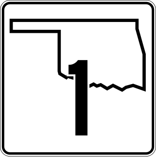
State Highway 1, sometimes abbreviated as SH-1, is a 209.7-mile (337 km) highway maintained by the U.S. state of Oklahoma. It travels through the southeastern part of the state, nicknamed Little Dixie. SH-1 is signed east and west.

Arkansas Highway 23 is a north–south state highway in north Arkansas. The route runs 129.88 miles (209.02 km) from US 71 near Elm Park north to the Missouri state line through Ozark and Eureka Springs. Between AR 16 at Brashears and Interstate 40 north of Ozark, Highway 23 winds through the Ozark National Forest and is designated as the Pig Trail Scenic Byway due to its steep hills and hairpin turns. The route has a strong connection with the University of Arkansas Razorbacks, connecting fans in Central Arkansas with the Northwest Arkansas area.

Highway 16 is an east–west state highway in Arkansas. The route begins in Siloam Springs at US Highway 412 (US 412) and Highway 59 and runs east through Fayetteville and the Ozark National Forest to US Highway 67 Business (US 67B) in Searcy. Highway 16 was created during the 1926 Arkansas state highway numbering, and today serves as a narrow, winding, 2-lane road except for overlaps of 10 miles (16 km) through Fayetteville. Much of the highway winds through the Ozarks, including the Ozark National Forest, where a portion of the highway is designated as an Arkansas Scenic Byway. The route has two spur routes in Northwest Arkansas; in Fayetteville and Siloam Springs.

Highway 21 is a north–south state highway in north central Arkansas. The route of 99.14 miles (159.55 km) runs from US Route 64 (US 64) in Clarksville north across US 62 to Missouri Route 13 at the Missouri state line The route is a two-lane highway with the exception of a brief concurrency with US 62, a four-lane highway, in Berryville.

Highway 72 is a designation for two east–west state highways in Benton County, Arkansas. A western route of 26.32 miles (42.36 km) runs east from Highway 43 at Maysville to U.S. Route 71B (US 71B) in Bentonville. A second route of 12.67 miles (20.39 km) begins at Interstate 49/US Route 71 (I-49/US 71) in Bentonville and runs northeast to US 62 near Avoca. The route is one of the original Arkansas state highways.

Highway 127 is a designation for four state highways in Northwest Arkansas. One route of 4.13 miles (6.65 km) begins at Madison County Road 3345 (CR 3345) and runs northwest to Highway 23 at Aurora. A second route of 4.86 miles (7.82 km) begins at US Highway 412 (US 412) at Old Alabam and runs north to Highway 23 at Forum. A third route of 8.58 miles (13.81 km) begins at Highway 12 and runs north to Highway 12 near Clifty. A fourth route of 5.82 miles (9.37 km) begins at Lost Bridge Village and runs north to US Highway 62 in Garfield. Highway 127 Spur is a spur route of 0.25 miles (0.40 km) near the southern terminus of the Lost Bridge Village route that provides access to Lost Bridge Marina. All routes are maintained by the Arkansas State Highway and Transportation Department (AHTD).

The Talimena Scenic Drive is a National Scenic Byway in southeastern Oklahoma and extreme western Arkansas spanning a 54.0-mile (86.9 km) stretch of Oklahoma State Highway 1 (SH-1) and Arkansas Highway 88 (AR 88) from Talihina, Oklahoma, to Mena, Arkansas.

Highway 8 is an east–west state highway in Lower Arkansas. The route of 229.83 miles (369.88 km) runs from Oklahoma State Highway 63 (SH-63) at the Oklahoma state line east across the state to US Route 65 (US 65) south of Eudora.

Highway 94 is an east–west state highway in Benton County, Arkansas. The route of 22.07 miles (35.52 km) runs from Horseshoe Bend Park near Beaver Lake west across US Route 71 Business (US 71B) and US 62 to Missouri Supplemental Route E at the Missouri state line. The route is maintained by the Arkansas State Highway and Transportation Department (AHTD).

Highway 272 is a designation for two east–west state highways in the Ouachita Mountains region of western Arkansas. One segment of 2.06 miles (3.32 km) runs west from U.S. Route 71 Business (US 71B) in Waldron to the Waldron Municipal Airport. A second route of 1.58 miles (2.54 km) begins at US 59/US 270 at Rich Mountain and runs west to Highway 88 at Queen Wilhelmina State Park. Both routes are owned and maintained by the Arkansas Department of Transportation (ArDOT).

Highway 351 is a designation for two state highways in Northeast Arkansas. One route 0.92 miles (1.48 km) in Jonesboro begins at the Interstate 555/US Highway 63 (I-555/US 63) frontage road and runs north to Highway 18 as Industrial Drive. A second route of 13.87 miles (22.32 km) begins at Airport Road and runs north to Highway 358. Between Jonesboro and the northern terminus, the route is designated as part of the Crowley's Ridge Parkway, a National Scenic Byway, and two Civil War trails under the Arkansas Heritage Trails System. Both routes are maintained by the Arkansas State Highway and Transportation Department (AHTD).

Highway 215 is a designation for three north–south state highways in northwest Arkansas. A southern route of 8.80 miles (14.16 km) runs north from Franklin County Road 31 and Franklin County Road 221 (CR 31/CR 221) at Dahoma to Highway 96 near the Arkansas River. A second route of 15.94 miles (25.65 km) begins at US Route 64/Highway 917 (US 64/AR 917) in Mulberry and runs north to CR 77/CR 102 in the Ozark National Forest. A third segment of 16.44 miles (26.46 km) begins at Highway 23 at Cass and runs north to Johnson CR 36 at Oark.

Arkansas Highway 309 is a designation for two state highways in Western Arkansas. One route of 5.11 miles (8.22 km) runs from Yell County Route 28 (CR 28) at Blue Mountain Lake northeast to Highway 10 at Waveland. A second segment begins at Highway 10 in Havana and winds northwest through the Ozark National Forest to Highway 23 at Webb City via Paris. A portion of the second route is designated as the Mount Magazine Scenic Byway, one of eleven Arkansas Scenic Byways maintained by the Arkansas State Highway and Transportation Department (AHTD).

Highway 298 is a designation for three state highways in Lower Arkansas. The western segment of 3.71 miles (5.97 km) begins at Sims at Highway 88 and runs southeast to US Route 270 (US 270). A middle segment of 28.39 miles (45.69 km) runs from Highway 27 at Story east to Highway 7. A segment in Saline County of 13.81 miles (22.23 km) runs east from Highway 9 to Highway 5 near Benton.

Highway 375 is a designation for one east-west and one north–south state highway in Polk County, Arkansas. A western route of 8.09 miles (13.02 km) runs east from U.S. Route 59/U.S. Route 71 (US 59/US 71) at Potter Junction to Highway 8 in Mena. A second route of 11.62 miles (18.70 km) begins at Highway 8 outside of Mena and runs south beyond County Road 630 to Shady, Arkansas, in the Ouachita National Forest.

U.S. Highway 71 is a U.S. highway that runs from Krotz Springs, LA to the Fort Frances–International Falls International Bridge at the Canadian border. In Arkansas, the highway runs from the Louisiana state line near Doddridge to the Missouri state line near Bella Vista. In Texarkana, the highway runs along State Line Avenue with US 59 and partially runs in Texas. Other areas served by the highway include Fort Smith and Northwest Arkansas.

Highway 80 is an east–west state highway in the Ouachita Mountains. The route of 49.87 miles (80.26 km) begins at AR 28 at Hon and runs east to AR 27 in Danville. The route is maintained by the Arkansas Department of Transportation (ArDOT).

Highway 276 is a designation for two state highways in Arkansas County, Arkansas. One route is a short industrial access road in south Stuttgart. A second route begins at US Highway 165 (US 165) at Lodge Corner and runs 16.17 miles (26.02 km) to US 165/AR 1/AR 152 south of De Witt. A spur route, designated Highway 267S, runs south at Bayou Meto to connect to Highway 11. All three routes are maintained by the Arkansas Department of Transportation (ArDOT).


