Waldron, Arkansas

Last updated

Waldron, Arkansas
Waldron, AR 006.jpg
Waldron, AR 003.jpg
Waldron Commercial Historic District, 2.JPG
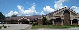
Clockwise from top: Scott County Courthouse, Downtown Waldron, and the Old Scott County Courthouse
Scott County Arkansas Incorporated and Unincorporated areas Waldron Highlighted 0572380.svg
Location of Waldron in Scott County, Arkansas.
Coordinates: 34°53′57″N94°05′29″W / 34.89917°N 94.09139°W / 34.89917; -94.09139
Country United States
State Arkansas
County Scott
Founded byW. G. Featherston
Named for W. P. Waldron
Area
[1]
  Total5.72 sq mi (14.83 km2)
  Land5.63 sq mi (14.59 km2)
  Water0.09 sq mi (0.23 km2)
Elevation
[2]
646 ft (197 m)
Population
 (2020)
  Total3,386
  Density600.99/sq mi (232.03/km2)
Time zone UTC-6 (Central (CST))
  Summer (DST) UTC-5 (CDT)
ZIP codes
72924, 72958
Area code 479
FIPS code 05-72380
GNIS feature ID2405661 [2]

Waldron is a city in Scott County, Arkansas, United States. Its population was 3,386 at the 2020 census. [3] The city is the county seat of Scott County. [4]

Contents

History

Waldron was platted in 1845 by surveyor W. P. Waldron, and named for him. [5] A post office called Waldron has been in operation since 1846. [6] Waldron was incorporated in 1875. [7] Waldron was reached by the Arkansas Western Railroad from Heavener, Oklahoma in 1901. [8] Later called the Arkansas Western Railway, a subsidiary of and subsequently incorporated into the Kansas City Southern, the line is now leased to and operated by the Arkansas Southern Railroad. [8] [9]

Geography

According to the United States Census Bureau, the city has a total area of 5.0 square miles (13 km2), of which 5.0 square miles (13 km2) is land and 0.1 square miles (0.26 km2) (1.19%) is water. Waldron is located approximately 38 miles south of Fort Smith, near the Poteau River.

Climate

The climate in this area is characterized by hot, humid summers and generally mild to cool winters. According to the Köppen Climate Classification system, Waldron has a humid subtropical climate, abbreviated "Cfa" on climate maps. [10]

Climate data for Waldron, Arkansas (1991–2020 normals, extremes 1919–present)
MonthJanFebMarAprMayJunJulAugSepOctNovDecYear
Record high °F (°C)84
(29)
90
(32)
95
(35)
94
(34)
99
(37)
110
(43)
111
(44)
113
(45)
114
(46)
103
(39)
87
(31)
82
(28)
114
(46)
Mean maximum °F (°C)71.8
(22.1)
75.2
(24.0)
81.4
(27.4)
85.9
(29.9)
89.9
(32.2)
94.2
(34.6)
99.5
(37.5)
99.5
(37.5)
95.2
(35.1)
87.8
(31.0)
77.8
(25.4)
71.7
(22.1)
101.5
(38.6)
Mean daily maximum °F (°C)50.6
(10.3)
55.6
(13.1)
64.0
(17.8)
72.4
(22.4)
79.1
(26.2)
87.3
(30.7)
92.2
(33.4)
92.0
(33.3)
85.0
(29.4)
73.8
(23.2)
61.6
(16.4)
53.0
(11.7)
72.2
(22.3)
Daily mean °F (°C)39.1
(3.9)
43.4
(6.3)
51.3
(10.7)
59.7
(15.4)
67.8
(19.9)
75.9
(24.4)
80.3
(26.8)
79.5
(26.4)
72.2
(22.3)
61.0
(16.1)
49.6
(9.8)
41.6
(5.3)
60.1
(15.6)
Mean daily minimum °F (°C)27.7
(−2.4)
31.2
(−0.4)
38.7
(3.7)
46.9
(8.3)
56.4
(13.6)
64.5
(18.1)
68.4
(20.2)
66.9
(19.4)
59.5
(15.3)
48.3
(9.1)
37.7
(3.2)
30.3
(−0.9)
48.0
(8.9)
Mean minimum °F (°C)11.1
(−11.6)
15.2
(−9.3)
20.6
(−6.3)
29.8
(−1.2)
40.3
(4.6)
54.0
(12.2)
59.6
(15.3)
57.3
(14.1)
43.4
(6.3)
30.5
(−0.8)
20.5
(−6.4)
15.4
(−9.2)
8.1
(−13.3)
Record low °F (°C)−14
(−26)
−20
(−29)
4
(−16)
19
(−7)
31
(−1)
44
(7)
49
(9)
46
(8)
30
(−1)
20
(−7)
6
(−14)
−7
(−22)
−20
(−29)
Average precipitation inches (mm)3.43
(87)
3.17
(81)
4.63
(118)
5.35
(136)
5.95
(151)
4.67
(119)
3.89
(99)
3.74
(95)
4.21
(107)
4.66
(118)
4.93
(125)
4.59
(117)
53.22
(1,352)
Average snowfall inches (cm)1.1
(2.8)
1.0
(2.5)
0.7
(1.8)
0.0
(0.0)
0.0
(0.0)
0.0
(0.0)
0.0
(0.0)
0.0
(0.0)
0.0
(0.0)
0.0
(0.0)
0.0
(0.0)
0.1
(0.25)
2.9
(7.4)
Average precipitation days (≥ 0.01 in)7.07.69.28.69.88.07.76.96.87.47.38.294.5
Average snowy days (≥ 0.1 in)0.60.60.20.00.00.00.00.00.00.00.00.21.6
Source: NOAA [11] [12]

Demographics

Historical population
CensusPop.Note
1850 90
1870 162
1880 28978.4%
1890 48768.5%
1900 4870.0%
1910 90084.8%
1920 9182.0%
1930 1,07717.3%
1940 1,29820.5%
1950 1,292−0.5%
1960 1,61925.3%
1970 2,13231.7%
1980 2,64223.9%
1990 3,02414.5%
2000 3,50816.0%
2010 3,6183.1%
2020 3,386−6.4%
U.S. Decennial Census [13]

2020 census

Waldron racial composition [14]
RaceNumberPercentage
White (non-Hispanic)2,57476.02%
Black or African American (non-Hispanic)100.3%
Native American 381.12%
Asian 822.42%
Pacific Islander 10.03%
Other/Mixed 1544.55%
Hispanic or Latino 52715.56%

As of the 2020 United States census, there were 3,386 people, 1,328 households, and 854 families residing in the city.

2000 census

As of the 2000 census, there were 3,508 people, 1,430 households, and 899 families residing in the city. [15] The population density was 704.4 inhabitants per square mile (272.0/km2). There were 1,563 housing units at an average density of 313.8 per square mile (121.2/km2). The racial makeup of the city was 90.42% White, 0.14% Black or African American, 0.91% Native American, 0.11% Asian, 7.16% from other races, and 1.25% from two or more races. 15.31% of the population were Hispanic or Latino of any race.

There were 1,430 households, out of which 31.3% had children under the age of 18 living with them, 45.9% were married couples living together, 11.3% had a female householder with no husband present, and 37.1% were non-families. 33.0% of all households were made up of individuals, and 16.8% had someone living alone who was 65 years of age or older. The average household size was 2.38 and the average family size was 3.00.

In the city, the population was spread out, with 26.9% under the age of 18, 10.2% from 18 to 24, 25.6% from 25 to 44, 19.6% from 45 to 64, and 17.8% who were 65 years of age or older. The median age was 35 years. For every 100 females, there were 96.6 males. For every 100 females age 18 and over, there were 87.8 males.

The median income for a household in the city was $21,921, and the median income for a family was $26,829. Males had a median income of $25,256 versus $16,136 for females. The per capita income for the city was $12,193. About 22.8% of families and 25.9% of the population were below the poverty line, including 31.1% of those under age 18 and 14.7% of those age 65 or over.

Education

Public education for elementary and secondary school students is primarily provided by the Waldron School District, which leads to graduation from Waldron High School. The district and school mascot and athletic emblem is the Bulldog with orange and black serving as the district and school colors.

Notable people

Related Research Articles

<span class="mw-page-title-main">Hope, Arkansas</span> City in Arkansas, United States

Hope is a city in Hempstead County in southwestern Arkansas, United States. Hope is the county seat of Hempstead County and the principal city of the Hope Micropolitan Statistical Area, which includes all of Hempstead and Nevada counties. As of the 2010 census the population was 10,095, and in 2019 the population was estimated at 9,599.

<span class="mw-page-title-main">Scott County, Arkansas</span> County in Arkansas, United States

Scott County is a county located in the U.S. state of Arkansas. As of the 2020 census, the population was 9,836. The county seat is Waldron. Scott County is Arkansas' 28th county, formed on November 5, 1833, and named for Andrew Scott, a justice of the Supreme Court of the Arkansas Territory. It is an alcohol-prohibited or dry county.

<span class="mw-page-title-main">Diamond City, Arkansas</span> City in Arkansas, United States

Diamond City is a city in northeast Boone County, Arkansas, United States. The population was 782 at the 2010 census. It is part of the Harrison Micropolitan Statistical Area.

<span class="mw-page-title-main">Corning, Arkansas</span> City in Arkansas, United States

Corning is a city in Clay County, Arkansas, United States. The population was 3,377 at the 2010 census. It is one of the two county seats of Clay County, along with Piggott.

<span class="mw-page-title-main">Clarksville, Arkansas</span> City in Arkansas, United States

Clarksville is a city in Johnson County, Arkansas, United States. As of the 2010 census the population was 9,178, up from 7,719 in 2000. As of 2018, the estimated population was 9,743. The city is the county seat of Johnson County. It is nestled between the Arkansas River and the foothills of the Ozark Mountains, and Interstate 40 and US Highway 64 intersect within the city limits. Clarksville-Johnson County is widely known for its peaches, scenic byways and abundance of natural outdoor recreational activities.

<span class="mw-page-title-main">Lewisville, Arkansas</span> City in Arkansas, United States

Lewisville is a city in Lafayette County, Arkansas, United States. The population was 1,280 at the 2010 census. It is the county seat of Lafayette County.

<span class="mw-page-title-main">Walnut Ridge, Arkansas</span> City in Arkansas, United States

Walnut Ridge is a city in and the county seat of Lawrence County, Arkansas, United States. The population was 5,098 at the United States Census's 2019 estimate. Walnut Ridge lies immediately north of Hoxie. The two towns form a contiguous urban area with approximately 8,000 residents. Williams Baptist University is in College City, a formerly separate community that merged into Walnut Ridge in 2017.

<span class="mw-page-title-main">Keo, Arkansas</span> Town in Arkansas, United States

Keo is a town in southwest Lonoke County, Arkansas, United States. The population was 256 at the 2010 census. It is part of the Little Rock–North Little Rock–Conway Metropolitan Statistical Area.

<span class="mw-page-title-main">Texarkana, Arkansas</span> City in Arkansas, United States

Texarkana is a city in the U.S. state of Arkansas and the county seat of Miller County, on the southwest border of the state. As of the 2020 census, it had a population of 29,387. It is the twin city of Texarkana, Texas, located just across the state line. The city was founded at a railroad intersection on December 8, 1873, and was incorporated in Arkansas on August 10, 1880. Texarkana and its Texas counterpart are the principal cities of the Texarkana metropolitan area, which in 2021 was ranked 289th in the United States with a population of 147,174, according to the United States Census Bureau.

<span class="mw-page-title-main">Brinkley, Arkansas</span> City in Arkansas, United States

Brinkley is the most populous city in Monroe County, Arkansas, United States. As of the 2020 census, the population was 2,700, down from 3,188 in 2010.

<span class="mw-page-title-main">Jacksonville, Arkansas</span> City in Arkansas, United States

Jacksonville is a city in Pulaski County, Arkansas, United States, and a suburb of Little Rock. As of the 2010 census, the population of the city was 28,364. It is part of the Little Rock–North Little Rock–Conway Metropolitan Statistical Area with 729,135 people as of 2014.

<span class="mw-page-title-main">Benton, Arkansas</span> City in Arkansas, United States

Benton is a city in and the county seat of Saline County, Arkansas, United States and a suburb of Little Rock. It was established in 1837. At the 2020 census, the city had a population of 35,014, making it the 12th most populous city in Arkansas. It is part of the Little Rock–North Little Rock–Conway Metropolitan Statistical Area. The city of Benton, first settled in 1833 and named after Missouri Senator Thomas Hart Benton, was formally chartered in 1836 when Arkansas became a state.

<span class="mw-page-title-main">Mansfield, Arkansas</span> City in Arkansas, United States

Mansfield is a city in Scott and Sebastian counties Arkansas, United States. The Sebastian County portion of the city is part of the Fort Smith, Arkansas-Oklahoma Metropolitan Statistical Area. As of the 2010 Census, the population was 1,139. The population was 1,097 at the 2000 census.

<span class="mw-page-title-main">De Queen, Arkansas</span> City in Arkansas, United States

De Queen is a city and the county seat of Sevier County, Arkansas, United States. The population was 6,629 at the 2010 census. The placename is the anglicization of the family name of the Dutch merchant and railway financier, Jan de Goeijen (1861–1944). De Goeijen was reportedly rather unhappy with the deformation of his name.

<span class="mw-page-title-main">Augusta, Kansas</span> City in Butler County, Kansas

Augusta is a city in Butler County, Kansas, United States. As of the 2020 census, the population of the city was 9,256. It is located east of Wichita along U.S. Route 54 / 400 highway.

<span class="mw-page-title-main">Arkansas City, Kansas</span> City in Cowley County, Kansas

Arkansas City is a city in Cowley County, Kansas, United States, situated at the confluence of the Arkansas River and Walnut River in the southwestern part of the county. As of the 2020 census, the population of the city was 11,974.

<span class="mw-page-title-main">Waldron, Kansas</span> City in Harper County, Kansas

Waldron is a city in Harper County, Kansas, United States. As of the 2020 census, the population of the city was 9. The south edge of the city is the Kansas / Oklahoma state border.

<span class="mw-page-title-main">Clinton, Missouri</span> City in Missouri, United States

Clinton is a city in Henry County, Missouri, United States. The population was 9,174 at the 2020 census. It is the county seat of Henry County.

<span class="mw-page-title-main">Spearman, Texas</span> City in Texas, United States

Spearman is a city in and the county seat of Hansford County, Texas, United States. As of the 2010 census, the city population was 3,368. It is known for its collection of windmills from the J.B. Buchanan windmill collection.

<span class="mw-page-title-main">Nephi, Utah</span> City in and county seat of Juab County, Utah, United States

Nephi is a city in Juab County, Utah, United States. It is part of the Provo–Orem metropolitan area. The population was 6,443 at the 2020 census. It is the county seat of Juab County. It was settled by Mormon pioneers in 1851 as Salt Creek, and it acquired its current name in 1882. It is the principal city in the Juab Valley, an agricultural area. Nephi was named after Nephi, son of Lehi, from the Book of Mormon.

References

  1. "2020 U.S. Gazetteer Files". United States Census Bureau. Retrieved October 29, 2021.
  2. 1 2 U.S. Geological Survey Geographic Names Information System: Waldron, Arkansas
  3. "Waldron city, Arkansas".
  4. "Find a County". National Association of Counties. Retrieved June 7, 2011.
  5. Waldron from the Encyclopedia of Arkansas History and Culture . Retrieved July 7, 2019.
  6. "Post Offices". Jim Forte Postal History. Retrieved February 9, 2018.
  7. McCutchen, Henry Grady (1922). History of Scott County, Arkansas. 22. p. 55.
  8. 1 2 "Arkansas Western Railroad". Encyclopedia of Arkansas. Retrieved July 5, 2022.
  9. "The Completion of the KCP&G – A Centennial History". Lowell G. McManus, The Meridian Speedway. Retrieved August 19, 2020.
  10. Climate Summary for Waldron, Arkansas
  11. "NOWData – NOAA Online Weather Data". National Oceanic and Atmospheric Administration. Retrieved November 23, 2023.
  12. "Summary of Monthly Normals 1991–2020". National Oceanic and Atmospheric Administration. Retrieved November 23, 2023.
  13. "Census of Population and Housing". Census.gov. Retrieved June 4, 2015.
  14. "Explore Census Data". data.census.gov. Retrieved December 31, 2021.
  15. "U.S. Census website". United States Census Bureau . Retrieved January 31, 2008.