Fordyce, Arkansas

Last updated

Fordyce, Arkansas
Fordyce Home Accident Insurance Company.jpg
The historic Fordyce Home Accident Insurance Company building in downtown Fordyce, 2007
Dallas County Arkansas Incorporated and Unincorporated areas Fordyce Highlighted 0524220.svg
Location of Fordyce in Dallas County, Arkansas.
Coordinates: 33°49′06″N92°25′01″W / 33.81833°N 92.41694°W / 33.81833; -92.41694
Country United States
State Arkansas
County Dallas
Area
[1]
  Total6.81 sq mi (17.65 km2)
  Land6.81 sq mi (17.65 km2)
  Water0.00 sq mi (0.00 km2)
Elevation
[2]
266 ft (81 m)
Population
 (2020)
  Total3,396
  Density498.39/sq mi (192.42/km2)
Time zone UTC−06:00 (Central (CST))
  Summer (DST) UTC−05:00 (CDT)
ZIP Code
71742
Area code 870
FIPS code 05-24220
GNIS feature ID2403630 [2]

Fordyce is a city in southeast Dallas County, Arkansas, United States. Its population has been decreasing since the 1980s when the town reached an all time high of 5,175. [3] The population in 2020 was 3,396 [4] down from 4,300 at the 2010 census, [5] and from 4,799 in 2000.

Contents

The city is the county seat, [6] home to the 1911 Dallas County Courthouse.

Within Fordyce there are 19 sites listed on the National Register of Historic Places, including the Fordyce Home Accident Insurance Company. The town was named for Samuel W. Fordyce. [7]

History

Before European settlement the area was inhabited by the Caddo people, whose artifacts are occasionally found. [3] The land that became Fordyce was partially cleared prior to 1850 by W. W. Killabrew, an early settler. [3] In the 1870s the land was owned by an African American named Henry Atkinson who sold it to Dr. Algernon Sidney Holderness for $118, who built the very first sawmill in town. [3]

Samuel Wesley Fordyce Samuel Wesley Fordyce (1840-1919).png
Samuel Wesley Fordyce

The town of the town of Fordyce was named for Samuel Wesley Fordyce. Little construction took place until 1881 when four railroad lines were constructed in the Dallas County, one of which was surveyed by Samuel Fordyce. [8] The St. Louis Southwestern Railway Company was completed in 1883 [9] under Fordyce's management, which he operated for sixteen years. [10] The rail line called the Cotton Belt Line passed thru the town of Fordyce until 1940 when the rail lines were abandoned, and trucks on the roads replaced the trains. [8]

By 1890 Fordyce was the largest town in the county and on April 8, 1908, it became incorporated [3] and the seat of Dallas County. [8] [3]

The Fordyce Lumber Co. was formed in February 1892 by Charles Warner Gates, John Wenzel Watzek and Edward Savage Crossett. Within four years of starting the Fordyce Lumber Co., the partners began the Crossett Lumber Co. in 1899. The city of Crossett is named after Edward Savage Crossett. On March 10, 1907, the Chicago, Rock Island and Pacific Railroad (CRI&PR) connected the town of Crossett to Fordyce. The (CRI&PR) allowed timber and lumber to move between the sawmills in Crossett to Fordyce that were owned by Charles Warner Gates, John Wenzel Watzek and Edward Savage Crossett. [11]

The first high school football team in the state of Arkansas was started in Fordyce in 1904. [8]

On July 5, 1975 The Rolling Stones band members Keith Richards and Ron Wood were arrested in Fordyce for reckless driving, carrying an illegal weapon- a hunting knife, and less than two grams of cocaine said to belong to a passenger in the car. They drank soda pop at the City Hall and called the British Embassy while a crowd gathered outside, but were released some hours later after paying $162.50 in bail and then they forfeited bond- not appearing on their court date. 31 years later in 2006 Richards was pardoned for the incident by the governor at the time Mike Huckabee. [12]

Geography

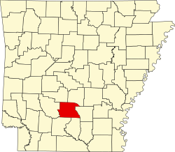
Fordyce is located in southeastern Dallas County, with the city's southern border following the Calhoun County line. U.S. Routes 79 and 167 bypass the city center to the north and west, while Arkansas Highway 8 passes through the downtown area. US 79 leads northeast 42 miles (68 km) to Pine Bluff and southwest 31 miles (50 km) to Camden, while US 167 leads north 35 miles (56 km) to Sheridan and south 51 miles (82 km) to El Dorado. AR 8 leads southeast 26 miles (42 km) to Warren and northwest 49 miles (79 km) to Arkadelphia.

According to the United States Census Bureau, Fordyce has a total area of 6.8 square miles (17.5 km2), all land. [5]

Climate

Climate data for Fordyce, Arkansas (1991–2020 normals, extremes 1911–1917, 1936–present)
MonthJanFebMarAprMayJunJulAugSepOctNovDecYear
Record high °F (°C)83
(28)
85
(29)
92
(33)
98
(37)
98
(37)
106
(41)
107
(42)
108
(42)
110
(43)
97
(36)
88
(31)
80
(27)
110
(43)
Mean maximum °F (°C)71.8
(22.1)
75.4
(24.1)
82.0
(27.8)
85.3
(29.6)
89.3
(31.8)
94.1
(34.5)
97.7
(36.5)
98.4
(36.9)
95.1
(35.1)
88.3
(31.3)
79.3
(26.3)
72.6
(22.6)
99.6
(37.6)
Mean daily maximum °F (°C)52.3
(11.3)
56.8
(13.8)
65.1
(18.4)
73.5
(23.1)
80.5
(26.9)
87.6
(30.9)
91.0
(32.8)
90.9
(32.7)
85.3
(29.6)
75.1
(23.9)
63.2
(17.3)
54.5
(12.5)
73.0
(22.8)
Daily mean °F (°C)41.6
(5.3)
45.3
(7.4)
53.0
(11.7)
61.2
(16.2)
69.7
(20.9)
77.3
(25.2)
80.7
(27.1)
80.0
(26.7)
73.7
(23.2)
62.4
(16.9)
51.5
(10.8)
43.8
(6.6)
61.7
(16.5)
Mean daily minimum °F (°C)30.8
(−0.7)
33.7
(0.9)
40.9
(4.9)
49.0
(9.4)
59.0
(15.0)
67.0
(19.4)
70.5
(21.4)
69.2
(20.7)
62.1
(16.7)
49.8
(9.9)
39.9
(4.4)
33.1
(0.6)
50.4
(10.2)
Mean minimum °F (°C)15.3
(−9.3)
20.2
(−6.6)
24.6
(−4.1)
33.4
(0.8)
44.1
(6.7)
56.8
(13.8)
62.6
(17.0)
60.9
(16.1)
48.1
(8.9)
34.4
(1.3)
24.9
(−3.9)
19.6
(−6.9)
13.5
(−10.3)
Record low °F (°C)−5
(−21)
−1
(−18)
10
(−12)
26
(−3)
35
(2)
44
(7)
51
(11)
45
(7)
24
(−4)
26
(−3)
14
(−10)
−2
(−19)
−5
(−21)
Average precipitation inches (mm)4.54
(115)
4.87
(124)
5.83
(148)
5.89
(150)
5.39
(137)
4.18
(106)
4.06
(103)
3.80
(97)
3.60
(91)
5.01
(127)
4.44
(113)
6.02
(153)
57.63
(1,464)
Average snowfall inches (cm)0.6
(1.5)
0.5
(1.3)
0.1
(0.25)
0.0
(0.0)
0.0
(0.0)
0.0
(0.0)
0.0
(0.0)
0.0
(0.0)
0.0
(0.0)
0.0
(0.0)
0.0
(0.0)
0.0
(0.0)
1.2
(3.0)
Average precipitation days (≥ 0.01 in)10.910.310.89.79.87.97.86.86.47.49.010.4107.2
Average snowy days (≥ 0.1 in)0.10.20.00.00.00.00.00.00.00.00.00.00.3
Source: NOAA [13] [14]

Demographics

Historical population
CensusPop.Note
1890 980
1900 1,71074.5%
1910 2,79463.4%
1920 2,9967.2%
1930 3,2067.0%
1940 3,4297.0%
1950 3,7549.5%
1960 3,8903.6%
1970 4,83724.3%
1980 5,1757.0%
1990 4,729−8.6%
2000 4,7991.5%
2010 4,300−10.4%
2020 3,396−21.0%
U.S. Decennial Census [15]
2014 Estimate [16]

2020 census

Fordyce racial composition [17]
RaceNum.Perc.
White (non-Hispanic)1,24236.57%
Black or African American (non-Hispanic)1,87955.33%
Native American 50.15%
Asian 50.15%
Other/Mixed 1474.33%
Hispanic or Latino 1183.47%

As of the 2020 United States census, there were 3,396 people, 1,398 households, and 808 families residing in the city.

2010 census

As of the 2010 United States Census, there were 4,300 people living in the city. The racial makeup of the city was 53.3% Black, 42.0% White, 0.5% Native American, 0.2% Asian, <0.1% Pacific Islander, 0.1% from some other race and 1.1% from two or more races. 2.6% were Hispanic or Latino of any race.

2000 census

As of the census [18] of 2000, there were 4,799 people, 1,737 households, and 1,186 families living in the city. The population density was 727.8 inhabitants per square mile (281.0/km2). There were 2,024 housing units at an average density of 307 square miles (800 km2). The racial makeup of the city was 48.61% White, 49.66% Black or African American, 0.19% Native American, 0.42% Asian, 0.75% from other races, and 0.38% from two or more races. 1.19% of the population were Hispanic or Latino of any race.

There were 1,737 households, out of which 32.0% had children under the age of 18 living with them, 46.4% were married couples living together, 17.5% had a female householder with no husband present, and 31.7% were non-families. 28.6% of all households were made up of individuals, and 13.4% had someone living alone who was 65 years of age or older. The average household size was 2.51 and the average family size was 3.09.

In the city, the population was spread out, with 28.5% under the age of 18, 8.9% from 18 to 24, 25.3% from 25 to 44, 21.0% from 45 to 64, and 16.3% who were 65 years of age or older. The median age was 36 years. For every 100 females, there were 90.7 males. For every 100 females age 18 and over, there were 87.1 males.

The median income for a household in the city was $23,297, and the median income for a family was $30,120. Males had a median income of $24,971 versus $15,553 for females. The per capita income for the city was $12,118. About 16.2% of families and 22.3% of the population were below the poverty line, including 27.2% of those under age 18 and 19.3% of those age 65 or over.

Industry

Top employers: [19]

Education

The town was once segregated with separate public schools, the one for white children was the Fordyce Grammar School and the school for black children was the J. E. Wallace Elementary School. [3] Public education is provided by the Fordyce School District. The city and surrounding area is served by and elementary, middle and Fordyce High School. The school's athletic teams are the Redbugs.

Notable people

The town of Fordyce and Dallas County have the highest number of inductees into the Arkansas Sports Hall of Fame in the state. [8]

Related Research Articles

<span class="mw-page-title-main">Dallas County, Arkansas</span> County in Arkansas, United States

Dallas County is a county located in the U.S. state of Arkansas. As of the 2020 census, the population was 6,482, making it the fourth-least populous county in Arkansas. The county seat is Fordyce. Dallas County is Arkansas's 49th county, formed on January 1, 1845; it was named for George M. Dallas, 11th Vice President of the United States.

<span class="mw-page-title-main">Ashley County, Arkansas</span> County in Arkansas, United States

Ashley County is a rural South Arkansas county with a culture, economy, and history based on timber and agriculture. Created as Arkansas's 52nd county on November 30, 1848, Ashley County has seven incorporated municipalities, including Hamburg, the county seat and Crossett, the most populous city. The county is also the site of numerous unincorporated communities and ghost towns. The county is named for Chester Ashley, a prominent lawyer in the Arkansas Territory and U.S. senator from the state from 1844 to 1848.

<span class="mw-page-title-main">Crossett, Arkansas</span> Tonia Braxton

Crossett is the largest city in Ashley County, Arkansas, United States, with a population of 5,507, according to 2010 Census Bureau estimates. Combined with North Crossett and West Crossett, the population is 10,752. Crossett was incorporated in 1903.

<span class="mw-page-title-main">North Crossett, Arkansas</span> CDP in Arkansas, United States

North Crossett is a census-designated place (CDP) in Ashley County, Arkansas, United States. Per the 2020 census, the population was 2,756.

<span class="mw-page-title-main">Hermitage, Arkansas</span> City in Arkansas, United States

Hermitage is a city in Bradley County, Arkansas, United States. The United States Census Bureau estimated the population to be 830 as of the 2010 census.

<span class="mw-page-title-main">Warren, Arkansas</span> City in Arkansas, United States

Warren is a city in and the county seat of Bradley County, Arkansas, United States. As of the 2010 census, the population was 6,003.

<span class="mw-page-title-main">Hampton, Arkansas</span> Town in Arkansas, United States

Hampton is a town in Calhoun County, Arkansas, United States. The population was 1,181 according to the 2020 United States Census. The town is the county seat of Calhoun County.

<span class="mw-page-title-main">Thornton, Arkansas</span> City in Arkansas, United States

Thornton is a city in Calhoun County, Arkansas, United States. The population was 407 as of the 2010 census, down from 517 in 2000. It is part of the Camden, Arkansas micropolitan area.

<span class="mw-page-title-main">Berryville, Arkansas</span> City in Arkansas, United States

Berryville is a city in Carroll County, Arkansas, United States. The population was 5,682 at the 2020 census. making it the largest city in Carroll County. Along with Eureka Springs, it is one of the two county seats of Carroll County.

<span class="mw-page-title-main">Whelen Springs, Arkansas</span> Town in Arkansas, United States

Whelen Springs is a town in Clark County, Arkansas, United States. The population was 92 at the 2010 census. From 1930 through 1939 the town thrived, being a main hub of operations for the then powerful Ozan Lumber Company.

<span class="mw-page-title-main">Rison, Arkansas</span> City in Arkansas, United States

Rison, officially the City of Rison, is a city in and the county seat of Cleveland County, Arkansas, United States. Its population was 1,344 at the 2010 U.S. census. It is included in the Pine Bluff, Arkansas Metropolitan Statistical Area. Rison is a bedroom community for people who work in Pine Bluff. The largest employers are the city and county governments, the Cleveland County School District, the Cleveland County Nursing Home. There are two banks, eight churches, and about forty-five businesses within the city limits. Among the local properties listed on the National Register of Historic Places are the Rison Cities Service Station and the Rison Texaco Service Station.

<span class="mw-page-title-main">Carthage, Arkansas</span> Town in Arkansas, United States

Carthage is a town in Dallas County, Arkansas, United States. The population was 343 at the 2010 census.

<span class="mw-page-title-main">Sparkman, Arkansas</span> City in Arkansas, United States

Sparkman is a city in Dallas County, Arkansas, United States. The population was 355 at the 2020 census, down from 427 in 2010.

<span class="mw-page-title-main">McGehee, Arkansas</span> City in Arkansas, United States

McGeheemə-GHEE is a city in Desha County, Arkansas, United States. The population was 4,219 at the 2010 census.

<span class="mw-page-title-main">Guy, Arkansas</span> City in Arkansas, United States

Guy is a city in Faulkner County, Arkansas, United States. The population was 708 at the 2010 census, up from 202 at the 2000 census. It is part of the Central Arkansas region.

<span class="mw-page-title-main">Marmaduke, Arkansas</span> City in Arkansas, United States

Marmaduke is a city in Greene County, Arkansas, United States. The population was 1,212 in 2020.

<span class="mw-page-title-main">Emmet, Arkansas</span> City in Arkansas, United States

Emmet is a city in Nevada and Hempstead counties in the U.S. state of Arkansas. It is located at the intersection of U.S. Highway 67 and Arkansas Highway 299 in the Arkansas Timberlands region of southwest Arkansas. It is part of the larger Ark-La-Tex tri-state region. As of the 2010 census, the population of Emmet was 518.

<span class="mw-page-title-main">Lewisville, Arkansas</span> City in Arkansas, United States

Lewisville is a city in Lafayette County, Arkansas, United States. The population was 1,280 at the 2010 census. It is the county seat of Lafayette County.

<span class="mw-page-title-main">Blytheville, Arkansas</span> City in Arkansas, United States

Blytheville is the county seat and the largest city in Mississippi County, Arkansas, United States. It is approximately 60 miles (100 km) north of West Memphis. The population was 13,406 at the 2020 census, down from 15,620 in 2010.

<span class="mw-page-title-main">Burdette, Arkansas</span> Town in Arkansas, United States

Burdette is a town in Mississippi County, Arkansas, United States. The population was 140 at the 2020 census, down from 191 in 2010.

References

  1. "2020 U.S. Gazetteer Files". United States Census Bureau. Retrieved October 29, 2021.
  2. 1 2 U.S. Geological Survey Geographic Names Information System: Fordyce, Arkansas
  3. 1 2 3 4 5 6 7 8 9 10 11 "Encyclopedia of Arkansas". Central Arkansas Library System. Retrieved June 17, 2022.
  4. "2020 Decennial Census : Fordyce city, Arkansas". U.S. Census Bureau. Retrieved June 17, 2022.
  5. 1 2 "Geographic Identifiers: 2010 Demographic Profile Data (G001): Fordyce city". U.S. Census Bureau, American Factfinder. Retrieved October 9, 2015.[ dead link ]
  6. "Find a County". National Association of Counties. Archived from the original on May 9, 2015. Retrieved June 7, 2011.
  7. Samuel Wesley Fordyce in The Encyclopedia of Arkansas History & Culture
  8. 1 2 3 4 5 6 "Arkansas Tourism Official Site: Fordyce". State of Arkansas. Retrieved June 17, 2022.
  9. Samuel Wesley Fordyce (1840–1919)
  10. Copied from Wikipedia, see that article for references and history
  11. | Good as gold, the timber industry celebrates a birthday at Crossett and Fordyce|Kim Harper| Journal Publishing, Inc. | Arkansas Business (Vol. 9, Issue 13)| 1992
  12. "Encyclopedia of Arkansas". Encyclopedia of Arkansas: Arrest of the Rolling Stones. State of Arkansas. Retrieved June 17, 2022.
  13. "NOWData – NOAA Online Weather Data". National Oceanic and Atmospheric Administration. Retrieved November 22, 2023.
  14. "Summary of Monthly Normals 1991–2020". National Oceanic and Atmospheric Administration. Retrieved November 22, 2023.
  15. "Census of Population and Housing". Census.gov. Retrieved June 4, 2015.
  16. "Annual Estimates of the Resident Population for Incorporated Places: April 1, 2010 to July 1, 2014". Archived from the original on May 22, 2015. Retrieved June 4, 2015.
  17. "Explore Census Data". data.census.gov. Retrieved December 13, 2021.
  18. "U.S. Census website". United States Census Bureau . Retrieved January 31, 2008.
  19. "Fordyce, Arkansas: Top Employers". Archived from the original on July 19, 2008. Retrieved January 29, 2009.
  20. "Cory Carr Stats | Basketball-Reference.com".