Remote sensing is the acquisition of information about an object or phenomenon without making physical contact with the object, in contrast to in situ or on-site observation. The term is applied especially to acquiring information about Earth and other planets. Remote sensing is used in numerous fields, including geophysics, geography, land surveying and most Earth science disciplines ; it also has military, intelligence, commercial, economic, planning, and humanitarian applications, among others.
Image analysis or imagery analysis is the extraction of meaningful information from images; mainly from digital images by means of digital image processing techniques. Image analysis tasks can be as simple as reading bar coded tags or as sophisticated as identifying a person from their face.

Geomatics is defined in the ISO/TC 211 series of standards as the "discipline concerned with the collection, distribution, storage, analysis, processing, presentation of geographic data or geographic information". Under another definition, it consists of products, services and tools involved in the collection, integration and management of geographic (geospatial) data. It is also known as geomatic(s) engineering. Surveying engineering was the widely used name for geomatic(s) engineering in the past.

Photogrammetry is the science and technology of obtaining reliable information about physical objects and the environment through the process of recording, measuring and interpreting photographic images and patterns of electromagnetic radiant imagery and other phenomena.

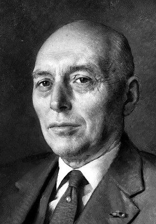
Willem "Wim" Schermerhorn was a Dutch politician who served as Prime Minister of the Netherlands from 25 June 1945 until 3 July 1946. He was a member of the now-defunct Free-thinking Democratic League (VDB) and later co-founder of the Labour Party (PvdA). According to Harry W. Laidler, the government under Schermerhorn's premiership "achieved important results in the fields of labor, finance, housing, old age pensions, and the social services".

Polarimetry is the measurement and interpretation of the polarization of transverse waves, most notably electromagnetic waves, such as radio or light waves. Typically polarimetry is done on electromagnetic waves that have traveled through or have been reflected, refracted or diffracted by some material in order to characterize that object.
The Indian Institute of Remote Sensing is an institute for research, higher education and training in the field of remote sensing, geoinformatics and GPS technology for natural resources, environmental and disaster management under the Indian Department of Space, which was established in the year 1966. It is located in the city of Dehradun, Uttarakhand.
The American Society for Photogrammetry and Remote Sensing (ASPRS) is an American learned society devoted to photogrammetry and remote sensing. It is the United States' member organization of the International Society for Photogrammetry and Remote Sensing. Founded in 1934 as American Society of Photogrammetry and renamed in 1985, the ASPRS is a scientific association serving over 7,000 professional members around the world. As a professional body with oversight of specialists in the arts of imagery exploitation and photographic cartography. Its official journal is Photogrammetric Engineering & Remote Sensing (PE&RS), known as Photogrammetric Engineering between 1937 and 1975.
The International Society for Photogrammetry and Remote Sensing (ISPRS) is an international non-governmental organization that enhances international cooperation between the worldwide organizations with interests in the photogrammetry, remote sensing and spatial information sciences. Originally named International Society for Photogrammetry (ISP), it was established in 1910, and is the oldest international umbrella organization in its field, which may be summarized as addressing “information from imagery”.

George Joseph is an Indian space scientist, best known for his contributions to the development of remote sensing technology in India, especially in the field of earth observation sensors. He is a former chairman of the Lunar Mission Study Task Force of the Indian Space Research Organization and an elected fellow of the National Academy of Sciences, India, Indian Academy of Sciences and Indian National Academy of Engineering. The Government of India awarded him the Padma Bhushan, the third highest civilian award, in 1999.
Prof. em. Dr. Armin Gruen is, since 1984, professor and head of the Chair of photogrammetry at the Institute of Geodesy and Photogrammetry (IGP), Federal Institute of Technology (ETH) Zurich, Switzerland. Since 1 August 2009, he is retired and is now with the Chair of Information Architecture, ETH Zurich Faculty of Architecture. He is currently acting as a principal investigator on the Simulation Platform of the SEC-FCL in Singapore.
Dr. Y. S. Rao is a professor at the Centre of Studies in Resources Engineering, Indian Institute of Technology Bombay, Mumbai, India. He is working in the field of microwave remote sensing and land based applications for more than 34 years. His early research was focused on the use of Synthetic Aperture Radar (SAR) interferometry for landslides and land deformation monitoring, Digital Elevation Model generation, snow and glacier monitoring. He is also actively involved in developing several techniques for soil moisture estimation using passive and active microwave remote sensing data for more than 25 years. His current research involves SAR Polarimetry for crop characterization, classification, biophysical parameter retrieval using linear and compact-pol SAR data. Apart from applications, he has also contributed in the field of Polarimetric SAR system calibration and software tool development.
Avik Bhattacharya is a professor at the Centre of Studies in Resources Engineering, Indian Institute of Technology Bombay, Mumbai, India. He has been working in the field of radar polarimetry theory and applications for more than a decade. His main focuses on the use of synthetic aperture radar (SAR) data for land use classification, change detection and qualitative and quantitative biophysical and geophysical information estimation.
The Remote Sensing and Photogrammetry Society (RSPSoc) is a British learned society devoted to photogrammetry and remote sensing. It is the UK's adhering body of the International Society for Photogrammetry and Remote Sensing.
The Journal of Spatial Science is an academic journal about spatial sciences published by Taylor & Francis on behalf of the Mapping Sciences Institute (Australia) and the Surveying and Spatial Sciences Institute. It covers cartography, geodesy, geographic information science, hydrography, digital image analysis and photogrammetry, remote sensing, surveying and related areas. Its editor-in-chief is Graeme Wright; its 2018 impact factor is 1.711.
The Indian Society of Remote Sensing (ISRS) is an Indian learned society devoted to remote sensing; it was created in 1969 and has more than 5000 members. It is a national member of the International Society for Photogrammetry and Remote Sensing and Asian Association on Remote Sensing. ISRS publishes the Journal of the Indian Society of Remote Sensing.
The NASA Ames Stereo Pipeline (ASP) is an open-source software package for photogrammetry. It can create digital elevation models and ortho images from stereo planetary data acquired with NASA spacecraft, including for the Moon, Mars, and all other bodies with a solid surface, and also from commercial Earth-orbiting satellites, such as Digital Globe and any vendors who support the RPC camera model, e.g., Pléiades and Cartosat. For stereo correlation ASP uses block-matching and semi-global matching. ASP also provides tools for correcting the input camera poses using bundle adjustment, registration of obtained terrain models using iterative closest point, and a tool for refining a 3D terrain model with shape from shading. ASP integrates the ISIS software for processing planetary data. Binary releases are available for Linux and OSX.

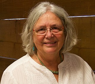
Susan Ustin is an American earth scientist who is the Distinguished Professor of Environmental Resource Science at the John Muir Institute for the Environment, University of California, Davis. Her research makes use of remote sensing technology to understand the characteristics of plant communities.
Land cover maps are tools that provide vital information about the Earth's land use and cover patterns. They aid policy development, urban planning, and forest and agricultural monitoring.

Qihao Weng is an American geographer, urban, environmental sustainability, and remote sensing scientist. He has been a Chair Professor at the Hong Kong Polytechnic University since July 2021, and was the Director of the Center for Urban and Environmental Change and is a professor of geography in the Department of Earth and Environmental Systems at the Indiana State University.


