Bangka Regency

Last updated
Bangka Regency
Kabupaten Bangka
Lambang Kabupaten Bangka.png
Motto: 
Sepintu Sedulang
Lokasi Babel Kabupaten Bangka.svg
Location within Bangka Belitung Islands
Indonesia Sumatra location map.svg
Red pog.svg
Bangka Regency
Location in Sumatra and Indonesia
Indonesia location map.svg
Red pog.svg
Bangka Regency
Bangka Regency (Indonesia)
Coordinates: 1°54′S105°53′E / 1.900°S 105.883°E / -1.900; 105.883
Country Indonesia
Province Bangka Belitung Islands
Regency seat Sungailiat
Government
  RegentMulkan
  Vice RegentSyahbudin
Area
  Total3,016.85 km2 (1,164.81 sq mi)
Population
 (mid 2022 estimate) [1]
  Total334,344
  Density110/km2 (290/sq mi)
Time zone UTC+7 (IWST)
Area code (+62) 717
Website bangka.go.id

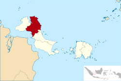
Bangka Regency is a regency (kabupaten) of Bangka Belitung Islands, Indonesia. It covers an area of 3,016.85 km2 in the northeast of Bangka Island, and had a population of 277,204 at the 2010 Census [2] rising to 326,265 at the 2020 Census; [3] the official estimate as at mid 2022 was 334,344 - comprising 172,248 males and 162,096 females. [1] The coastal town of Sungailiat is its regency seat.

Contents

Administrative Districts

The Regency as at 2022 was divided into eight districts (kecamatan), tabulated below with their areas and their populations at the 2010 Census [2] and the 2020 Census, [3] together with the official estimates as at mid 2022. [1] The table also includes the location of the district administrative centres, the number of administrative villages (totaling 62 rural desa and 19 urban kelurahan) and the number of offshore islands in each district, and its postal codes.

However, a further three districts have recently been established - those of Karang Lintang, Maras Makmur and Simpang Tiga, although data concerning these have not yet been published.

Kode
Wilayah
Name of
District
(kecamatan)
Area
in
km2
Pop'n
Census
2010
Pop'n
Census
2020
Pop'n
Estimate
mid 2022
Admin
centre
No.
of
villages
No.
of
islands
Post
codes
19.01.04Mendo Barat685.6442,29051,13352,399Petaling Banjar15833173
19.01.03Merawang215.8926,20030,59631,354Batu Rusa10133172
19.01.08Puding Besar272.1016,38519,41919,900Puding Besar7-33171
19.01.01 Sungai Liat 147.0582,63592,88395,183Sri Menanti13733211 - 33215
19.01.05Pemali140.4624,98534,70535,564Air Duren5-33251 & 33255.
19.01.06Bakam426.2616,66719,03919,510Bakam9-33252
19.01.02 Belinyu 503.5444,40150,20051,443Kuto Oanji121933253
19.01.07Riau Silip625.9123,64128,29028,991Riau91333254
Totals3,016.85277,204326,265334,344Sungailiat8148

Religion

In 2014 Bangka Regency had 247,316 Moslem, 31,710 Buddhism religion, 6,464 Protestantism, 5,845 Confusianism, 3,368 Catholicism, 2,326 other religions, 62 Hinduism and 16,995 persons are not identified/other. [4]

Related Research Articles

<span class="mw-page-title-main">Bireuën Regency</span> Regency in Sumatra, Indonesia

Bireuën Regency is a regency of Aceh, the westernmost province of Indonesia. It is located on the island of Sumatra, and was created on 4 October 1999 from the former western districts of North Aceh Regency. The capital is the town of Bireuën, 105 miles east of the provincial capital, Banda Aceh. The regency covers an area of 1,796.97 square kilometres and had a population of 340,271 people according to the 2000 Census; at the 2010 Census it had a population of 389,288, which had risen to 436,418 at the 2020 Census; the official estimate as at mid 2023 was 453,242 - comprising 224,053 males and 229,189 females. It is bordered by the Strait of Malacca on the northeast coastline. Bireuen has been affected by the clashes between the Free Aceh Movement (GAM) and the government, and by the Indian Ocean earthquake and tsunami on 26 December 2004.

<span class="mw-page-title-main">Pelalawan Regency</span> Regency in Riau, Indonesia

Pelalawan is a regency (kabupaten) of Riau Province, Indonesia. It is located on the island of Sumatra. The regency was created on 4 October 1999 as a result of the division of Kampar Regency, of which it was previously the eastern 43%. It now has an area of 13,408.72 km2 and had a population of 301,829 at the 2010 Census and 390,046 at the 2020 Census; the official estimate as at mid 2022 was 410,988. The administrative centre is in the town of Pangkalan Kerinci.

<span class="mw-page-title-main">Bintan Regency</span> Regency in Riau Islands, Indonesia

Bintan Regency is an administrative area in the Riau Islands Province of Indonesia. Bintan Regency includes all of Bintan Island and also includes many outlying islands including the Tambelan Archipelago and Badas Islands situated between Bintan and West Kalimantan.

<span class="mw-page-title-main">Southwest Aceh Regency</span> Regency in Sumatra, Indonesia

Southwest Aceh Regency is a regency in the Aceh Province of Indonesia. The regency was created on 10 April 2002 from the northwestern districts of South Aceh Regency. It is located on the west side of the island of Sumatra. The regency covers an area of 1,882.99 square kilometres and according to the 2010 census had a population of 126,036; this rose to 140,366 at the 2015 Census, and to 150,775 at the 2020 Census; the official estimate as at mid 2023 was 156,990. The seat of the regency government is the town of Blangpidie.

<span class="mw-page-title-main">West Bangka Regency</span> Regency in Bangka Belitung Islands, Indonesia

West Bangka Regency is a regency (kabupaten) of Bangka Belitung Islands Province, Indonesia. It comprises the northwestern part of Bangka Island, together with a number of small islands off its coast. The regency covers an area of 2,820.61 km2 and had a population of 175,110 at the 2010 Census, rising to 204,612 at the 2020 census; the official estimate as at mid 2022 was 209,791 - comprising 108,102 males and 101,689 females. The town of Muntok is its regency seat.

<span class="mw-page-title-main">South Bangka Regency</span> Regency in Bangka Belitung Islands, Indonesia

South Bangka Regency is a regency (kabupaten) of Bangka Belitung Islands Province, Indonesia, with the town of Toboali as its regency seat. It also includes several small islands off the coast of Bangka in the Gaspar Strait, such as Lepar and Pongok. The regency covers an area of 3,607.08 km2 and had a population of 172,476 at the 2010 Census and 198,189 at the 2020 Census; the official estimate as at mid 2022 was 202,263.

<span class="mw-page-title-main">Central Bangka Regency</span> Regency in Bangka Belitung Islands, Indonesia

Central Bangka Regency is a regency (kabupaten) of the Bangka Belitung Islands Province, Indonesia. It covers an area of 2,155.77 km2 and had a population of 161,075 at the 2010 Census, rising to 198,946 at the 2020 Census; the official estimate as at mid 2022 was 205,510 - comprising 106,340 males and 99,170 females. The town of Koba is its regency seat.

<span class="mw-page-title-main">Belitung Regency</span> Regency in Bangka Belitung Islands, Indonesia

Belitung Regency is a regency (kabupaten) of Bangka Belitung Islands Province, Indonesia, with the town of Tanjungpandan as the regency seat. It formerly covered the whole of Belitung island, but subsequently the eastern districts on the island have been cut out to create a new East Belitung Regency. The regency now covers an area of 2,293.69 km2, and had a population of 156,765 at the 2010 Census and 182,079 at the 2020 Census; the official estimate as at mid 2022 was 186,331.

<span class="mw-page-title-main">East Belitung Regency</span> Regency in Bangka Belitung Islands, Indonesia

East Belitung Regency is a regency (kabupaten) of Bangka Belitung Islands Province, Indonesia, encompassing the eastern half of Belitung Island. It covers an area of 2,506.91 km2 and had a population of 106,463 at the 2010 Census and 127,018 at the 2020 Census; the official estimate as at mid 2022 was 130,463 - comprising 67,145 males and 63,318 females. Its regency seat is the town of Manggar.

<span class="mw-page-title-main">Nabire Regency</span> Regency in Papua, Indonesia

Nabire Regency is one of the regencies (kabupaten) in the Indonesian province of Central Papua. It covers an area of 12,010.65 km2, and had a population of 129,893 at the 2010 Census and 169,136 at the 2020 Census, comprising 87,688 males and 81,448 females. The official estimate as at mid 2022 was 173,043 - comprising 90,823 males and 82,220 females. The administrative centre is the town of Nabire, which faces onto Cenderawasih Bay.

<span class="mw-page-title-main">Manggarai Regency</span> Regency in East Nusa Tenggara, Indonesia

Manggarai Regency is a regency in East Nusa Tenggara province of Indonesia, situated on the island of Flores. Established in 1958 the regency was reduced in size and population by the separation of the more western districts to form West Manggarai Regency in 2003 and of the more eastern districts to form East Manggarai Regency in 2007. The area of the residual Manggarai Regency is 1,343.83 km2 and its population was 292,037 at the 2010 census and 312,855 at the 2020 census; the official estimate as at mid 2023 was 328,758. The capital of the regency is the town of Ruteng.

<span class="mw-page-title-main">Siau Tagulandang Biaro Islands Regency</span> Regency in North Sulawesi, Indonesia

Sitaro Islands Regency is a regency located off the northern extremity of Sulawesi Island in the southern Sangihe Islands, North Sulawesi Province, Indonesia. The regency was formed under Law Number 15 Year 2007 from 2 January 2007, by separation from the Sangihe Islands Regency of which it had previously formed the southern part. The short form of the name is formed from one syllable from each of the names of the three principal islands — Siau, Tagulandang and Biaro.

Central Halmahera Regency is a regency of North Maluku Province, Indonesia. The regency was originally formed on 15 August 1990 from part of the former North Maluku Regency, but on 25 February 2003 parts of the new regency were split off to form a separate East Halmahera Regency and the city of Kota Tidore Kepulauan. It now comprises just the southern half of the southeastern peninsula of Halmahera Island, together with part of the southern peninsula of that island.

<span class="mw-page-title-main">East Barito Regency</span> Regency in Kalimantan, Indonesia

East Barito Regency is one of the thirteen regencies which comprise the Central Kalimantan Province on the island of Kalimantan (Borneo), Indonesia. It was formed on 10 April 2002 from districts which were formerly part of South Barito Regency. The town of Tamiang Layang is the capital of East Barito Regency, which covers an area of 3,834 km2. The population of the Regency was 97,372 at the 2010 Census and 113,229 at the 2020 Census; the official estimate as at mid 2023 was 117,312.

<span class="mw-page-title-main">East Lampung Regency</span> Regency in Lampung, Indonesia

East Lampung Regency is a regency (kabupaten) of Lampung Province, Sumatra, Indonesia. It has an area of 5,325.03 km2 and a population of 951,639 people at the 2010 census and 1,110,340 at the 2020 census. The official estimate as at mid 2023 was 1,114,016 - comprising 566,648 males and 547,368 females. The regency seat is at the town of Sukadana.

<span class="mw-page-title-main">Mesuji Regency</span> Regency in Lampung, Sumatra, Indonesia

Mesuji Regency is a regency (kabupaten) of Lampung Province, on Sumatra island, Indonesia. It was created on 29 October 2008 from what were previously the most northern districts of Tulang Bawang Regency. It has an area of 2,200.51 km2 and a population of 187,286 people at the 2010 census and 227,518 at the 2020 census; the official estimate as at mid 2023 was 237,935. The regency seat is the town of Mesuji.

<span class="mw-page-title-main">Pesawaran Regency</span> Regency in Lampung, Indonesia

Pesawaran Regency is a regency (kabupaten) of Lampung Province, Sumatra, Indonesia. It covers an area of 1,278.21 km2, and had a population of 398,848 at the 2010 Census and 477,468 at the 2020 Census; the official estimate as at mid 2022 was 485,671. The regency seat is the town of Gedong Tataan. This regency was formerly part of South Lampung Regency from which it was separated on 17 July 2007.

<span class="mw-page-title-main">North Minahasa Regency</span> Regency in North Sulawesi, Indonesia

North Minahasa Regency is a regency in North Sulawesi, Indonesia. Its capital is Airmadidi. It was originally part of the Minahasa Regency until it was split off and established as a separate regency on 20 November 2003. It covers an area of 1,059.24 km2, and had a population of 188,904 at the 2010 Census; this had risen to 224,993 at the 2020 Census, and the official estimate as at mid 2023 was 231,791. The Regency includes the offshore islands of Bangka and Talisei to the north of Sulawesi, and Mantenang and Naeng Besar to the northwest.

<span class="mw-page-title-main">Mahakam Ulu Regency</span> Regency in East Kalimantan, Indonesia

Mahakam Ulu Regency is a regency (kabupaten) in the province of East Kalimantan, Indonesia. As the name implies, it comprises the upper valley of the Mahakam River. It covers an area of 18,427.81 km2. The regency was established on 14 December 2012, formed from the former northern districts of West Kutai Regency. The districts now forming the regency held a combined population of 24,994 at the 2010 Census; the population for the new regency at the 2020 Census was 32,513; the official estimate as at mid 2023 was 38,498. The administrative capital is at Ujoh Bilang. It is the only regency in East Kalimantan having an international land border with the Malaysian state of Sarawak.

<span class="mw-page-title-main">West Muna Regency</span> Regency in Southeast Sulawesi, Indonesia

West Muna Regency is a new regency of Southeast Sulawesi Province of Indonesia,and is situated in the northwest corner of Muna Island and smaller ilsands of its coast. It was established under Act No.14 of 2014, dated 23 July 2014 by separation from the Muna Regency. It covers an area of 906.28 km2, and the districts comprising it had a population of 71,632 at the 2010 Census; the 2020 Census resulted in a population of 84,590, and the official estimate as at mid 2022 was 85,706, comprising 42,242 males and 43,464 females. The administrative centre lies at Laworo in the Tiworo Islands District.

References

  1. 1 2 3 Badan Pusat Statistik, Jakarta, 2023, Kabupaten Bangka Dalam Angka 2023 (Katalog-BPS 1102001.1901)
  2. 1 2 Biro Pusat Statistik, Jakarta, 2011.
  3. 1 2 Badan Pusat Statistik, Jakarta, 2021.
  4. Edwardi (September 23, 2014). "Kerukuman Beragama di Kabupaten Bangka Terbaik se Babel". Archived from the original on 2014-09-23. Retrieved 2014-09-23.

1°54′S105°53′E / 1.900°S 105.883°E / -1.900; 105.883