Bartonville, Texas

Last updated

Bartonville, Texas
Denton County Texas Incorporated Areas Bartonville highlighted.svg
Location of Bartonville in Denton County, Texas
Coordinates: 33°4′37″N97°9′7″W / 33.07694°N 97.15194°W / 33.07694; -97.15194
Country United States
State Texas
County Denton
Area
[1]
  Total6.89 sq mi (17.84 km2)
  Land6.83 sq mi (17.70 km2)
  Water0.06 sq mi (0.15 km2)
Elevation
[2]
679 ft (207 m)
Population
 (2010)
  Total1,469
  Estimate 
(2019) [3]
1,785
  Density261.23/sq mi (100.87/km2)
Time zone UTC-6 (Central (CST))
  Summer (DST) UTC-5 (CDT)
ZIP code
76226
Area code 940
FIPS code 48-05768 [4]
GNIS feature ID2411664 [2]
Website Town of Bartonville

Bartonville is a town in Denton County, Texas, United States. The population was 1,469 at the 2010 census. [5]

Contents

History

Bartonville was originally part of the Chinn's Chapel settlement, but then it decided to change to a place that was established in 1853 by Elisha Chinn. Chinn's Chapel eventually became three small communities, with Bartonville being the lone remaining town. Bartonville was settled in 1878 and was named for T. Bent Barton. In 1886 a local post office was established, and by 1890 Bartonville had 25 residents, a general store, a gristmill, and a cotton gin, all owned by the Barton family. By 1896 Bartonville's population was estimated at 100 and the town had three general stores. The post office was discontinued in 1906. Slow growth continued, and by 1930 Bartonville had a population of 300 and a business establishment.

In 1960, with cities such as Irving looking to expand northward, local residents feared annexation and Bartonville incorporated for the first time. The town then included Double Oak and Copper Canyon, as well as present-day Bartonville. Once the fear of annexation subsided a few years later, Bartonville citizens voted for disincorporation.

The present town of Bartonville was incorporated in 1973, and the town has continued to grow as part of the general development of the area north of Dallas/Fort Worth International Airport. Bartonville is adjacent to the master-planned Lantana residential development, which is currently not incorporated.

Geography

Bartonville is located at 33°4′37″N97°9′7″W / 33.07694°N 97.15194°W / 33.07694; -97.15194 (33.076965, –97.152027). [6]

According to the United States Census Bureau, the town has a total area of 6.3 square miles (16.2 km2), of which 6.2 square miles (16.1 km2) is land and 0.04 square miles (0.1 km2), or 0.83%, is water. [7]

Demographics

Historical population
CensusPop.Note
1980 441
1990 84992.5%
2000 1,09328.7%
2010 1,46934.4%
2019 (est.)1,785 [3] 21.5%
U.S. Decennial Census [8]

As of the census [4] of 2000, there were 1,093 people, 382 households, and 323 families residing in the town. The population density was 181.2 inhabitants per square mile (70.0/km2). There were 391 housing units at an average density of 64.8 per square mile (25.0/km2). The racial makeup of the town was 97.62% White, 0.91% Asian, 0.55% from other races, and 0.91% from two or more races. Hispanic or Latino of any race were 3.20% of the population.

There were 382 households, out of which 36.9% had children under the age of 18 living with them, 74.3% were married couples living together, 6.5% had a female householder with no husband present, and 15.2% were non-families. 12.6% of all households were made up of individuals, and 2.1% had someone living alone who was 65 years of age or older. The average household size was 2.86 and the average family size was 3.10.

In the town, the population was spread out, with 25.8% under the age of 18, 6.9% from 18 to 24, 26.1% from 25 to 44, 35.6% from 45 to 64, and 5.7% who were 65 years of age or older. The median age was 41 years. For every 100 females, there were 104.7 males. For every 100 females age 18 and over, there were 105.3 males.

The median income for a household in the town was $95,259, and the median income for a family was $98,140. Males had a median income of $63,750 versus $43,625 for females. The per capita income for the town was $43,706. About 3.1% of families and 4.4% of the population were below the poverty line, including 6.6% of those under age 18 and 4.5% of those age 65 or over.

Education

Different portions of Bartonville are served by the Denton Independent School District (east-south) and by the Argyle Independent School District (northwest). [9]

Most of Denton ISD Bartonville is zoned to Adkins Elementary School, [10] while a single parcel is zoned to E. P. Rayzor Elementary School. [11] The Denton ISD part is zoned to Harpool Middle School, [12] and Guyer High School. [13]

Related Research Articles

<span class="mw-page-title-main">Camp Swift, Texas</span> Census-designated place in Texas, United States

Camp Swift is a census-designated place (CDP) in Bastrop County, Texas, United States. The population was 7,943 at the 2020 census. Camp Swift began as a United States Army training base built in 1942. It is named after Major General Eben Swift.

<span class="mw-page-title-main">Circle D-KC Estates, Texas</span> CDP in Texas, United States

Circle D-KC Estates is a census-designated place (CDP) in Bastrop County, Texas, United States. The population was 2,588 at the 2020 census.

<span class="mw-page-title-main">Wyldwood, Texas</span> CDP in Texas, United States

Wyldwood is a census-designated place (CDP) in Bastrop County, Texas, United States. The population was 3,694 at the 2020 census.

<span class="mw-page-title-main">Copper Canyon, Texas</span> Town in Texas, United States

Copper Canyon is a town in Denton County, Texas, United States. The population was 1,731 in 2020. Copper Canyon is adjacent to the master-planned Lantana residential development.

<span class="mw-page-title-main">Corinth, Texas</span> City in Texas, United States

Corinth is a city in Denton County, Texas, United States; it is a part of the Dallas-Fort Worth metroplex. Its population was 22,634 at the 2020 census.

<span class="mw-page-title-main">Draper, Texas</span> Town in Texas, United States

Draper, formerly Corral City, is a town in Denton County, Texas, United States. The population was 27 at the 2010 census.

<span class="mw-page-title-main">Cross Roads, Texas</span> Town in Texas, United States

Cross Roads is a town in Denton County, Texas, United States. The population was 1,744 in 2020.

<span class="mw-page-title-main">Double Oak, Texas</span> Town in Texas, United States

Double Oak is a town in Denton County, Texas, United States. The population was 2,867 at the 2010 census.

<span class="mw-page-title-main">Hickory Creek, Texas</span> Town in Texas, United States

Hickory Creek is a town in Denton County, Texas, United States, located 30 miles (48 km) north of downtown Dallas. The population of Hickory Creek has grown from 219 at its incorporation in 1963 to 3,247 at the 2010 census. It is also one of the four communities in the Lake Cities.

<span class="mw-page-title-main">Lakewood Village, Texas</span> City in Texas, United States

Lakewood Village is a city in Denton County, Texas, United States located near Lewisville Lake. The population was estimated to be 706 in 2022

<span class="mw-page-title-main">Lincoln Park, Texas</span> Former Town in Texas, United States

Lincoln Park was a town in Denton County, Texas, United States. The population was 308 at the 2010 census.

<span class="mw-page-title-main">Oak Point, Texas</span> City in Texas, United States

Oak Point is a city in Denton County, Texas, United States. Ranked in the Top 20 of 62 suburbs in the Dallas area by D Magazine, Oak Point had a population of 2,786 at the 2010 census.

<span class="mw-page-title-main">Shady Shores, Texas</span> Town in Texas, United States

Shady Shores is a town in Denton County, Texas, United States. The population was 2,612 at the 2010 census. It is also one of four communities in the Lake Cities.

<span class="mw-page-title-main">Taylor Lake Village, Texas</span> City in Harris County, Texas, United States

Taylor Lake Village is a city in Harris County, Texas, United States. The population was 3,704 at the 2020 U.S. census.

<span class="mw-page-title-main">Llano Grande, Texas</span> Census-designated place in Texas

Llano Grande is a census-designated place (CDP) in Hidalgo County, Texas, United States. The population was 3,008 at the 2010 United States Census. It is part of the McAllen–Edinburg–Mission Metropolitan Statistical Area. Llano Grande means "Big Plain" in Spanish. Nearby Llano Grande State Park is popular with bird watchers and the supposed site of many ghost appearances, including the ghosts of historic figures in Texas history.

<span class="mw-page-title-main">Mila Doce, Texas</span> Census-designated place in Texas

Mila Doce is a census-designated place (CDP) in Hidalgo County, Texas, United States. The population was 6,222 at the 2010 United States Census. It is part of the McAllen–Edinburg–Mission Metropolitan Statistical Area.

<span class="mw-page-title-main">Villa Verde, Texas</span> Census-designated place in Texas

Villa Verde is a census-designated place (CDP) in Hidalgo County, Texas. The population was 874 at the 2010 United States Census. It is part of the McAllen–Edinburg–Mission Metropolitan Statistical Area.

<span class="mw-page-title-main">Brushy Creek, Williamson County, Texas</span> CDP in Texas, United States

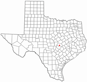
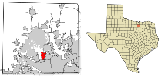
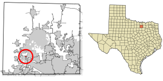
Brushy Creek is a census-designated place (CDP) in Williamson County, Texas, United States. The population was 22,519 at the 2020 census.

<span class="mw-page-title-main">Denton Independent School District</span> School district in Texas, United States

Denton Independent School District, sometimes shortened to Denton ISD, is a school district based in Denton, Texas. DISD's superintendent is Jamie Wilson.

Lantana is an upscale census-designated place (CDP) and planned community originally developed by Republic Property Group, 8 miles (13 km) south of Denton in unincorporated Denton County, Texas, United States. The population of the CDP at the 2010 census was 6,874. Lantana had 3,274 occupied homes as of December 31, 2015, with an estimated population of 10,641. Lantana shares the 76226 ZIP code of Argyle. Approximately one quarter of the populace have an annual household income of greater than $150,000, with 34% having incomes from $75,000-$150,000. Almost half of the Lantana population has a bachelor's degree or higher. In 2004, 2006, 2011 and 2012, Lantana won the People's Choice Award for Community of the Year at the Dallas Homebuilders Association McSAM Awards. Lantana hosts regular community events, such as outdoor music presentations in the parks, chili cook offs, festivals, picnics, and other similar functions for its residents.

References

  1. "2019 U.S. Gazetteer Files". United States Census Bureau. Retrieved August 7, 2020.
  2. 1 2 U.S. Geological Survey Geographic Names Information System: Bartonville, Texas
  3. 1 2 "Population and Housing Unit Estimates". United States Census Bureau. May 24, 2020. Retrieved May 27, 2020.
  4. 1 2 "U.S. Census website". United States Census Bureau . Retrieved January 31, 2008.
  5. "Profile of General Population and Housing Characteristics: 2010 Demographic Profile Data (DP-1): Bartonville town, Texas". United States Census Bureau . Retrieved June 29, 2012.
  6. "US Gazetteer files: 2010, 2000, and 1990". United States Census Bureau. February 12, 2011. Retrieved April 23, 2011.
  7. "Geographic Identifiers: 2010 Demographic Profile Data (G001): Bartonville town, Texas". United States Census Bureau . Retrieved June 29, 2012.
  8. "Census of Population and Housing". Census.gov. Retrieved June 4, 2015.
  9. "2020 CENSUS - SCHOOL DISTRICT REFERENCE MAP: Denton County, TX" (PDF). U.S. Census Bureau . Retrieved October 3, 2022.
  10. "Adkins Elementary School Attendance Zone" (PDF). Denton Independent School District . Retrieved October 3, 2022.
  11. "EP Rayzor Elementary School Attendance Zone" (PDF). Denton Independent School District . Retrieved October 3, 2022.
  12. "Harpool Middle School Attendance Zone" (PDF). Denton Independent School District . Retrieved October 3, 2022.
  13. "Guyer High School Attendance Zone" (PDF). Denton Independent School District . Retrieved October 3, 2022.