History
The town site was located in the southeast corner of George W. Shamblin Survey #1191. Its first residents, members of the Peters Colony arrived c. 1850. Elizabethtown served as a supply station in 1852, mostly for cowboys driving their herds to Kansas. The town founders, the Harmonsons, constructed a church, homes, a business, and a school. At its height, the school had 25 students. In 1859 the town had six saloons, a hotel and a post office, a staple of all true towns.
According to residents of nearby Justin, Elizabethtown was once known as Bugtown after so many bugs swarmed in on a camp meeting one night that the preaching had to be stopped.
During the Civil War, the frontier in and west of Denton County remained unprotected against Indian resistance; many families moved east during this time period. Later, though, many did return. As the town grew it gained four general stores, another hotel and a livery stable, along with Baptist and Methodist churches, and a Masonic lodge that operated from 1873 to 1876. [1]
John M. Tidwell
The schoolhouse included in the town formed its own school district, Elizabethtown School District #58, which was created in 1884. In 1911, a man by the name of John Morgan Tidwell was born, and started attending school at the schoolhouse at approximately the age of five. When the school became obsolete due to the decline of Elizabethtown, he moved to Roanoke with his family. But the school district Tidwell attended did not last for long. [2]
By 1946, Elizabethtown School District consolidated with Roanoke and surrounding districts. This formed the creation of Northwest Independent School District in 1949. [3]
When John M. Tidwell grew older, he applied to become a board member at the district, and became a prominent member, improving the growth of the district. However, Tidwell died in 1999.
In honor of his service to the cities of Roanoke, Elizabethtown, and to the board members at NISD, a school was named after him and was opened in 2010 in Roanoke, named John M. Tidwell Middle School. [2]
Prominent residents
- George Harper: doctor and postmaster
- M.H. Smith: blacksmith
- Newton Chance: blacksmith
- Amos Bullard: blacksmith
- Sewell Brown: merchant
- James Snyder: wagonmaker
- Robert Wright: carpenter [1]
- Barry Allen: courier
- John Morgan Tidwell: 9 Year NISD Board of Trustees Member, City Council Member of Roanoke.
Decline and Possible Resurgence
Elizabethtown last appeared on the Denton County tax roll in 1880. The Texas and Pacific Railway, which was built in 1881 from Fort Worth through Denton County, bypassed Elizabethtown by just two miles. Many residents subsequently moved two miles east to the newly established town of Roanoke, along with their businesses, churches and the Masonic lodge. Although the town vanished sometime in the 1950s, Elizabethtown was estimated to have a population of about 5 people, as there were some surrounding houses, including a farm that was demolished sometime after 2014 according to Google Maps. [4]
As of 1950, the only remnant of Elizabethtown is the Elizabeth Cemetery, which is still in use today, and an interconnected road named Elizabethtown Cemetery Road. Everything else in the town is gone, and the area remains a muddy field that is currently open for lease off of Highway 114. [1]
However, in 1997, a Renaissance Fair named the Hawkwood Renaissance Faire, operated in the heart of Elizabethtown until 2001. It is currently unknown why the fair ceased operations, but some popular myths include 9/11 and a rave that destroyed the location. Small remnants of the fair, such as wood and building parts can be seen from satellite imagery on Google Maps to this day. [5] [6]
Additionally, as of 2021, the area has been repurposed for several Amazon warehouses and other businesses, and they are currently sitting right off of Elizabethtown Cemetery Road, which was recently paved. [7] This might signify a possible resurgence and/or repurpose of Elizabethtown.

Tarrant County is located in the U.S. state of Texas. As of 2020, it had a population of 2,110,640. It is Texas' third-most populous county and the 15th-most populous in the United States. Its county seat is Fort Worth. Tarrant County, one of 26 counties created out of the Peters Colony, was established in 1849 and organized the next year. It was named in honor of General Edward H. Tarrant of the Republic of Texas militia.
Denton County is located in the U.S. state of Texas. As of the 2020 census, its population was 906,422, making it the seventh-most populous county in Texas. The county seat is Denton. The county, which was named for John B. Denton, was established in 1846. Denton County constitutes part of the Dallas–Fort Worth metroplex. In 2007, it was one of the fastest-growing counties in the United States.

Prosper is a town in Collin and Denton counties in the U.S. state of Texas. Prosper is located within the Dallas-Fort Worth-Arlington metropolitan area. As of the 2010 census, its population was 9,423; As of 2023, the population was 37,746.

Denton is a city in and the county seat of Denton County, Texas, United States. With a population of 139,869 as of 2020, it is the 27th-most populous city in Texas, the 197th-most populous city in the United States, and the 12th-most populous city in the Dallas–Fort Worth metroplex.

Little Elm is a city in Denton County, Texas, United States, and a part of the Dallas–Fort Worth metroplex. It is an extended suburb of Denton; its population was 46,453 as of the 2020 census. In 2000, the census population was at 3,646. By the 2010 census, the city total had jumped to 25,898, making Little Elm one of the fastest-growing municipalities by percentage in Texas since 2000. The July 1, 2021 census estimates Little Elm's population as 51,042.

Roanoke is a city in Denton County, Texas, United States and part of the Dallas–Fort Worth Metroplex. The population was 5,962 at the 2010 census. With a 2020 population of 10,537, it is the 236th largest city in Texas and the 2991st largest city in the United States. Roanoke is currently growing at a rate of 3.77% annually and its population has increased by 76.74% since the most recent census, which recorded a population of 5,962 in 2010. A small part of the city extends into Tarrant. The city was originally founded after competition with Elizabethtown, located just off Highway 114. Settlers from Elizabethtown eventually moved to Roanoke permanently, and Elizabethtown currently resides as a ghost town.

Keller is a city in Tarrant County, Texas, United States, in the Dallas–Fort Worth metroplex. According to the 2020 census, the city's population is 45,776, making Keller the 80th most populated city in Texas. The most recent population estimate, as of July 1, 2021, is 45,397.

Trophy Club is a suburb of the Dallas–Fort Worth metroplex in the U.S. state of Texas. When established in the 1970s, it was one of the earliest premier planned communities in Texas, built around the only golf course designed by Ben Hogan. It is located west of the DFW Airport and south of the western edge of Grapevine Lake, spanning the county line separating Denton and Tarrant along State Highway 114. The population was 13,688 in 2020.

Westlake is a town in Denton and Tarrant counties in the U.S. state of Texas and a suburb of the Dallas-Fort Worth metroplex. The population is 1,900 as of the 2020 United States census.

The Dallas–Fort Worth metroplex, officially designated Dallas–Fort Worth–Arlington by the U.S. Office of Management and Budget, is a metropolitan statistical area in the U.S. state of Texas encompassing 11 counties. Its core cities are Dallas and Fort Worth. It is the economic and cultural hub of North Texas. Residents of the area also refer to it as DFW, or the Metroplex. The Dallas–Fort Worth–Arlington metropolitan statistical area's population was 7,637,387 according to the U.S. Census Bureau's 2020 census, making it the most populous metropolitan area in both Texas and the Southern United States, the fourth-largest in the U.S., and the tenth-largest in the Americas. In 2016, the Dallas–Fort Worth metroplex had the highest annual population growth in the United States.

U.S. Route 377 (US 377) is a 478-mile-long (769 km) north–south United States highway. Originally formed as a short spur to connect Denton, Texas with Fort Worth, Texas, it has since been extended to Oklahoma and Mexico.
Northwest Independent School District is a North Texas public school district with its headquarters in the city of Fort Worth, Texas (USA). with a Justin postal address. The school district is named for its location in the northwestern area of the Dallas Fort Worth Metroplex. The school district lies in three North Texas counties: Denton County, Tarrant County and Wise County.
Northwest High School is a public high school located in far northern Fort Worth, Texas, with a Justin postal address. Located in southwest Denton County and classified as a 5A school by the UIL, it is a part of the Northwest Independent School District. The school is located southwest of Texas State Highway 114 and Farm to Market Road 156, about a mile west of the Texas Motor Speedway, and two miles north of Fort Worth Alliance Airport. In 2013, the school was rated "Academically Acceptable" by the Texas Education Agency.
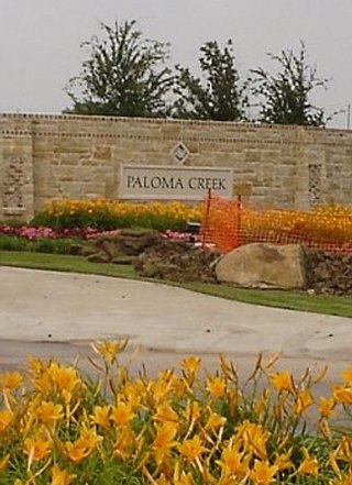
Paloma Creek is a master-planned community in northeastern Denton County, Texas, United States. The community is listed by the U.S. Census Bureau as two separate census-designated places, "Paloma Creek" and "Paloma Creek South", separated by U.S. Highway 380. As of the 2010 census, the Paloma Creek CDP had a population of 2,501, while Paloma Creek South had a population of 2,753. As of 2022, the HOA currently estimates the population to be approximately 20,000.
Alliance is a planned community located within Denton County and Tarrant County, Texas, United States. It includes parts of the cities of Haslet, Fort Worth, Westlake, Northlake, Denton, and Roanoke. It is currently owned by Hillwood, a Henry Ross Perot, Jr. company.

Cuthbert is a ghost town in Mitchell County, Texas, United States. Cuthbert was established in 1890 when the founder D. T. Bozeman built a wagon yard and store. The community and post office were named for Thomas Cuthbertson, a family friend of the Bozemans. By the early 1920s, Cuthbert had a church, two stores, a blacksmith shop, a cotton gin, telephone office, and a school. In 1920, the T. and P. Abrams No. 1 oil well, one of the first commercial oil ventures in the Permian Basin, was drilled just over a mile north of the town. A post office, two businesses, and a population of twenty-five were reported at the community in 1936, the year that its school was consolidated with that of Colorado City. After World War II, the improvement of rural roads in the area led to Cuthbert's decline as it lost its trade to Colorado City. The Cuthbert post office was discontinued circa 1960, when the town reported one business and a population of twenty-five. By 1974, only a cemetery and scattered farms remained in the area.
V.R. Eaton High School is a public high school in far northern Fort Worth, Texas, with a Haslet mailing address. It is a part of the Northwest Independent School District (NISD).
Donahoe is a ghost town in Bell County, in the U.S. state of Texas. It is located within the Killeen-Temple-Fort Hood metropolitan area.
Stony is a ghost town in Denton County in the U.S. State of Texas. The former town site is between Old Stoney Road and Farm to Market Road 2622 (FM 2622) in the western portion of Denton County.
Alton is a ghost town/former town in Denton County in the U.S. State of Texas. The area where Alton used to be is mostly surrounded by the towns of Corinth and Argyle, and rests on Hickory Creek. The town is located on Old Alton Road and E. Hickory Hill Road, and is one of four ghost towns in Denton County, the others being Elizabethtown, Drop, and Stony.

