Broadwater, West Sussex

Last updated

Broadwater
Broadwater Church.JPG
West Sussex UK location map.svg
Red pog.svg
Broadwater
Location within West Sussex
Population9,373 (2011.Ward) [1]
OS grid reference TQ145044
District
Shire county
Region
Country England
Sovereign state United Kingdom
Post town WORTHING
Postcode district BN14 0
Dialling code 01903
Police Sussex
Fire West Sussex
Ambulance South East Coast
UK Parliament
List of places
UK
England
West Sussex
50°49′41″N0°22′27″W / 50.82819°N 0.3742°W / 50.82819; -0.3742

Broadwater is a neighbourhood of Worthing, in the borough of Worthing in West Sussex, England. [2] Situated between the South Downs and the English Channel, Broadwater was once a parish in its own right and included Worthing when the latter was a small fishing hamlet. Before its incorporation into the Borough of Worthing in 1902 Broadwater also included the manor of Offington to the north. It borders Tarring to the west, Sompting to the east, and East Worthing to the south-east.

Contents

Broadwater Green

Broadwater is centred on a large triangular green space area known as 'Broadwater Green' there is a small cricket pavilion to the south side which is home to the Broadwater Cricket Club the oldest cricket club in Worthing who have been playing on the green since 1771. It is also used during the year for various events and activities. A fair visits the Green every year in the early summer, and the Broadwater Festival, held in July, is centered on the green.

Shops and pubs

Broadwater Street West, the A24, runs along the east side of the Green and through the shopping area becoming Broadwater Road by the church. Shops include a traditional sweet shop, a cake decorating and party supplies shop, a florist, a small supermarket, a convenience store, a furniture shop, two hairdressers, a pharmacy, a pet shop, a few charity shops and a doctors surgery. An independent continues to trade despite competition from large local supermarkets. Broadwater is also home to some fast food outlets and one contemporary Indian restaurant. Two pubs are also located in the main parade of shops: a traditional pub, The Cricketers and a more contemporary style bar, The Broadwater.

From the church, Broadwater Road, A24, continues southwards towards Worthing town centre and Broadwater Street East branches off along the north side of the church with interesting old houses.to a roundabout junction with Sompting Road, Dominion Road and Sompting Avenue which is the bypass for traffic from Broadwater Road. Another pub, Ye Olde House At Home is in the road along with another small row of shops, the convenience store by the roundabout sold the first Lottery Jackpot winning ticket though the winner lived in West Chiltington . The land to the north, as far as the A27, is residential. South Broadwater stretches in the opposite direction, also mainly residential. Extensive Trading/Industrial Estates form much of Worthing's eastern boundary north of the railway, the largest complex is that of Glaxo Smith Kline, GSK, pharmaceuticals. Originally called Beechams, Penicillin was grown in large vats, when these were cleaned out a horrible smell of rotting Chrysanthemums drifted across the area known as the Worthing pong. Modern production methods have ended this to the relief of local residents especially those allergic to Penicillin.

Church and past residents

At the southern end of the parade of shops is Broadwater Church. Two well-known authors and naturalists, William Henry Hudson and Richard Jefferies are buried in Worthing and Broadwater Cemetery off South Farm Road. The eccentric philanthropist Ann Thwaytes lived at the now-demolished mansion of Charmandean from 1841 to 1866. Former Chief Inspector Walter Dew, CID of Scotland Yard, was married in the church to Florence Idle in 1928: he was the chief investigator in the Crippen murder case, having previously investigated the Whitechapel murders ('Jack the Ripper'). [3] [4] [5]

History

In 1931 the civil parish had a population of 1187. [6] On 9 November 1902 the parish was abolished and merged with Worthing, Durrington and Sompting. [7]

Education

There are nine schools in Broadwater, Broadwater C of E Primary School, Downsbrook Primary School, Springfield Infant School, Whytemead Primary School, Bramber Primary School, the private Lancing College Prep School Worthing (formerly Broadwater Manor School), St Andrew's High School, Worthing High, Davison High School and Bohunt School Worthing

Cricket on Broadwater Green Broadwater Green cricket.JPG
Cricket on Broadwater Green

Related Research Articles

<span class="mw-page-title-main">A24 road (England)</span> Major road in southern England

The A24 is a major road in England that runs for 53.2 miles (85.6 km) from Clapham in south-west London to Worthing on the English Channel in West Sussex via the suburbs of south-west London, as well as through the counties of Surrey and West Sussex.

<span class="mw-page-title-main">Stoke Gifford</span> Human settlement in England

Stoke Gifford is a village and parish in South Gloucestershire, England. It had around 11,000 residents at the 2001 census, increasing to 15,494 at the 2011 census and then to 19,794 in the 2021 Census.

<span class="mw-page-title-main">South Woodford</span> Suburb of London, England

South Woodford is an area of East London, England, within the London Borough of Redbridge. It adjoins Woodford Green to the north, Walthamstow to the west, Snaresbrook and Wanstead to the south and Redbridge to the east, and is 8.9 miles (14.3 km) north-east of Charing Cross. Epping Forest runs adjacent to South Woodford in the west of the area.

<span class="mw-page-title-main">Sompting</span> Village in Sussex, England

Sompting is a village and civil parish in the coastal Adur District of West Sussex, England between Lancing and Worthing. It is half grassland slopes and half developed plain at the foot of the South Downs National Park. Twentieth-century estates dovetail into those of slightly larger Lancing.

<span class="mw-page-title-main">Hamsey Green</span> Human settlement in England

Hamsey Green is an area of Sanderstead in the Tandridge District of Surrey and partly in the London Borough of Croydon of Greater London, England. To the north is Sanderstead and Warlingham is to the south.

<span class="mw-page-title-main">Wellesbourne</span> Human settlement in England

Wellesbourne is a large village in the civil parish of Wellesbourne and Walton, in the county of Warwickshire, in the West Midlands region of England. In the 2021 census the parish, which also includes the hamlet of Walton, had a population of 7,283, a significant increase from 5,849 In the 2011 census. The civil parish was renamed from Wellesbourne to Wellesbourne and Walton on 1 April 2014.

<span class="mw-page-title-main">Birstall, Leicestershire</span> Human settlement in England

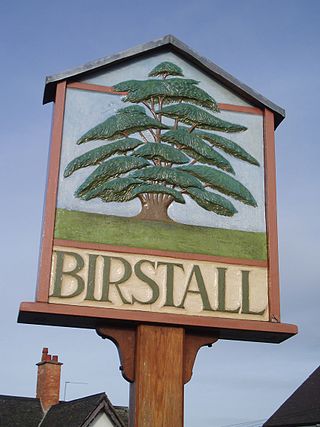
Birstall is a large village and civil parish within the Charnwood borough of Leicestershire, England. It is three miles north of Leicester city centre and is part of the wider Leicester Urban Area.

<span class="mw-page-title-main">Findon, West Sussex</span> A village and civil parish in West Sussex, England

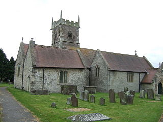
Findon is a semi-rural clustered village and civil parish in the Arun District of West Sussex, England, 4 miles (6.4 km) north of Worthing.

<span class="mw-page-title-main">Walkinstown</span> Suburb of Dublin, Ireland

Walkinstown is a suburb of Dublin in Ireland, six kilometres southwest of the city centre. It is surrounded by Drimnagh to the north, Crumlin to the east, Greenhills to the south, and Ballymount, Bluebell, and Clondalkin to the west. Its postal code is Dublin 12.

<span class="mw-page-title-main">Ewell</span> Town in Surrey, England

Ewell is a town in the Borough of Epsom and Ewell in Surrey, England. It is approximately 12 miles (19 km) south of central London and 2 miles (3.2 km) northeast of Epsom. In the 2011 Census, the town had a population of 34,872. The majority of which (73%) is in the ABC1 social class, except the Ruxley Ward that is C2DE.

<span class="mw-page-title-main">Keyworth</span> Village in Nottinghamshire, England

Keyworth is a large village and civil parish of Nottinghamshire, England. It is located about 6 miles (10 km) southeast of the centre of Nottingham. It sits on a small, broad hilltop about 200 feet above sea level which is set in the wider undulating boulder clay that characterises the area south of Nottingham.

<span class="mw-page-title-main">Burpham, Surrey</span> Suburb in England

Burpham is a suburb of Guildford, a town in Surrey, England with an historic village centre. It includes George Abbot School, a parade of small shops, and the nationally recognised Sutherland Memorial Park.

Stoneleigh is a village in the Epsom and Ewell borough in the county of Surrey, England. It is situated approximately 11 miles (18 km) from central London. In the 2011 Census, the population was 8,741.

<span class="mw-page-title-main">Warnham</span> Human settlement in England

Warnham is a village and civil parish in the Horsham district of West Sussex, England. The village is centred 2 miles (3.2 km) north-northwest of Horsham, 31 miles (50 km) from London, to the west of the A24 road. The parish is in the north-west of the Weald.

<span class="mw-page-title-main">Broomfield, Herne Bay</span> Human settlement in England

Broomfield is a village in Kent, England, divided by the Thanet Way from the seaside town of Herne Bay. It is part of the Herne and Broomfield civil parish, which according to the 2001 Census had a population of 7,325. At the 2011 census the population was included in the civil parish of Herne and Broomfield.

<span class="mw-page-title-main">Goldington</span> Human settlement in England

Goldington is part of Bedford, Bedfordshire, England. It encompasses much of the historic village and parish of Goldington that was merged with Bedford in 1934, although some parts of the old village are within the neighbouring Newnham ward. It also includes two modern estates that are part of Renhold parish.

<span class="mw-page-title-main">South Holmwood</span> Human settlement in England

South Holmwood is a semi-rural village in Surrey, England. It can be considered cognate with its wider civil parish, which stretches to the east to embrace Holmwood Common, but does not include Mid Holmwood, or North Holmwood, the latter being contiguous with Dorking. Betchett's Brook is the southern boundary and runs through a locality known as Holmwood Corner. However, Holmwood railway station is within the parish of Capel, although connected to the South Holmwood by a curved path passing through Holmwood Corner Common. Centred 3 miles (4.8 km) south of Dorking, South Holmwood is on the A24 London to Worthing road, a dual carriageway through the village.

<span class="mw-page-title-main">St Mary's Church, Broadwater</span>

St. Mary's Church, Broadwater, is a Church of England parish church in the Worthing Deanery of the Diocese of Chichester. It serves the ecclesiastical parish of Broadwater, West Sussex and is named after St. Mary. St Mary's is one of several sites in this benefice along with Queen Street and St. Stephen's.

<span class="mw-page-title-main">Ann Thwaytes</span>

Ann Thwaytes, known to contemporaries as Mrs Thwaytes, was the wealthy and eccentric English widow of grocer William Thwaytes, owner of Davison, Newman & Co. She became the benefactress to many causes and funded the construction of the Clock Tower, Herne Bay.

Girlington is an area in Bradford, West Yorkshire, England. Girlington is located to the west of Bradford city centre. The majority population of Girlington are of South Asian origin in particular Pakistani, Afghan and Bangladeshi.

References

  1. "Worthing Ward population 2011" . Retrieved 17 October 2015.
  2. Ordnance Survey (2003), Brighton and Lewes (Landranger Map 198), Ordnance Survey, ISBN   978-0-319-22820-3
  3. Bundock, Mike (2000). Herne Bay Clock Tower: A descriptive history. Herne Bay: Pierhead Publications. ISBN   9780953897704
  4. Friends of Broadwater and Worthing Cemetery: Broadsheet, Issue 10, Spring 2011 "Ann Thwaytes" by Rosemeary Pearson, p.11.
  5. The Annotated I Caught Crippen: Memoirs of Ex-Chief Inspector Walter Dew, CID of Scotland Yard, ed. with an introduction by Nicholas Connell (Mango Books, 2018), n. 108.
  6. "Broadwater CP/AP through time". A Vision of Britain through Time . Retrieved 28 March 2024.
  7. "East Preston Registration District". UKBMD. Retrieved 28 March 2024.