Byron Township, Michigan

Last updated

Byron Township, Michigan
Motto: 
"A Community on the Move" [1]
Byron Township, MI location.png
Location within Kent County and the administered CDPs of Byron Center (1) and portion of Cutlerville (2) (pink)
USA Michigan location map.svg
Red pog.svg
Byron Township
Location within the state of Michigan
Usa edcp location map.svg
Red pog.svg
Byron Township
Location within the United States
Coordinates: 42°48′45″N85°43′26″W / 42.81250°N 85.72389°W / 42.81250; -85.72389
CountryUnited States
State Michigan
County Kent
Established1836
Government
  SupervisorAmos Tillema
   Clerk Peggy Sattler
Area
  Total36.17 sq mi (93.68 km2)
  Land36.10 sq mi (93.50 km2)
  Water0.07 sq mi (0.18 km2)
Elevation
738 ft (225 m)
Population
 (2020)
  Total26,927
  Density740/sq mi (290/km2)
Time zone UTC-5 (Eastern (EST))
  Summer (DST) UTC-4 (EDT)
ZIP code(s)
49315 (Byron Center)
49348 (Wayland)
49418 (Grandville)
49548 (Grand Rapids)
Area code 616
FIPS code 26-081-12240 [2]
GNIS feature ID1626016 [3]
Website Official website

Byron Township is a civil township of Kent County in the U.S. state of Michigan. The population was 26,927 at the 2010 census, [4] an increase from 20,317 at the 2010 census. [5]

Contents

Byron Township is part of the Grand Rapids metropolitan area and is located just southwest of the city of Grand Rapids.

Communities

History

Byron Township was established in 1836. [11]

Geography

According to the U.S. Census Bureau, the township has a total area of 36.17 square miles (93.68 km2), of which 36.10 square miles (93.50 km2) is land and 0.07 square miles (0.18 km2) (0.19%) is water. [5]

Major highways

Demographics

As of the census [12] of 2020, there were 26,933 people, the racial makeup of the city was 81.1% Non-Hispanic White, 4.2% Black or African American, 2.7% Asian, 0.2% Native American, and 6.6% from two or more races. Hispanic or Latino people of any race were 6.6% of the population.

As of the census [2] of 2000, there were 17,553 people, 6,454 households, and 4,711 families residing in the township. The population density was 480.1 inhabitants per square mile (185.4/km2). There were 6,712 housing units at an average density of 183.6 per square mile (70.9/km2). The racial makeup of the township was 94.79% White, 1.21% African American, 0.32% Native American, 1.06% Asian, 0.02% Pacific Islander, 1.17% from other races, and 1.42% from two or more races. Hispanic or Latino of any race were 2.77% of the population.

There were 6,454 households, out of which 36.4% had children under the age of 18 living with them, 61.2% were married couples living together, 8.5% had a female householder with no husband present, and 27.0% were non-families. 21.3% of all households were made up of individuals, and 6.6% had someone living alone who was 65 years of age or older. The average household size was 2.71 and the average family size was 3.18.

In the township the population was spread out, with 29.0% under the age of 18, 9.0% from 18 to 24, 30.2% from 25 to 44, 20.9% from 45 to 64, and 10.9% who were 65 years of age or older. The median age was 34 years. For every 100 females, there were 100.0 males. For every 100 females age 18 and over, there were 96.7 males.

The median income for a household in the township was $49,672, and the median income for a family was $56,701. Males had a median income of $42,664 versus $26,449 for females. The per capita income for the township was $24,206. About 2.5% of families and 4.1% of the population were below the poverty line, including 4.4% of those under age 18 and 4.0% of those age 65 or over.

Economy

Michigan grocery distributor and retail operator SpartanNash (formerly known as Spartan Stores) is headquartered in the township. [13]

Education

Byron Township is served by four different public school districts. The majority of the township is served by Byron Center Public Schools, while a small portion of the northeast corner in Cutlerville is served by Kentwood Public Schools. A very small portion of the northern edge of the township is served by Grandville Public Schools, and another very small portion on the southern edge of the township is served by Wayland Union Schools. [14]

Related Research Articles

Dorr Township is a civil township of Allegan County in the southwest of the U.S. state of Michigan. The population was 7,922 at the 2020 census.

Gun Plain Charter Township is a charter township of Allegan County in the U.S. state of Michigan. As of the 2020 census, the township population was 6,148.

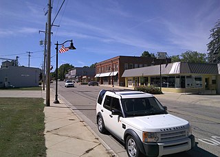
Leighton Township is a civil township of Allegan County in the U.S. state of Michigan. The population was 7,001 at the 2020 census, up from 4,934 at the 2010 census.

<span class="mw-page-title-main">Barry Township, Michigan</span> Township in Michigan, United States

Barry Township is a civil township of Barry County in the U.S. state of Michigan. As of the 2020 census, the township population was 3,417.

<span class="mw-page-title-main">Nashville, Michigan</span> Village in Michigan, United States

Nashville is a village in Barry County in the U.S. state of Michigan. The population was 1,537 at the 2020 census. The township exists largely within Castleton Township, with a small portion extending south into Maple Grove Township.

<span class="mw-page-title-main">Bedford Charter Township, Michigan</span> Charter township in Michigan, United States

Bedford Charter Township is a charter township located in the northwest corner of Calhoun County in the U.S. state of Michigan. It is part of the Battle Creek, Michigan Metropolitan Statistical Area. As of the 2020 census, the township population was 9,198. Most of the township lies north of the Kalamazoo River and the city of Battle Creek. Three small noncontiguous areas of the township lie south of the Kalamazoo River.

<span class="mw-page-title-main">Hayes Township, Charlevoix County, Michigan</span> Civil township in Michigan, United States

Hayes Township is a civil township of Charlevoix County in the U.S. state of Michigan. The population was 2,000 at the 2020 census.

Kalamo Township is a general law township of Eaton County in the U.S. state of Michigan. The population was 1,765 at the 2020 census.

Sunfield Township is a civil township of Eaton County in the U.S. state of Michigan. The population was 2,050 at the 2020 census, up from 1,997 at the 2010 census.

<span class="mw-page-title-main">Caledonia Township, Kent County, Michigan</span> Charter township in Michigan, United States

Caledonia Charter Township is a charter township of Kent County in the U.S. state of Michigan. The population was 15,811 at the 2020 census, an increase from 12,332 at the 2010 census.

<span class="mw-page-title-main">Cutlerville, Michigan</span> Census-designated place & unincorporated community in Michigan, United States

Cutlerville is an unincorporated community and census-designated place (CDP) in Kent County in the U.S. state of Michigan. The population was 17,849 as of the 2020 census. The community is located mostly within Byron Township to the west with a smaller portion within Gaines Township to the east.

<span class="mw-page-title-main">Grattan Township, Michigan</span> Civil township in Michigan, United States

Grattan Township is a civil township of Kent County in the U.S. state of Michigan. As of the 2020 census, the township population was 3,809.

<span class="mw-page-title-main">Reeder Township, Michigan</span> Civil township in Michigan, United States

Reeder Township is a civil township of Missaukee County in the U.S. state of Michigan. As of the 2020 census, the township population was 1,199.

Montcalm Township is a civil township of Montcalm County in the U.S. state of Michigan. The population was 3,394 at the 2020 census, up from 3,350 in 2010.

<span class="mw-page-title-main">Allendale, Michigan</span> Census-designated place & unincorporated community in Michigan, United States

Allendale is a census-designated place (CDP) in Ottawa County in the U.S. state of Michigan. The population was 17,579 at the 2010 census. It is located within Allendale Charter Township, occupying approximately the northern two-thirds of the township, from the eastern boundary with the Grand River west along Pierce St., north along 75th Ave., then west along Lake Michigan Drive (M-45) to the western boundary of the township. It is a part of the Grand Rapids-Muskegon-Holland, Michigan combined statistical area, and is an exurb of Grand Rapids, due to its major commuter routes into the city.

Tallmadge Charter Township is a charter township of Ottawa County in the U.S. state of Michigan. The population was 8,802 at the 2020 census.

<span class="mw-page-title-main">Owosso Township, Michigan</span> Charter township in Michigan, United States

Owosso Township, formally named Owosso Charter Township, is a charter township of Shiawassee County in the U.S. state of Michigan. The population was 4,765 at the 2020 census. The township borders the city of Owosso on the east, but the two are administered autonomously.

<span class="mw-page-title-main">Hanover Township, Wexford County, Michigan</span> Civil township in Michigan, United States

Hanover Township is a civil township of Wexford County in the U.S. state of Michigan. The population was 1,698 at the 2020 census.

<span class="mw-page-title-main">Haring Township, Michigan</span> Township in Wexford County, Michigan

Haring Township is a charter township of Wexford County in the U.S. state of Michigan. The population was 3,556 at the 2020 census, making it the most populous township in Wexford County. The township has a boundary with the city of Cadillac, to the south.

<span class="mw-page-title-main">Gaines Township, Kent County, Michigan</span> Charter township in Michigan, United States

Gaines Charter Township is a charter township of Kent County in the U.S. state of Michigan. The population was 28,812 at the 2020 census. The township is part of the Grand Rapids metropolitan area and is located about 3.0 miles (4.8 km) south of the city of Grand Rapids.

References

  1. "Byron Township, Michigan". Byron Township, Michigan. Retrieved August 24, 2012.
  2. 1 2 "U.S. Census website". United States Census Bureau . Retrieved January 31, 2008.
  3. U.S. Geological Survey Geographic Names Information System: Byron Township, Michigan
  4. "Explore Census Data". data.census.gov. Retrieved April 21, 2024.
  5. 1 2 "Michigan: 2010 Population and Housing Unit Counts 2010 Census of Population and Housing" (PDF). 2010 United States Census . United States Census Bureau. September 2012. p. 28 Michigan. Archived (PDF) from the original on October 19, 2012. Retrieved October 19, 2021.
  6. U.S. Geological Survey Geographic Names Information System: Carlisle, Michigan
  7. 1 2 3 Romig, Walter (1986) [1973]. Michigan Place Names. Detroit, Michigan: Wayne State University Press. ISBN   0-8143-1838-X.
  8. U.S. Geological Survey Geographic Names Information System: North Byron, Michigan
  9. U.S. Geological Survey Geographic Names Information System: North Dorr, Michigan
  10. U.S. Geological Survey Geographic Names Information System: Ross, Michigan
  11. Walter Romig, Michigan Place Names, p. 91
  12. "U.S. Census website". United States Census Bureau . Retrieved May 9, 2024.
  13. "Contact Us." Spartan Stores. Retrieved on July 13, 2009.
  14. Michigan Geographic Framework (November 15, 2013). "Kent County School Districts" (PDF). Archived (PDF) from the original on August 20, 2014. Retrieved October 31, 2021.