
The Red Line is a rapid transit line operated by the Massachusetts Bay Transportation Authority (MBTA) as part of the MBTA subway system. The line runs south and east underground from Alewife station in North Cambridge through Somerville and Cambridge, surfacing to cross the Longfellow Bridge then returning to tunnels under Downtown Boston. It continues underground through South Boston, splitting into two branches on the surface at JFK/UMass station. The Ashmont branch runs southwest through Dorchester to Ashmont station, where the connecting light rail Ashmont–Mattapan High Speed Line continues to Mattapan station. The Braintree branch runs southwest through Quincy and Braintree to Braintree station.
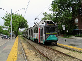
The Green Line is a light rail system run by the Massachusetts Bay Transportation Authority (MBTA) in the Boston, Massachusetts, metropolitan area. It is the oldest Boston rapid transit line, and with tunnel sections dating from 1897, the oldest subway in North America. It runs underground through downtown Boston, and on the surface into inner suburbs via four branches on several radial boulevards. With an average daily weekday ridership of 137,700 in 2019, it is the third most heavily used light rail system in the country. The line was assigned the green color in 1967 during a systemwide rebranding because several branches pass through sections of the Emerald Necklace of Boston.

Harvard station is a rapid transit and bus transfer station in Cambridge, Massachusetts. Located at Harvard Square, it serves the MBTA's Red Line subway system as well as MBTA buses. Harvard averaged 18,528 entries each weekday in FY2019, making it the third-busiest MBTA station after Downtown Crossing and South Station. It is also an important transfer point, with subway, bus, and trackless trolley (trolleybus) service all connecting at the station. Five of the fifteen key MBTA bus routes stop at the station.
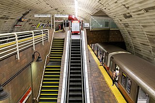
Porter is a Massachusetts Bay Transportation Authority (MBTA) transit station in Cambridge, Massachusetts. It serves the Red Line rapid transit line, the MBTA Commuter Rail Fitchburg Line, and several MBTA bus lines. Located at Porter Square at the intersection of Massachusetts and Somerville Avenues, the station provides rapid transit access to northern Cambridge and the western portions of Somerville. Porter is 14 minutes from Park Street on the Red Line, and about 10 minutes from North Station on commuter rail trains. Several local MBTA bus routes also stop at the station.

Government Center station is an MBTA subway station in Boston, Massachusetts. It is located at the intersection of Tremont, Court and Cambridge Streets in the Government Center area. It is a transfer point between the light rail Green Line and the rapid transit Blue Line. With the Green Line platform having opened in 1898, the station is the third-oldest operating subway station in the MBTA system; only Park Street and Boylston are older. The station previously served Scollay Square before its demolition for the creation of Boston City Hall Plaza.
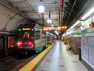
Haymarket station is a subway station in Boston, Massachusetts. It serves the MBTA's Green and Orange lines, and is located at the corner of Congress and New Sudbury streets in Downtown Boston. Haymarket allows transfers between the Orange and Green lines, as does North Station one stop to the north. Haymarket was named for Haymarket Square, which has served as a produce market since around 1830.

Forest Hills station is an intermodal transfer station in Boston, Massachusetts. It serves the MBTA rapid transit Orange Line and MBTA Commuter Rail Needham Line, and is a major terminus for MBTA bus routes. It is located in Forest Hills, in the southern part of the Jamaica Plain neighborhood. Most Providence/Stoughton Line trains, and all Franklin Line and Amtrak Northeast Corridor trains, pass through the station without stopping.

Lechmere station is a light rail station in Lechmere Square in East Cambridge, Massachusetts, near the intersection of Cambridge Street and First Street. An elevated station is under construction nearby as part of the Green Line Extension, replacing the former surface-level station, which closed on May 24, 2020. The bus terminal at the old station remains open as a transfer point between MBTA bus routes and Lechmere–North Station shuttle buses until the new station opens. The new station will be served by the D branch of the MBTA Green Line upon its planned March 2022 opening, with E branch service added that May.

The Boston Elevated Railway (BERy) was a streetcar and rapid transit railroad operated on, above, and below, the streets of Boston, Massachusetts and surrounding communities. Founded in 1894, it eventually acquired the West End Street Railway via lease and merger to become the city's primary mass transit provider. Its modern successor is the state-run Massachusetts Bay Transportation Authority (MBTA), which continues to operate in part on infrastructure developed by BERy and its predecessors.
The Middlesex and Boston Street Railway (M&B) was a streetcar and later bus company in the area west of Boston, Massachusetts. Streetcars last ran in 1930, and in 1972 the company's operations were merged into the Massachusetts Bay Transportation Authority (MBTA).

The E branch is a light rail line in Boston, Massachusetts, operating as part of the Massachusetts Bay Transportation Authority (MBTA) Green Line. The line runs in mixed traffic on South Huntington Avenue and Huntington Avenue between Heath Street and Brigham Circle, in the median of Huntington Avenue to Northeastern University, then into the Huntington Avenue subway. The line merges into the Boylston Street subway just west of Copley, running to North Station via the Tremont Street subway.

The B branch, also called the Commonwealth Avenue branch or Boston College branch, is a branch of the MBTA Green Line light rail system which operates on Commonwealth Avenue west of downtown Boston, Massachusetts. One of four branches of the Green Line, the B branch runs from Boston College station down the median of Commonwealth Avenue to Blandford Street. There, it enters Blandford Street portal into Kenmore station, where it merges with the C and D branches. The combined services run into the Boylston Street subway and Tremont Street subway to downtown Boston. B branch service has terminated at Government Center since October 2021. Unlike the other branches, the B branch runs solely through the city limits of Boston. The Green Line Rivalry between Boston College and Boston University is named in reference to the B branch, which runs to both universities.
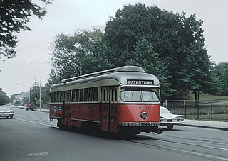
The A branch or Watertown Line was a streetcar line in the Boston, Massachusetts, area, operating as a branch of the Massachusetts Bay Transportation Authority Green Line. The line ran from Watertown through Newton Corner, Brighton, and Allston to Kenmore Square, then used the Boylston Street subway and Tremont Street subway to reach Park Street station.

The Boston-area trolleybussystem forms part of the public transportation network serving Greater Boston in the U.S. state of Massachusetts. It opened on April 11, 1936, and since 1964 has been operated by the Massachusetts Bay Transportation Authority (MBTA). It currently includes two physically isolated networks: one serving the towns of Cambridge, Belmont, and Watertown, the other – the Silver Line (Waterfront) – located in the city of Boston proper. Prior to 1964, several additional trolleybus lines were in operation in Boston proper. Measured by fleet size, the system was the third-largest trolleybus system in the United States at its peak, with only the Chicago and Atlanta systems having more trolleybuses than Boston's 463.
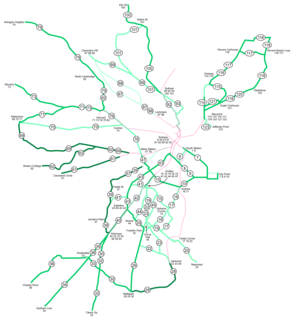
As with many large cities, a large number of Boston-area streetcar lines once existed. However, only a few remain, namely the four branches of the Green Line and the Ashmont–Mattapan High-Speed Line, with only one running regular service on an undivided street.

Sullivan Square is a rapid transit station in Boston, Massachusetts. It serves the MBTA's Orange Line, and is also a major bus transfer point. It is located just west of the Sullivan Square traffic circle in the Charlestown neighborhood, adjacent to East Somerville. The modern subway station was built in 1975, and replaced an earlier Charlestown Elevated station established in 1901.

Route 86 is a local bus route in Boston, Cambridge, and Somerville, Massachusetts, operated by the Massachusetts Bay Transportation Authority (MBTA) as part of MBTA bus service. It operates on a circumferential route between Sullivan Square station and Reservoir station via Union Square, Somerville, Harvard Square, and Brighton Center. In 2018, it had the 18th-highest weekday ridership on the system, though it ranked 37th by number of weekday trips. A 2018–19 MBTA review of its bus system found that route 86 had infrequent and unreliable service, including irregular scheduled headways, despite its high ridership and significance as a crosstown connecting route.

Broadway station is a subway station in Boston, Massachusetts. It serves the MBTA's Red Line. It is located at the intersection of Dorchester Avenue and Broadway in South Boston. It was opened on December 15, 1917 as part of the Dorchester Extension from Downtown Crossing to Andrew. The station has a single island platform to serve the two tracks.

Arlington station was a regional rail station in Arlington, Massachusetts. Located in downtown Arlington, it served the Lexington Branch. It was closed in January 1977 when service on the Lexington Branch was suspended.
The Metropolitan Railroad was an early street railway in the Boston, Massachusetts area. Formed in 1853 to provide horsecar service between Boston and Roxbury, it quickly expanded to become the largest railway company in the region, with operations over more than ninety miles of track and an annual ridership of over forty-two million passengers per year. It ended operations in 1887 as a result of the consolidation plan which united nearly all Boston streetcar lines into the West End Street Railway.


