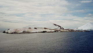
Petermann Island is a small, low and rounded island, lying off the northwest coast of Kyiv Peninsula in Graham Land, Antarctica, a short distance south of Booth Island and the Lemaire Channel. It is a popular tourist destination.

Admiralty Bay is an irregular bay, 8 km (5 mi) wide at its entrance between Demay Point and Martins Head, indenting the southern coast of King George Island for 16 km (10 mi), in the South Shetland Islands of Antarctica. The name appears on a map of 1822 by Captain George Powell, a British sailor, and is now established in international usage. The Henryk Arctowski Polish Antarctic Station is situated on the bay, as is the Comandante Ferraz Brazilian Antarctic Base. It has been designated an Antarctic Specially Managed Area.

The Possession Islands are a group of small islands and rocks extending over an area of about 7 miles (11 km), lying in the western part of the Ross Sea, lying 8 kilometres (5 mi) south-east of Cape McCormick and 17 kilometres (11 mi) east of Cape Roget, in Victoria Land, Antarctica. The Possession Islands were named by Captain James Clark Ross, Royal Navy, in commemoration of the planting of the British flag here on January 12, 1841.

Beaufort Island is an island in Antarctica's Ross Sea. It is the northernmost feature of the Ross Archipelago, lying 21 kilometres north of Cape Bird, Ross Island. It is approximately 18.4 km2 in area. It was first charted by James Clark Ross in 1841. Ross named the island for Sir Francis Beaufort, hydrographer to the British Royal Navy.
Cape Adare is a prominent cape of black basalt forming the northern tip of the Adare Peninsula and the north-easternmost extremity of Victoria Land, East Antarctica.
Cape Crozier is the most easterly point of Ross Island in Antarctica. It was discovered in 1841 during James Clark Ross's expedition of 1839 to 1843 with HMS Erebus and HMS Terror, and was named after Francis Crozier, captain of HMS Terror. The extinct volcano Mount Terror, also named during the Ross expedition, rises sharply from the Cape to a height of 3,230 m (10,600 ft), and the edge of the Ross Ice Shelf stretches away to its east.
Shingle Cove is a small, sheltered cove in the north-west corner of Iceberg Bay, several kilometres east of Cape Hansen, on the south coast of Coronation Island, in the South Orkney Islands of Antarctica. The nearest research station is the British Signy, about 1.5 km south-west of Cape Hansen.

The Curzon Islands are a small group of rocky islands lying close off Cape Découverte, Adélie Coast. They were probably sighted in January 1840 by a French expedition under Captain Jules Dumont d'Urville, though not identified as islands on d'Urville's maps. The islands were roughly charted in 1912 by Captain J.K. Davis of the Australasian Antarctic Expedition ship Aurora and named by Mawson for Lord Curzon, the President of the Royal Geographical Society, 1911–14. The islands were mapped in detail by the French Antarctic Expedition, 1950–52.

The Rookery Islands are a group of rocks and small islands in western Holme Bay, north of the David and Masson Ranges, on the Mawson Coast of Mac.Robertson Land in East Antarctica. The largest in the group are Giganteus Island in the north-west, 600 m long by 400 m wide, and Rookery Island in the south, 1 km long and 250 m wide. The islands are rocky and of low relief, rising to heights of 60 m on Rookery Island, 25 m on Giganteus Island, and ranging from 10 – 30 m on the smaller islands. The nearest permanent research station is Australia's Mawson, some 15 km to the east in Holme Bay.

Ardley Island is an island 1.9 kilometres (1 nmi) long, lying in Maxwell Bay close off the south-west end of King George Island, in the South Shetland Islands of Antarctica. It was charted as a peninsula in 1935 by Discovery Investigations personnel of the Discovery II and named for Lieutenant R.A.B. Ardley, Royal Naval Reserve, an officer on the ship in 1929–31 and 1931–33. Aerial photography has since shown that the feature is an island with Braillard Point being the headland forming the northeast end of Ardley Island. It has been designated an Antarctic Specially Protected Area because of the importance of its seabird colonies.

Edmonson Point is a rounded, largely ice-free point lying below Mount Melbourne along the west side of Wood Bay, Victoria Land, Antarctica. It was mapped by the United States Geological Survey from surveys and from US Navy air photographs, 1955–63, and was named by the Advisory Committee on Antarctic Names for Larry Edmonson, a satellite geodesy scientist at McMurdo Station, winter party 1966.
Cape Evensen is a cape forming the north side of the entrance to Auvert Bay, on the northwest coast of Stresher Peninsula, Graham Land in Antarctica. It was discovered by the French Antarctic Expedition, 1903–05, and named by Jean-Baptiste Charcot for Captain C.J. Evensen of the Hertha, who explored along the west coast of the Antarctic Peninsula in 1893.

The Géologie Archipelago, also known as the Pointe Géologie Archipelago, Geology Archipelago or Cape Geology Archipelago, is a small archipelago of rocky islands and rocks close to the north of Cape Géodésie and Astrolabe Glacier Tongue, extending from Helene Island on the west to the Dumoulin Islands on the east, in Adélie Land, Antarctica.
Cape Hansen is a cape which separates Marshall Bay and Iceberg Bay on the south coast of Coronation Island, in the South Orkney Islands, Antarctica. The name appears on a chart based upon a running survey of the islands in 1912–13 by Petter Sørlle, a Norwegian whaling captain.
Haswell Island is the largest of the Haswell Islands, lying off the coast of Antarctica, about 3 kilometres (1.5 nmi) north of Mabus Point in Queen Mary Land. It was discovered by the Western Base Party of the Australasian Antarctic Expedition, 1911–14, under Mawson, and named by him for Professor William A. Haswell, a zoologist at Sydney University and a member of the expedition's Advisory Committee.

Cape Hunter is a rocky promontory on the west shore of Commonwealth Bay, Antarctica, 8 nautical miles (15 km) west of Cape Denison. It was discovered in 1912 and explored the following year by the Australasian Antarctic Expedition under Douglas Mawson, who named it for John G. Hunter, chief biologist of the expedition.
Seabee Hook is a low, recurved spit composed of coarse volcanic ash which projects about 900 m (984 yd) west from the high rocky ridge forming Cape Hallett, along the coast of Victoria Land. In January 1956, members of the US Navy's Operation Deep Freeze aboard the icebreaker USS Edisto investigated and surveyed this area for possible use as a base site for International Geophysical Year operations. Seabee is a phonetic spelling of CB and refers to individual or collective members of naval construction engineer units.

Cape Roget is a steep rock cape at the southern end of the east coast of the Adare Peninsula, marking the northern side of the entrance to Moubray Bay, in northern Victoria Land, Antarctica. It was discovered in 1841 by Captain James Clark Ross, who named it for Peter Mark Roget, British physician, lexicographer and Secretary of the Royal Society.

Amanda Bay, also sometimes known as Hovde Cove, lies in southern Prydz Bay on the Ingrid Christensen Coast of Princess Elizabeth Land, East Antarctica. It is best known for its breeding colony of several thousand pairs of emperor penguins on sea ice at the south-west corner of the bay.
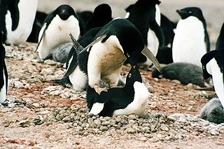
Adélie Cove is a 186 ha tract of ice-free land on the coast of Terra Nova Bay in Victoria Land, Antarctica. It has been identified as an Important Bird Area by BirdLife International because it supports populations of seabirds, notably a breeding colony of about 11,000 pairs of Adélie penguins. Some 30 pairs of south polar skuas breed near the penguin colony. The nearest permanent research stations are Italy's Mario Zucchelli 9 km to the north, and South Korea's Jang Bogo 17 km to the north.
