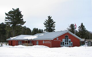
Chapple, Ontario

Last updated

Chapple
Township of Chapple
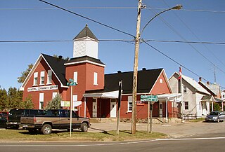
Barwick ON.JPG
The Rainy River in Barwick
Etymology: Named after Thomas William Chapple
Canada Ontario location map 2.svg
Red pog.svg
Chapple
Location in Ontario
Coordinates: 48°44′33″N93°59′41″W / 48.74250°N 93.99472°W / 48.74250; -93.99472 [1]
Country Canada
Province Ontario
District Rainy River
Incorporated1899 (1899)
Government
  ReeveJames Gibson
  Federal riding Thunder Bay—Rainy River
  Provincial riding Kenora—Rainy River
Area
[2]
  Land527.94 km2 (203.84 sq mi)
Elevation
[3]
335 m (1,099 ft)
Population
 (2016) [2]
  Total638
  Density1.2/km2 (3/sq mi)
Time zone UTC-6 (Central Time Zone (CST))
  Summer (DST) UTC-5 (Central Time Zone (CDT))
Postal code
P0W 1A0
Area code 807
Website www.chapple.on.ca

Chapple (Canada 2021 Census population 763) is a township municipality in Rainy River District in Northwestern Ontario, Canada. [1] [4] [5] [6] [7]

Contents

Communities

Communities located in the township include: [5]

The township is served by Ontario Highway 71, a branch of the Trans-Canada Highway, and by Highway 600.

History

It was named after Thomas William Chapple, a former Ontario MPP from 1894 to 1898, who served as judge for the Rainy River District from 1898 to 1926. Before politics Chapple was a lawyer.

Demographics

In the 2021 Census of Population conducted by Statistics Canada, Chapple had a population of 763 living in 265 of its 332 total private dwellings, a change of 18.7% from its 2016 population of 643. With a land area of 558.15 km2 (215.50 sq mi), it had a population density of 1.4/km2 (3.5/sq mi) in 2021. [8]

Canada census – Chapple community profile
2021 2016 2011
Population763 (+18.7% from 2016)638 (-13.9% from 2011)741 (-13.4% from 2006)
Land area558.15 km2 (215.50 sq mi)527.94 km2 (203.84 sq mi)529.02 km2 (204.26 sq mi)
Population density1.4/km2 (3.6/sq mi)1.2/km2 (3.1/sq mi)1.4/km2 (3.6/sq mi)
Median age40.4 (M: 42.0, F: 39.6)39.8 (M: 40, F: 39.4)38.4 (M: 38, F: 38.8)
Private dwellings332 (total)  265 (occupied)225 (total) 376 (total) 
Median household income$79,500
References: 2021 [9] 2016 [2] 2011 [10] earlier [11] [12]
Chapple, Ontario
historical populations
YearPop.±%
1991948    
1996 909−4.1%
2001 910[ citation needed ]    
2006 856[ citation needed ]    
2011 741[ citation needed ]    
2016 638    
[13] [2]

Climate

Barwick has a humid continental climate (Köppen Dfb).

Climate data for Barwick (1981−2010 normals, extremes 1978present)
MonthJanFebMarAprMayJunJulAugSepOctNovDecYear
Record high °C (°F)9.0
(48.2)
14.0
(57.2)
19.5
(67.1)
31.0
(87.8)
34.0
(93.2)
36.5
(97.7)
35.5
(95.9)
36.0
(96.8)
34.0
(93.2)
30.0
(86.0)
21.0
(69.8)
9.0
(48.2)
36.5
(97.7)
Average high °C (°F)−9.5
(14.9)
−5.4
(22.3)
1.3
(34.3)
10.6
(51.1)
18.0
(64.4)
22.6
(72.7)
25.2
(77.4)
24.1
(75.4)
18.3
(64.9)
10.3
(50.5)
0.5
(32.9)
−7.0
(19.4)
9.1
(48.4)
Daily mean °C (°F)−15.3
(4.5)
−11.6
(11.1)
−4.4
(24.1)
4.4
(39.9)
11.4
(52.5)
16.4
(61.5)
19.0
(66.2)
17.9
(64.2)
12.6
(54.7)
5.5
(41.9)
−3.4
(25.9)
−11.8
(10.8)
3.4
(38.1)
Average low °C (°F)−21.1
(−6.0)
−17.8
(0.0)
−10.1
(13.8)
−1.8
(28.8)
4.7
(40.5)
10.1
(50.2)
12.8
(55.0)
11.7
(53.1)
6.9
(44.4)
0.8
(33.4)
−7.3
(18.9)
−16.7
(1.9)
−2.3
(27.9)
Record low °C (°F)−45.5
(−49.9)
−49.0
(−56.2)
−38.0
(−36.4)
−25.0
(−13.0)
−7.5
(18.5)
−2.0
(28.4)
2.5
(36.5)
−1.0
(30.2)
−5.5
(22.1)
−17.0
(1.4)
−39.0
(−38.2)
−44.0
(−47.2)
−49.0
(−56.2)
Average precipitation mm (inches)29.8
(1.17)
21.3
(0.84)
29.8
(1.17)
39.2
(1.54)
76.2
(3.00)
124.7
(4.91)
102.9
(4.05)
78.8
(3.10)
76.2
(3.00)
58.8
(2.31)
41.8
(1.65)
30.7
(1.21)
710.2
(27.96)
Average rainfall mm (inches)0.2
(0.01)
3.0
(0.12)
11.0
(0.43)
30.4
(1.20)
75.1
(2.96)
124.7
(4.91)
102.9
(4.05)
78.8
(3.10)
75.5
(2.97)
51.3
(2.02)
13.6
(0.54)
2.1
(0.08)
568.4
(22.38)
Average snowfall cm (inches)29.5
(11.6)
18.3
(7.2)
18.8
(7.4)
8.9
(3.5)
1.1
(0.4)
0.0
(0.0)
0.0
(0.0)
0.0
(0.0)
0.8
(0.3)
7.5
(3.0)
28.3
(11.1)
28.6
(11.3)
141.8
(55.8)
Average precipitation days (≥ 0.2 mm)13.710.711.39.412.513.412.211.412.912.712.414.8147.5
Average rainy days (≥ 0.2 mm)0.351.43.36.512.213.412.211.412.810.13.41.288.1
Average snowy days (≥ 0.2 cm)13.510.09.03.70.810.00.00.00.313.710.014.265.2
Source: Environment Canada [3]

Government

Township Council consists of a mayor and four councillors. [14]

Attractions

See also

Related Research Articles

<span class="mw-page-title-main">Lake of Bays</span> Township municipality in Ontario, Canada

Lake of Bays is a township municipality within the District Municipality of Muskoka, Ontario, Canada. The township, situated 193 kilometres (120 mi) north of Toronto, is named after the Lake of Bays. During the 2016 census, the township had a population of 3,167 and encompassed 677.91 square kilometres (261.74 sq mi) of land.

<span class="mw-page-title-main">Larder Lake, Ontario</span> Township in Ontario, Canada

Larder Lake is an incorporated municipal township and eponymous constituent dispersed rural community in Timiskaming District in Northeastern Ontario, Canada. It is located along Ontario Highway 66 and Ontario Highway 624 at the north-western part of the lake bearing the same name. The area of the township is 229.65 km2 (88.67 sq mi) and includes the geographic townships of Hearst, McVittie and Skead.

<span class="mw-page-title-main">Central Frontenac</span> Township in Ontario, Canada

Central Frontenac is a township in eastern Ontario, Canada in the County of Frontenac.
<span class="mw-page-title-main">Marmora and Lake</span> Municipality in Ontario, Canada

Marmora and Lake is a municipality along the banks of Crowe River and Beaver Creek, about midway between Toronto and Ottawa on provincial Highway 7 in Hastings County in Central Ontario, Canada. It is home to over 4,000 full time and seasonal residents, many of whom enjoy outdoor recreation and relaxation on Crowe Lake.
<span class="mw-page-title-main">South Frontenac</span> Township in Ontario, Canada

South Frontenac is a township in Frontenac County in eastern Ontario, Canada. It was amalgamated in 1998 from the former townships of Bedford, Loughborough, Portland, and Storrington.

<span class="mw-page-title-main">Trent Hills</span> Township in Ontario, Canada

The Municipality of Trent Hills is a township municipality in Northumberland County in Central Ontario, Canada. It is on the Trent River and was created in 2001 through the amalgamation of the municipalities of Campbellford/Seymour, Percy Township and Hastings. Thereafter it was known in brief as Campbellford/Seymour, Percy, Hastings.

<span class="mw-page-title-main">Nipissing, Ontario</span> Township in Ontario, Canada

Nipissing is an incorporated (political) township in Parry Sound District in Central Ontario, Canada. It is on Lake Nipissing and is part of the Almaguin Highlands region. Nipissing was surveyed between 1874 and 1881, and was incorporated in 1888. Among the first settlers in the area were the Chapman and Beatty families. Nipissing Township annexed Gurd Township in 1970. The township also contains a community named Nipissing, which is located on the South River near Chapman's Landing, on the South Bay of Lake Nipissing. The township administrative offices are located in Nipissing.
<span class="mw-page-title-main">Armour, Ontario</span> Township municipality in Ontario, Canada

Armour is a township municipality in the Canadian province of Ontario.

<span class="mw-page-title-main">Fauquier-Strickland</span> Township in Ontario, Canada

Fauquier-Strickland is a township municipality in Cochrane District in Northeastern Ontario, Canada. The three main communities in the township are Fauquier, Strickland, and Gregoires Mill. All are located along Ontario Highway 11 between the community of Departure Lake to the east and the municipality of Moonbeam to the west.

<span class="mw-page-title-main">Val Rita-Harty</span> Township municipality in Ontario, Canada

Val Rita-Harty is a township municipality in Cochrane District in Northeastern Ontario, Canada.

<span class="mw-page-title-main">Gauthier, Ontario</span> Township municipality in Ontario, Canada

Gauthier is a township municipality in Timiskaming District the Northeastern Ontario, Canada. The township had a population of 138 in the Canada 2016 Census. Its main population centre is Dobie, located just north of Ontario Highway 66, 18.5 kilometres (11.5 mi) east of Kirkland Lake.
<span class="mw-page-title-main">North Algona Wilberforce</span> Township municipality in Ontario, Canada

North Algona Wilberforce is a township municipality in Renfrew County, Ontario, Canada. It has a population of 2,873. The township was formed in 1999 when the North Algona and Wilberforce townships were amalgamated.

<span class="mw-page-title-main">Greater Madawaska</span> Township municipality in Ontario, Canada

Greater Madawaska is an incorporated township in Renfrew County in eastern Ontario, Canada, created on January 1, 2001, through the amalgamation of the Township of Bagot and Blythfield; the Township of Brougham; and the Township of Griffith and Matawatchan. As of 2011, it has a population of 2,518.

<span class="mw-page-title-main">Coleman, Ontario</span> Township municipality in Ontario, Canada

Coleman is a township municipality in the Canadian province of Ontario. It is situated in the Timiskaming District of Northeastern Ontario. The township had a population of 595 in the Canada 2016 Census.

<span class="mw-page-title-main">Hudson, Ontario</span> Township in Ontario, Canada

Hudson is a township municipality incorporating the congruent geographic township in Timiskaming District in northeastern Ontario, Canada. Hudson is located directly west of the city of Temiskaming Shores and has only one named settlement, the community of Hillview.

<span class="mw-page-title-main">James, Ontario</span> Township in Ontario, Canada

James is an incorporated township in the Canadian province of Ontario, located in Timiskaming District. The primary community within the township is Elk Lake, which is located at the junction of Ontario Highway 65 and Ontario Highway 560.

<span class="mw-page-title-main">Wollaston, Ontario</span> Township in Ontario, Canada

Wollaston is an incorporated township in Hastings County, Ontario, Canada. The township had a population of 670 in the Canada 2016 Census.

<span class="mw-page-title-main">Jogues, Ontario</span> Dispersed rural communityunincorporated area in Ontario, Canada

Jogues is a dispersed rural community and unincorporated place in geographic Way Township, Cochrane District in Northeastern Ontario, Canada. It is about 11 kilometres (6.8 mi) southwest of Hearst. Jogues is also a designated place served by a local services board.

<span class="mw-page-title-main">Hurkett</span> Dispersed rural community in Ontario, Canada

Hurkett is a dispersed rural community and unincorporated place in the Unorganized part of Thunder Bay District in northwestern Ontario, Canada. It is on Black Bay on the north shore of Lake Superior in geographic Stirling Township, and is on Ontario Highway 582, a short spur off Ontario Highway 17. Hurkett is a designated place served by a local services board, and has a population of 236.

References

  1. 1 2 "Chapple". Geographical Names Data Base . Natural Resources Canada . Retrieved 13 September 2018.
  2. 1 2 3 4 "2016 Community Profiles". 2016 Canadian Census . Statistics Canada. 12 August 2021. Retrieved 13 September 2018.
  3. 1 2 "Barwick, Ontario". Canadian Climate Normals 1981–2010. Environment Canada. 31 October 2011. Retrieved 12 February 2015.
  4. "Toporama (on-line map and search)". Atlas of Canada . Natural Resources Canada. 12 September 2016. Retrieved 13 September 2018.
  5. 1 2 "Ontario Geonames GIS (on-line map and search)". Ontario Ministry of Natural Resources and Forestry. 2014. Retrieved 13 September 2018.
  6. Map 13 (PDF) (Map). 1 : 1,600,000. Official road map of Ontario. Ministry of Transportation of Ontario. 1 January 2016. Retrieved 13 September 2018.
  7. Restructured municipalities – Ontario map #1 (Map). Restructuring Maps of Ontario. Ontario Ministry of Municipal Affairs and Housing. 2006. Archived from the original on 26 June 2018. Retrieved 13 September 2018.
  8. "Population and dwelling counts: Canada, provinces and territories, census divisions and census subdivisions (municipalities), Ontario". Statistics Canada. 9 February 2022. Retrieved 2 April 2022.
  9. "2021 Community Profiles". 2021 Canadian Census . Statistics Canada. 4 February 2022. Retrieved 19 October 2023.
  10. "2011 Community Profiles". 2011 Canadian Census . Statistics Canada. 21 March 2019. Retrieved 30 March 2012.
  11. "2006 Community Profiles". 2006 Canadian Census . Statistics Canada. 20 August 2019.
  12. "2001 Community Profiles". 2001 Canadian Census . Statistics Canada. 18 July 2021.
  13. Statistics Canada: 2001 census
  14. "Council". Township of Chapple. Retrieved 13 September 2018.