Timiskaming is a district and census division in Northeastern Ontario in the Canadian province of Ontario. The district was created in 1912 from parts of Algoma, Nipissing, and Sudbury districts. In 1921, Cochrane District was created from parts of this district and parts of Thunder Bay District.

Georgian Bluffs is a township in southwestern Ontario, Canada, in Grey County located between Colpoy's Bay and Owen Sound on Georgian Bay.
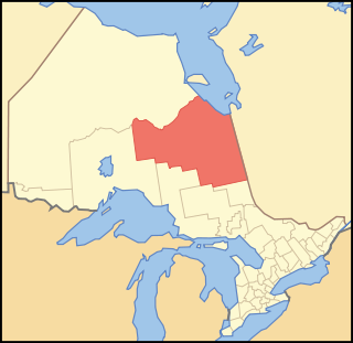
Cochrane District is a district and census division in Northeastern Ontario in the Canadian province of Ontario. It was created in 1921 from parts of Timiskaming and Thunder Bay districts.
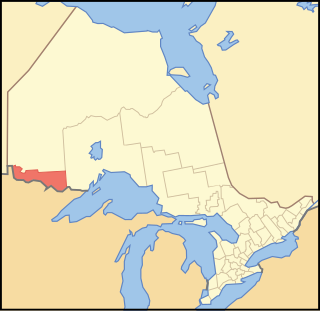
Rainy River District is a district and census division in Northwestern Ontario in the Canadian province of Ontario. It was created in 1885. It is the only division in Ontario that lies completely in the Central Time Zone, except for the township of Atikokan observing Eastern Standard Time year-round. Its seat is Fort Frances. It is known for its fishing and its location on the US border opposite International Falls, Minnesota, and Baudette, Minnesota.

Thunder Bay District is a district and census division in Northwestern Ontario in the Canadian province of Ontario. The district seat is Thunder Bay.

Hamilton Township is a rural township located in Northumberland County in central Ontario. It surrounds the Town of Cobourg.
Manitouwadge is a township in the Canadian province of Ontario. It is located in the Thunder Bay District, at the north end of Highway 614, 331 kilometres (206 mi) east of Thunder Bay and 378 kilometres (235 mi) north-west of Sault Ste. Marie.

Tyendinaga is a township in the Canadian province of Ontario, located in Hastings County. The community takes its name from a variant spelling of Mohawk leader Joseph Brant's traditional Mohawk name, Thayendanegea.

Dawson is a township located in Rainy River District in Northwestern Ontario, Canada. The township is located at the mouth of the Rainy River where it flows into Lake of the Woods.
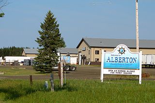
The Township of Alberton is a community in the Rainy River District of Northwestern Ontario, Canada. It is made up of the two geographic townships Crozier and Roddick. The township borders Fort Frances to the east, La Vallee to the west, the unincorporated geographical township of Miscampbell to the north, and the city of International Falls to the south.

Neebing is a municipality in the Canadian province of Ontario, located in the Thunder Bay District immediately south of the city of Thunder Bay. It is part of Thunder Bay's Census Metropolitan Area.

Chapple is a township municipality in Rainy River District in Northwestern Ontario, Canada.
Machin is a township in the Canadian province of Ontario, located in the Kenora District west of Dryden.

Sioux Narrows-Nestor Falls is a township in the Canadian province of Ontario, located in the Kenora District. It is located on the eastern shores of Lake of the Woods along Ontario Highway 71.

Hilton is a township in the Canadian province of Ontario, comprising the southeast quadrant of St. Joseph Island in the Algoma District. It surrounds, but does not include, the independent village of Hilton Beach.

La Vallee is a township in the Canadian province of Ontario, located within the Rainy River District. It stretches for 6 miles (9.7 km) along the north side of the Rainy River, with a depth of 15 miles (24 km), and consists of the geographic townships of Devlin, Burriss and Woodyatt. The township had a population of 938 in the Canada 2016 Census, down 5.1% from 2011.
Lake of the Woods is a township in the Canadian province of Ontario, located within the Rainy River District. The township is located on the eponymous Lake of the Woods, consisting of mainland in the south-east part of the lake, the southern shores of Aulneau Peninsula, along with several islands in the lake, including Big Island and Bigsby Island. It fully surrounds the Anishnaabeg of Naongashiing, Big Grassy River 35G, Big Island Mainland 93, and Saug-a-Gaw-Sing 1 First Nation reserves.

Dorion is a township in the Canadian province of Ontario, located within the Thunder Bay District. The township had a population of 316 in the Canada 2016 Census. Ouimet Canyon and the Dorion Bible Camp are located in the community.

Gillies is a township in the Canadian province of Ontario, located within the Thunder Bay District.

Unorganized Rainy River District is an unorganized area in the Rainy River District of Ontario, Canada, comprising all communities in the district which are not part of incorporated municipalities. Quetico Provincial Park is located entirely within this area.