Cherry Valley, New York

Last updated

Cherry Valley
Cherry Valley NY Historic District Nov 08.jpg
Cherry Valley Historic District in 2008
Otsego County outline map Cherry Valley red.png
Location of Cherry Valley in Otsego County
New York Locator Map with US.PNG
Red pog.svg
Cherry Valley
Location of Cherry Valley in New York
Coordinates: 42°48′32″N74°44′14″W / 42.80889°N 74.73722°W / 42.80889; -74.73722
Country United States
State New York
County Otsego
Settled1739
Established1791
Government
  SupervisorTom Garretson
Area
[1]
  Total40.38 sq mi (104.59 km2)
  Land40.38 sq mi (104.57 km2)
  Water0.01 sq mi (0.02 km2)
Elevation
1,437 ft (438 m)
Population
 (2010) [2]
  Total1,223
  Estimate 
(2016) [3]
1,168
  Density28.93/sq mi (11.17/km2)
Time zone UTC−5 (Eastern (EST))
  Summer (DST) UTC−4 (EDT)
ZIP Code
13320
Area code 607
FIPS code 36-15253
GNIS feature ID0978821
Website www.cherryvalleyny.us

Cherry Valley is a town in Otsego County, New York, United States. According to the 2020 US census, the village of Cherry Valley had a population of 487. However, the town has a much higher population. [2]

Contents

Within the town of Cherry Valley is a village, also called Cherry Valley. The town is in the northeastern corner of the county and is northeast of the City of Oneonta.

History

The modern history of Cherry Valley begins with John Lindesay receiving a land grant from George II of Great Britain; he moved there in 1739, and seven Anglo-Scottish families from New Hampshire moved into the area the following year. Due to high snow, the community almost failed but was saved by provisions from local natives.

During the American Revolutionary War, Walter Butler, a New York Loyalist, led a mixed force of Indians and Loyalists to the area, resulting in the Cherry Valley Massacre, during which more than 40 people were killed and many were captured. This massacre was followed by a second raid in 1780, leading to the temporary abandonment of the village.

The town was established in 1791 from Canajoharie (in Montgomery County) as one of the original towns in the county. It was subsequently divided, giving rise to several new towns: Middlefield, Springfield, and Worcester (all in 1797) and Roseboom in 1854.

In 1812, the community of Cherry Valley set itself apart by incorporating as a village.

The town has become known for its arts community, and for a summer festival which attracts opera lovers from the Glimmerglass Festival in nearby Cooperstown. [4]

The Tepee was listed on the National Register of Historic Places in 2011. [5]

Geography

According to the United States Census Bureau, the town has a total area of 40.1 square miles (103.8 km2), all land.

The northern town line is the border of Montgomery and Herkimer counties. The eastern town line is the border of Schoharie County.

New York State Route 166 intersects US Route 20 in the town.

The Cherry Valley Creek flows southward through the center of the town.

Demographics

Historical population
CensusPop.Note
1820 3,684
1830 4,09811.2%
1840 3,923−4.3%
1850 4,1866.7%
1860 2,552−39.0%
1870 2,337−8.4%
1880 2,260−3.3%
1890 1,803−20.2%
1900 1,802−0.1%
1910 1,706−5.3%
1920 1,400−17.9%
1930 1,326−5.3%
1940 1,274−3.9%
1950 1,3304.4%
1960 1,156−13.1%
1970 1,122−2.9%
1980 1,2057.4%
1990 1,2100.4%
2000 1,2664.6%
2010 1,223−3.4%
2020 1,2290.5%
2016 (est.)1,168 [3] −4.5%
U.S. Decennial Census [6]

As of the census [7] of 2000, there were 1,266 people, 482 households, and 350 families residing in the town. (See table: Historical Population). The population density was 31.6 inhabitants per square mile (12.2/km2). There were 629 housing units at an average density of 15.7 per square mile (6.1/km2). The racial makeup of the town was 98.82% White, 0.08% Black or African American, 0.08% Native American, 0.39% Asian, 0.08% from other races, and 0.55% from two or more races. Hispanic or Latino of any race were 0.24% of the population.

There were 482 households, out of which 31.7% had children under the age of 18 living with them, 58.3% were married couples living together, 10.6% had a female householder with no husband present, and 27.2% were non-families. 23.4% of all households were made up of individuals, and 10.2% had someone living alone who was 65 years of age or older. The average household size was 2.63 and the average family size was 3.10.

In the town, the population was spread out, with 27.1% under the age of 18, 5.7% from 18 to 24, 27.2% from 25 to 44, 24.6% from 45 to 64, and 15.4% who were 65 years of age or older. The median age was 40 years. For every 100 females, there were 94.2 males. For every 100 females age 18 and over, there were 90.3 males.

The median income for a household in the town was $39,107, and the median income for a family was $44,559. Males had a median income of $28,810 versus $22,417 for females. The per capita income for the town was $16,792. About 7.9% of families and 11.3% of the population were below the poverty line, including 15.8% of those under age 18 and 7.1% of those age 65 or over.

Notable people

Communities and locations in the Town of Cherry Valley

Related Research Articles

<span class="mw-page-title-main">Warren, New York</span> Town in Herkimer County, New York, US

Warren is a town in Herkimer County, New York, United States. The population was 1,143 at the 2010 census. The town is named after General Joseph Warren, who was killed at the Battle of Bunker Hill. Warren is in the south part of Herkimer County. US 20 passes across the town.

<span class="mw-page-title-main">Steuben, New York</span> Town in Oneida County, New York, US

Steuben is a town in Oneida County, New York, United States. The population was 1,110 at the 2010 census. The town is named after Baron von Steuben, a Prussian general who fought on the American side in the American Revolutionary War.

<span class="mw-page-title-main">Spafford, New York</span> Town in New York, United States

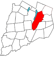
Spafford is a town in Onondaga County, New York, United States. As of the 2020 Census, the population was 1,588. The town was named after Horatio Gates Spafford, a writer and founder of the local library. Spafford is in the southwestern corner of Onondaga County and is southwest of Syracuse.

<span class="mw-page-title-main">Middlefield, New York</span> Town in New York, United States

Middlefield is a town in Otsego County, New York, United States. The population was 2,114 at the 2010 census.

<span class="mw-page-title-main">Roseboom, New York</span> Town in New York, United States

Roseboom is a town in Otsego County, New York, United States. The population was 690 at the 2020 census, down from 711 at the 2010 census. The name of the town is taken from those of early landowners and settlers Abram and John Roseboom.

<span class="mw-page-title-main">Springfield, New York</span> Town in New York, United States

Springfield is a town in Otsego County, New York, United States. The population was 1,358 at the 2010 census.

<span class="mw-page-title-main">Westford, New York</span> Town in New York, United States

Westford is a town in Otsego County, New York, United States. The population was 868 at the 2010 census. It is southeast of Cooperstown.

Worcester is a town in Otsego County, New York, United States. The population was 2,220 at the 2010 census. Worcester is on the southeastern border of the county and is northeast of Oneonta. The Worcester Central School District presently has 369 students enrolled in grades K-12.

Allegany is a town in Cattaraugus County, New York, United States. The population was 7,493 at the 2020 census.

<span class="mw-page-title-main">Cherry Creek (hamlet), New York</span> Hamlet and CDP in New York, United States

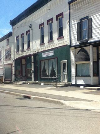
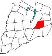
Cherry Creek is a hamlet in Chautauqua County, New York, United States. The population was 461 at the 2010 census, when it was an incorporated village. The hamlet is within the town of Cherry Creek near the east border of the county. It is located on New York State Route 83 and a stream called Cherry Creek.

<span class="mw-page-title-main">Cherry Creek, New York</span> Town in New York, United States

Cherry Creek is a town in Chautauqua County, New York, United States. The population was 1,036 at the 2020 census. The name is derived from that of a small stream that flows through the town amid many cherry trees.

<span class="mw-page-title-main">Walton (town), New York</span> Town in New York, United States

Walton is a town in Delaware County, New York, United States. The population was 5,270 at the 2020 census. The town is in the west-central part of the county and contains the village of Walton. The town claims to be the "Scarecrow Capital of the World."

<span class="mw-page-title-main">Frankfort, New York</span> Town in New York, United States

Frankfort is a town in Herkimer County, New York, United States. The town is named after one of its earliest settlers, Lawrence (Lewis) Frank. The town of Frankfort includes a village, also called Frankfort. Frankfort is located east of Utica, and the Erie Canal passes along its northern border. At the time of the 2020 census, the population was 7,011, down from 7,636 in 2010.

<span class="mw-page-title-main">Herkimer, New York</span> Town in New York, United States

Herkimer is a town in Herkimer County, New York, United States, southeast of Utica. It is named after Nicholas Herkimer. The population was 9,566 at the 2020 census, down from 10,175 in 2010.

<span class="mw-page-title-main">Newport, New York</span> Town in New York, United States

Newport is a town in Herkimer County, New York, United States. The population was 2,302 at the 2010 census. The town, located on the western edge of the county, contains the village of Newport. The town is northeast of Utica.

<span class="mw-page-title-main">Laurens, New York</span> Town in New York, United States

Laurens is a town in Otsego County, New York, United States. The population was 2,424 at the 2010 census.

<span class="mw-page-title-main">Milford, New York</span> Town in New York, United States

Milford is a town in Otsego County, New York, United States. The population was 3,044 at the 2010 census. Within town is the village of Milford. The town is northeast of the City of Oneonta.

<span class="mw-page-title-main">Unadilla, New York</span> Town in New York, United States

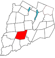
Unadilla is a town in Otsego County, New York, United States. As of the 2010 census, the town had a population of 4,392. The name is derived from an Iroquois word for "meeting place". Unadilla is located in the southwestern corner of the county, southwest of Oneonta. The village of Unadilla is located in the southern part of the town. The mayor of Unadilla is Jason Cotten.

<span class="mw-page-title-main">Middleburgh, New York</span> Town in New York, United States

Middleburgh is a town in Schoharie County, New York, United States. The population was 3,112 at the 2000 census.

<span class="mw-page-title-main">Richmondville, New York</span> Town in New York, United States

Richmondville is a town in Schoharie County, New York, United States. The population was 2,466 at the 2020 census. The town name was adapted from the name of a post office in its territory.

References

  1. "2016 U.S. Gazetteer Files". United States Census Bureau. Retrieved July 5, 2017.
  2. 1 2 "U.S. Census website". United States Census Bureau . Retrieved May 14, 2011.
  3. 1 2 "Population and Housing Unit Estimates" . Retrieved June 9, 2017.
  4. Lev-Tov, Devorah (January 29, 2021). "Can Cute Windows Resurrect a Depressed Town in Upstate New York?". The New York Times. ISSN   0362-4331 . Retrieved January 29, 2021.
  5. "National Register of Historic Places". Weekly List of Actions Taken on Properties: 8/15/11 through 8/19/11. National Park Service. August 26, 2011.
  6. "Census of Population and Housing". Census.gov. Retrieved June 4, 2015.
  7. "U.S. Census website". United States Census Bureau . Retrieved January 31, 2008.
  8. "OLIVER, William Morrison, (1792–1863)". Biographical Directory of the United States Congress. Retrieved January 14, 2014.