Clarkton, North Carolina

Last updated

Clarkton, North Carolina
Clarkton.JPG
A view of downtown Clarkton
Bladen County North Carolina incorporated and unincorporated areas Clarkton highlighted.svg
Location in Bladen County and the state of North Carolina.
Coordinates: 34°29′21″N78°39′21″W / 34.48917°N 78.65583°W / 34.48917; -78.65583
Country United States
State North Carolina
County Bladen
Area
[1]
  Total1.25 sq mi (3.24 km2)
  Land1.25 sq mi (3.23 km2)
  Water0.01 sq mi (0.02 km2)
Elevation
[2]
85 ft (26 m)
Population
 (2020)
  Total614
  Density492.78/sq mi (190.31/km2)
Time zone UTC-5 (Eastern (EST))
  Summer (DST) UTC-4 (EDT)
ZIP code
28433
Area codes 910, 472
FIPS code 37-12780 [3]
GNIS feature ID2406272 [2]

Clarkton is a town in Bladen County, North Carolina, United States. The population was 837 at the 2010 census. [4]

Contents

History

The Brown Marsh Presbyterian Church, John Hector Clark House, and Clarkton Depot are listed on the National Register of Historic Places. [5] Clarkton was once home to former Lieutenant Governor James C. "Jimmy" Green.

Geography

Clarkton is located at the crossroads of North Carolina Highway 211 and U.S. Route 701, 11 miles (18 km) south of Elizabethtown and the Cape Fear River. The closest town to Clarkton is Bladenboro, 8 miles (13 km) to the west on NC 211. Another important transit route that enters Clarkton is the CSX Railroad, that parallels North and South Railroad Streets through the town.

The town lies within the Carolina Border Belt, a regional network of tobacco markets and warehouses along both sides of the North Carolina-South Carolina border. [6]

According to the United States Census Bureau, the town has a total area of 1.2 square miles (3.2 km2), of which 0.008 square miles (0.02 km2), or 0.57%, is water. [4]

Demographics

Historical population
CensusPop.Note
1910 276
1920 36833.3%
1930 45824.5%
1940 4845.7%
1950 58921.7%
1960 66212.4%
1970 6620.0%
1980 6640.3%
1990 73911.3%
2000 705−4.6%
2010 83718.7%
2020 614−26.6%
U.S. Decennial Census [7]

As of the census [3] of 2000, there were 705 people, 285 households, and 176 families residing in the town. The population density was 630.1 people per square mile (243.3 people/km2). There were 321 housing units at an average density of 286.9 per square mile (110.8/km2). The racial makeup of the town was 64.68% White, 32.34% African American, 0.99% Native American, 1.42% from other races, and 0.57% from two or more races. Hispanic or Latino of any race were 4.68% of the population.

There were 285 households, out of which 29.1% had children under the age of 18 living with them, 37.5% were married couples living together, 21.1% had a female householder with no husband present, and 38.2% were non-families. 34.4% of all households were made up of individuals, and 16.8% had someone living alone who was 65 years of age or older. The average household size was 2.30 and the average family size was 2.95.

In the town, the population was spread out, with 25.0% under the age of 18, 6.1% from 18 to 24, 25.1% from 25 to 44, 27.7% from 45 to 64, and 16.2% who were 65 years of age or older. The median age was 41 years. For every 100 females, there were 84.1 males. For every 100 females age 18 and over, there were 80.5 males.

The median income for a household in the town was $22,206, and the median income for a family was $31,146. Males had a median income of $31,719 versus $25,764 for females. The per capita income for the town was $14,278. About 25.1% of families and 31.3% of the population were below the poverty line, including 57.5% of those under age 18 and 23.7% of those age 65 or over.

Related Research Articles

<span class="mw-page-title-main">Clarkton, Missouri</span> City in Missouri, United States

Clarkton is a city in Dunklin County, Missouri, United States. The population was 1,288 at the 2010 census. Clarkton is the oldest city in Dunklin County.

<span class="mw-page-title-main">Florence, New York</span> Town in New York, United States

Florence is a town in Oneida County, New York, United States. The population was 1,025 at the 2010 census. The town is named after the city Florence in Italy.

<span class="mw-page-title-main">Green Level, North Carolina</span> Town in North Carolina, United States

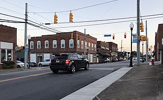
Green Level is a town in Alamance County, North Carolina, United States. It is part of the Burlington, North Carolina Metropolitan Statistical Area. As of the 2020 census, the population was 3,156.

<span class="mw-page-title-main">Jefferson, North Carolina</span> Town in North Carolina, United States

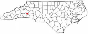
Jefferson is a town in and the county seat of Ashe County, North Carolina, United States. The population was 1,622 at the 2020 U.S. census.

<span class="mw-page-title-main">White Lake, North Carolina</span> Town in North Carolina, United States

White Lake is a town in Bladen County, North Carolina, United States. The population was 802 at the 2010 census, up from 529 in 2000.

Belville is a town in Brunswick County, North Carolina, United States. The population was 1,936 at the 2010 census, up from 285 in 2000. It is part of the Wilmington, NC metropolitan area.

<span class="mw-page-title-main">Catawba, North Carolina</span> Town in North Carolina, United States

Catawba is a town in Catawba County, North Carolina, United States. The population was 603 at the 2010 census. It is part of the Hickory–Lenoir–Morganton Metropolitan Statistical Area. As with the county, the name recalls the Catawba people, the indigenous people who once inhabited the area.

<span class="mw-page-title-main">Casar, North Carolina</span> Town in North Carolina, United States

Casar is a small town in northern Cleveland County, North Carolina, United States. The population was 297 at the 2010 census.

<span class="mw-page-title-main">Earl, North Carolina</span> Town in North Carolina, United States

Earl is a town in Cleveland County, North Carolina, United States. The population was 260 at the 2010 census.

<span class="mw-page-title-main">Trenton, North Carolina</span> Town in North Carolina, United States

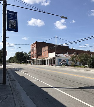
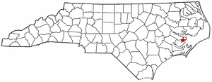
Trenton is a town in Jones County, North Carolina, United States. The population was 238 in 2020 census. It is the county seat of Jones County.

<span class="mw-page-title-main">Mesic, North Carolina</span> Town in North Carolina, United States

Mesic is a town in Pamlico County, North Carolina, United States. The population was 220 at the 2010 census. It is part of the New Bern, North Carolina Micropolitan Statistical Area.

<span class="mw-page-title-main">Stonewall, North Carolina</span> Town in North Carolina, United States

Stonewall is a town in Pamlico County, North Carolina, United States. The population was 281 at the 2010 census. It is part of the New Bern, North Carolina Micropolitan Statistical Area.

<span class="mw-page-title-main">Staley, North Carolina</span> Town in North Carolina, United States

Staley is a town in Randolph County, North Carolina, United States. The population was 393 at the 2010 census.

<span class="mw-page-title-main">Mayodan, North Carolina</span> Town in North Carolina, United States

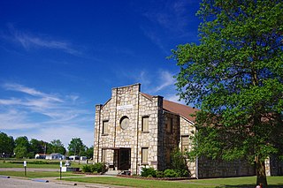
Mayodan is a town in Rockingham County, North Carolina, in the United States. It is a manufacturing site for Sturm, Ruger & Co., Bridgestone Aircraft Tire, and formerly General Tobacco. Washington Mills Company, later Tultex, operated a textile mill in Mayodan until 1999.

Flat Rock is a census-designated place (CDP) in Surry County, North Carolina, United States. The name "Flat Rock" stems from the community's granite quarry. The granite quarry is the largest open-face granite quarry in the world, and has been mined continuously since 1889 by the North Carolina Granite Corporation.

<span class="mw-page-title-main">Spencer, Ohio</span> Village in Ohio, United States

Spencer is a village in Spencer Township located in Medina County, Ohio, United States. The population was 684 at the 2020 census.

<span class="mw-page-title-main">Hilda, South Carolina</span> Town in South Carolina, United States

Hilda is a town in Barnwell County, South Carolina, United States. The population was 447 at the 2010 census..

<span class="mw-page-title-main">West Liberty, West Virginia</span> Town in West Virginia, United States

West Liberty is a town in Ohio County, West Virginia, United States. The population was 1,557 at the 2020 census. It is part of the Wheeling metropolitan area.

<span class="mw-page-title-main">Namakagon, Wisconsin</span> Town in Wisconsin, United States

Namakagon is a town in Bayfield County, Wisconsin, United States. The population was 246 at the 2010 census.

<span class="mw-page-title-main">Genoa (town), Wisconsin</span> Human settlement in Vernon County, Wisconsin, United States of America

Genoa is a town in Vernon County, Wisconsin, United States. The population was 705 at the 2000 census. The Village of Genoa is located within the town. The unincorporated community of Romance is located in the town of Genoa.

References

  1. "ArcGIS REST Services Directory". United States Census Bureau. Retrieved September 20, 2022.
  2. 1 2 U.S. Geological Survey Geographic Names Information System: Clarkton, North Carolina
  3. 1 2 "U.S. Census website". United States Census Bureau . Retrieved January 31, 2008.
  4. 1 2 "Geographic Identifiers: 2010 Demographic Profile Data (G001): Clarkton town, North Carolina". U.S. Census Bureau, American Factfinder. Archived from the original on February 12, 2020. Retrieved February 6, 2014.
  5. "National Register Information System". National Register of Historic Places . National Park Service. July 9, 2010.
  6. Yeargin, W.W. (2006). "Tobacco Belts". NCPedia. North Carolina Government & Heritage Library. Retrieved July 21, 2022.
  7. "Census of Population and Housing". Census.gov. Retrieved June 4, 2015.