Daly Range

Last updated
Daly Range
Daly Bjerge
Roosevelt Range 1903.png
Roosevelt Range section of Robert Peary's 1900 explorations map "Polar Regions"
Highest point
PeakUnnamed
Elevation 1,399 m (4,590 ft)
Listing List of mountain ranges of Greenland
Dimensions
Length40 km (25 mi)NW/SE
Width15 km (9.3 mi)NE/SW
Geography
Greenland edcp relief location map.jpg
Red triangle with thick white border.svg
Location
Country Greenland
RegionPeary Land
Range coordinates 83°22′N27°10′W / 83.367°N 27.167°W / 83.367; -27.167
Parent range Roosevelt Range
Geology
Age of rock Precambrian, Silurian

The Daly Range or Daly Mountains (Danish : Daly Bjerge) is a mountain range in Peary Land, Northern Greenland. Administratively this range is part of the Northeast Greenland National Park.

Contents

It forms the eastern end of the northernmost mountain range on Earth. [1] The area of the range is barren and uninhabited.

History

The mountain chain was named by Robert Peary after Judge Charles P. Daly, President of the American Geographical Society and member of the executive committee of the Peary Arctic Club in New York. [2]

In 1900 Peary saw the range from the coast and was the first to put it on the map. The Daly Range was further surveyed in 1907 by Johan Peter Koch, Aage Bertelsen and Tobias Gabrielsen, the northern team of the ill-fated Denmark expedition, when they reached their northernmost point, Cape Bridgman. [3] Aerial surveys by Lauge Koch in 1930 during the Three-year Expedition to East Greenland mapped the area with higher precision. [4]

Still, the Daly Range remained very little explored until July 2000, when members of the American Alpine Club made an attempt to climb the highest point up the Bertelsen Glacier to the base of the peak. This attempt, however, was thwarted by awful weather conditions and the mountain remained unclimbed until July 2003 when four alpinists led by Dennis Schmitt were able to reach the highest point of the range from the Moore Glacier. [5]

Geography

The Daly Range is the easternmost subrange of the Roosevelt Range. [6] Its highest peak rises above the confluence of the Moore Glacier and the Bertelsen Glacier. [7] It is a prominent 1,399 m (4,590 ft) high summit covered by an ice cap —Schmitt gives a height of 1,456 m (4,777 ft) that contradicts the height on maps. [5]

This mountain chain runs roughly from WNW to ESE at the eastern end of Johannes V. Jensen Land southeast of Bliss Bay in the Wandel Sea, SW of Cape Bridgman and north of the mouth area of Frederick E. Hyde Fjord, rising steeply above the coastal plain. [8] The H. H. Benedict Range (H. H. Benedict Bjerge) rises to the west and southwest, beyond the Moore Glacier. [7]

Map of Northern Ellesmere Island and far Northern Greenland. Operational Navigation Chart A-5, 3rd edition.jpg
Map of Northern Ellesmere Island and far Northern Greenland.
J. P. Koch 1911 map of NE Greenland showing at the top the Daly Range and the Bertelsen Glacier, the easternmost features of the Roosevelt Range. Karte Nordostgronland Koch 1911.png
J. P. Koch 1911 map of NE Greenland showing at the top the Daly Range and the Bertelsen Glacier, the easternmost features of the Roosevelt Range.

See also

Related Research Articles

<span class="mw-page-title-main">Peary Land</span> Peninsula in northern Greenland

Peary Land is a peninsula in northern Greenland, extending into the Arctic Ocean. It reaches from Victoria Fjord in the west to Independence Fjord in the south and southeast, and to the Arctic Ocean in the north, with Cape Morris Jesup, the northernmost point of Greenland's mainland, and Cape Bridgman in the northeast.

<span class="mw-page-title-main">Johan Peter Koch</span> Danish captain and explorer

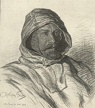
Johan Peter Koch was a Danish captain and explorer of the Arctic dependencies of Denmark, born at Vestenskov. He was the uncle of the geologist Lauge Koch

<span class="mw-page-title-main">Lauge Koch</span> Danish geologist and Arctic explorer

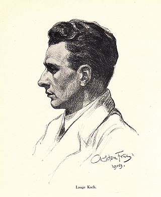
Lauge Koch was a Danish geologist and Arctic explorer.

<span class="mw-page-title-main">Frederick E. Hyde Fjord</span>

Frederick E. Hyde Fjord is a fjord in Peary Land, far northern Greenland.

<span class="mw-page-title-main">Watkins Range</span> Mountain range in Greenland

The Watkins Range is Greenland's highest mountain range. It is located in King Christian IX Land, Sermersooq municipality.

<span class="mw-page-title-main">Peary Arctic Club</span>

The Peary Arctic Club was an American-based club with the goal of promoting the Arctic expeditions of Robert Peary (1856–1920).

<span class="mw-page-title-main">Stauning Alps</span>

The Stauning Alps are a large system of mountain ranges in Scoresby Land, King Christian X Land, northeastern Greenland. Administratively the Stauning Alps are part of the Northeast Greenland National Park zone.

<span class="mw-page-title-main">Denmark expedition</span>

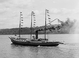
The Denmark expedition, also known as the Denmark Expedition to Greenland's Northeast Coast and the Danmark Expedition after the ship's name, was an expedition to northeastern Greenland in 1906–1908.

<span class="mw-page-title-main">Cape Bridgman</span>

Cape Bridgman is a headland in the Wandel Sea, Arctic Ocean, northeast Greenland.

<span class="mw-page-title-main">Nordkrone</span> Mountain in Greenland

Nordkrone is a mountainous area in Peary Land, Northern Greenland. Administratively it is part of the Northeast Greenland National Park.

<span class="mw-page-title-main">Bliss Bay</span>

Bliss Bay is a bay in the Wandel Sea, Northern Greenland. The area of the bay is uninhabited. Administratively Bliss Bay and its surroundings belong to the Northeast Greenland National Park.

<span class="mw-page-title-main">Roosevelt Range</span>

The Roosevelt Range or Roosevelt Mountains is a mountain range in Northern Greenland. Administratively this range is part of the Northeast Greenland National Park. Its highest peak is the highest point in Peary Land.

<span class="mw-page-title-main">Frigg Fjord</span>

Frigg Fjord is a fjord in Peary Land, far northern Greenland.

<span class="mw-page-title-main">H. H. Benedict Range</span> Mountain range in northern Greenland

The H. H. Benedict Range or H. H. Benedict Mountains is a mountain range in Peary Land, Northern Greenland. Administratively this range is part of the Northeast Greenland National Park.

<span class="mw-page-title-main">Peary Channel (Greenland)</span>

The Peary Channel was a hypothetical sound or marine channel running from east to west separating Peary Land in northernmost Greenland from the mainland further south.

<span class="mw-page-title-main">Johannes V. Jensen Land</span> Region in Northeast Greenland National Park, Greenland

Johannes V. Jensen Land is an area in Peary Land, Northern Greenland. Administratively it lies in the Northeast Greenland National Park zone. The area is remote and currently uninhabited.

<span class="mw-page-title-main">Moore Glacier</span> Glacier in northern Greenland

Moore Glacier is a glacier in northern Greenland. Administratively it belongs to the Northeast Greenland National Park. Between 2006 and 2010 there was an automatic weather station in the glacier.

<span class="mw-page-title-main">Bertelsen Glacier</span> Glacier in northern Greenland

Bertelsen Glacier is a glacier in northern Greenland. Administratively it belongs to the Northeast Greenland National Park. Between 2006 and 2010 there was an automatic weather station near the glacier.

<span class="mw-page-title-main">Gertrud Rask Land</span>

Gertrud Rask Land is an area in Peary Land, North Greenland. Administratively it is part of the Northeast Greenland National Park.

References

  1. 2002 American Alpine Journal, p.286
  2. R. E. Peary, Report of RE Peary, CE, USN, on Work Done in the Arctic in 1898-1902, 1903 - JSTOR
  3. G. Amdrup: Report on the Danmark Expedition to the North-East Coast of Greenland 1906–1908 . In: Meddelelser om Grønland 41, 1913, pp. 1–270
  4. Geological Survey of Denmark and Greenland, Bulletin 21. 2010
  5. 1 2 North America, Greenland, The Far North, Jensenland, Explorations of Most Northerly Land
  6. "Greenland Pilot" (PDF). Danish Geodata Agency. Archived from the original (PDF) on 3 June 2019. Retrieved 15 June 2019.
  7. 1 2 "Daly Bjerge". Mapcarta. Retrieved 18 June 2019.
  8. "Daly Range". Geographical Items on North Greenland Encyclopedia Arctica vol.14-0639. Retrieved 15 June 2019.