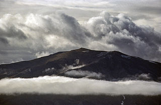
List of mountain ranges of Greenland

Last updated

Contents

View of a range at the edge of the Greenland ice sheet. A great number of mountain ranges in Greenland are yet unnamed Greenland ice cap.jpg
View of a range at the edge of the Greenland ice sheet. A great number of mountain ranges in Greenland are yet unnamed
Mountains rising above Kaiser Franz Joseph Fjord Franz Josef Fjord, mountains (js)1.jpg
Mountains rising above Kaiser Franz Joseph Fjord
View of the Watkins Range Watkinsmountains.jpg
View of the Watkins Range
Kloftbjerge mountains in eastern Renland Kloftbjerge aerial.jpg
Kloftbjerge mountains in eastern Renland

This is a list of mountain ranges of Greenland.

List by alphabetical order

See also

Related Research Articles

<span class="mw-page-title-main">Andrée Land (Greenland)</span>

Andrée Land is a peninsula in King Christian X Land, East Greenland that is bounded by Kejser Franz Joseph Fjord, Isfjord and Geologfjord.
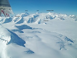
<span class="mw-page-title-main">Watkins Range</span> Mountain range in Greenland

The Watkins Range is Greenland's highest mountain range. It is located in King Christian IX Land, Sermersooq municipality.

<span class="mw-page-title-main">Kangerlussuaq Fjord, East Greenland</span> Body of water

Kangerlussuaq Fjord is a fjord in eastern Greenland. It is part of the Sermersooq municipality.

<span class="mw-page-title-main">King Frederick VIII Land</span> Region in Greenland

King Frederick VIII Land is a major geographic division of northeastern Greenland. It extends above the Arctic Circle from 76°N to 81°N in a N/S direction along the coast of the Greenland Sea.

<span class="mw-page-title-main">Stauning Alps</span>

The Stauning Alps are a large system of mountain ranges in Scoresby Land, King Christian X Land, northeastern Greenland. Administratively the Stauning Alps are part of the Northeast Greenland National Park zone.

<span class="mw-page-title-main">Schweizerland</span> Mountain range in eastern Greenland

Schweizerland, also known as Schweizerland Alps, is a mountain range in King Christian IX Land, eastern Greenland. Administratively this range is part of the Sermersooq Municipality. Its highest point is one of the highest peaks in Greenland.

<span class="mw-page-title-main">Queen Louise Land</span> Mountainous region in northeastern Greenland

Queen Louise Land is a vast mountainous region located west of Dove Bay, King Frederick VIII Land, northeastern Greenland. Administratively it is part of the Northeast Greenland National Park zone.

<span class="mw-page-title-main">Lemon Range</span> Mountain range in Greenland

The Lemon Range or Lemon Mountains is a mountain range in King Christian IX Land, eastern Greenland. Administratively this range is part of the Sermersooq Municipality.

<span class="mw-page-title-main">Gronau Nunataks</span>

The Gronau Nunataks is a mountain range in King Christian IX Land, eastern Greenland. Administratively this range is part of the Sermersooq Municipality.

<span class="mw-page-title-main">Lindbergh Range</span> Mountain range in Greenland

The Lindbergh Range or Lindbergh Nunataks is a mountain range in King Christian IX Land, eastern Greenland. Administratively the range is part of the Sermersooq Municipality.

The Graah Mountains are a mountain range in southeastern Greenland. Administratively this range is part of the Kujalleq municipality.

<span class="mw-page-title-main">Inglefield Gulf</span> Fjord in northwestern Greenland

Inglefield Gulf or Inglefield Fjord is a fjord in northwestern Greenland. To the west, the fjord opens into the Baffin Bay. Administratively it belongs to the Avannaata municipality.

<span class="mw-page-title-main">Lilloise Range</span> Mountain range in eastern Greenland

The Lilloise Range or Lilloise Mountains is a mountain range in King Christian IX Land, eastern Greenland. Administratively this range is part of the Sermersooq Municipality.

<span class="mw-page-title-main">Roosevelt Range</span>

The Roosevelt Range or Roosevelt Mountains is a mountain range in Northern Greenland. Administratively this range is part of the Northeast Greenland National Park. Its highest peak is the highest point in Peary Land.

<span class="mw-page-title-main">H. H. Benedict Range</span> Mountain range in northern Greenland

The H. H. Benedict Range or H. H. Benedict Mountains is a mountain range in Peary Land, Northern Greenland. Administratively this range is part of the Northeast Greenland National Park.

<span class="mw-page-title-main">Daly Range</span>

The Daly Range or Daly Mountains is a mountain range in Peary Land, Northern Greenland. Administratively this range is part of the Northeast Greenland National Park.

Nathorst Land is an area in King Christian X Land, Eastern Greenland. It lies in the Northeast Greenland National Park zone. The area is remote and uninhabited.

Frederiksborg Glacier is a glacier on the east coast of the Greenland ice sheet. It is named after Frederiksborg Castle in Denmark.

The Kangerluluk Range is a mountain range in the King Frederick VI Coast, southeastern Greenland. Administratively this range is part of the Kujalleq municipality.
<span class="mw-page-title-main">Wiedemann Range</span>

The Wiedemann Range is a mountain range in King Christian IX Land, eastern Greenland. Administratively this range is part of the Sermersooq Municipality.

References

  1. "Alángup Qáqai". Mapcarta. Retrieved 22 June 2016.
  2. 1 2 3 4 5 6 7 8 9 10 11 12 13 14 15 16 17 18 19 20 21 22 "Catalogue of place names in northern East Greenland". Geological Survey of Denmark. Retrieved 18 June 2016.
  3. "Amitsorssûp Qulâ". Mapcarta. Retrieved 24 June 2016.
  4. "Borgtinderne". Mapcarta. Retrieved 6 July 2016.
  5. "Brages Bjerge". Mapcarta. Retrieved 24 June 2016.
  6. "Kronprins Frederik Bjerge". Mapcarta. Retrieved 23 June 2016.
  7. "Daly Bjerge". Mapcarta. Retrieved 22 June 2016.
  8. "Greenland Pilot" (PDF). Danish Geodata Agency. Retrieved 15 June 2019.
  9. 1 2 Geological Survey of Denmark and Greenland bulletin 21, 2010 - GEUS
  10. "Ejnar Mikkelsen Fjeld". Mapcarta. Retrieved 23 June 2016.
  11. Greenland Pilot - Danish Geodata Agency, p. 22
  12. "Gronau Nunatakker". Mapcarta. Retrieved 26 June 2016.
  13. 1 2 "Roosevelt Range". Geographical Items on North Greenland Encyclopedia Arctica vol.14. Retrieved 13 June 2019.
  14. 1 2 1:1,000,000 scale Operational Navigation Chart, Sheet A-5
  15. "Hallebjergene". Mapcarta. Retrieved 22 June 2016.
  16. "Hauge Bjerge". Mapcarta. Retrieved 23 June 2016.
  17. "J.A.D. Jensen Nunatakker, Greenland". Peakbagger. Retrieved 2 August 2016.
  18. "Jyske Ås". Mapcarta. Retrieved 26 June 2016.
  19. "Kangerluluk". Mapcarta. Retrieved 6 May 2016.
  20. "Kloftbjerge, Greenland". Peakbagger. Retrieved 3 August 2016.
  21. "Klosterbjerge, Greenland". Peakbagger. Retrieved 3 August 2016.
  22. "Knud Rasmussen Bjerge". Mapcarta. Retrieved 24 June 2016.
  23. "Lacroix Bjerge". Mapcarta. Retrieved 20 June 2016.
  24. "Lemon Bjerge". Mapcarta. Retrieved 20 June 2016.
  25. "Lilloise Bjerge". Mapcarta. Retrieved 22 June 2016.
  26. "Lindbergh Fjelde". Mapcarta. Retrieved 23 June 2016.
  27. "Nordfjord Plateau". Mapcarta. Retrieved 25 July 2016.
  28. Nunat Aqqi; Stednavne
  29. "Paul Stern Land". Google Maps. Retrieved 28 July 2016.
  30. "Pentamerus Bjerge". Mapcarta. Retrieved 24 June 2016.
  31. "Prinsen af Wales Bjerge". Mapcarta. Retrieved 23 June 2016.
  32. "Prinsesse Caroline Mathilde Alper". Mapcarta. Retrieved 22 June 2016.
  33. "Prinsesse Elisabeth Alper". Mapcarta. Retrieved 22 June 2016.
  34. O'Carroll, Etain (2005). Greenland and the Arctic. Lonely Planet. p. 206. ISBN   978-1-74059-095-2.
  35. "Qârusuit". GeoNames. Retrieved 24 June 2016.
  36. "Qivssakatdlagfik". Mapcarta. Retrieved 24 June 2016.
  37. Arctic Summits - Summit Climbs
  38. Roosevelt Range, Greenland - Geographical Names
  39. "Schweizerland". Mapcarta. Retrieved 22 June 2016.
  40. "Sioraq Fjelde". Mapcarta. Retrieved 23 June 2016.
  41. "Skærmen". Mapcarta. Retrieved 6 July 2016.
  42. "North America, Greenland, East Coast, Sortebrae Mountains, Seven Ascents". AAJ. Retrieved 24 June 2016.
  43. Geology of East Greenland: The Werner Bjerge
  44. "Wiedemann Bjerge". Mapcarta. Retrieved 26 June 2016.