Ejnar Mikkelsen Range

Last updated
Ejnar Mikkelsen Range
Operational Navigation Chart C-13, 3rd edition.jpg
Defense Mapping Agency map of Greenland sheet.
Highest point
Peak Ejnar Mikkelsen Fjeld
Elevation 3,282 m (10,768 ft)
Dimensions
Length23 km (14 mi)N/S
Width7 km (4.3 mi)E/W
Geography
Greenland edcp relief location map.jpg
Red triangle with thick white border.svg
Location in Greenland
Country Greenland
Range coordinates 68°53′N28°37′W / 68.883°N 28.617°W / 68.883; -28.617
Parent range Watkins Range

Ejnar Mikkelsen Range (Danish : Ejnar Mikkelsen Fjeld) [1] is a mountain range in King Christian IX Land, eastern Greenland. Administratively it is part of the Sermersooq Municipality.

Contents

The range is part of the greater Watkins Range and is named after Danish polar explorer Ejnar Mikkelsen. The highest peak is one of the most impressive mountains in Greenland and has a good reputation among alpinists. [2] It was first climbed in 1970 by Andrew Ross leading a Scottish team, [3] and for the second time in 1998 by Roland Aeschimann leading a Swiss team. [4]

Geography

The Ejnar Mikkelsen Range is a long nunatak with high peaks extending for about 23 km (14 mi) in a north–south direction. It is located east of the main Watkins Range on the eastern side of the Kronborg Glacier and west of the Borgtinderne, another nunatak with high peaks. Its northern end connects with the northern part of the Watkins Range. The area of this range is uninhabited. [5]

Mountains

The highest point in the range is 3,282.7 m (10,770 ft) high Ejnar Mikkelsen Fjeld main peak, a massive mountain having a black rock needle at the top that marks the true summit. [6] None of the other peaks in the nunatak rises above 3,000 m (9,800 ft). This summit is one of the highest summits in Greenland and it is marked as a 3,325 m (10,909 ft) peak in some sources. [7]

Climate

Polar climate prevails in the region. The average annual temperature in the area of the range is -14 °C. The warmest month is July when the average temperature reaches -2 °C and the coldest is February when the temperature sinks to -22 °C. [8]

See also

Related Research Articles

<span class="mw-page-title-main">Gunnbjørn Fjeld</span> Tallest mountain in Greenland

Gunnbjørn Fjeld is the tallest mountain in Greenland, the Kingdom of Denmark, and north of the Arctic Circle. It is a nunatak, a rocky peak protruding through glacial ice.

<span class="mw-page-title-main">Watkins Range</span> Mountain range in Greenland

The Watkins Range is Greenland's highest mountain range. It is located in King Christian IX Land, Sermersooq municipality.

<span class="mw-page-title-main">Stauning Alps</span>

The Stauning Alps are a large system of mountain ranges in Scoresby Land, King Christian X Land, northeastern Greenland. Administratively the Stauning Alps are part of the Northeast Greenland National Park zone.

Petermann Peak,, also known as Petermann Fjeld, Petermanns Topp and Petermann Point is a mountain in King Christian X Land, Northeast Greenland. Administratively it is part of the Northeast Greenland National Park zone.

<span class="mw-page-title-main">Schweizerland</span> Mountain range in eastern Greenland

Schweizerland, also known as Schweizerland Alps, is a mountain range in King Christian IX Land, eastern Greenland. Administratively this range is part of the Sermersooq Municipality. Its highest point is one of the highest peaks in Greenland.

<span class="mw-page-title-main">Queen Louise Land</span> Mountainous region in northeastern Greenland

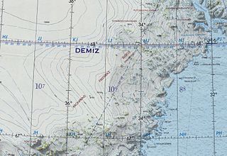
Queen Louise Land is a vast mountainous region located west of Dove Bay, King Frederik VIII Land, northeastern Greenland. Administratively it is part of the Northeast Greenland National Park zone.

<span class="mw-page-title-main">Lemon Range</span> Mountain range in Greenland

The Lemon Range or Lemon Mountains is a mountain range in King Christian IX Land, eastern Greenland. Administratively this range is part of the Sermersooq Municipality.

<span class="mw-page-title-main">Crown Prince Frederik Range</span> Mountain range in King Christian IX Land, Greenland

The Crown Prince Frederik Range is a large mountain range in King Christian IX Land, eastern Greenland. Administratively this range is part of the Sermersooq Municipality.

<span class="mw-page-title-main">Borgtinderne</span>

Borgtinderne, meaning 'Castle Pinnacles' in the Danish language, is a mountain range in King Christian IX Land, eastern Greenland. Administratively this range is part of the Sermersooq Municipality.

<span class="mw-page-title-main">Gronau Nunataks</span> Greenlandic mountain range

The Gronau Nunataks is a mountain range in King Christian IX Land, eastern Greenland. Administratively this range is part of the Sermersooq Municipality.

<span class="mw-page-title-main">Lindbergh Range</span> Mountain range in Greenland

The Lindbergh Range or Lindbergh Nunataks is a mountain range in King Christian IX Land, eastern Greenland. Administratively the range is part of the Sermersooq Municipality.

<span class="mw-page-title-main">Lilloise Range</span> Mountain range in eastern Greenland

The Lilloise Range or Lilloise Mountains is a mountain range in King Christian IX Land, eastern Greenland. Administratively this range is part of the Sermersooq Municipality.

<span class="mw-page-title-main">Wiedemann Range</span>

The Wiedemann Range is a mountain range in King Christian IX Land, eastern Greenland. Administratively this range is part of the Sermersooq Municipality.

Pic de Gerlache is a mountain in King Frederick VIII Land, NE Greenland. Administratively it is part of the Northeast Greenland National Park.

<span class="mw-page-title-main">Alabama Nunatak</span> Mountain feature in Greenland

Alabama Nunatak is a nunatak in the King Frederik VIII Land area of northeastern Greenland. Administratively it is part of the Northeast Greenland National Park zone.

References

  1. "Ejnar Mikkelsen Fjeld". Mapcarta. Retrieved 3 August 2016.
  2. Mountain Info
  3. North America, Greenland, Ejnar Mikkelsen Fjeld Ascent
  4. The Development of Mountaineering in East and North-East Greenland - An Outline History
  5. 1 2 3 4 Google Earth
  6. Summit Post - Ejnar Mikkelsens Fjeld
  7. "Ejnar Mikkelsen Fjeld, Greenland". Peakbagger. Retrieved 3 August 2016.
  8. "NASA Earth Observations Data Set Index". NASA. Archived from the original on 11 May 2020. Retrieved 30 January 2016.