Halle Range

Last updated
Halle Range
Hallebjergene

Eskimonaes C501 map sheet.tif

Map of Clavering Island (Eskimonaes) and neighbouring areas
Highest point
Peak Bramsen Bjerg
Elevation 1,272 m (4,173 ft)
Dimensions
Length 20 km (12 mi)NW/SE
Width 15 km (9.3 mi)NE/SW
Area 300 km2 (120 sq mi)
Geography
Greenland edcp relief location map.jpg
Red triangle with thick white border.svg
Location
Country Greenland
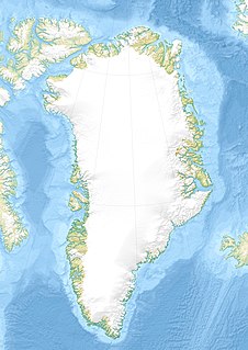
Range coordinates 74°14′N21°45′W / 74.233°N 21.750°W / 74.233; -21.750 Coordinates: 74°14′N21°45′W / 74.233°N 21.750°W / 74.233; -21.750
Geology
Age of rock Upper Carboniferous [1]

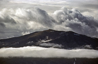
The Halle Range or Halle Mountains (Danish : Hallebjergene) [2] is a mountain range in Clavering Island, King Christian X Land, northeastern Greenland. Administratively this range is part of the Northeast Greenland National Park zone.

Danish language North Germanic language spoken in Denmark

Danish is a North Germanic language spoken by around six million people, principally in Denmark and in the region of Southern Schleswig in northern Germany, where it has minority language status. Also, minor Danish-speaking communities are found in Norway, Sweden, Spain, the United States, Canada, Brazil, and Argentina. Due to immigration and language shift in urban areas, around 15–20% of the population of Greenland speak Danish as their first language.

Mountain range A geographic area containing several geologically related mountains

A mountain range or hill range is a series of mountains or hills ranged in a line and connected by high ground. A mountain system or mountain belt is a group of mountain ranges with similarity in form, structure, and alignment that have arisen from the same cause, usually an orogeny. Mountain ranges are formed by a variety of geological processes, but most of the significant ones on Earth are the result of plate tectonics. Mountain ranges are also found on many planetary mass objects in the Solar System and are likely a feature of most terrestrial planets.

Clavering Island island

Clavering Island is a large island in eastern Greenland off Gael Hamkes Bay, to the south of Wollaston Foreland.

Contents

The range was named by Lauge Koch during his 1929–30 expedition after Thore Gustav Halle (1884–1964), a professor at the University of Stockholm who had worked on the plant samples brought by the expedition. Formerly it had been also known as Joh. H. Andresenfjellet. [3]

Lauge Koch Danish geologist

Lauge Koch was a Danish geologist and Arctic explorer.

Geography

The Halle Range is an up to 1200 m high little glaciated mountain massif located in the southwest part of Clavering Island (Clavering Ø). Its average elevation is 912 m and the highest point of the range is 1272 m high Bramsen Bjerg. The Vildbækdalen is a valley in the heart of the range. The area of the Halle mountains is uninhabited. [4]

Detailed map of the area around Clavering Island. Eskimonaes C501 map sheet.tif
Detailed map of the area around Clavering Island.

Mountains

See also

Related Research Articles

Peary Land peninsula

Peary Land is a peninsula in northern Greenland, extending into the Arctic Ocean. It reaches from Victoria Fjord in the west to Independence Fjord in the south and southeast, and to the Arctic Ocean in the north, with Cape Morris Jesup, the northernmost point of Greenland's mainland, and Cape Bridgman in the northeast.

Wollaston Foreland peninsula in Greenland

Wollaston Foreland is a peninsula in the NE Greenland National Park area, East Greenland.

Frænkel Land peninsula in Greenland

Frænkel Land is a peninsula in eastern Greenland. Located in the Northeast Greenland National Park, it is bounded by the inner reaches of Kejser Franz Joseph Fjord and the Isfjord.

Andrée Land (Greenland) peninsula in Greenland

Andrée Land is a peninsula in King Christian X Land, East Greenland that is bounded by Kejser Franz Joseph Fjord, Isfjord and Geologfjord.

Rigny Bjerg

Mount Rigny, Danish: Rigny Bjerg, Rignys Bjerg) is a mountain peak in East Greenland. It is located in King Christian IX Land, Sermersooq Municipality.

Watkins Range range in Greenland

The Watkins Range is Greenland's highest mountain range. It is located in King Christian IX Land, Sermersooq municipality.

Petermann Peak

Petermann Peak,, also known as Petermann Fjeld, Petermanns Topp and Petermann Point is a mountain in King Christian X Land, Northeast Greenland. Administratively it is part of the Northeast Greenland National Park zone.

Schweizerland

Schweizerland, also known as Schweizerland Alps, is a mountain range in King Christian IX Land, eastern Greenland. Administratively this range is part of the Sermersooq Municipality. Its highest point is one of the highest peaks in Greenland.

Princess Caroline-Mathilde Alps

The Princess Caroline-Mathilde Alps are a mountain range system in the Holm Land Peninsula, King Frederick VIII Land, northeastern Greenland. Administratively this range is part of the Northeast Greenland National Park zone.

Adolf S. Jensen Land peninsula in Greenland

Adolf S. Jensen Land is a peninsula in the southern limit of King Frederick VIII Land, northeastern Greenland. Administratively it belongs to the NE Greenland National Park area.

Queen Margrethe II Land peninsula in Greenland

Queen Margrethe II Land is a peninsula in the northern limit of King Christian X Land, northeastern Greenland. Administratively it belongs to the NE Greenland National Park area.

Queen Louise Land

Queen Louise Land is a vast mountainous region located west of Dove Bay, King Frederick VIII Land, northeastern Greenland. Administratively it is part of the Northeast Greenland National Park zone.

Hjelm Range

The Hjelm Range is a mountain range in the Gauss Peninsula, King Christian X Land, northeastern Greenland. Administratively this range is part of the Northeast Greenland National Park zone.

Lindbergh Range

The Lindbergh Range or Lindbergh Nunataks is a mountain range in King Christian IX Land, eastern Greenland. Administratively this range is part of the Sermersooq Municipality.

Mount Wistar mountain in Northeast Greenland National Park Greenland

Mount Wistar is a mountain in Peary Land, Northern Greenland. Administratively it is part of the Northeast Greenland National Park.

References

  1. Druid Wilson,Geologic Names of North America, Parts 1-2, p. 610
  2. "Hallebjergene". Mapcarta. Retrieved 22 June 2016.
  3. "Catalogue of place names in northern East Greenland". Geological Survey of Denmark. Retrieved 18 June 2016.
  4. Google Earth