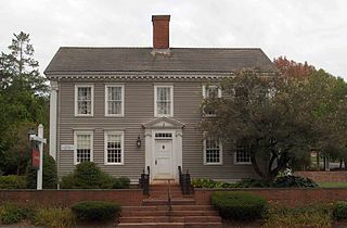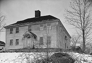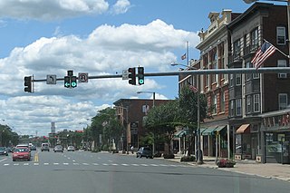
Danielson is a borough in the town of Killingly in Windham County, Connecticut, United States. The population was 4,051 at the 2010 census.

Putnam is a town in Windham County, Connecticut, United States. The population was 9,584 at the 2010 census. It is home to WINY, an AM radio station.

Branford Center is a neighborhood and census-designated place (CDP) in the town of Branford, Connecticut, United States. The CDP encompasses the traditional town center area and the area known as Branford Point. The population of the CDP was 5,819 at the 2010 census.

The Main Street Historic District in Danbury, Connecticut, United States, is the oldest section of that city, at its geographical center. It has long been the city's commercial core and downtown. Its 132 buildings, 97 of which are considered contributing properties, include government buildings, churches, commercial establishments and residences, all in a variety of architectural styles from the late 18th century to the early 20th. It is the only major industrial downtown of its size in Connecticut not to have developed around either port facilities or a water power site.

Broad Street – Davis Park Historic District is a historic district in the borough of Danielson, in the town of Killingly, Connecticut. The district is mainly residential in character, and includes Davis Park, a 1.9-acre (0.77 ha) triangular park created in 1890 and bounded by Main, Reynolds, and Broad Streets. The district as a whole is 30 acres (12 ha) in size. It includes examples of Stick/Eastlake, Queen Anne, and Colonial Revival architectural styles and was added to the National Register of Historic Places in 1998. It includes 95 contributing buildings, one contributing site, and four contributing objects.

Quinebaug Mill–Quebec Square Historic District is a historic district roughly bounded by the Quinebaug River, Quebec Square, and Elm and S. Main Streets in the town of Brooklyn in Windham County, Connecticut. The district encompasses a well-preserved 19th-century mill village. It was added to the National Register of Historic Places in 1985.

The Dayville Historic District encompasses a collection of mid-19th century architecture in the Dayville village of Killingly, Connecticut. It is clustered around the junction of Main and Pleasant Streets, extending along Main to High Street. The area flourished in the mid-19th century, as a consequence of the railroad being routed nearby, serving area textile mills. The district, residential except for a church, was added to the National Register of Historic Places in 1988.

The Noank Historic District is a historic district encompassing the historic main part of the village of Noank in the town of Groton, Connecticut. The district contains a distinctive assortment of mid-to-late 19th-century residential architecture that is notable for its often picturesque woodwork. At the time of their construction, the village was primarily a worker village for nearby shipyards. The district was listed on the National Register of Historic Places in 1979.

The Main Street Historic District encompasses the historic portion of the central business district of Willimantic, in Windham, Connecticut. The district encompasses the commercial business district of Willimantic and is roughly linear along Main Street and Riverside Drive between Church Street and Bridge Street. It was first listed on the National Register of Historic Places in 1982. Its area was increased in 1992 to include the Hall and Bill building on North Street, built in 1889 by one of Willimantic's leading printers.

Plainfield Street Historic District is a historic district in Plainfield, Connecticut that encompasses the historic area of Plainfield Village, the town center of Plainfield. The district is linear, being located along Route 12 between Railroad Avenue and Route 14A. It has been the center of the town's civic life since its settlement in the early 18th century, and includes two centuries of architectural styles. The district was listed on the National Register of Historic Places in 1991.

The Simsbury Center Historic District is a 75-acre (30 ha) historic district located in the town center area of Simsbury, Connecticut. It encompasses seven blocks of Hopmeadow Street, as well as the cluster of commercial, civic, and residential buildings along Railroad, Station, and Wilcox Streets, and Phelps Lane. Although its oldest element is the cemetery, most of its buildings were built in the late 19th and early 20th century. It was listed on the National Register of Historic Places in 1996.

The Tariffville Historic District is a 93 acres (38 ha) historic district in the town of Simsbury, Connecticut. It was listed on the National Register of Historic Places in 1993. It is part of the Tariffville section of Simsbury. The district includes 165 contributing buildings and two contributing sites. It also includes 26 non-contributing buildings and 4 non-contributing sites. There are several houses in the district of Gothic Revival style, probably following designs from pattern books of architect Andrew Jackson Downing. The Trinity Episcopal Church is the only building in the district designed by an architect of national standing, namely Henry C. Dudley. Many of the homes in the area were built by the Tariff Manufacturing Company, which opened a carpet mill along the Farmington River, and needed housing for workers.

The Downtown North Historic District is a 19-acre (7.7 ha) historic district in Hartford, Connecticut. It is a predominantly residential area located around Main Street and High Street north of I-84 and south of the Amtrak railroad tracks. Its apartment blocks, houses, schools and churches, built up mainly in the late 19th and early 20th centuries as part of an expansion of the city's urban core. It includes the 130-foot (40 m) Keney Tower. The area was listed on the National Register of Historic Places in 2004.

Norwichtown is a historic neighborhood in the city of Norwich, Connecticut. It is generally the area immediately north of the Yantic River between I-395 and Route 169.

The North Stonington Village Historic District is a 105-acre (42 ha) historic district encompassing the historic center of the main village of North Stonington, Connecticut. The district includes a well-preserved small industrial village, which flourished in the years before the American Civil War, and declined afterward. The district was listed on the National Register of Historic Places in 1983.

The Greenwich Avenue Historic District is a historic district representing the commercial and civic historical development of the downtown area of the town of Greenwich, Connecticut. The district was listed on the National Register of Historic Places on August 31, 1989. Included in the district is the Greenwich Municipal Center Historic District, which was listed on the National Register the year before for the classical revival style municipal buildings in the core of Downtown. Most of the commercial buildings in the district fall into three broad styles, reflecting the period in which they were built: Italianate, Georgian Revival, and Commercial style. The district is linear and runs north–south along the entire length of Greenwich Avenue, the main thoroughfare of Downtown Greenwich, between U.S. Route 1 and the New Haven Line railroad tracks.

The Water Street Historic District encompasses a historic commercial and industrial area on the west side of downtown Torrington, Connecticut. Extending roughly along Water and Church Streets between the Naugatuck River and Prospect Street, the district includes factory and commercial buildings, as well as the former Torrington Fire Department Headquarters and the civic Knights of Pythias building. Developed between about 1885 and 1920, the district was listed on the National Register of Historic Places in 2003.

The Downtown Main Street Historic District encompasses a well-preserved historical section of downtown East Hartford, Connecticut. It extends along Main Street from between Burnside Avenue and Governor Street, and along Chapman Street to Chapman Place. Developed between about 1890 and 1945, its architecture encapsulates the town's transition from a main agrarian community to a modern suburb. The district was listed on the National Register of Historic Places in 1996.

The Old Westfield Cemetery is located at 320 North Street in the Danielson borough of Killingly, Connecticut. The cemetery was established in 1720, not long after Killingly's incorporation (1708). It occupies a 10-acre (4.0 ha) parcel on the north side of North Street, and is bounded in part by the Five Mile River. Its main entry is marked by granite pillars placed in 1920, giving access to a perimeter road. The cemetery is laid out in a form typical of 18th-century and early 19th-century, with graves lined up in relatively even rows, avoiding the mid-19th century rural cemetery movement. Most of its 450 graves date to the 19th century. The cemetery was listed on the National Register of Historic Places in 2010.

The Colony Street-West Main Street Historic District encompasses a major section of the historic downtown area of Meriden, Connecticut. Extending north and west from the junction of Colony and West Main Streets, this area was developed commercially after the arrival of the railroad line which runs just to its east. Despite some redevelopment, the historic commercial and mixed residential-commercial buildings convey the appearance of a typical late 19th or early 20th-century downtown. The district was listed on the National Register of Historic Places in 1987. Since its listing, a number of the historic buildings have been demolished.


