Dayton | |
---|---|
Dayton, Washington | |
Coordinates: 46°19′11″N117°58′40″W / 46.31972°N 117.97778°W | |
Country | United States |
State | Washington |
County | Columbia |
Area | |
• Total | 1.44 sq mi (3.73 km2) |
• Land | 1.44 sq mi (3.73 km2) |
• Water | 0.00 sq mi (0.00 km2) |
Elevation | 1,660 ft (506 m) |
Population | |
• Total | 2,526 |
• Estimate (2019) [3] | 2,442 |
• Density | 1,694.66/sq mi (654.48/km2) |
Time zone | UTC−8 (Pacific (PST)) |
• Summer (DST) | UTC−7 (PDT) |
ZIP code | 99328 |
Area code | 509 |
FIPS code | 53-16970 |
GNIS feature ID | 1504356 [4] |
Website | City of Dayton |
Dayton is a city in and the county seat of Columbia County, Washington, United States. [5] The population was 2,526 at the 2010 census.
Dayton was founded in the 1860s. A town site plat was filed by Jesse N. and Elizabeth Day on November 23, 1871. The city was officially incorporated on November 10, 1881, and was named for Jesse Day. [6] Dayton has the oldest train depot in Washington state, dating from 1881, and the oldest continuously used courthouse, operating since 1887. The historic community of Baileysburg was situated about one mile southeast of Dayton, at the junction of North Touchet and South Touchet Roads.[ citation needed ]
In the 1980s and 1990s, the town underwent a $3 million restoration program, repairing the historic depot and historic courthouse, adding pedestrian amenities to Main Street, and creating a National Historic District. [7]
Dayton is located at 46°19′11″N117°58′40″W / 46.31972°N 117.97778°W (46.319608, -117.977699). [8]
According to the United States Census Bureau, the city has a total area of 1.43 square miles (3.70 km2), all of it land. [9] The Touchet River runs through Dayton.
Dayton has a Mediterranean climate (Köppen Csb) with hot summers (though nights are pleasantly cool) and chilly, though not severe, winters with only very moderate snowfall. Dayton's winter climate is somewhat milder than most of eastern Washington. Precipitation is moderate for most of the year except for a dry period between July and September, at which time major wildfires are very common in the region due to the hot days and very low humidity.
Climate data for Dayton, Washington (1991–2020 normals, extremes 1893–present) | |||||||||||||
---|---|---|---|---|---|---|---|---|---|---|---|---|---|
Month | Jan | Feb | Mar | Apr | May | Jun | Jul | Aug | Sep | Oct | Nov | Dec | Year |
Record high °F (°C) | 70 (21) | 74 (23) | 84 (29) | 93 (34) | 101 (38) | 111 (44) | 109 (43) | 114 (46) | 105 (41) | 92 (33) | 80 (27) | 69 (21) | 114 (46) |
Mean daily maximum °F (°C) | 41.5 (5.3) | 46.2 (7.9) | 53.9 (12.2) | 61.1 (16.2) | 69.9 (21.1) | 76.8 (24.9) | 87.6 (30.9) | 86.7 (30.4) | 77.2 (25.1) | 62.9 (17.2) | 49.3 (9.6) | 40.7 (4.8) | 62.8 (17.1) |
Daily mean °F (°C) | 34.0 (1.1) | 37.2 (2.9) | 43.4 (6.3) | 49.4 (9.7) | 57.2 (14.0) | 63.4 (17.4) | 71.3 (21.8) | 70.5 (21.4) | 62.2 (16.8) | 50.4 (10.2) | 40.2 (4.6) | 33.6 (0.9) | 51.1 (10.6) |
Mean daily minimum °F (°C) | 26.4 (−3.1) | 28.2 (−2.1) | 33.0 (0.6) | 37.8 (3.2) | 44.5 (6.9) | 49.9 (9.9) | 54.9 (12.7) | 54.2 (12.3) | 47.2 (8.4) | 38.0 (3.3) | 31.0 (−0.6) | 26.5 (−3.1) | 39.3 (4.1) |
Record low °F (°C) | −22 (−30) | −22 (−30) | 2 (−17) | 12 (−11) | 18 (−8) | 22 (−6) | 30 (−1) | 28 (−2) | 18 (−8) | 7 (−14) | −10 (−23) | −25 (−32) | −25 (−32) |
Average precipitation inches (mm) | 2.08 (53) | 1.72 (44) | 2.24 (57) | 1.86 (47) | 1.80 (46) | 1.24 (31) | 0.39 (9.9) | 0.45 (11) | 0.73 (19) | 1.54 (39) | 2.43 (62) | 2.31 (59) | 18.79 (477) |
Average snowfall inches (cm) | 6.3 (16) | 1.9 (4.8) | 1.0 (2.5) | 0.1 (0.25) | 0.0 (0.0) | 0.0 (0.0) | 0.0 (0.0) | 0.0 (0.0) | 0.0 (0.0) | 0.1 (0.25) | 1.2 (3.0) | 5.2 (13) | 15.8 (40) |
Average precipitation days (≥ 0.01 in) | 13.5 | 12.0 | 13.1 | 11.6 | 9.8 | 7.4 | 3.1 | 3.0 | 5.1 | 9.9 | 14.1 | 14.3 | 116.9 |
Average snowy days (≥ 0.1 in) | 3.4 | 2.4 | 0.9 | 0.1 | 0.0 | 0.0 | 0.0 | 0.0 | 0.0 | 0.1 | 1.0 | 3.6 | 11.5 |
Source: NOAA [10] [11] |
Census | Pop. | Note | %± |
---|---|---|---|
1880 | 996 | — | |
1890 | 1,880 | 88.8% | |
1900 | 2,216 | 17.9% | |
1910 | 2,389 | 7.8% | |
1920 | 2,695 | 12.8% | |
1930 | 2,528 | −6.2% | |
1940 | 3,026 | 19.7% | |
1950 | 2,979 | −1.6% | |
1960 | 2,913 | −2.2% | |
1970 | 2,596 | −10.9% | |
1980 | 2,565 | −1.2% | |
1990 | 2,468 | −3.8% | |
2000 | 2,655 | 7.6% | |
2010 | 2,526 | −4.9% | |
2019 (est.) | 2,442 | [3] | −3.3% |
U.S. Decennial Census [12] 2015 Estimate [13] |
At the 2010 census there were 2,526 people, 1,082 households, and 670 families living in the city. The population density was 1,766.4 inhabitants per square mile (682.0/km2). There were 1,200 housing units at an average density of 839.2 per square mile (324.0/km2). The racial makeup of the city was 91.6% White, 0.4% African American, 1.9% Native American, 0.6% Asian, 0.6% Pacific Islander, 1.8% from other races, and 3.2% from two or more races. Hispanic or Latino of any race were 7.1%. [2]
Of the 1,082 households 25.7% had children under the age of 18 living with them, 47.0% were married couples living together, 10.8% had a female householder with no husband present, 4.2% had a male householder with no wife present, and 38.1% were non-families. 33.1% of households were one person and 15.8% were one person aged 65 or older. The average household size was 2.27 and the average family size was 2.85.
The median age was 46.3 years. 21.6% of residents were under the age of 18; 6.2% were between the ages of 18 and 24; 20.1% were from 25 to 44; 30% were from 45 to 64; and 22.2% were 65 or older. The gender makeup of the city was 49.0% male and 51.0% female.
At the 2000 census, there were 2,655 people, 1,081 households, and 695 families living in the city. The population density was 1,803.0 people per square mile (697.3/km2). There were 1,181 housing units at an average density of 802.0 per square mile (310.2/km2). The racial makeup of the city was 92.58% White, 0.30% African American, 1.05% Native American, 0.49% Asian, 0.04% Pacific Islander, 3.54% from other races, and 2.00% from two or more races. Hispanic or Latino of any race were 8.17% of the population.
Of the 1,081 households 30.6% had children under the age of 18 living with them, 51.4% were married couples living together, 9.5% had a female householder with no husband present, and 35.7% were non-families. 31.9% of households were one person and 15.4% were one person aged 65 or older. The average household size was 2.39 and the average family size was 3.02.
The age distribution was 25.8% under the age of 18, 7.8% from 18 to 24, 23.1% from 25 to 44, 24.5% from 45 to 64, and 18.9% 65 or older. The median age was 40 years. For every 100 females, there were 91.6 males. For every 100 females age 18 and over, there were 90.1 males.
The median household income was $31,409 and the median family income was $40,714. Males had a median income of $31,395 versus $21,339 for females. The per capita income for the city was $15,925. About 10.3% of families and 13.3% of the population were below the poverty line, including 17.0% of those under age 18 and 9.6% of those age 65 or over.
The city's public school system is managed by the Dayton School District, which covers the vast majority of Columbia County. [14]
A library within the city is operated by the Columbia County Rural Library District. People living in Dayton are in the library's taxation base, but not in the library's voting base; the voting area for the library only consists of unincorporated areas. [15] The library was established in 1919 as a small reading room while a women's civics club fundraised for a permanent building. The raised funds were transferred to the Dayton city government in 1935 and used to construct a public library in 1937 using New Deal funding; the building was later expanded in 1947. [16]
It is the only public library in Columbia County. A ballot measure submitted in 2023 proposed to close the rural library district, and therefore the library itself, entirely due to the placement and availability of children's books on racial issues and LGBT topics; amid then-ongoing book banning efforts in the United States, the library would have been the first one nationwide to close over such a dispute if it succeeded, according to the American Library Association. The library collection would be received by the Washington State Library if the rural library district was dissolved. [15] The initiative was ruled unconstitutional in September 2023 by the Columbia County Superior Court due to its exclusion of voters in incorporated areas; the ruling blocked the initiative from appearing on the November 2023 ballot. [17]
Walla Walla County is a county located in the U.S. state of Washington. As of the 2020 census, its population was 62,584. The county seat and largest city is Walla Walla. The county was formed on April 25, 1854 and is named after the Walla Walla tribe of Native Americans.
Stevens County is a county located in the U.S. state of Washington along the Canada–US border. At the 2020 census, its population was 46,445. As of July 2021, the population was estimated to be 47,426. The county seat and largest city is Colville. The county was created in 1863 and named after Isaac Stevens, the first governor of Washington Territory.
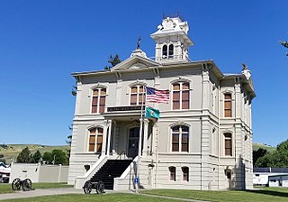
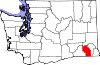
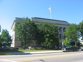
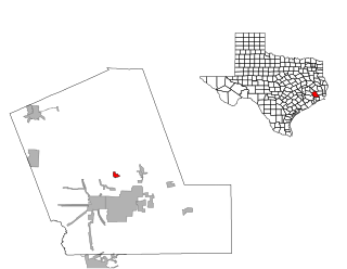
Columbia County is a county located in the U.S. state of Washington. As of the 2020 census, the population was 3,952, making it the second-least populous county in Washington. The county seat and largest city is Dayton. The county was created out of Walla Walla County on November 11, 1875, and is named after the Columbia River. Columbia County is included in the Walla Walla, WA Metropolitan Statistical Area.
Columbia City is a city in Columbia Township, Whitley County, in the U.S. state of Indiana. The population was 9,892 at the 2020 Census, up from 8,750 at the 2010 Census, estimated to be 10,064 in 2023. The city is the county seat of Whitley County, and is the largest community therein. It is part of the Fort Wayne MSA.
Dayton is a city in Webster County, Iowa, United States. The population was 772 at the time of the 2020 census.
Ramsey is a suburban city 22 miles (35 km) north-northwest of downtown Minneapolis in Anoka County, Minnesota, United States. The population was 27,646 at the 2020 census. It is a northwest suburb of the Twin Cities.
Bellbrook is a city in Greene County, Ohio, United States. The population was 7,317 at the 2020 census. It is part of the Dayton Metropolitan Statistical Area. It sits about 10.7 miles (17.2 km) southeast of Dayton.
Brookville is a small city in northwestern Montgomery County, Ohio, United States. It is a suburb of Dayton. The population was 5,989 at the 2020 census.
Englewood is a city in Montgomery County, Ohio, and a northern suburb of Dayton. The population was 13,463 at the 2020 census. It is part of the Dayton metropolitan area.
New Lebanon is a village in Montgomery County, Ohio, United States. The population was 3,796 at the 2020 census. It is part of the Dayton Metropolitan Statistical Area.
Trotwood is a city in Montgomery County, Ohio, United States. The population was 23,070 at the 2020 census. A suburb of Dayton, it is part of the Dayton metropolitan area. The city is served by the Trotwood-Madison City School District.
West Carrollton is a city in Montgomery County, Ohio, United States. A suburb of Dayton, its population was 13,129 at the 2020 census. It is part of the Dayton Metropolitan Statistical Area. The Great Miami River runs through the town and forms most of its northern border.
Eaton is a city in, and the county seat of Preble County, Ohio, United States, approximately 24 mi (38 km) west of Dayton. The population was 8,375 at the 2020 census, down 0.4% from the population of 8,407 at the 2010 census.
Dayton is a city in Yamhill County, Oregon, United States. The population was 2,678 at the 2020 census.
Daisytown is a borough in Cambria County, Pennsylvania, United States. It is part of the Johnstown, Pennsylvania Metropolitan Statistical Area. The population was 326 at the 2010 census.
Shirley Township is a township in Huntingdon County, Pennsylvania, United States. The population was 2,419 at the 2020 census.
Dayton Lakes is a city in Liberty County, Texas, United States. The population was 93 at the 2010 census. Prior to 1985 Dayton Lakes city was a developed and marketed recreational subdivision named Dayton Lake Estates. In January 1985 the corporation that marketed the original subdivision held and election of residents and when the election was successful, they petitioned the District Court in Liberty County, Texas and The City of Dayton Lakes, TX, a Non Profit Corporation, was created as a city/town. The actual document was filed and recorded on January 19, 1985. Those corporate papers are the city's legal identity.
Touchet is a census-designated place (CDP) in Walla Walla County, Washington, United States. The population was 421 at the 2010 census.
Springboro is a city in the U.S. state of Ohio. A suburb of Cincinnati and Dayton, it is located mostly in Warren County in Clearcreek and Franklin Townships; with a small portion in Miami Township in Montgomery County. The city is part of the Miami Valley. As of the 2020 census, the city had a population of 19,062.
Blackwell is a city in Coke and Nolan Counties in the U.S. state of Texas. Its population was 311 at the 2010 census.