Waterville, Washington

Last updated

Waterville
Waterville, Washington
Waterville, Washington, United States.jpg
Downtown Waterville pictured in 2018
Douglas County Washington Incorporated and Unincorporated areas Waterville Highlighted.svg
Location of Waterville, Washington
Coordinates: 47°38′52″N120°4′22″W / 47.64778°N 120.07278°W / 47.64778; -120.07278
Country United States
State Washington
County Douglas
Area
[1]
  Total0.86 sq mi (2.24 km2)
  Land0.86 sq mi (2.24 km2)
  Water0.00 sq mi (0.00 km2)
Elevation
2,625 ft (800 m)
Population
 (2020) [2]
  Total1,134
  Density1,318.60/sq mi (506.25/km2)
Time zone UTC-8 (Pacific (PST))
  Summer (DST) UTC-7 (PDT)
ZIP code
98858
Area code 509
FIPS code 53-76510
GNIS feature ID1527848 [3]
Website Town of Waterville

Waterville is a town in and the county seat of Douglas County, [4] Washington, United States which is known for its wheat industry. As a part of Douglas County, it is part of the Wenatchee-East Wenatchee metropolitan area. The population was 1,134 [2] at the 2020 census.

Contents

History

The area Waterville occupies was settled in 1883 by A.T. Greene. In 1886 he successfully encouraged land donations and the town was established under the name "Jumper's Flat." After the discovery of a large water reservoir underneath Greene's farm, the town was renamed to "Waterville." [5]

Geography

Truck in front of a wheat field near Waterville Eastern Washington Truck.jpg
Truck in front of a wheat field near Waterville

Waterville is located at 47°38′52″N120°4′22″W / 47.64778°N 120.07278°W / 47.64778; -120.07278 (47.647889, −120.072779). [6]

According to the United States Census Bureau, the town has a total area of 0.87 square miles (2.25 km2), all of it land. [7]

Like most of Eastern Washington, Waterville experiences a semi-arid climate (Köppen BSk) with cold, moist winters and hot, dry summers.

At 2,625 ft (800 m), Waterville has the highest elevation of any incorporated city or town in Washington.

Climate data for Waterville, Washington
MonthJanFebMarAprMayJunJulAugSepOctNovDecYear
Record high °F (°C)66
(19)
59
(15)
74
(23)
88
(31)
96
(36)
102
(39)
105
(41)
104
(40)
97
(36)
84
(29)
68
(20)
56
(13)
105
(41)
Mean daily maximum °F (°C)30.3
(−0.9)
36.1
(2.3)
45.7
(7.6)
57.1
(13.9)
66.2
(19.0)
73.5
(23.1)
82.7
(28.2)
81.6
(27.6)
72.0
(22.2)
58.3
(14.6)
41.1
(5.1)
31.9
(−0.1)
56.4
(13.6)
Mean daily minimum °F (°C)14.8
(−9.6)
18.9
(−7.3)
26.7
(−2.9)
34.1
(1.2)
41.0
(5.0)
47.0
(8.3)
52.5
(11.4)
52.3
(11.3)
44.6
(7.0)
34.9
(1.6)
25.1
(−3.8)
17.6
(−8.0)
34.1
(1.2)
Record low °F (°C)−30
(−34)
−25
(−32)
−10
(−23)
11
(−12)
16
(−9)
29
(−2)
32
(0)
29
(−2)
15
(−9)
4
(−16)
−21
(−29)
−33
(−36)
−33
(−36)
Average precipitation inches (mm)1.44
(37)
1.10
(28)
0.82
(21)
0.69
(18)
0.96
(24)
0.93
(24)
0.39
(9.9)
0.49
(12)
0.53
(13)
0.75
(19)
1.49
(38)
1.69
(43)
11.28
(286.9)
Average snowfall inches (cm)11.4
(29)
8.2
(21)
3.4
(8.6)
0.7
(1.8)
trace0.0
(0.0)
0.0
(0.0)
0.0
(0.0)
trace0.4
(1.0)
6.6
(17)
14.0
(36)
44.9
(114)
Source: [8]

Demographics

Historical population
CensusPop.Note
1890 293
1900 48264.5%
1910 95097.1%
1920 1,19826.1%
1930 856−28.5%
1940 9399.7%
1950 1,0137.9%
1960 1,0130.0%
1970 919−9.3%
1980 908−1.2%
1990 9959.6%
2000 1,16316.9%
2010 1,138−2.1%
2020 1,134−0.4%

2010 census

Waterville during a snow storm. PB260208.JPG
Waterville during a snow storm.

As of the 2010 census, [9] there were 1,138 people, 449 households, and 316 families residing in the town. The population density was 1,308.0 inhabitants per square mile (505.0/km2). There were 482 housing units at an average density of 554.0 per square mile (213.9/km2). The racial makeup of the town was 94.5% White, 1.1% Native American, 0.6% Asian, 0.1% Pacific Islander, 2.5% from other races, and 1.1% from two or more races. Hispanic or Latino of any race were 9.8% of the population.

There were 449 households, of which 30.3% had children under the age of 18 living with them, 57.5% were married couples living together, 9.6% had a female householder with no husband present, 3.3% had a male householder with no wife present, and 29.6% were non-families. 23.8% of all households were made up of individuals, and 12.9% had someone living alone who was 65 years of age or older. The average household size was 2.51 and the average family size was 2.98.

The median age in the town was 43.3 years. 22.8% of residents were under the age of 18; 7.4% were between the ages of 18 and 24; 21.5% were from 25 to 44; 30.5% were from 45 to 64; and 17.9% were 65 years of age or older. The gender makeup of the town was 50.4% male and 49.6% female.

2000 census

As of the 2000 census, there were 1,163 people, 433 households, and 314 families residing in the town. The population density was 1,365.4 people per square mile (528.3/km2). There were 481 housing units at an average density of 564.7 per square mile (218.5/km2). The racial makeup of the town was 90.11% White, 1.03% African American, 1.12% Native American, 0.26% Asian, 6.10% from other races, and 1.38% from two or more races. 8.77% of the population is Hispanic or Latino of any race.

There were 443 households, out of which 33.7% had children under the age of 18 living with them, 62.6% were married couples living together, 6.0% had a female householder with no husband present, and 27.3% were non-families. 24.0% of all households were made up of individuals, and 13.9% had someone living alone who was 65 years of age or older. The average household size was 2.65 and the average family size was 3.17.

In the town, the age distribution of the population shows 28.8% under the age of 18, 5.8% from 18 to 24, 23.4% from 25 to 44, 24.2% from 45 to 64, and 17.7% who were 65 years of age or older. The median age was 40 years. For every 100 females, there were 91.6 males. For every 100 females age 18 and over, there were 93.5 males.

The median income for a household in the town was $36,458, and the median income for a family was $47,386. Males had a median income of $35,375 versus $23,375 for females. The per capita income for the town was $18,880. About 5.0% of families and 7.5% of the population were below the poverty line, including 7.1% of those under age 18 and 2.8% of those age 65 or over.

Education

Waterville School District operates the town's public school.

See also

Related Research Articles

<span class="mw-page-title-main">Douglas County, Washington</span> County in Washington, United States

Douglas County is a county located in the U.S. state of Washington. As of the 2020 census, its population was 42,938. The county seat is Waterville, while its largest settlement is East Wenatchee. The county was created out of Lincoln County on November 28, 1883 and is named for American statesman Stephen A. Douglas.
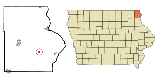
<span class="mw-page-title-main">Waterville, Iowa</span> City in Iowa, United States

Waterville is a city in Paint Creek Township, Allamakee County, Iowa, United States. The population was 109 at the time of the 2020 census.

<span class="mw-page-title-main">Robins, Iowa</span> City in Iowa, United States

Robins is a city in Linn County, Iowa, United States. The population was 3,353 at the time of the 2020 census. It is a suburb of Cedar Rapids and part of the Cedar Rapids Metropolitan Statistical Area.

<span class="mw-page-title-main">Waterville, Kansas</span> City in Marshall County, Kansas

Waterville is a city in Marshall County, Kansas, United States. As of the 2020 census, the population of the city was 658.

<span class="mw-page-title-main">Albion, Maine</span> Town in the state of Maine, United States

Albion is a town in Kennebec County, Maine, United States. The population was 2,006 at the 2020 census.
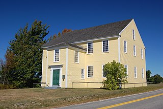
<span class="mw-page-title-main">Alna, Maine</span> Town in the state of Maine, United States

Alna is a town in Lincoln County, Maine, United States. The population was 710 at the 2020 census. Alna is home to the Wiscasset, Waterville and Farmington Railway Museum and is noted for its historic architecture, including the early mill village of Head Tide.

Moscow is a town in Somerset County, Maine, United States. The population was 475 at the 2020 census.

<span class="mw-page-title-main">Waterville, Minnesota</span> City in Minnesota, United States

Waterville is a town in Le Sueur County, Minnesota, United States. The population was 1,868 at the 2010 census. It is close to Sakatah Lake State Park on the Cannon River.

Waterville Township is a township in Le Sueur County, Minnesota, United States. The population was 742 at the 2000 census.
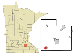
<span class="mw-page-title-main">Morristown, Minnesota</span> City in Minnesota, United States

Morristown is a city in Rice County, Minnesota, United States. The population was 949 at the 2020 census.

<span class="mw-page-title-main">Marshall, New York</span> Town in New York, United States

Marshall is a town in Oneida County, New York, United States. The population was 2,131 at the 2010 census.

<span class="mw-page-title-main">Sangerfield, New York</span> Town in New York, United States

Sangerfield is a town in Oneida County, New York, United States. The population was 2,561 at the 2010 census. The town is named after Jedediah Sanger, an early settler.

<span class="mw-page-title-main">Waterville, Ohio</span> City in Ohio, United States

Waterville is a city in Lucas County, Ohio, United States, along the Maumee River. A suburb of Toledo, the population was 6,003 at the 2020 census.
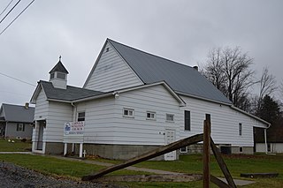
<span class="mw-page-title-main">Toby Township, Pennsylvania</span> Township in Pennsylvania, United States

Toby Township is a township in Clarion County, Pennsylvania, United States. The population was 984 at the 2020 census, a decrease from the figure of 991 in 2010 census, which was, in turn, a decline from 1,166 at the 2000 census.

<span class="mw-page-title-main">Tatum, South Carolina</span> Town in South Carolina, United States

Tatum is a town in Marlboro County, South Carolina, United States. The population was 75 at the 2010 census.

<span class="mw-page-title-main">Waterville, Vermont</span> Town in Vermont, United States

Waterville is a town in Lamoille County, Vermont, United States. The population was 686 at the 2020 census.
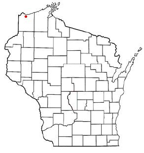
<span class="mw-page-title-main">Parkland, Wisconsin</span> Town in Wisconsin, United States

Parkland is a town in Douglas County, Wisconsin, United States. The population was 1,240 at the 2000 census. The unincorporated communities of Cutter, Parkland, Peyton, South Itasca, Sunnyside and South Range are in the town.

<span class="mw-page-title-main">Clarno, Wisconsin</span> Township in Wisconsin, United States

Clarno is a town in Green County, Wisconsin, United States. The population was 1,079 at the 2000 census. The unincorporated communities of Clarno and Schneyville are located in the town.

<span class="mw-page-title-main">Waterville, Wisconsin</span> Town in Wisconsin, United States

Waterville is a town in Pepin County, Wisconsin, United States. The population was 829 at the 2020 census. The unincorporated community of Arkansaw is located within the eastern portion of the town.

<span class="mw-page-title-main">Oakland, Maine</span> Town in the state of Maine, United States

Oakland is a town in Kennebec County in the U.S. state of Maine. The population was 6,230 at the 2020 census. Oakland is 4 miles (6 km) west of Waterville and approximately 18 miles (29 km) north of Augusta, the state capital. Waterville and Augusta are service centers for Oakland, and many Oakland residents commute to jobs in those areas.

References

  1. "2019 U.S. Gazetteer Files". United States Census Bureau. Retrieved August 7, 2020.
  2. 1 2 "2020 Census State Redistricting Data". census.gov. U.S. Census Bureau. Retrieved May 4, 2022.
  3. "US Board on Geographic Names". United States Geological Survey. October 25, 2007. Retrieved January 31, 2008.
  4. "Find a County". National Association of Counties. Retrieved June 7, 2011.
  5. Hitchman, Robert (1985). Place Names of Washington. Washington State Historical Society. p. 325. ISBN   0-917048-57-1.
  6. "US Gazetteer files: 2010, 2000, and 1990". United States Census Bureau. February 12, 2011. Retrieved April 23, 2011.
  7. "US Gazetteer files 2010". United States Census Bureau . Retrieved December 19, 2012.
  8. "WATERVILLE, WASHINGTON (459012)". Western Regional Climate Center. Retrieved March 22, 2018.
  9. "U.S. Census website". United States Census Bureau . Retrieved December 19, 2012.