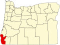
Denmark, Oregon

Last updated

Denmark, Oregon
USA Oregon location map.svg
Red pog.svg
Denmark
Location within the state of Oregon
Usa edcp location map.svg
Red pog.svg
Denmark
Denmark (the United States)
Coordinates: 42°53′26″N124°27′45″W / 42.89056°N 124.46250°W / 42.89056; -124.46250
Country United States
State Oregon
County Curry
Time zone UTC-8 (Pacific (PST))
  Summer (DST) UTC-7 (PDT)
ZIP code
97450
Area code(s) 458 and 541
GNIS feature ID1119858

Denmark is an unincorporated community in Curry County, Oregon, United States, between Bandon and Port Orford where U.S. Route 101 crosses Willow Creek. [1]

Denmark was founded by first generation Danes who developed a profitable dairy industry in the area. [2] [3] Denmark post office was established in 1882. [4] In 1915 the community had a sawmill, a cheese factory, a creamery, and a public school. [2] In 1940 Denmark had a population of 96. [5] Improvements to U.S. 101 bypassed the business district and the community went into decline. [3] The post office closed in 1960. [4] By the 1990s, the only business in Denmark was a store/gas station. [2] [3] In 2009 there was a drive-through espresso stand at the same location. [6]

Denmark was the focus of a 2009 series of articles on Oregon Public Broadcasting (OPB) about climate change that coincided with the Copenhagen Summit in the country of Denmark. [6]

Climate

This region experiences warm and dry summers, with no average monthly temperatures above 71.6 °F (22.0 °C). According to the Köppen climate classification system, Denmark has a warm-summer Mediterranean climate, abbreviated "Csb" on climate maps. [7]

Climate data for Denmark, OR
MonthJanFebMarAprMayJunJulAugSepOctNovDecYear
Record high °F (°C)73
(23)
74
(23)
77
(25)
83
(28)
94
(34)
81
(27)
89
(32)
88
(31)
93
(34)
92
(33)
79
(26)
71
(22)
94
(34)
Mean daily maximum °F (°C)55.8
(13.2)
56.4
(13.6)
57.2
(14.0)
59.2
(15.1)
63.4
(17.4)
66.1
(18.9)
70
(21)
71.3
(21.8)
70.5
(21.4)
65.6
(18.7)
59.3
(15.2)
55.6
(13.1)
62.5
(16.9)
Mean daily minimum °F (°C)41
(5)
40
(4)
40.7
(4.8)
42
(6)
45.8
(7.7)
50
(10)
52.8
(11.6)
52.7
(11.5)
49.7
(9.8)
46
(8)
43.6
(6.4)
40.7
(4.8)
45.4
(7.4)
Record low °F (°C)22
(−6)
22
(−6)
29
(−2)
30
(−1)
33
(1)
40
(4)
42
(6)
41
(5)
40
(4)
29
(−2)
28
(−2)
16
(−9)
16
(−9)
Average precipitation inches (mm)11.62
(295)
9.34
(237)
9.65
(245)
5.87
(149)
3.79
(96)
1.83
(46)
0.45
(11)
0.86
(22)
1.71
(43)
4.75
(121)
10.83
(275)
12.1
(310)
72.8
(1,850)
Average precipitation days19161815128346111819149
Source: [8]

Related Research Articles

<span class="mw-page-title-main">Valsetz, Oregon</span>

Valsetz was an unincorporated community and timber company town in Polk County, Oregon, United States, west of Falls City in the Central Oregon Coast Range. It no longer exists.

Carpenterville is an unincorporated community in Curry County, Oregon, United States. It is located on the former alignment of U.S. Route 101 known as the Roosevelt Highway, about 16 miles north of Brookings. Carpenterville was the highest point on the former main coastal highway and the area is known for its views.

<span class="mw-page-title-main">Bull Run, Oregon</span> Unincorporated community in the state of Oregon, United States

Bull Run is an unincorporated community in Clackamas County, Oregon, United States. It is located about 5 miles (8.0 km) northeast of Sandy, near the Bull Run River and the powerhouse of the defunct Mount Hood Railway and Power Company.

<span class="mw-page-title-main">Goldson, Oregon</span> Unincorporated community in the state of Oregon, United States

Goldson is an unincorporated community in Lane County, Oregon, United States on Oregon Route 36 near Bear Creek, about 3.5 miles (5.6 km) from Cheshire. Goldson post office was established in 1891 and named for the first postmaster, J. M. Goldson. It ran until 1934. The community's elevation is 404 feet (123 m).

<span class="mw-page-title-main">Cushman, Oregon</span> Unincorporated community in the state of Oregon, United States

Cushman is an unincorporated community in Lane County, Oregon, United States. It is located on the north bank of the Siuslaw River on Oregon Route 126, between Tiernan and Florence.

<span class="mw-page-title-main">Birkenfeld, Oregon</span> Unincorporated community in the state of Oregon, United States

Birkenfeld is an unincorporated community in Columbia County, Oregon, United States, in the Nehalem Valley on Oregon Route 202 between Jewell and Mist.

Pinehurst is an unincorporated community in Jackson County, Oregon, United States, on Oregon Route 66 about 25 miles (40 km) southeast of Ashland. It is along Jenny Creek near Round Prairie between the Siskiyou Mountains and the foothills of the Cascade Range.

Riverton is an unincorporated community in Coos County, Oregon, United States, on Oregon Route 42S, about 12 miles (19 km) up the Coquille River from Bandon. Route 42S is the former alignment of U.S. Route 101.

<span class="mw-page-title-main">Quincy, Oregon</span> Unincorporated community in the state of Oregon, United States

Quincy is an unincorporated community in Columbia County, Oregon, United States. It is located about 4.5 miles northeast of Clatskanie and 3.5 miles southwest of Mayger in a drained and diked area of the Columbia River lowlands.

Hamilton is an unincorporated community in Grant County, Oregon, United States. It is located on Oregon Route 402 east of Monument and west of Long Creek. As of 1993, the community had no businesses and only three houses.

Harlan is an unincorporated community in Lincoln County, Oregon, United States, about 30 miles west of Corvallis. It is located in a valley of the Central Oregon Coast Range in the Siuslaw National Forest. The community's economy was once based on logging and sawmills. Cattle ranching is another mainstay of the local economy.

Provolt is an unincorporated community in Jackson County, Oregon, United States. It is about 15 miles (24 km) southeast of Grants Pass on Oregon Route 238, near the Applegate River on the county line between Jackson and Josephine counties.

Gaylord is an unincorporated community in Coos County, Oregon, United States. It is about 12 miles (19 km) south of Myrtle Point on Oregon Route 542, near the South Fork Coquille River.

Walker is an unincorporated community in Lane County, Oregon, United States. It is located about 4 miles (6 km) north of Cottage Grove on Oregon Route 99, near the Coast Fork Willamette River.

Hamlet is an unincorporated community in Clatsop County, Oregon, United States. It is located approximately six miles southeast of Necanicum, in the Northern Oregon Coast Range near the confluence of the North Fork Nehalem River and the Little North Fork Nehalem River. It is surrounded by units of the Clatsop State Forest.

<span class="mw-page-title-main">Sitkum, Oregon</span> Unincorporated community in the state of Oregon, United States

Sitkum is an unincorporated community in Coos County, Oregon, United States. It is about 27 miles north of Remote in the Southern Oregon Coast Range near the East Fork Coquille River. Sitkum is served by the Myrtle Point post office.

<span class="mw-page-title-main">Rocky Point, Oregon</span> Unincorporated community in the state of Oregon, United States

Rocky Point is an unincorporated community in Klamath County, Oregon, United States. It is on Pelican Bay on the west shore of Upper Klamath Lake, about 29 miles (47 km) northwest of Klamath Falls and about 3 miles (5 km) north of Oregon Route 140 on Forest Highway 34. It is within the Winema National Forest.

Dora is an unincorporated community in Coos County, Oregon, United States. It is about 19 miles (31 km) east of Coquille near the East Fork Coquille River on the former route of the Coos Bay Wagon Road. It is in the Southern Oregon Coast Range.

Cascade Summit is an unincorporated community in Klamath County, Oregon, United States. It is located on the west shore of Odell Lake near Shelter Cove; about 30 miles southeast of Oakridge.

Hobsonville is an unincorporated community in Tillamook County, Oregon, United States. Although it is considered a ghost town, it is still classified as a populated place by the United States Geological Survey (USGS). Hobsonville is on the east shore of Tillamook Bay, about 2 miles south of Garibaldi via U.S. Route 101 or about a mile from Garibaldi across Miami Cove.

References

  1. "Denmark". Geographic Names Information System . United States Geological Survey, United States Department of the Interior. November 28, 1980. Retrieved October 12, 2010.
  2. 1 2 3 Friedman, Ralph (1990). In Search of Western Oregon (2nd ed.). Caldwell, Idaho: The Caxton Printers, Ltd. p. 98. ISBN   0-87004-332-3.
  3. 1 2 3 Friedman, Ralph (1993) [1972]. Oregon for the Curious (3rd ed.). Portland, Oregon: Pars Publishing Company. pp. 26–27. ISBN   0-87004-222-X.
  4. 1 2 McArthur, Lewis A.; McArthur, Lewis L. (2003) [1928]. Oregon Geographic Names (7th ed.). Portland, Oregon: Oregon Historical Society Press. p. 279. ISBN   978-0875952772.
  5. Writers' Program of the Work Projects Administration in the State of Oregon (1940). Oregon: End of the Trail. American Guide Series. Portland, Oregon: Binfords & Mort. p.  384. OCLC   4874569.
  6. 1 2 "The Denmark Project: Climate Change From Europe To The Oregon Coast". Oregon Public Broadcasting. July 1, 2009. Archived from the original on January 9, 2011. Retrieved January 13, 2010.
  7. Climate Summary for Denmark, Oregon
  8. "DENMARK 1 NNW, OR (354721)". Western Regional Climate Center. Retrieved November 26, 2015.