
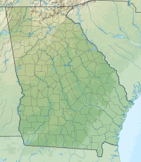
Harris County is a county located in the west-central portion of the U.S. state of Georgia; its western border with the state of Alabama is formed by the Chattahoochee River. As of the 2020 census, the population was 34,668. The county seat is Hamilton. The largest city in the county is Pine Mountain, a resort town that is home to the Franklin D. Roosevelt State Park. Harris County was created on December 14, 1827, and named for Charles Harris, a Georgia judge and attorney.

Bowdon is a city in Carroll County, Georgia, United States. As of the 2020 census, the city had a population of 2,161.

Hamilton is a city in, and the county seat of Harris County, Georgia, United States. It is part of the Columbus, Georgia-Alabama metropolitan statistical area. The population was 1,680 at the 2020 census, up from 307 at the 2000 census.

Pine Mountain is a town in Harris and Meriwether counties in the U.S. state of Georgia. As of the 2020 census it had a population of 1,216.

Madison is a city in Morgan County, Georgia, United States. It is part of the Atlanta-Athens-Clarke-Sandy Springs Combined Statistical Area. The population was 4,447 at the 2020 census, up from 3,979 in 2010. The city is the county seat of Morgan County and the site of the Morgan County Courthouse.

Cuthbert is a city in, and the county seat of, Randolph County, Georgia, United States. The population was 3,520 in 2019.

Blairsville is a city and the county seat of Union County, on the northern border of Georgia, United States. It was founded near the Nottely River, which was dammed in 1942 as part of the Tennessee Valley Authority project, forming Lake Nottely. As of the 2020 census, the city had a population of 616.

Brasstown Bald is the highest point in the U.S. state of Georgia. It is located in the northeastern part of the state in the Blue Ridge Mountains on the border between Towns and Union counties south of the city of Hiawassee. The mountain is known to the native Cherokee people as Enotah.

The Chattahoochee River forms the southern half of the Alabama and Georgia border, as well as a portion of the Florida and Georgia border. It is a tributary of the Apalachicola River, a relatively short river formed by the confluence of the Chattahoochee and Flint rivers and emptying from Florida into Apalachicola Bay in the Gulf of Mexico. The Chattahoochee River is about 430 miles (690 km) long. The Chattahoochee, Flint, and Apalachicola rivers together make up the Apalachicola–Chattahoochee–Flint River Basin. The Chattahoochee makes up the largest part of the ACF's drainage basin.

The Blue Ridge Parkway is a National Parkway and All-American Road in the United States, noted for its scenic beauty. The parkway, which is the longest linear park in the U.S., runs for 469 miles (755 km) through 29 counties in Virginia and North Carolina, linking Shenandoah National Park to Great Smoky Mountains National Park. It runs mostly along the spine of the Blue Ridge, a major mountain chain that is part of the Appalachian Mountains. Its southern terminus is at U.S. Route 441 (US 441) on the boundary between Great Smoky Mountains National Park and the Qualla Boundary of the Eastern Band of Cherokee Indians in North Carolina, from which it travels north to Shenandoah National Park in Virginia. The roadway continues through Shenandoah as Skyline Drive, a similar scenic road which is managed by a different National Park Service unit. Both Skyline Drive and the Virginia portion of the Blue Ridge Parkway are part of Virginia State Route 48 (SR 48), though this designation is not signed.

F.D. Roosevelt State Park is a 9,049 acres (36.62 km2) Georgia state park located near Pine Mountain and Warm Springs. The park is named for former U.S. President Franklin Delano Roosevelt, who sought a treatment for his paralytic illness in nearby Warm Springs at the Little White House. The park is located along the Pine Mountain Range. The western portion of the park, formerly named Pine Mountain State Park, was named a National Historic Landmark in 1997. F.D. Roosevelt State Park is Georgia's largest state park.

The Chattahoochee–Oconee National Forest in northern Georgia comprises two United States National Forests, the Oconee National Forest in eastern Georgia and the Chattahoochee National Forest located in the North Georgia Mountains. The Chattahoochee National Forest is composed of an eastern and western forest. The western forest contains Johns Mountain, Little Sand Mountain, and Taylor Ridge (Georgia). The combined total area of the Chattahoochee–Oconee National Forest is 867,265 acres (3,510 km2), of which the Chattahoochee National Forest comprises 751,069 acres (3,039 km2) and the Oconee National Forest comprises 116,196 acres (470 km2). The county with the largest portion of the eastern forest is Rabun County, Georgia, which has 148,684 acres (601.7 km2) within its boundaries.

Dick's Knob or Dicks Knob, with an elevation of 4,620 feet (1,408 m), is the third-highest peak in the State of Georgia if using a 200 ft. prominence rule. It is located in Rabun County, Georgia within the Southern Nantahala Wilderness and is the second-highest mountain in the county.

State Route 190 (SR 190) is a 16.7-mile-long (26.9 km) state highway that runs west–east mostly through F. D. Roosevelt State Park and Roosevelt's Little White House Historic Site. It is known as Scenic Heights Road and Pine Mountain Highway. It connects the Pine Mountain area and Manchester. It parallels the Pine Mountain Range for much of its length.

The Pine Mountain Range is a long ridge in Meriwether County, Georgia, Harris County, Georgia, and Talbot County, Georgia. The highest altitudes in all three of these west Georgia counties can be found along the range.
Pine Mountain Valley is located in Harris County, Georgia, United States. Its ZIP code is 31823.

 bronze statue of Franklin D. Roosevelt
 detail of statue
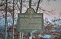 historical marker
 historical marker

