DuPont, Washington

Last updated

DuPont, Washington
DuPont WA dynamite train in Robinson Park.jpg
DuPont dynamite train exhibit in DuPont Village
DuPont, Washington official flag.png
DuPont, Washington emblem.png
Pierce County Washington Incorporated and Unincorporated areas DuPont Highlighted.svg
Location of DuPont, Washington
Coordinates: 47°5′57″N122°38′15″W / 47.09917°N 122.63750°W / 47.09917; -122.63750
CountryUnited States
State Washington
County Pierce
IncorporatedApril 15, 1951 [1]
Government
  Type Mayor–Council
   Mayor Ronald Frederick
   Deputy Mayor Mike Winkler [2]
Area
[3]
  Total5.85 sq mi (15.15 km2)
  Land5.82 sq mi (15.07 km2)
  Water0.03 sq mi (0.08 km2)
Elevation
249 ft (76 m)
Population
 (2020) [4]
  Total10,151
  Estimate 
(2021) [5]
10,112
  Density1,635.33/sq mi (631.41/km2)
Time zone UTC-8 (PST)
  Summer (DST) UTC-7 (PDT)
ZIP code
98327
Area code 253
FIPS code 53-18965
GNIS feature ID1513919 [6]
Website dupontwa.gov

DuPont is a city in Pierce County, Washington, United States. The population was 10,151 at the 2020 census. [4] Originally a company town, the city is named after the DuPont chemical company which operated an explosives manufacturing plant in the area from 1909 to 1975. [1]

Contents

History

There was a Native American presence in the area for the last 10,000 years. At the time of contact the Nisqually Tribe lived in relative peace and prosperity in their aboriginal homeland of about two million acres (810,000 ha) near the present-day towns of Olympia, Tenino, and DuPont, and extending to Mount Rainier. Tribal life changed radically with the advent of Euro-American settlement about 150 years ago. Forced to compromise its interests and rights over the years, the Tribe always sought to maintain its integrity and dignity. [7] Subsisting on shellfish from the beaches and salmon from Sequalitchew Creek. Captain George Vancouver mapped the area in 1792, and in 1833, the Hudson's Bay Company established a fur trading post at Fort Nisqually as a halfway point between Ft. Vancouver and Ft. Langley. The fort was relocated upstream in 1843. [8] It was relocated to expand on the fort to house more workers and to have better access to fresh water. [9] Charles Wilkes of the United States Exploring Expedition held the first American Independence Day celebration west of the Mississippi River in the present-day DuPont area on July 5, 1841.

The first school in the area was the Nisqually Methodist Mission school, which operated from 1840 through 1842. Chloe A. Clark was appointed teacher at the school. [10] The first public school was established in 1852. By 1869, the Hudson Bay Company had to sell the land to the U.S. government for $650,000. [11] The Oregon Treaty of 1846 gave the land of the Oregon Territory to the U.S. but still allowed the HBC to continue operating in the area. American farmers in the area resented this decision and pushed out the company by establishing their own market place and squatting on company land. By 1865, there were about 150 illegal squatters on company property who would harass the livestock of the Hudson's Bay Company. A few of the farmers urged Congress to remove the fort as well as the Puget Sound Agricultural Company from the Pacific Northwest. [11] [12] These conditions made it hard to continue operations in the region so the fort was closed.

The land was up for grabs once Hudson's Bay Company left and many farmers bought the land. In 1906, the DuPont chemical company purchased a 5-square-mile (13 km2) area from the farmers for construction of an explosives plant, as the company was in the midst of expanding into the west. The plant was built on the initial 1833 Ft. Nisqually site and was completed in 1909. [1] During its nearly 70-year history, the plant produced dynamite for the U.S. military as well as for the construction of various civilian projects including the Grand Coulee Dam, the Alcan Highway, and the Panama Canal. [13]

A company town was set up about a mile east of the explosives manufacturing facility. By 1909, the village had two houses for the plant managers and 58 houses for the workers, which increased to over 100 houses by the end of 1917. [1] The village was re-designated as the town of DuPont on March 26, 1912, but it was not officially incorporated as a town until 1951, when the company started selling the houses to the employees. [1] The original company town, roughly bounded by Santa Cruz St, Penniman St, Brandywine Ave, and DuPont Ave, was added to the National Register of Historic Places as the DuPont Village Historic District in 1987. [14]

The dynamite plant was shut down in 1975 and the land was subsequently purchased by the Weyerhaeuser company for $12 million. The initial plan was to use the 3,000 acres (1,200 ha) of land to construct a lumber export plant, but the company eventually decided to further develop the town under a New Urbanism model. [15] DuPont, Weyerhaeuser, and the state Department of Ecology began decontamination of the original explosives plant site in 1991, with a golf course being built on the former location of the plant. [16] In recent years, DuPont has undergone a transformation with the realization of the modern planned community of "Northwest Landing". The city is expected to have a built-out population of more than 12,000.

In 1975, the midden for the Sequalitchew Archeological site was added to the National Register of Historic Places, it being the oldest known midden in Washington. [13]

Present day

DuPont remains a growing community. The elementary school in DuPont, Chloe Clark Elementary (which hosted kindergarten through fifth grade), reached capacity in the 2007–2008 school year. As a result, starting from the following school year, Steilacoom Historical School District realigned all three elementary schools. Chloe Clark Elementary and Cherrydale Primary in Steilacoom now only have students from grades K-3. Saltar's Point Elementary in Steilacoom now serves 4th and 5th grades. Pioneer Middle School relocated from Steilacoom to DuPont in August 2008. The new school received the LEED award for its "Green" Design elements. [17]

DuPont is divided into several subdivisions, each with its own design style and/or building contractors. Northwest Landing is the most visible due to a sign along the freeway drawing attention to it. Several businesses have opened in the downtown area, but development has slowed in recent years. Hoffman Hill is the largest in area, and houses about 60% of the total population. The Historic Village, a residential area which is on the registry of historic places, is the only part of DuPont that is not a modern planned community. Bell Hill is considered the most expensive area of the city. DuPont features trails and green belts throughout, and is about 95% built-out according to the master plan. [18]

On December 18, 2017, an Amtrak train derailed near DuPont, killing three people and injuring more than 100 others.

Geography

DuPont is located at 47°05′57″N122°38′15″W / 47.099070°N 122.637544°W / 47.099070; -122.637544 (47.099070, -122.637544). [19]

According to the United States Census Bureau, the city has a total area of 5.88 square miles (15.23 km2), of which 5.86 square miles (15.18 km2) is land and 0.02 square miles (0.05 km2) is water. [20]

Sequalitchew Creek trail and beach

Within the city limits of DuPont, next to the city hall, lies the Sequalitchew Creek trail which can be accessed by the old narrow gauge railway roadbed which ran from the old Powderworks plant to Puget Sound. The trail leads to Sequalitchew Beach. The creek corridor hosts hundreds of species, including bald eagles, hawks, McKay's bunting, song birds, herons, ducks, owls, frogs, salamanders, snakes, beaver, raccoons, coyotes, deer, and rabbits. The waters off Sequalitchew Beach are inhabited by harbor seals, marbled murrelet and gray whales. [21] [22]

Other trails and wildlife areas

DuPont's other trails and its parks offer similar access to wildlife and exceptional opportunities for outdoor activity. The trail and greenbelt system provides a wide cross-section of DuPont's geographic and natural environments, while maintaining an urban feel. Full maps can be obtained from the visitor center, city hall, and the history museum. [23]

Demographics

Historical population
CensusPop.Note
1920 600
1960 354
1970 3848.5%
1980 55945.6%
1990 5925.9%
2000 2,452314.2%
2010 8,199234.4%
2020 10,15123.8%
2021 (est.)10,112 [5] −0.4%
U.S. Decennial Census [24]
2020 Census [4]

2010 census

As of the 2010 census, [25] there were 8,199 people, 3,023 households, and 2,185 families residing in the city. The population density was 1,399.1 inhabitants per square mile (540.2/km2). There were 3,241 housing units at an average density of 553.1 per square mile (213.6/km2). The racial makeup of the city was 68.7% White, 8.1% African American, 0.5% Native American, 10.2% Asian, 1.1% Pacific Islander, 2.6% from other races, and 8.9% from two or more races. Hispanic or Latino of any race were 9.7% of the population.

There were 3,023 households, of which 47.6% had children under the age of 18 living with them, 58.0% were married couples living together, 11.6% had a female householder with no husband present, 2.7% had a male householder with no wife present, and 27.7% were non-families. 24.0% of all households were made up of individuals, and 6.9% had someone living alone who was 65 years of age or older. The average household size was 2.71 and the average family size was 3.27.

The median age in the city was 32 years. 33.4% of residents were under the age of 18; 5.2% were between the ages of 18 and 24; 37.1% were from 25 to 44; 17.2% were from 45 to 64; and 7.1% were 65 years of age or older. The gender makeup of the city was 47.2% male and 52.8% female.

2000 census

As of the 2000 census, there were 2,452 people, 936 households, and 670 families residing in the city. The population density was 430.6 inhabitants per square mile (166.3/km2). There were 977 housing units at an average density of 171.6 inhabitants per square mile (66.3/km2). The racial makeup of the city was 74.63% White, 8.20% African American, 0.82% Native American, 7.34% Asian, 0.69% Pacific Islander, 2.24% from other races, and 6.08% from two or more races. Hispanic or Latino of any race were 6.36% of the population.

There were 936 households, out of which 40.1% had children under the age of 18 living with them, 63.8% were married couples living together, 6.0% had a female householder with no husband present, and 28.4% were non-families. 23.2% of all households were made up of individuals, and 3.7% had someone living alone who was 65 years of age or older. The average household size was 2.61 and the average family size was 3.12.

In the city, the population was spread out, with 29.9% under the age of 18, 5.0% from 18 to 24, 40.8% from 25 to 44, 17.8% from 45 to 64, and 6.5% who were 65 years of age or older. The median age was 32 years. For every 100 females, there were 93.7 males. For every 100 females age 18 and over, there were 94.2 males.

The median income for a household in the city was $52,969, and the median income for a family was $57,202. Males had a median income of $42,946 versus $36,741 for females. The per capita income for the city was $22,742. About 2.2% of families and 4.6% of the population were below the poverty line, including 3.5% of those under age 18 and 2.5% of those age 65 or over.

Education

The city is in the Steilacoom Historical School District. [26] Steilacoom High School is the district's comprehensive high school.

Related Research Articles

<span class="mw-page-title-main">Pierce County, Washington</span> County in Washington, United States

Pierce County is a county in the U.S. state of Washington. As of the 2020 census, the population was 921,130, up from 795,225 in 2010, making it the second-most populous county in Washington, behind King County, and the 59th-most populous in the United States. The county seat and largest city is Tacoma. Formed out of Thurston County on December 22, 1852, by the legislature of Oregon Territory, it was named for U.S. President Franklin Pierce. Pierce County is in the Seattle metropolitan area.

<span class="mw-page-title-main">Mayes County, Oklahoma</span> County in Oklahoma, United States

Mayes County is a county located in the U.S. state of Oklahoma. As of the 2020 census, the population was 39,046. Its county seat is Pryor Creek. Named for Samuel Houston Mayes, Principal Chief of the Cherokee Nation from 1895 to 1899, it was originally created at the Sequoyah Convention in August 1905.

<span class="mw-page-title-main">Delaware City, Delaware</span> City in Delaware, United States

Delaware City is a city in New Castle County, Delaware, United States. The population was 1,885 as of 2020. It is a small port town on the eastern terminus of the Chesapeake and Delaware Canal and is the location of the Forts Ferry Crossing to Fort Delaware on Pea Patch Island.

<span class="mw-page-title-main">Greenville, Delaware</span> CDP in Delaware, United States

Greenville is a bedroom community in New Castle County, Delaware, United States, and a suburb of Wilmington. The population was 2,326 at the 2010 census. For statistical purposes, the United States Census Bureau has defined Greenville as a census-designated place (CDP). The community is also home to the private residence of Joe Biden, the 46th and current president of the United States, and many Du Pont family descendants.

<span class="mw-page-title-main">Dupo, Illinois</span> Village in Illinois, United States

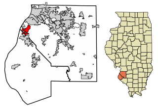
Dupo is a village in St. Clair County, Illinois, United States. The population was 4,138 at the 2010 census, an increase from 3,933 in 2000. The village was settled in about 1750 and was incorporated in 1907. Its modern name, adopted in the early 20th century, is shortened from Prairie du Pont.

<span class="mw-page-title-main">Hudson, Iowa</span> City in Iowa, United States

Hudson is a city in Black Hawk County, Iowa, United States. The population was 2,546 at the time of the 2020 census. The rural community of Hudson has grown in recent years and is included as a part of the Waterloo-Cedar Falls Metropolitan Statistical Area.

<span class="mw-page-title-main">Camden, South Carolina</span> City in South Carolina, United States

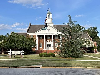
Camden is the largest city and county seat of Kershaw County, South Carolina. The population was 7,764 in the 2020 census, and the 2022 population estimate is 8,213. It is part of the Columbia, South Carolina, Metropolitan Statistical Area. Camden is the oldest inland city in South Carolina, and home to the Carolina Cup and the National Steeplechase Museum.

<span class="mw-page-title-main">Buckley, Washington</span> City in Washington, United States

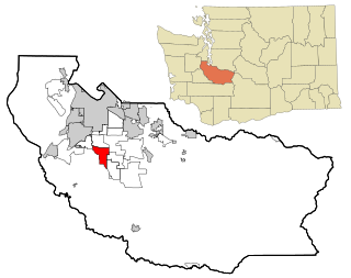
Buckley is a city in Pierce County, Washington, United States, founded in 1882. The population was 5,114 at the 2020 census. Buckley sits below Mount Rainier and is well known for hosting the annual Log Show.

<span class="mw-page-title-main">Eatonville, Washington</span> Town in Washington, United States

Eatonville is a town in Pierce County, Washington, United States. It is 32 mi (51 km) south of Tacoma. The population was 2,845 at the 2020 census. The town motto is "Better Together".

<span class="mw-page-title-main">Edgewood, Washington</span> City in Washington, United States

Edgewood is a city in Pierce County, Washington, United States. The population was 12,327 at the 2020 census. Neighboring towns include Fife to the west, Milton to the northwest, Federal Way to the north, Sumner to the east, and Puyallup to the south.

<span class="mw-page-title-main">Fox Island, Washington</span> CDP in Washington, United States

Fox Island is an island and census-designated place (CDP) in Pierce County, Washington, United States, in Puget Sound. It is located approximately 5 miles (8 km) from Gig Harbor. The island was named Fox by Charles Wilkes during the United States Exploring Expedition, to honor J.L. Fox, an assistant surgeon on the expedition. The population was 3,633 at the 2010 census.

<span class="mw-page-title-main">Lakewood, Washington</span> City in Washington, United States

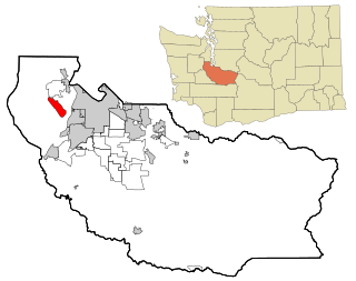
Lakewood is a city in Pierce County, Washington, United States. The population was 63,612 at the 2020 census.

<span class="mw-page-title-main">Spanaway, Washington</span> CDP in Washington, United States

Spanaway is a census-designated place (CDP) in Pierce County, Washington, United States. The population was 35,476 at the 2020 census, up from 27,227 in 2010. Spanaway is an unincorporated area near Tacoma, and is often identified together with the more urban, less wealthy Parkland.

<span class="mw-page-title-main">Steilacoom, Washington</span> Town in Washington, United States

Steilacoom is a town in Pierce County, Washington, United States. The population was 6,727 at the 2020 census. Steilacoom incorporated in 1854 and became the first incorporated town in what is now the state of Washington. It has also become a bedroom community for service members stationed at Joint Base Lewis–McChord, aka McChord AFB and Fort Lewis.

<span class="mw-page-title-main">Nisqually Reservation</span> CDP in Washington, United States

The Nisqually Reservation, also known as Nisqually Indian Reservation is a federally recognized Indian reservation in Thurston County, Washington, United States. The population was 668 at the 2020 census.

<span class="mw-page-title-main">Yelm, Washington</span> City in Washington, United States

Yelm is a city in Thurston County, Washington, United States. Its population was 10,617 at the 2020 census.

<span class="mw-page-title-main">Belle, West Virginia</span> Town in West Virginia, United States

Belle is a town in Kanawha County, West Virginia, United States, situated along the Kanawha River. The population was 1,171 at the 2020 census. Belle was incorporated on December 13, 1958, by the Kanawha County Circuit Court. It is the home of the Belle Bulldogs Elementary School.

<span class="mw-page-title-main">Vienna, West Virginia</span> City in West Virginia, United States

Vienna is a city in Wood County, West Virginia, United States, situated along the Ohio River. The population was 10,676 at the 2020 census. It is the second-largest city in the Parkersburg–Vienna metropolitan area.

<span class="mw-page-title-main">Barksdale, Wisconsin</span> Town in Wisconsin, United States

Barksdale is a town in Bayfield County, Wisconsin, United States. The population was 723 at the 2010 census. The unincorporated community of Barksdale is located in the town. The town was named by William G. Ramsay, the chief engineer for the DuPont Chemical Company, for Hamilton M. Barksdale, vice president of DuPont.

<span class="mw-page-title-main">Fort Nisqually</span> United States historic place

Fort Nisqually was an important fur trading and farming post of the Hudson's Bay Company in the Puget Sound area, part of the Hudson's Bay Company's Columbia Department. It was located in what is now DuPont, Washington. Today it is a living history museum located in Tacoma, Washington, USA, within the boundaries of Point Defiance Park. The Fort Nisqually Granary, moved along with the Factor's House from the original site of the second fort to this park, is a U.S. National Historic Landmark. Built in 1843, the granary is the oldest building in Washington state and one of the only surviving examples of a Hudson's Bay Company "post-and-plank" structure. The Factor's House and the granary are the only surviving Hudson's Bay Company buildings in the United States.

References

  1. 1 2 3 4 5 The DuPont Era, DuPont Museum Archived August 18, 2011, at the Wayback Machine
  2. "City Council". City of DuPont. Retrieved March 25, 2022.
  3. "2019 U.S. Gazetteer Files". United States Census Bureau. Retrieved August 7, 2020.
  4. 1 2 3 "Explore Census Data". United States Census Bureau . Retrieved May 16, 2022.
  5. 1 2 "City and Town Population Totals: 2020-2021". United States Census Bureau. June 22, 2022. Retrieved June 22, 2022.
  6. "US Board on Geographic Names". United States Geological Survey. October 25, 2007. Retrieved January 31, 2008.
  7. "Nisqually Indian Tribe :: Heritage".
  8. Hudson's Bay Company Era, DuPont Museum Archived July 10, 2011, at the Wayback Machine
  9. Carpenter, Cecelia (1986). Fort Nisqually: A Documented History of Indian and British Interaction. Tacoma, WA: Tahoma Research Publication. pp. 120–121. ISBN   978-0-9616969-0-0.
  10. "Official DuPont Washington Museum Website". Archived from the original on August 18, 2011. Retrieved January 17, 2011.
  11. 1 2 Crooks, Drew (2001). In Past Reflections: Essays on the Hudson's Bay Company in the Southern Puget Sound Region. Tacoma, WA: Ft. Nisqually Foundation. pp. 46–54.
  12. Galbraith, John (1950). "The British and Americans at Fort Nisqually, 1846-1859". The Pacific Northwest Quarterly. 41 (2): 109–120. JSTOR   40487610.
  13. 1 2 Creighton, Janet (2004). Cultural Resources in Conflict: Historic Preservation and Private Property at Northwest Landing, DuPont, WA. Ann Arbor, MI.{{cite book}}: CS1 maint: location missing publisher (link)
  14. "Historic Village". DuPont Historical Museum. Retrieved September 4, 2019.
  15. Veninga, Catherine (2004), "Spatial Prescriptions and Social Realities: New Urbanism and the Production of Northwest Landing", Urban Geography, 25 (4): 458–482, doi:10.2747/0272-3638.25.5.458, S2CID   145225052
  16. "About The Home Course". The Home Course. Retrieved September 4, 2019.
  17. Steilacoom School District Timeline, 2008 Entry Archived April 9, 2010, at the Wayback Machine
  18. City of DuPont Master Building Plan Archived October 5, 2011, at the Wayback Machine
  19. "US Gazetteer files: 2010, 2000, and 1990". United States Census Bureau. February 12, 2011. Retrieved April 23, 2011.
  20. "US Gazetteer files 2010". United States Census Bureau. Archived from the original on July 2, 2012. Retrieved December 19, 2012.
  21. "Sequalitchew Creek Council". Archived from the original on January 28, 2011. Retrieved January 17, 2011.
  22. Weyerhaueser Export Facility Plan, Final Environmental Impact Statement
  23. Parks and Recreation in DuPont Archived August 19, 2010, at the Wayback Machine
  24. United States Census Bureau. "Census of Population and Housing" . Retrieved July 25, 2013.
  25. "U.S. Census website". United States Census Bureau . Retrieved December 19, 2012.
  26. U.S. Census Bureau Geography Division (December 23, 2009). 2020 Census – School District Reference Map: Pierce County, WA (PDF) (Map). 1:80,000. U.S. Census Bureau. p. 3. Retrieved July 20, 2022.