Wilkeson, Washington

Last updated

Wilkeson, Washington
Entrance sign in Wilkeson.jpg
Pierce County Washington Incorporated and Unincorporated areas Wilkeson Highlighted.svg
Location of Wilkeson, Washington
Coordinates: 47°6′25″N122°2′54″W / 47.10694°N 122.04833°W / 47.10694; -122.04833 [1]
CountryUnited States
State Washington
County Pierce
Area
[2]
  Total0.47 sq mi (1.21 km2)
  Land0.47 sq mi (1.21 km2)
  Water0.00 sq mi (0.00 km2)
Elevation
804 ft (245 m)
Population
 (2020) [3]
  Total499
  Density1,103.00/sq mi (425.68/km2)
Time zone UTC-8 (Pacific (PST))
  Summer (DST) UTC-7 (PDT)
ZIP code
98396
Area code 360
FIPS code 53-78925
GNIS feature ID1528154 [4]

Wilkeson is a town in Pierce County, Washington, United States. The population was 499 at the 2020 census. [3]

Contents

History

Downtown Wilkeson Wilkeson, Washington.jpg
Downtown Wilkeson
Holy Trinity Orthodox Church, built 1900, is a legacy of the many Eastern Europeans who came to work in the mines and quarries around Wilkeson. Wilkeson, WA - Holy Trinity Orthodox Church 07.jpg
Holy Trinity Orthodox Church, built 1900, is a legacy of the many Eastern Europeans who came to work in the mines and quarries around Wilkeson.

Settlers searching for coal arrived in the area that became Wilkeson in the 1870s. [5] By 1877, a Northern Pacific Railway line transported coal to Tacoma. Northern Pacific Railway president Henry Villard hired geologist Bailey Willis to direct field explorations of the coal fields around Wilkeson. [6] Much of the property of Wilkeson was purchased by Northern Pacific Railway, with the remaining part of town known as Hope. In 1885, coke ovens were built by the Wilkeson Coal and Coke Company. In addition to coal, Wilkeson shipped timber and sandstone across Washington. [5]

Wilkeson was officially incorporated on July 18, 1909. The town is named for Samuel Wilkeson, father of journalist and pioneer settler Frank Wilkeson. [7]

At its peak, Wilkeson had a newspaper, cigar factory, two electric plants, two theaters, two bakeries, and a bottling plant. Much of the town burned down in 1910 and 1912 fires. By 1937, coke production in Wilkeson had ended. [5]

Although it was known as a ghost town for a time, people began moving to Wilkeson in the late 20th century, many who commute to Enumclaw, Bellevue, and Seattle for work. Town improvements are paid for by a 160-acre tree farm managed by the town. Its new sewage treatment plant includes 900 feet of sewer lines replaced by volunteers. [5] During this time, town management and activities were marked by a tension between a preservationist faction and an environmentalist faction. [5]

Geography

According to the United States Census Bureau, the town has a total area of 0.47 square miles (1.22 km2), all of it land. [8]

The community is situated between the town of Carbonado and the unincorporated community of Burnett. The city of Buckley is situated approximately 5 miles to the north.

Wilkeson is located near to the northwest corner of Mt. Rainier National Park. Access to the park is attainable south of the town at an entrance point at the Carbon River. Unimproved roads from the east of Wilkeson plunge deep into the park. One Road, FS 7720 leads to within 200 yards (180 m) of the Wilderness Boundary.

Surrounding places Blank map.svg
Surrounding places
Map pointer black.svg Wilkeson
Small-city-symbol.svg Buckley (5.1 mi, 8.2 km)
Small-city-symbol.svg Carbonado (2.3 mi, 3.7 km)
Small-city-symbol.svg Enumclaw (9.0 mi, 14.0 km)
Small-city-symbol.svg Orting (13.0 mi, 20.9 km)
Small-city-symbol.svg Prairie Ridge (8.4 mi, 13.5 km)
Small-city-symbol.svg South Prairie (5.2 mi, 8.3 km)

Climate

This region experiences warm (but not hot) and dry summers, with no average monthly temperatures above 71.6 F (22 C). According to the Köppen Climate Classification system, Wilkeson has a warm-summer Mediterranean climate, abbreviated "Csb" on climate maps. [9]

Demographics

Historical population
CensusPop.Note
1880 104
1910 899
1920 803−10.7%
1930 448−44.2%
1940 369−17.6%
1950 3864.6%
1960 4126.7%
1970 317−23.1%
1980 316−0.3%
1990 36615.8%
2000 3957.9%
2010 47720.8%
2020 4994.6%
U.S. Decennial Census [10]
2020 Census [3]
Wilkeson Town Hall 2011-10-27, Wilkeson Town Hall, Wilkeson, Washington, 01.jpg
Wilkeson Town Hall

Wilkeson was once much larger, boasting a population of 1,437 in the 1910 census.

Evans Creek ORV (Off Road Vehicle) park at the base of Mt. Rainier, Washington, near the end of SR165. EvansCreekORV.jpg
Evans Creek ORV (Off Road Vehicle) park at the base of Mt. Rainier, Washington, near the end of SR165.

2010 census

As of the census [11] of 2010, there were 477 people, 169 households, and 129 families living in the town. The population density was 1,014.9 inhabitants per square mile (391.9/km2). There were 175 housing units at an average density of 372.3 per square mile (143.7/km2). The racial makeup of the town was 96.2% White, 0.6% African American, 0.4% Native American, 2.3% from other races, and 0.4% from two or more races. Hispanic or Latino of any race were 3.4% of the population.

There were 169 households, of which 40.2% had children under the age of 18 living with them, 58.0% were married couples living together, 13.0% had a female householder with no husband present, 5.3% had a male householder with no wife present, and 23.7% were non-families. 21.3% of all households were made up of individuals, and 5.3% had someone living alone who was 65 years of age or older. The average household size was 2.82 and the average family size was 3.20.

The median age in the town was 33.9 years. 29.4% of residents were under the age of 18; 9% were between the ages of 18 and 24; 25.1% were from 25 to 44; 28.9% were from 45 to 64; and 7.5% were 65 years of age or older. The gender makeup of the town was 50.9% male and 49.1% female.

2000 census

As of the census of 2000, there were 395 people, 140 households, and 100 families living in the town. The population density was 810.0 people per square mile (311.2/km2). There were 150 housing units at an average density of 307.6 per square mile (118.2/km2). The racial makeup of the town was 95.95% White, 1.01% Native American, and 3.04% from two or more races. Hispanic or Latino of any race were 1.52% of the population.

There were 140 households, out of which 38.6% had children under the age of 18 living with them, 58.6% were married couples living together, 10.7% had a female householder with no husband present, and 27.9% were non-families. 20.7% of all households were made up of individuals, and 9.3% had someone living alone who was 65 years of age or older. The average household size was 2.82 and the average family size was 3.37.

In the town, the age distribution of the population shows 30.4% under the age of 18, 10.4% from 18 to 24, 28.1% from 25 to 44, 21.8% from 45 to 64, and 9.4% who were 65 years of age or older. The median age was 35 years. For every 100 females, there were 91.7 males. For every 100 females age 18 and over, there were 97.8 males.

The median income for a household in the town was $44,375, and the median income for a family was $46,875. Males had a median income of $38,250 versus $31,458 for females. The per capita income for the town was $17,481. About 2.0% of families and 4.0% of the population were below the poverty line, including none of those under age 18 and 18.2% of those age 65 or over.

Arts and culture

Events

Wilkeson hosts the National Handcar Races annually on the third Saturday in July. [12]

Historic buildings and sites

The town is home to the Holy Trinity Orthodox Church, the oldest Orthodox church in Washington state, and the Wilkeson School, a schoolhouse built in 1909 and listed on the National Register of Historic Places.

There are several existing relics from Wilkeson's mining past, including bee hive coke ovens, a gated mine shaft on Wilkeson Creek and an abandoned concrete coal works. [13] The 30 remaining coke ovens from the town's early involvement in the coal industry are listed on the National Register of Historic Places. [5]

Related Research Articles

<span class="mw-page-title-main">West Blocton, Alabama</span> Town in Alabama, United States

West Blocton is a town in Bibb County, Alabama, United States. At the 2020 census, the population was 1,217. The current mayor is Daniel Sims.

<span class="mw-page-title-main">Dora, Alabama</span> City in Alabama, United States

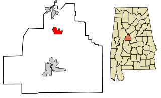
Dora is a city in Walker County, Alabama, United States.

<span class="mw-page-title-main">Bonanza, Arkansas</span> City in Arkansas, United States

Bonanza is a city in Sebastian County, Arkansas, United States. It is part of the Fort Smith, Arkansas-Oklahoma Metropolitan Statistical Area. At the 2010 Census, the population of Bonanza was 575. According to the 2018 US Census Bureau estimates, the population of Bonanza was 564. Bonanza began as a coal mining town of the Central Coal and Coke company.

<span class="mw-page-title-main">New Miami, Ohio</span> Village in Ohio, United States

New Miami is a village in St. Clair Township, located in central Butler County in the southwestern part of the U.S. state of Ohio. The population was 2,217 at the 2020 census.

<span class="mw-page-title-main">Leetonia, Ohio</span> Village in Ohio, United States

Leetonia is a village in northern Columbiana County, Ohio, United States. The population was 1,833 at the 2020 census. It is part of the Salem micropolitan area, about 16 miles (26 km) south of Youngstown.

<span class="mw-page-title-main">Howe, Oklahoma</span> Town in Oklahoma, United States

Howe is a town in Le Flore County, Oklahoma, United States. It is part of the Fort Smith, Arkansas-Oklahoma Metropolitan Statistical Area. The population was 802 at the 2010 census, a gain of 15.1 percent over the figure of 697 recorded in 2000. The town was once noted for producing coal and coke, but today is chiefly supported by agriculture.

<span class="mw-page-title-main">Carbon Township, Pennsylvania</span> Township in Pennsylvania, United States

Carbon Township is a township in Huntingdon County, Pennsylvania, United States. As of the 2020 census, the township population was 318.

<span class="mw-page-title-main">Calumet-Norvelt, Pennsylvania</span> Unincorporated community in Pennsylvania, United States

Calumet-Norvelt was a census-designated place (CDP) in Westmoreland County, Pennsylvania, United States. The community was divided into the two separate communities of Calumet and Norvelt for the 2010 census. Although the US Census treats Calumet and Norvelt as a single community, they are in reality two very different communities, each reflecting a different chapter in how the Great Depression affected rural Pennsylvanians. Calumet was a typical "patch town", built by a single company to house its miners as cheaply as possible. The closing of the Calumet mine during the Great Depression caused enormous hardship in an era when unemployment compensation and welfare payments were non-existent. On the other hand, Norvelt was created during the depression by the US federal government as a model community, intended to increase the standard of living of laid-off coal miners.

<span class="mw-page-title-main">Washington Township, Westmoreland County, Pennsylvania</span> Township in Pennsylvania, United States

Washington Township is a township in Westmoreland County, Pennsylvania, United States. It was founded in 1789 from Salem Township. At that time, it included the present-day municipalities of Allegheny, Lower Burrell, Upper Burrell, and most of Bell. In 2020, the population of Washington Twp was 6,887.

<span class="mw-page-title-main">Coalmont, Tennessee</span> City in Tennessee, United States

Coalmont is a city in Grundy County, Tennessee, United States. Established in 1904, the city has an area of 6 square miles. The population was 841 at the 2010 census.

<span class="mw-page-title-main">Dunlap, Tennessee</span> City in Tennessee, United States

Dunlap is a city in and the county seat of Sequatchie County, Tennessee, United States. The population was 5,357 at the 2020 census and 4,815 at the 2010 census.

<span class="mw-page-title-main">Hobart, Washington</span> Census-designated place in Washington, United States

Hobart is an unincorporated community and census-designated place (CDP) in King County, Washington, United States. The population was 6,767 at the 2020 census.

<span class="mw-page-title-main">Ravensdale, Washington</span> Census-designated place in Washington, United States

Ravensdale is a census-designated place (CDP) in King County, Washington, United States. The population was 555 at the 2020 census.

<span class="mw-page-title-main">Buckley, Washington</span> City in Washington, United States

Buckley is a city in Pierce County, Washington, United States, founded in 1882. The population was 5,114 at the 2020 census. Buckley sits below Mount Rainier and is well known for hosting the annual Log Show.

<span class="mw-page-title-main">Carbonado, Washington</span> Town in Washington, United States

Carbonado is a town in Pierce County, Washington, United States. It is located near the Carbon River in the north of the county, approximately 50 miles (80 km) southeast of Seattle. Carbonado is the last town before entering Mount Rainier National Park and is also a popular spot for off-roading. The town also served as an important coal mining community in the late nineteenth and early twentieth centuries, when the town operated the largest coal mine in Pierce County. The population was 734 at the 2020 census.

<span class="mw-page-title-main">Junior, West Virginia</span> Town in West Virginia, United States

Junior is a town in Barbour County, West Virginia, United States, situated along the Tygart Valley River. The population was 384 at the 2020 census.

<span class="mw-page-title-main">Gassaway, West Virginia</span> Town in West Virginia, United States

Gassaway is a town in Braxton County, West Virginia, United States. The population was 769 at the 2020 census. Gassaway was incorporated in 1905 and named for Henry Gassaway Davis, the Democratic Party's nominee for Vice President of the United States in 1904. The center of population of West Virginia is located approximately 7 miles (11 km) north of Gassaway.

<span class="mw-page-title-main">Farmington, West Virginia</span> Town in West Virginia, United States

Farmington is a town in Marion County, West Virginia, United States. The population was 389 at the 2020 census. The small town is situated on Buffalo Creek and the Allegheny Mountains about 6 miles west of Fairmont, Marion County's county seat. It is best known for being the site of the 1968 Farmington Mine disaster.

<span class="mw-page-title-main">Davy, West Virginia</span> Town in West Virginia, United States

Davy is a town in McDowell County, West Virginia, United States. The population was 420 at the 2010 census. Founded in 1873, the town was originally called Hallsville but the name would change to Davy by 1901. Davy was officially incorporated in 1948. It is a mostly residential community in a coal mining district along the main line of the Norfolk Southern Railway.

<span class="mw-page-title-main">Gary, West Virginia</span> City in West Virginia, United States

Gary is a city located along the Tug Fork River in McDowell County, West Virginia, United States. According to the 2020 census, the city had a population of 762. It was named for Elbert Henry Gary, one of the founders of U.S. Steel. The former coal towns of Elbert, Filbert, Thorpe, and Wilcoe became part of Gary at the time of its incorporation in 1971.

References

  1. "US Gazetteer files: 2010, 2000, and 1990". United States Census Bureau. February 12, 2011. Retrieved April 23, 2011.
  2. "2019 U.S. Gazetteer Files". United States Census Bureau. Retrieved August 7, 2020.
  3. 1 2 3 "2020 Census Redistricting Data (Public Law 94-171) Summary File". American FactFinder. United States Census Bureau . Retrieved May 16, 2022.
  4. "US Board on Geographic Names". United States Geological Survey. October 25, 2007. Retrieved January 31, 2008.
  5. 1 2 3 4 5 6 Hatcher, Candy (October 25, 2000). "Double Life of an Old Ghost Town". Seattle Post-Intelligencer. p. A1. ProQuest   385572841.
  6. Haines, Aubrey (1999). Mountain fever: historic conquests of Rainier. Seattle: University of Washington Press. pp. 58–59. ISBN   0-295-97847-3. OCLC   41619403.
  7. "Frank Wilkeson biography". 2020 Skagit River Journal home. June 6, 2011. Retrieved January 5, 2022.
  8. "US Gazetteer files 2010". United States Census Bureau . Retrieved December 19, 2012.
  9. Climate Summary for Wilkeson, Washington
  10. United States Census Bureau. "Census of Population and Housing" . Retrieved July 25, 2013.
  11. "U.S. Census website". United States Census Bureau . Retrieved December 19, 2012.
  12. "Wilkeson National Handcar Races | Town of Wilkeson".
  13. "Wilkeson Coke Ovens | Town of Wilkeson".