Dupont Circle is a historic roundabout park and neighborhood of Washington, D.C., located in Northwest D.C. The Dupont Circle neighborhood is bounded approximately by 16th Street NW to the east, 22nd Street NW to the west, M Street NW to the south, and Florida Avenue NW to the north. Much of the neighborhood is listed on the National Register of Historic Places. However, the local government Advisory Neighborhood Commission and the Dupont Circle Historic District have slightly different boundaries.

Kalorama is a neighborhood in Northwest Washington, D.C., United States. It includes the Kalorama Triangle Historic District and Sheridan-Kalorama Historic District. It is named after the Kalorama mansion.

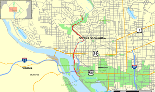
The Rock Creek and Potomac Parkway, informally called the Rock Creek Parkway, is a parkway maintained by the National Park Service as part of Rock Creek Park in Washington, D.C. It runs next to the Potomac River and Rock Creek in a generally north–south direction, carrying four lanes of traffic from the Lincoln Memorial and Arlington Memorial Bridge north to a junction with Beach Drive near Connecticut Avenue at Calvert Street, N.W., just south of the National Zoological Park.

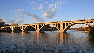
The Francis Scott Key Bridge, more commonly known as the Key Bridge, is a six-lane reinforced concrete arch bridge conveying U.S. Route 29 (US 29) traffic across the Potomac River between the Rosslyn neighborhood of Arlington County, Virginia, and the Georgetown neighborhood of Washington, D.C. Completed in 1923, it is Washington's oldest surviving road bridge across the Potomac River.

Connecticut Avenue is a major thoroughfare in the Northwest quadrant of Washington, D.C., and suburban Montgomery County, Maryland. It is one of the diagonal avenues radiating from the White House, and the segment south of Florida Avenue was one of the original streets in Pierre (Peter) Charles L'Enfant's plan for Washington. A five-mile segment north of Rock Creek was built in the 1890s by a real-estate developer.

The Taft Bridge is a historic bridge located in the Northwest quadrant of Washington, D.C. It carries Connecticut Avenue over the Rock Creek gorge, including Rock Creek and the Rock Creek and Potomac Parkway, connecting the neighborhoods of Woodley Park and Kalorama. It is named after former United States president and Supreme Court Chief Justice William Howard Taft, and sits to the southwest of the Duke Ellington Bridge.

The Dumbarton Bridge, also known as the Q Street Bridge and the Buffalo Bridge, is a historic masonry arch bridge in Washington, D.C.

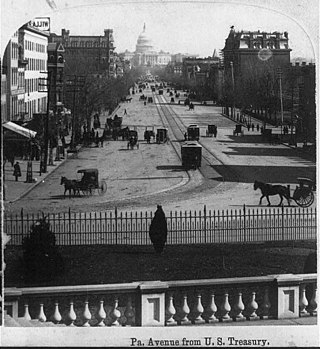
Streetcars in Washington, D.C. transported people across the city and region from 1862 until 1962.

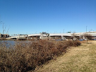
The 11th Street Bridges are a complex of three bridges across the Anacostia River in Washington, D.C., United States. The bridges convey Interstate 695 across the Anacostia to its southern terminus at Interstate 295 and DC 295. The bridges also connect the neighborhood of Anacostia with the rest of the city of Washington.

The Rock Creek Railway, which operated independently from 1890 to 1895, was one of the first electric streetcar companies in Washington, D.C., and the first to extend into Maryland.

Barney Circle is a small residential neighborhood located between the west bank of the Anacostia River and the eastern edge of Capitol Hill in southeast Washington, D.C., in the United States. The neighborhood is characterized by its sense of community, activism, walkability, and historic feel. The neighborhood's name derives from the eponymous former traffic circle Pennsylvania Avenue SE just before it crosses the John Philip Sousa Bridge over the Anacostia. The traffic circle is named for Commodore Joshua Barney, Commander of the Chesapeake Bay Flotilla in the War of 1812.
The Capital Traction Company was the smaller of the two major street railway companies in Washington, D.C., in the early 20th century.

The Washington and Georgetown Railroad Company was the first streetcar company to operate in Washington, D.C., United States. It was incorporated and started operations in 1862, using horse-drawn cars on tracks between Georgetown and the Navy Yard. Two additional lines ran on 7th Street NW/SW and 14th Street NW. In 1890, it switched to cable cars. On September 21, 1895, the company was purchased by the Rock Creek Railway and the two formed the Capital Traction Company.

The P Street Bridge or Lauzun's Legion Bridge is a 336-foot (102 m) concrete arch bridge that conveys P Street across Rock Creek and Rock Creek Park between the Georgetown and Dupont Circle neighborhoods of Northwest Washington, D.C. Built in 1935, it replaced an older iron truss bridge.

The Pennsylvania Avenue Bridge conveys Pennsylvania Avenue across Rock Creek and the adjoining Rock Creek and Potomac Parkway, between the neighborhoods of Georgetown and Foggy Bottom in Northwest Washington, D.C. Pennsylvania Avenue terminates at M Street immediately west of the bridge.

P Street refers to four different streets within the city of Washington, D.C. The streets were named by President George Washington in 1791 as part of a general street naming program, in which east–west running streets were named alphabetically and north–south running streets numerically.

The H Street/Benning Road Line is a currently operating line of DC Streetcar. It has eight stations and began operation on February 27, 2016. The 2.4-mile (3.9 km) line runs along H Street NE and Benning Road NE in Washington, D.C. In September 2016 service was increased from six days a week to seven, and with shorter 12-minute headways.

The West Sixth Street Bridge is a historic stone arch bridge in downtown Austin, Texas. Built in 1887, the bridge is one of the state's oldest masonry arch bridges. It is located at the site of the first bridge in Austin, carrying Sixth Street across Shoal Creek to link the western and central parts of the old city. The bridge was added to the National Register of Historic Places in 2014.

The Chevy Chase Land Company is a real estate holding and development company based in suburban Washington, D.C.


