Last updated Two Rock Creek Railway electric streetcars sit at 18th and U Streets, the line's original Washington, D.C. terminus, in 1893.The Rock Creek Railway streetcar line is shown on this 1897 map of property owned by the Chevy Chase Land Company.
Created to increase the value of land owned by the Chevy Chase Land Company, the railroad began service in 1890. By 1893, it stretched more than seven miles from the Cardoza/Shaw neighborhood of D.C. to Coquelin Run in Maryland. The trip from Chevy Chase to downtown took about 35 minutes.[2]
In 1895, the railroad purchased the Washington and Georgetown Railroad Company and changed its name to the Capital Traction Company, which would become one of the two major streetcar companies that operated in and around Washington, D.C., in the early decades of the 20th century. The line fostered the development of several neighborhoods of northwest Washington, D.C., and suburban Maryland.
History
Construction of the viaduct across Rock Creek, ca. 1891Looking east from Connecticut Avenue NW towards the Calvert Street Bridge, ca. 1920A streetcar runs through modern-day Cleveland Park, ca. 1903, near the site of the Uptown TheaterConnecticut Ave. north from Bradley Lane, ca. 1910Waiting room and office at Chevy Chase Lake, the railroad's northern terminus, 1914
The Rock Creek Railway was founded by Francis Newlands as part of a plan to develop streetcar suburbs in northwestern D.C. and adjacent Maryland. He and his partners incorporated the company on June 23, 1888 (just four days after D.C.'s first electric trolley company, the Eckington and Soldiers' Home Railway).[3] The railroad's officers were the same as the Chevy Chase Land Company's: Newlands, president; Edward J. Stellwagen, vice-president; Howard S. Nyman, secretary; Thomas M. Gale, treasurer, and A. J. Warner, manager.[1]
In 1890, the railroad began operations on its first quarter-mile of track, connecting Connecticut Avenue NW and 18th Street NW along Florida Avenue (recently renamed from Boundary Street). Overhead trolley poles were forbidden in this part of the city, so the railroad used the Love conduit system between the rails to provide power to the cars.[1] (These original tracks would be removed in 1899 as the city's streetcar network developed.[4])
Meanwhile, the Land Company was extending Connecticut Avenue, down whose center the railroad would run, from the Rock Creek valley past the D.C.-Maryland line and into the land that would become Chevy Chase, Maryland. “The road bed, after leaving the improved streets of the city, was constructed with great difficulty, and at an enormous expense. Connecticut Avenue (extended) having as yet been unimproved, and the country being very rugged, a succession of deep cuts and fills were necessary, as well as the bridging of several deep ravines," wrote Electrical World. Some 454,000 cubic yards were removed, including 242,000 of solid rock, 97,000 of loose rock, 32,000 of hard pan, and 83,000 of earth: an average of 75,000 cubic yards for each of the six miles.[5] One iron overhead-cable pole manufactured by John A. Roebling’s Sons Co. was set every 125 feet[5], and a bridge was built to carry road and track across Klingle Ford Road.[4]
But the major engineering work was bridging Rock Creek. The company hired the Edge Moor Iron Works[6] to build an iron truss bridge at Cincinnati Street NW (now Calvert Street NW). The 775-foot, 1,226-ton bridge, whose six trusses sat on 125-foot-high iron trestles,[7] was officially completed on July 21, 1891. On the previous day, the railroad, under the terms of its charter, had transferred both of its bridges to the city of Washington, D.C.[4] (In 1911, the rickety Rock Creek bridge would be shored up by narrowing its roadway from 40 feet to 25 and adding timber cribbing, which would in 1922 be replaced by steel joints and asphalt surface.[8] The bridge itself would be replaced in 1935 by the Duke Ellington Bridge;[7] to minimize traffic disruption, the trestle was moved 80 feet downstream on rollers and kept in use until the new bridge was completed, whereupon it was demolished on December 17 of that year[8].)
On September 16, 1892, service opened on a six-mile extension of the line that made the Rock Creek Railway the first D.C.-based streetcar to reach Maryland. The tracks ran from the original terminus at U Street NW up 18th Street through the neighborhood today known as Adams Morgan, where it formed a junction with the Metropolitan Railroad at Columbia Road.[4][9] Turning west along Erie Street (today's Calvert Street), the line crossed the Rock Creek bridge, then ran north-northwest along the recently graded extension of Connecticut Avenue NW north of Rock Creek.[1][10] The line continued on Connecticut to the District line at Chevy Chase Circle, then on trackage built by Newlands' Chevy Chase Land Company 1.7 miles due north to just past Coquelin Run in today's unincorporated Chevy Chase, Maryland.[4]
The line ended just south of the grade crossing of the Baltimore and Ohio Railroad's Georgetown Branch at Connecticut Avenue. Here the Rock Creek built a terminus complex that included a small station and the railroad's six-track car barn. Coquelin Run, a small tributary of Rock Creek, was dammed to create a lake to supply water to the railroad's northern power house.[11] This generating plant, which burned coal that arrived on a B&O siding, used the Thomson-Houston system installed by General Electric to deliver electricity to streetcars via overhead poles. The poles—ornamented iron within the city and a mile beyond, square post lumber for the remaining mile—drove streetcars all the way to 18th and U Streets.[1][12][13]
Congress approved two proposed extensions on April 30, 1892. One was a northern spur to the National Zoo that was never built,[3] but the authorization to lay track east along Florida Avenue to North Capital Street was eventually used.[4]
On March 2, 1893, the Rock Creek Railway opened a 1-mile extension that ran from its former terminus at 18th and Florida east along U Street NW through the neighborhood of Shaw to 7th Street NW. This double-track line, which used the Love conduit system,[13] intersected with several downtown lines and made Adams Morgan more readily accessible from downtown.[10]
The price for a single streetcar ride was 5 cents, or 6 rides for 25 cents. (It would rise to 7 cents in 1919.)[14]
To boost ridership, the line advertised its route past the National Zoological Park, which opened in 1889.[1] And like many streetcar companies, the Chevy Chase Land Company built its own trolley park: Chevy Chase Lake Amusement Park, which opened on 1894 just east of Connecticut Avenue at the railroad's northern terminus. A central feature was the power house's artificial lake, landscaped for boating.[14]
One more source of passenger traffic was the Chevy Chase Lake & Kensington Railway (later, the Kensington Railway Company), a streetcar line that opened in 1895 and ran two winding miles north from the Rock Creek's terminus to the town of Kensington.
Expansion
On March 1, 1895, Congress authorized the Rock Creek Railway to purchase the Washington and Georgetown Railroad as part of an attempt to consolidate the streetcar system. Negotiations in August led to a deal in which the RCR issued stock with a total par value of $12,000,000,[15] of which $10,750,000 was given to W&G stockholders.[16] The actual value of RCR stock and bonds at the time was $1,500,000 ($52,760,000 today[17]).[15]
On September 21, 1895, the two formed the Capital Traction Company, the first company created during "the great streetcar consolidation."[18][19] The deal also took advantage of a peculiar facet of the Rock Creek Railway, whose revenues were rather sparse but whose charter placed no limits on the amount of money that might be raised through the sale of stock and bonds. "This providential clause was turned to good advantage in the reorganization of the prosperous Washington and Georgetown Railroad which was severely crippled by its fixed capital ceiling of only $500,000", according to a 1966 history of D.C. streetcars.[20]
In 1923, Capital Traction gained the right to run its streetcars on the tracks of the Kensington Railway, which allowed it to operate through service from downtown D.C. through Chevy Chase Lake to Norris Station in Kensington.
Twelve years later, Capital Traction was given permission to replace streetcars on the Chevy Chase line with buses. The last streetcars ran on September 15, 1935. The trolley poles, safety domes, and most of the waiting stations were removed the following week. The tracks remained for several years, but when the Export Control Act was passed barring the sale of most scrap metal to Japan it had a loophole for old rails, which made Rock Creek rail very lucrative. At that point, the tracks in Maryland were pulled up and sold to Japan by the state of Maryland. It's likely the tracks were melted down for use in the Japanese war effort.[23]
In 1937, the disused car barn at Chevy Chase Lake was converted into an equestrian riding ring for a polo club led by Mildred Pepper, wife of Sen. Claude Pepper, D-Florida.[24][25]
In 1980, the Chevy Chase Lake waiting station at the northern end of the line was disassembled and moved to Hyattstown, Maryland.[23]
1 2 3 4 5 6 Bolles, F.G. (January 14, 1893). "The Rock Creek Railway". The Electrical World. 22 (2): 23–26. Archived from the original on September 26, 2023. Retrieved September 26, 2023– via HathiTrust.
↑ "A Streetcar City". National Museum of American History. 2017-02-28. Archived from the original on 2023-09-26. Retrieved 2023-09-26.
1 2 Bolles, F.G. (January 14, 1893). "The Rock Creek Railway". The Electrical World. 22 (2): 23–26. Archived from the original on September 26, 2023. Retrieved September 26, 2023– via HathiTrust.
↑ "Erection of the Rock Creek Viaduct". The Engineering Record. 29: 37. December 16, 1893. Archived from the original on September 24, 2023. Retrieved September 24, 2023– via HathiTrust.
Chevy Chase is the colloquial name of an area that includes a town, several incorporated villages, and an unincorporated census-designated place in southern Montgomery County, Maryland; and one adjoining neighborhood in northwest Washington, D.C. Most derive from a late-19th-century effort to create a new suburb that its developer dubbed Chevy Chase after a colonial land patent.
In the United States, trolley parks, which started in the 19th century, were picnic and recreation areas along or at the ends of streetcar lines in most of the larger cities. These were precursors to amusement parks. Trolley parks were often created by the streetcar companies to give people a reason to use their services on weekends.
Chevy Chase is a neighborhood in northwest Washington, D.C. It borders Chevy Chase, Maryland.
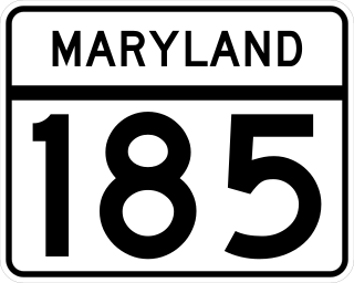
Maryland Route 185 is a state highway in the U.S. state of Maryland. Known as Connecticut Avenue, the state highway runs 8.30 mi (13.36 km) from Chevy Chase Circle at the Washington, D.C., border north to MD 97 in Aspen Hill. MD 185 serves as a major north-south commuter route in southern Montgomery County, connecting the District of Columbia with the residential suburbs of Chevy Chase, Kensington, and Wheaton.
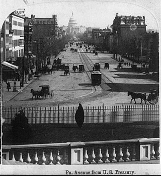
Connecticut Avenue is a major thoroughfare in the Northwest quadrant of Washington, D.C., and suburban Montgomery County, Maryland. It is one of the diagonal avenues radiating from the White House, and the segment south of Florida Avenue was one of the original streets in Pierre (Peter) Charles L'Enfant's plan for Washington. A five-mile segment north of Rock Creek was built in the 1890s by a real-estate developer.
Francis Griffith Newlands was an American politician and land developer who served as United States representative and Senator from Nevada and a member of the Democratic Party.
Streetcars in Washington, D.C. transported people across the city and region from 1862 until 1962.
The Capital Crescent Trail (CCT) is a 7.04-mile (11.33 km), shared-use rail trail that runs from Georgetown in Washington, D.C., to Bethesda, Maryland. An extension of the trail from Bethesda to Silver Spring along a route formerly known as the Georgetown Branch Trail is being built as part of the Purple Line light rail project.
The National Capital Trolley Museum (NCTM) is a 501(c)(3) nonprofit organization that operates historic street cars, trolleys and trams for the public on a regular schedule. Located in Montgomery County, Maryland, the museum's primary mission is to preserve and interpret the history of the electric street and interurban railways of the National Capital region.
Streetcars and interurbans operated in the Maryland suburbs of Washington, D.C., between 1890 and 1962.
The Capital Traction Company was the smaller of the two major street railway companies in Washington, D.C., in the early 20th century.
The Washington and Georgetown Railroad Company was the first streetcar company to operate in Washington, D.C., United States. It was incorporated and started operations in 1862, using horse-drawn cars on tracks between Georgetown and the Navy Yard. Two additional lines ran on 7th Street NW/SW and 14th Street NW. In 1890, it switched to cable cars. On September 21, 1895, the company was purchased by the Rock Creek Railway and the two formed the Capital Traction Company.
The Washington Railway and Electric Company (WRECo) was the larger of the two major streetcar companies in Washington, D.C., and its Maryland suburbs in the early decades of the 20th century.
The Metropolitan Railroad was the second streetcar company to operate in Washington, D.C., the capital city of the United States. It was incorporated and started operations in 1864, running from the Capitol to the War Department and along H Street NW in downtown. It added lines on 9th Street NW, on 4th Street SW/SE, along Connecticut Avenue to Dupont Circle, to Georgetown, to Mount Pleasant and north along Georgia Avenue. In the late 19th century, it was purchased by the Washington Traction and Electric Company and on February 4, 1902, became a part of the Washington Railway and Electric Company.
Western Avenue is one of three boundary streets between Washington, D.C., and the state of Maryland. It follows a southwest-to-northeast line, beginning at Westmoreland Circle in the south and ending at Oregon Avenue NW in the north. It is roughly 3.5 miles (5.6 km) in length. First proposed in 1893, it was constructed somewhat fitfully from about 1900 to 1931.
Chevy Chase Lake was a trolley park in southern Montgomery County, Maryland, that operated from 1894 until the mid-1930s. It was created by the Chevy Chase Land Company, which sought to draw residents of Washington, D.C., to its nascent suburb of Chevy Chase. Its eponymous lake was formed by the 1892 damming of Coquelin Run, a tributary of Rock Creek. The lake gave its name to the neighborhood that grew up near it in unincorporated Chevy Chase.
The Chevy Chase Land Company is a real estate holding and development company based in suburban Washington, D.C.
The Chevy Chase Lake & Kensington Railway was a streetcar company that operated in southern Montgomery County, Maryland, from 1895 to 1935. It connected the town of Kensington to the northern terminus of the Rock Creek Railway at Chevy Chase Lake. At its peak, it operated on about 3.75 miles of track, including the associated Sandy Spring Railway.
A trio of streetcar companies provided service along a single 10-mile line from the Washington, D.C., neighborhood of Georgetown northward and ultimately to Rockville, Maryland, in the early decades of the 20th century.
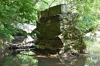
Coquelin Run is a tributary of Rock Creek in Montgomery County, Maryland. It rises in the Town of Chevy Chase, runs for about two miles while draining an area of 1,095 acres, and debouches in Rock Creek in unincorporated Chevy Chase.
This page is based on this Wikipedia article Text is available under the CC BY-SA 4.0 license; additional terms may apply. Images, videos and audio are available under their respective licenses.