U Street (Washington, D.C.)

Last updated

U Street Corridor
Lincoln theatre dc (cropped).jpg
Ben's Chili Bowl, 1213 U St., NW, Washington, D.C LCCN2010641780 (cropped).tif
1200 block of U Street NW.jpg
1602-1612 U Street NW.jpg
The DC Center for the LGBT Community Open House 33791 (11037646554) (cropped).jpg
Top: Lincoln Theatre (left) and Ben's Chili Bowl (right); middle: view of U Street; bottom: U Street by 16th Street (left) and U Street by 14th Street (right)
Coordinates: 38°55′01″N77°01′59″W / 38.917046°N 77.03293°W / 38.917046; -77.03293
Country United States
District Washington, D.C.
WardWard 1
Government
  Councilmember Brianne Nadeau (Ward 1)
Area
  Total.2 sq mi (0.5 km2)
Population
 (2017)
  Total5,385
  Density26,732/sq mi (10,321/km2)
Website https://washington.org/dc-neighborhoods/u-street

The U Street Corridor or Greater U Street, sometimes known as Cardozo/Shaw, is a neighborhood in Washington, D.C., located in Northwest D.C. Centered along U Street, the neighborhood is one of Washington's most popular nightlife and entertainment districts, as well as one of the most significant African American heritage districts in the country. [1]

Contents

The area was largely built after the U.S. Civil War and with the arrival of the Washington streetcar system in the 1880s, the neighborhood development boomed. By 1920, the neighborhood was predominantly African-American and flourished as the "Black Broadway", the heart of African-American culture in Washington. [2] [1] The area declined for a period following the 1968 Washington riots, but recovered following the 1991 opening of the U Street station of the Washington Metro. Since the 2000s, the area has been subject to significant urban redevelopment and gentrification. [3]

History

19th century

View of 19th-century Victorian rowhomes on Wallach Place. Wallach street row houses seen from the northwest (cropped).jpg
View of 19th-century Victorian rowhomes on Wallach Place.

U Street is a largely Victorian-era neighborhood, developed between 1862 and 1900, the majority of which has been designated as the Greater U Street historic district.

At the time of the Civil War, the area was woods and open fields. The Union command chose this area for military encampments including Camp Barker near 13th and R streets and others in what is now the Shaw neighborhood proper. The encampments were safe havens for freed slaves fleeing the South, and thus the area became a popular one for African Americans to settle. [4]

After the war, horse-drawn streetcar lines opened, running north from downtown Washington along 7th, 9th and 14th streets, [5] making the area an easily accessible place to live. The lines were later turned into cable cars. Both blacks and whites lived here, gradually shifting to a predominantly African American population between 1900 and 1920. [4] The area's oldest buildings are Italianate, Second Empire and Queen Anne-style row houses built rapidly by speculative developers in response to the city's high demand for housing with the post-Civil War growth of the federal government.

Early 20th century

Bohemian Caverns hosted acts like Duke Ellington and Miles Davis. Bohemian Caverns.jpg
Bohemian Caverns hosted acts like Duke Ellington and Miles Davis.

Until the 1920s, when it was overtaken by Harlem, the U Street Corridor was home to the nation's largest urban African American community. [6] The area was home to the Industrial Bank, the city's oldest African American-owned bank, [7] and to hundreds of black-owned and black-friendly businesses, churches, theaters, gyms, and other community spaces. Natives of the area included jazz musician Duke Ellington, opera singer Lillian Evanti, surgeon Charles R. Drew, and law professor Charles Hamilton Houston. [7]

In its cultural heyday – roughly consisting of the years between 1900 and the early 1960s [7] – the U Street Corridor was known as "Black Broadway", a phrase coined by singer Pearl Bailey. [8] Performers who played the local clubs of the era included Cab Calloway, Louis Armstrong, Miles Davis, Sarah Vaughan, Billie Holiday, and Jelly Roll Morton, among many others. [9]

Thurgood Marshall Center 12th Street YMCA Building.JPG
Thurgood Marshall Center

During Prohibition, U Street was also home to many of the capital's 2,000-3,000 speakeasies, which some historians credit for helping integrate a city long divided between black and white. [10]

From 1911 to 1963, the west end of the U Street neighborhood was anchored by Griffith Stadium, home of the District's baseball team, the Washington Senators. The Lincoln Theatre opened in 1921, and Howard Theatre in 1926. [11] Duke Ellington's childhood home was located on 13th street between T and S Streets.

The Green Book, a travel guide for black travelers (1933–1963) listed many sites along U Street NW by Green Book Travelers. [12]

Late 20th century

The Reeves Center, built in 1986. Frank D. Reeves Municipal Center - Washington, D.C.jpg
The Reeves Center, built in 1986.

While the area remained a cultural center for the African American community through the 1960s, the neighborhood began to decline following the assassination of Martin Luther King Jr. on 4 April 1968. The intersection of 14th Street and U Street was the epicenter of violence, 13 deaths and damage to 1,200 homes and businesses during the 1968 Washington, D.C. riots, which rampaged for four days after King's murder. [13] Following the riots, and the subsequent flight of affluent residents and businesses from the area, the corridor became blighted. [14] Drug trafficking rose dramatically in the mid-1970s, when the intersection of 14th and U Streets was an area of drug trafficking in Washington, D.C. [15]

The African American Civil War Memorial, dedicated in 1991. 2016.04.16 Emancipation Day - African American Civil War Memorial 04-22 (25971393673).jpg
The African American Civil War Memorial, dedicated in 1991.

Following the economic downturn the area faced following the 1968 riots, the community and DC government launched numerous redevelopment efforts, such as the construction of the Reeves Center in 1986, the opening of the U Street station in 1991, and the 1998 Department of Housing and Urban Development grants funding "Remembering U Street" signage marking 15 historic properties and as façade improvements to 150 dilapidated storefronts on U and 14th streets [16]

In the 1990s, revitalization of Adams Morgan and later Logan Circle began. More than 2,000 luxury condominiums and apartments were constructed between 1997 and 2007. As the area improved and became more attractive Washingtonians of all races and ethnicities, and of higher incomes and wealth, to live there, the ethnic mix of the neighborhood changed dramatically: in 2000 it was roughly 20% white and 60% black; while by 2010 that had reversed and the it was roughly 60% white and 20% black.

21st century

Redevelopment continued further into the 2000s and 2010s, [14] along with rising concerns about gentrification. [17]

Since 2013 numerous large mixed use residential buildings with retail on the ground floor have been built into the corridor. [18] This represents a significant population increase versus the population of 4,572 registered in the 2010 census.

In 2011, U Street NW was designated a Great Street among Great Places in America by the American Planning Association. It is said to have been selected for in recognition of the street return to its grandeur after several decades of difficulties. Once again, the street hosts the arts, food, and businesses. The community works to embrace its historical significance for the African American community of Washington, D.C. during segregation. [19]

On January 4, 2021, the book "Black Broadway" by DC author and journalist Briana A. Thomas was published by The History Press [20] Thomas narrates U Street's rich and unique history, from the early triumph of emancipation to the days of civil rights pioneer Mary Church Terrell and music giant Duke Ellington, through the recent struggles of gentrification.

Geography

Historic architecture U St & 16th St. 1600 U Street NW.jpg
Historic architecture U St & 16th St.

The U Street Corridor is bounded by:

In addition to U Street itself, the intersecting 14th Street is a major retail, dining, and entertainment corridor. Retailers located on 14th near U include Room and Board, West Elm, and Lululemon.

Name

The area is often referred to as the U Street Corridor, [1] [2] and has been known by other names:

Demographics

The True Reformer Building True reformer building (cropped).jpg
The True Reformer Building

Figures are for Census tract 44 through 2017, which was split into tracts 44.01 (north of U Street) and 44.02 (south of U street) as of the 2020 census. [25]

Demographic2020 census2010 census2000 census1990 census1980 census
Total pop.6,1854,5722,4502,9513,598
Children (under 18)6.8%27%
Seniors (65+)4.8%8.6%
Citizen (of over 18 pop.)
NH White63.3%60.8%22%8.7%
NH Black13.4%21.5%58%77%
Asian & Pacific Islander6.8%1.7%1.6%
Asian8.3% (NH)
Pacific Islander & Native Hawaiian0.05% (NH)
Some other race0.53% (NH)
Two or more races5.2% (NH)2.7%
Hispanic9.2%9.1%17%12%

NH = non-Hispanic, NHPI = does not include Native Hawaiians and Pacific Islanders

The Southern Aid Society-Dunbar Theater Building, built in 1921. Dunbar Theatre Washington DC.JPG
The Southern Aid Society–Dunbar Theater Building, built in 1921.

Census tract 44 was bounded by 14th, S, and 7th streets and Florida Av. NW, thus including the entire U Street Corridor plus four blocks east of 9th St. NW. As of 2020, it was divided into tracts 44.01 and 44.02 along U Street. This area counted a population of 5,385 in the more than double the 1990 population. The official census count was 4,572 in 2010, an 87% increase from only 2,450 in 2000, thus reversing the trend of a decreasing population from 2,951 in 1990 and 3,598 in 1980.

The racial change in the tract's population has been dramatic; non-Hispanic Black residents who were once the dominant group in the area, were only 13% of the population in 2020, down from 22% in 2010, and sharply down from 58% in 2000 and 77% in 1990; corresponding to an increase in whites and Asians: the white non-Hispanic population was 63% in 2020, 61% in 2010, 22% in 2000, 8.7% in 1990. The Asian/Pacific Islander population was 8.3%, a continued increase from 6.8% in 2010, and much higher than 1.7% in 2000 and 1.6% in 1990. The Hispanic population was 9.2% in 2020, relatively stable vs. 9.1% in 2010, but down from 17% in 2000 and 12% in 1990. [26]

Community Change headquarters 1536 U Street, N.W. (cropped).JPG
Community Change headquarters

The 2017 American Community Survey [3] showed 6.8% of the area's residents were children in 2010, sharply down from 27% in 1990. Seniors also showed a decline at 4.8% in 2010, down from 8.6% in 1990. The foreign-born population was 18% in 2011–15, up from only 2.3% in 1980. [26]

The per capita income in 2017 was est. $110,175 ±$10,961, more than double the average in D.C. ($50,832 ±$645); the Median household income was est. $166,071, more than$166,071, more than double the D.C. average of $77,649. [3]

Landmarks

Greater U Street Historic District
2235 - 2245 13th Street, N.W. (cropped).jpg
Location Boundary map
Architectural styleVarious (approximately 1580 contributing properties) [27]
NRHP reference No. 98001557 [28]
Added to NRHPDecember 31, 1998

The neighborhood's landmark buildings are nearly all the works of prominent early 20th century African American architects, including: [29]

Other landmarks include:

Culture

The Funk Parade is held annually on U Street, since 2013. 2016.05.07 Funk Parade Washington, DC USA 04659 (26888655665).jpg
The Funk Parade is held annually on U Street, since 2013.

U Street has long been a center of Washington's music scene, with the Lincoln Theatre (1922), Howard Theatre, Bohemian Caverns (1926), and other clubs like on 9th Street at Harrington's, and Chez Maurice Restaurants and historic jazz venues. The 9:30 Club, the Black Cat, DC9, U Street Music Hall, and the Velvet Lounge musical venues are located on the corridor. [33]

U Street also hosts the annual Funk Parade, a festival and celebration of funk music, community arts, and creativity. Public art, street art or graffiti and murals can be found on almost every corner along U Street.

Transportation

The Corridor is served by the U Street station of the Washington Metro (subway), with service on the Green Line. WMATA buses run along both U and 14th streets, and the DC Circulator Woodley Park-Adams Morgan-McPherson Square line stops at 14th and U. Capital Bikeshare and various scooter-sharing systems have stations/vehicles in the area.

See also

Related Research Articles

<span class="mw-page-title-main">Adams Morgan</span> Neighborhood of Washington, D.C.

Adams Morgan, commonly abbreviated as AdMo, is a neighborhood in Washington, D.C., located in Northwest D.C. Adams Morgan is noted as a historic hub for counterculture and as an arts district. It is also known for its popular entertainment district and culinary scene, centered on both 18th Street and Columbia Road.

<span class="mw-page-title-main">U Street station</span> Washington Metro station

U Street station is a rapid transit station on the Green Line of the Washington Metro in the U Street neighborhood of Washington, D.C.

<span class="mw-page-title-main">Mount Pleasant (Washington, D.C.)</span> Neighborhood of Washington, D.C.

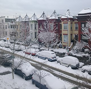
Mount Pleasant is a neighborhood in Washington, D.C., located in Northwest D.C. The neighborhood is primarily residential, with restaurants and stores centered along a commercial corridor on Mt. Pleasant Street. Mount Pleasant is known for its unique identity and multicultural landscape, home to diverse groups such as the punk rock, the Peace Corps and Hispanic Washingtonian communities.

<span class="mw-page-title-main">Northwest (Washington, D.C.)</span> Quadrant in the United States

Northwest is the northwestern quadrant of Washington, D.C., the capital of the United States, and is located north of the National Mall and west of North Capitol Street. It is the largest of the four quadrants of the city, and it includes the central business district, the Federal Triangle, and the museums along the northern side of the National Mall, as well as many of the District's historic neighborhoods.

<span class="mw-page-title-main">Columbia Heights (Washington, D.C.)</span> Neighborhood of Washington, D.C.

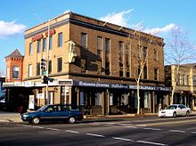
Columbia Heights is a neighborhood in Washington, D.C., located in Northwest D.C. The neighborhood is an important retail hub for the area, as home to DC USA mall and to numerous other restaurants and stores, primarily along the highly commercialized 14th Street. Columbia Heights is home to numerous historical landmarks, including Meridian Hill Park, National Baptist Memorial Church, All Souls Church, along with a number of embassy buildings.

<span class="mw-page-title-main">Logan Circle (Washington, D.C.)</span> Place in the United States

Logan Circle is a historic roundabout park and neighborhood of Washington, D.C., located in Northwest D.C. The majority of Logan Circle is primarily residential, except for the highly-commercialized 14th Street corridor that passes through the western part of the neighborhood. In the 21st century, Logan Circle has been the focus of urban redevelopment and become one of Washington's most expensive neighborhoods. Today, Logan Circle is also one of D.C.'s most prominent gay neighborhoods.

<span class="mw-page-title-main">Shaw (Washington, D.C.)</span> Neighborhood of Washington, D.C.

Shaw is a neighborhood of Washington, D.C., located in the Northwest quadrant. Shaw is a major entertainment and retail hub, and much of the neighborhood is designated as a historic district, including the smaller Blagden Alley-Naylor Court Historic District. Shaw and the U Street Corridor have historically have been the city's hub for African-American social, cultural, and economic life.

<span class="mw-page-title-main">LeDroit Park</span> Neighborhood of Washington, D.C.

LeDroit Park is a neighborhood in Washington, D.C. located immediately southeast of Howard University. Its borders include W Street to the north, Rhode Island Avenue and Florida Avenue to the south, Second Street NW to the east, and Howard University to the west. LeDroit Park is known for its history and 19th century protected architecture. The community's diversity entices new residents to the community, as well as its close proximity to the Shaw–Howard University Metro station and many dining options.

<span class="mw-page-title-main">14th Street (Washington, D.C.)</span> Street in northwest and southwest quadrants of Washington, D.C., US

14th Street NW/SW is a street in Northwest and Southwest quadrants of Washington, D.C., located 1.25 miles (2.01 km) west of the U.S. Capitol. It runs from the 14th Street Bridge north to Eastern Avenue.

<span class="mw-page-title-main">Bloomingdale (Washington, D.C.)</span> Place in the United States

Bloomingdale is a neighborhood in the Northwest quadrant of Washington, D.C., less than two miles (3 km) north of the United States Capitol building. It is a primarily residential neighborhood, with a small commercial center near the intersection of Rhode Island Avenue and First Street NW featuring bars, restaurants, and food markets.

<span class="mw-page-title-main">Lincoln Theatre (Washington, D.C.)</span> Historic movie theater in Washington, D.C.

Lincoln Theatre is a historic theater in Washington, D.C., located at 1215 U Street, next to Ben's Chili Bowl. The theater, located on "Washington's Black Broadway", served the city's African American community when segregation kept them out of other venues. The Lincoln Theatre included a movie house and ballroom, and hosted jazz and big band performers such as Duke Ellington. The theater closed after the 1968 race-related riots. It was restored and reopened in 1994, and hosts a variety of performances and events. The U Street Metro station, which opened in 1991, is located across the street from the Lincoln Theatre.

The District of Columbia is a federal district with an ethnically diverse population. In 2020, the District had a population of 689,545 people, with a resident density of 11,515 people per square mile.

<span class="mw-page-title-main">Twelfth Street YMCA Building</span> United States historic place

Twelfth Street YMCA Building, also known as Anthony Bowen YMCA, was home to the first African American chapter of YMCA, founded in 1853 by Anthony Bowen. It is located at 1816 12th Street NW in the U Street Corridor (Cardozo/Shaw) neighborhood of Washington, D.C. The building was reopened on February 20, 2000, as the Thurgood Marshall Center in honor of the first African American Associate Justice to serve on the United States Supreme Court. The Thurgood Marshall Center now serves as a community center for residents of the U Street Corridor and Shaw neighborhoods. The permanent organization of Phi Beta Sigma fraternity was established in the Bowen Room.

<span class="mw-page-title-main">Strivers' Section Historic District</span> Historic district in Washington, D.C., United States

The Strivers' Section Historic District is a historic district located in the Dupont Circle neighborhood of Washington, D.C. Strivers' Section was historically an enclave of upper-middle-class African Americans, often community leaders, in the late 19th and early 20th centuries. It takes its name from a turn-of-the-20th-century writer who described the district as "the Striver's section, a community of Negro aristocracy." The name echoes that of Strivers' Row in Harlem, a New York City historic neighborhood of black professionals. The district is roughly bounded by Swann Street and the Dupont Circle Historic District on the south, Florida Avenue and the Washington Heights Historic District on the north and west, and the Sixteenth Street Historic District on the east.

<span class="mw-page-title-main">True Reformer Building</span> United States historic place

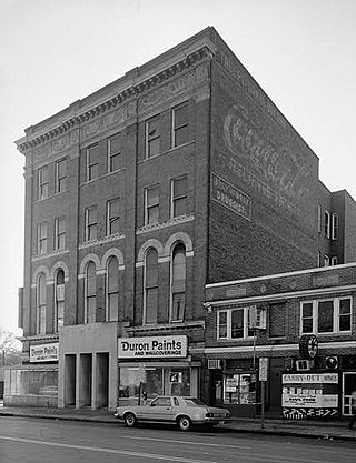
The True Reformer Building is an historic building constructed for the True Reformers, an African American organization founded by William Washington Browne. The building is at 1200 U Street, Northwest, Washington, D.C. in the U Street Corridor (Cardozo/Shaw) neighborhood. It was designed by John Anderson Lankford. The building was commissioned by the Grand United Order of True Reformers in 1902. It was dedicated on July 15, 1903.

<span class="mw-page-title-main">Whitelaw Hotel</span> United States historic place

The Whitelaw Hotel is a historic structure located in the U Street Corridor in Northwest Washington, D.C. It was listed on the National Register of Historic Places in 1993.

<span class="mw-page-title-main">Fourteenth Street Historic District</span> Historic district in Washington, D.C.

The Fourteenth Street Historic District is located in the Logan Circle and U Street Corridor neighborhoods of Washington, D.C. It was listed on both the District of Columbia Inventory of Historic Sites and the National Register of Historic Places in 1994. The area was then expanded on both lists in 2007.

<span class="mw-page-title-main">Shaw Junior High School</span> United States historic place

Shaw Junior High School, now known as Asbury Dwellings, is a historic structure located in the Shaw neighborhood of Washington, D.C. It has been listed on the District of Columbia Inventory of Historic Sites and on the National Register of Historic Places since 2008.

The Black Renaissance in D.C. was a social, intellectual, and cultural movement in Washington, D.C. that began in 1919 and continued into the late 1920s.

References

  1. 1 2 3 "10 Things to See & Do On U Street". Washington.org. March 21, 2016. Retrieved February 23, 2019.
  2. 1 2 Jones, Erica. "A Look Back at DC's 'Black Broadway'". NBC New York. Retrieved February 23, 2019.
  3. 1 2 3 "Census profile: Census Tract 44, District of Columbia, DC". Census Reporter.
  4. 1 2 Williams, Paul K. (2001). City within a City: Greater U Street Heritage Trail. Cultural Tourism DC. Retrieved February 27, 2019.
  5. 1888 U.S. Geological Service maps
  6. "U Street/Shaw". culturaltourismdc.org. Retrieved February 23, 2019.
  7. 1 2 3 Thomas, Briana (February 12, 2017). "The Forgotten History of U Street". Washingtonian . Archived from the original on April 4, 2018.
  8. Duke Ellington's Jazz Tour, Site Seeing Tours
  9. Wiltz, Teresa (March 5, 2006). "U Turn". The Washington Post . ISSN   0190-8286. Archived from the original on April 4, 2018.
  10. Geiling, Natasha (May 31, 2014). "Grab a Drink, on the Sly, at One of D.C.'s Former Speakeasies". Smithsonian . Retrieved April 4, 2018.
  11. Kaiser, Robert G. (April 22, 2004). "A City of Splendid Spaces, Great Events; 4 Landmarks Offer Washingtonians Gateways to a Capital Adventure". The Washington Post.
  12. "Historypin". Historypin. Retrieved February 23, 2019.
  13. Kaplan, Sarah (August 27, 2014). "Recording 'Black Broadway': A U Street oral history project aims to capture what once was". The Washington Post . ISSN   0190-8286. Archived from the original on November 4, 2016.
  14. 1 2 Steve Inskeep (April 8, 2008). "U Street Corridor: Tracing a D.C. Neighborhood's Comeback from 1968". NPR . Archived from the original on April 4, 2018.
  15. Lusane, Clarence Pipe Dream Blues: Racism and the War on Drugs South End Press, Boston 1991, ISBN   0-89608-410-8
  16. Kreyling, Christine. "Something Old, Something New," Planning; August/September 2006, Vol. 72 Issue 8, p34-39, 6p. Retrieved April 4, 2007.
  17. Hyra, Derek (June 12, 2017). "Selling a Black D.C. Neighborhood to White Millennials". Next City . Archived from the original on April 4, 2018.
  18. "The Difference A Decade Makes: Images Show Rapid Growth Of 7 D.C. Neighborhoods". Bisnow.
  19. "2011 Great Places in America". American Planning Association.
  20. Thomas, Briana A. (January 4, 2021). "Black Broadway in Washington, DC". www.arcadiapublishing.com. Arcadia Publishing. ISBN   9781467139298. Archived from the original on December 3, 2020. Retrieved June 1, 2023.
  21. Levey, Jane Freundel; Williams, Paul K. (2006). Midcity at the Crossroads: Shaw Heritage Trail. Cultural Tourism DC. Retrieved March 3, 2019.
  22. 1 2 "Building a Block of Prosperity in Shaw". March 20, 2000 via www.washingtonpost.com.
  23. "Chapter 20 Mid-City Area Element" (PDF). dc.gov. April 8, 2011. Archived (PDF) from the original on April 20, 2022. Retrieved February 25, 2023.
  24. "DRAFT DEVELOPMENT FRAMEWORK FOR A CULTURAL DESTINATION DISTRICT WITHIN WASHINGTON, DC'S GREATER SHAW / U STREET" (PDF). dc.gov. September 2004. Archived (PDF) from the original on August 11, 2022. Retrieved February 25, 2023.
  25. Census Tracts in D.C., D.C. government Open Data site
  26. 1 2 "DC 2010 Tract Profile - Population - NeighborhoodInfo DC". www.neighborhoodinfodc.org. Retrieved February 23, 2019.
  27. "District of Columbia - Inventory of Historic Sites" (PDF). District of Columbia: Office of Planning. Government of the District of Columbia. September 1, 2004. Archived from the original (PDF) on July 17, 2009. Retrieved August 8, 2009.
  28. "National Register Information System". National Register of Historic Places . National Park Service. March 13, 2009.
  29. "2011 Great Places in America". U Street NW, Washington, D.C. American Planning Association. Archived from the original on March 15, 2012.
  30. "About Us – Ben's Chili Bowl". benschilibowl.com. Retrieved December 1, 2016.
  31. 1 2 African American Heritage Trail. Cultural Tourism DC. 2003. Retrieved February 27, 2019.
  32. Smith, Kathryn S. (January 1, 1997). "Remembering U Street". Washington History. 9 (2): 28–53. JSTOR   40073294.
  33. "Music". The Washington Post. Archived from the original on November 9, 2012.

38°55′1.2″N77°1′46.5″W / 38.917000°N 77.029583°W / 38.917000; -77.029583