
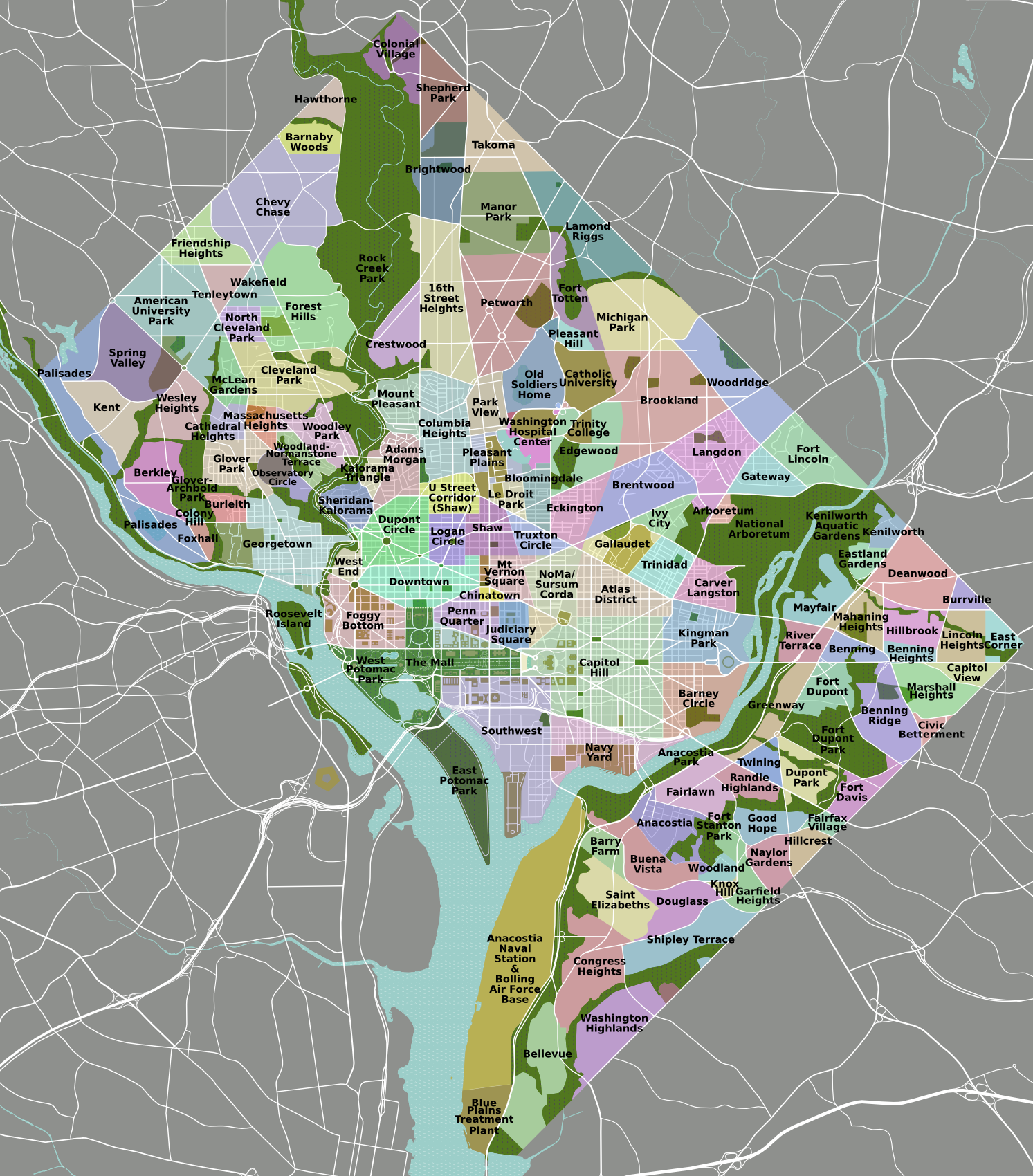
The Palisades, or simply Palisades, is a neighborhood in Washington, D.C., along the Potomac River, running roughly from the edge of the Georgetown University campus to the D.C.-Maryland boundary. MacArthur Boulevard is the main thoroughfare that passes through the Palisades.

Virginia State Route 110 (SR 110) is a primary state highway in Arlington, Virginia. Known as the Richmond Highway, the state highway runs 2.41 miles (3.88 km) from U.S. Route 1 (US 1) and Interstate 395 (I-395) in Crystal City north to I-66 in the Rosslyn neighborhood. SR 110 is a four- to six-lane freeway that parallels the Potomac River, providing a connection between several of Arlington's urban villages and major landmarks, including the Pentagon, which is the headquarters of the United States Department of Defense, the grounds of Arlington National Cemetery. The highway also provides access to SR 27, an east–west freeway between the Pentagon and the cemetery, and the George Washington Parkway that parallels the Potomac River. SR 110 is a part of the National Highway System for its entire length.

The Apotheosis of Washington is the fresco painted by Greek-Italian artist Constantino Brumidi in 1865 and visible through the oculus of the dome in the rotunda of the United States Capitol Building. The fresco is suspended 180 feet (55 m) above the rotunda floor and covers an area of 4,664 square feet (433.3 m2). The figures painted are up to 15 feet (4.6 m) tall and are visible from the floor below. The dome was completed in 1863, and Brumidi painted it over the course of 11 months at the end of the Civil War. He was paid $40,000 for the fresco.

The Fort Pitt Tunnel is a vehicular tunnel under Mount Washington in Pittsburgh, Pennsylvania. It connects the West End region on the southwest side to the South Shore neighborhood on the northeast side. The adjoining Fort Pitt Bridge on the northeast end connects to Downtown Pittsburgh. The tunnel carries traffic on Interstate 376 (I-376), U.S. Route 22, US 30, and US 19 Truck. The structure comprises two bores, each with two lanes of traffic. The inbound tunnel flows onto the top deck of the double-deck Fort Pitt Bridge, opposite traffic from the lower deck using the outbound tunnel. To accommodate the bridge, the northeast portals of the parallel tunnels are vertically staggered by 30 feet. The tunnel opened in September 1960, a year after the Fort Pitt Bridge.

Reese Court is a 6,000-seat multi-purpose arena in Cheney, Washington, on the campus of Eastern Washington University. It is home to the EWU Eagles basketball team and replaced Eastern Washington Fieldhouse in 1975. It was the host venue of the 2004 Big Sky Conference men's basketball tournament, and is located southwest of the football stadium, Roos Field.
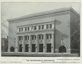
Minneapolis Auditorium was an indoor arena in Minneapolis, Minnesota. It hosted the NBA's Minneapolis Lakers from 1947 until they moved to the Minneapolis Armory in 1959. The arena held 10,000 people and was built in 1927. The building fell into obscurity after the opening of the Met Center in suburban Bloomington. It was demolished in 1988 to make way for the Minneapolis Convention Center.
MacArthur Stadium was a stadium in Syracuse, New York. Opened in 1934 as Municipal Stadium, it was used primarily for baseball and was the home of Syracuse Chiefs before they moved to P&C Stadium, in 1997. The ballpark had an initial capacity of 8,416 people; its capacity was increased to 10,006 before it was renamed in honor of General Douglas MacArthur in 1942. The stadium was razed in 1997 to provide a parking lot for the newly built P&C Stadium.
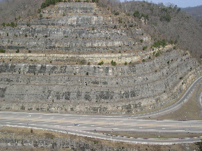
The Pikeville Cut-Through is a rock cut in Pikeville, Kentucky, United States, created by the U.S. Army Corps of Engineers, through which passes a four-lane divided highway, a railroad line, and the Levisa Fork of the Big Sandy River. It is one of the largest civil engineering projects in the western hemisphere, moving nearly 18,000,000 cubic yards (14,000,000 m3) of soil and rock, compared to the Big Dig and the Panama Canal. Dr. William Hambley, who served as mayor of Pikeville for 29 years, Robert H. Holcomb, Chamber of Commerce president, and Henry Stratton, local attorney, spearheaded the project.
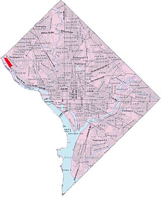
Potomac Heights is a neighborhood in Northwest Washington, D.C., overlooking the Potomac River from MacArthur Boulevard westward. Potomac Heights is the part of the Palisades bounded to the north by Loughboro Road and to the south by Chain Bridge and Arizona Avenue NW. It is part of Advisory Neighborhood Commission 3D in Ward 3, the far northwest corner of the Northwest Quadrant just north of Georgetown.

Berkley is a neighborhood in the Northwest quadrant of Washington, D.C.

The Philadelphia Transportation Company (PTC) was the main public transit operator in Philadelphia, Pennsylvania, from 1940 to 1968. A private company, PTC was the successor to the Philadelphia Rapid Transit Company (PRT), in operation since 1902, and was the immediate predecessor of the Southeastern Pennsylvania Transportation Authority (SEPTA).

The 40-Mile Loop is a partially completed greenway trail around and through Portland in the U.S. state of Oregon. It was proposed in 1903 by the Olmsted Brothers architecture firm as part of the development of Forest Park. One greenway expert calls it "one of the most creative and resourceful greenway projects in the country."

The Fred G. Redmon Bridge, also known as the Selah Creek Bridge, is a twin arch bridge in the northwest United States, in Yakima County, Washington. It carries Interstate 82 across Selah Creek near Selah, between Yakima and Ellensburg.
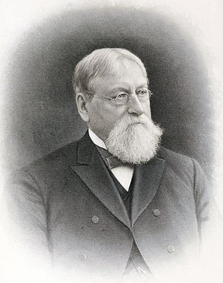
Crosby Stuart Noyes was the publisher of the Washington Evening Star.

The Alfred Lawson Jr. Multipurpose Center and Teaching Gymnasium is a 9,639-seat multi-purpose arena in Tallahassee, Florida on the Campus of Florida A&M University. It was built in 2009 and it is home to the Florida A&M men's and women's basketball teams and women's volleyball team. The arena replaced Jake Gaither Gymnasium, which is a 3,365-seat multi-purpose arena. The Al Lawson Center is the second biggest arena in Tallahassee, behind the 12,500-seat Donald L. Tucker Civic Center. The official ribbon cutting ceremony was April 8, 2009.

Battery Kemble Park is a park in Northwest Washington D.C., administered by the National Park Service.

The Parvin Bridge is a covered bridge located in Lane County, Oregon, U.S. near Dexter. It was built in 1921 as a single-lane 75-foot (23 m) bridge across Lost Creek, a tributary of the Middle Fork Willamette River.

The Cheshire Bridge spans the Connecticut River between Charlestown, New Hampshire and Springfield, Vermont.

The Ranger Bridge between Wells River, Vermont and Woodsville, New Hampshire, is a three-hinged steel arch truss bridge over the Connecticut River. It was built in 1923 to replace a 1917 bridge. This is the oldest steel arch bridge over the Connecticut River.

The Maple Street Bridge is a girder bridge in the northwest United States in Spokane, Washington. It spans West Central to Downtown, crossing over the Spokane River and the Peaceful Valley neighborhood. Along with the Division Street Bridge and Monroe Street Bridge, the Maple Street Bridge is one of several major bridges that cross the Spokane River.

