River Terrace (Washington, D.C.)

Last updated
River Terrace
Neighborhood
Map river terrace.jpg
Map of Washington, D.C., with the River Terrace neighborhood highlighted in red
Coordinates: 38°53′36″N076°57′29″W / 38.89333°N 76.95806°W / 38.89333; -76.95806
Country United States
District Washington, D.C.
WardWard 7
Constructed1937
Named for proximity to the Anacostia River
Government
  Councilmember Vincent C. Gray

River Terrace is an urban cul-de-sac neighborhood in Northeast Washington, D.C., on the eastern bank of the Anacostia River. River Terrace is Washington, DC's only planned unit development that has an unimpeded connection to and relationship with the Anacostia River.

Contents

The 2010 U.S. Census reported that River Terrace has a total of 1,962 residents who live in 998 households. In addition to single-family row houses and semi-detached houses, the neighborhood has about 75 rental apartments in 7 low-rise multi-family buildings. [1]

River Terrace is bounded by DC Route 295 (also known as the Anacostia Freeway) to the east; Benning Road, NE to the north; the Anacostia River to the west; and East Capitol Street to the south. [2] [3] In addition to the residences, the neighborhood consists of River Terrace Park (part of the National Park Service's 11-mile shoreline Anacostia Park); the River Terrace Shopping Center; the Varick Memorial African Methodist Episcopal Zion Church; a U.S. Postal Service Carrier Annex; and the River Terrace Education Campus, which opened in the fall of 2015.

History of the Development of River Terrace

River Terrace neighborhood at the intersection of 34th St and Clay Pl NE in September 2018 River Terrace Washington DC.jpg
River Terrace neighborhood at the intersection of 34th St and Clay Pl NE in September 2018

National Insured Homes Corporation, a building subsidiary of N. K. Winston & Co., Inc., was the original developer of River Terrace. The Winston company was a New York-based real estate and construction firm. Successor developers included Myron Davy and Frank J. Murphy, Jr. of the River Terrace Company. [4]

The River Terrace neighborhood began in 1937, built on 65 acres of rural, undeveloped land. The cul-de-sac neighborhood was bounded by Benning Road, NE; Anacostia Park; and the Baltimore & Ohio and Pennsylvania Railroad rights-of-way (DC Route 295 and the East Capitol Street Bridge were not yet built). [5] [6] The developer of River Terrace advertised it as being "eight minutes from downtown Washington, with street cars and buses close at hand." Most of the attached homes (later referred to as row houses or townhouses) were designed to sell for less than $5,000 each to working-class families. [7] [8]

In DC Government historical records, River Terrace is defined as part B of an area on the east side of the Anacostia River that the Government named Lily Ponds. In the 1880s, Civil War veteran Walter Shaw transplanted wild water lilies from his native Maine to a pond he created on his farmland and tidal wetlands located on the north end of the Anacostia River in Washington, DC. In 1939, the National Park Service acquired Kenilworth Aquatic Gardens, making it the only U.S. National Park devoted to aquatic plants. [9]

Architecture in River Terrace

George Thomas Santmyers, Jr., one of Washington, DC's most prolific architects of the 20th century, designed the houses in River Terrace. [10]

The initial two-story brick and masonry row houses were 15-feet wide on 100-feet-deep lots, and each home had two or three bedrooms. All the houses had steel casement windows and hardwood floors on the first and second floors, and many houses included a full concrete basement. [11]

A 1937 newspaper advertisement boasted that River Terrace is a "community of modern homes specifically designed for the two- to five-member family of average means." [8]

The same advertisement also said, "Adjoining Anacostia Park. This is a close-in [to downtown] restricted residential neighborhood." [8] Before 1948, exclusionary covenants were legally used in the United States for segregationist purposes.

River Terrace row houses in 1937 had hip roofs, and the exterior finishes were designed to resemble those of a rustic English village. [8] [12] Later houses were semi-detached, flat roofed, and 20-feet wide. [13] These houses resembled tract housing that had few architectural details, but they had large back yards. [14]

In 1938, the 100th home in River Terrace was completed, and the Federal Housing Administration approved River Terrace homes for insured financing. [15]

River Terrace Grows

By 1940, River Terrace had more than 300 finished houses, and the developer planned to build an additional 700 houses. [16] Also, construction was underway at the River Terrace Shopping Center, to include six stores and a group of offices. [17]

The following year, the United States entered World War II, and the influx of defense-related employees increased the demand for housing throughout the Washington, DC area. [6]

In 1944, the U.S. government passed the Servicemen's Readjustment Act, known informally as the G.I. Bill. The Act included numerous benefits for returning World War II veterans, including low-cost mortgages that enabled U.S. soldiers to purchase their first homes.

When the River Terrace neighborhood was built-out in 1958, it had about 1,000 single-family homes and 7 apartment buildings. [18]

Exclusionary Covenants

When home sales began in 1937, River Terrace was advertised as "a restricted residential neighborhood." The deed for each house included racially restrictive covenants that forbade the sale, lease, rental, or occupation of River Terrace homes to "negroes or any person or persons of negro blood or extraction." [8] [11]

In 1948, the U.S. Supreme Court ruled in Shelley v. Kraemer that exclusionary covenants are unconstitutional under the Fourteenth Amendment and are therefore legally unenforceable.

However, in April 1949, River Terrace's first black residents endured name-calling and vandalism of their property: "Two hours after a Negro family moved into a row house in a Northeast Washington white neighborhood [River Terrace], the house was stoned twice and a trash fire of undetermined origin was discovered in the back yard." [19]

A neighbor told the new River Terrace family that Ku Klux Klan activity in the neighborhood included cross burning. [19]

Two months later, the new family endured further hostilities: False classified advertisements were placed in three Washington newspapers, offering the home for sale and recruiting a cook-maid. [20]

Undeterred—despite being treated as second-class citizens—black families continued to buy homes in River Terrace. By 1951, River Terrace had both "white and Negro families living in the more than 500 dwelling units there." However, the River Terrace Elementary School under construction was "authorized [in 1949] as a white school." [21]

In Brown v. Board of Education of Topeka in 1954, the U.S. Supreme Court declared that state laws establishing separate public schools for black and white students are unconstitutional. [22]

Eventually, all of the initial white owners in River Terrace sold their homes, and frequently at a financial loss. This social phenomenon is known as white flight. [22]

History of the River Terrace Community Organization (RTCO)

In 1950, the River Terrace Community Organization (RTCO) formed to promote and protect the interests of the residents of the River Terrace neighborhood.

RTCO's founders agreed on an organizational title "that would differentiate their group from the prevailing [segregated social] system that had set up 'civic associations' as black groups and 'citizens associations' as white groups." [23] In other words, the RTCO wanted to represent all who live in the neighborhood; the previously formed Citizens Association of River Terrace did not. [5] [19] [24]

When the River Terrace Elementary School opened in 1952, the RTCO secured a permanent location for its monthly community meetings, held during the school year. [25]

History of the RTCO Newsletter

In March 1958, the RTCO published the first issue of its newsletter for River Terracers, named "On the Terrace." For each issue, a team of residents delivered the free newsletter to the door of each of the households in River Terrace. [26]

The first newsletter had 4 pages, including a report that officers were elected and committee chairmen were selected in October 1957 for the following volunteer, one-year terms: President, Vice President, Recording Secretary, Financial Secretary, Corresponding Secretary, Treasurer, Chaplain, Sergeant-at-Arms, Reporter, Parliamentarian, Education, Legislation, Recreation and Social, Public Service, Ways and Means, Membership, and Junior Civic Association. [27]

Subsequent issues of the newsletter included summaries of programs and activities of various committees, and articles and notes of general interest to residents. [26]

The January 1961 issue of "On the Terrace" had 20 pages. [28]

RTCO Accomplishments

In 1958, RTCO membership dues were $1.00 per year for individuals, and $1.50 per household couple. [29] In the 1950s, RTCO membership peaked at 724, and in 1963, RTCO had "1,000 members, the largest number ever to join in one year." [30]

In June 1959, the RTCO won first prize—$200—in the YMCA's Northeast Spring Cleanup Campaign. The YMCA cited the RTCO for its "all-out community effort" to recruit "several hundred residents to clean up debris, seed or mow lawns, put up fences, paint houses, or [make] other improvements." [31]

Over the decades, RTCO activities in River Terrace have included youth gardening programs, block parties, adult education classes, scout troops for boys and girls, a neighborhood-watch program, athletic teams, December holiday parties, "River Terrace Day and Parade" in June, and block captain programs. [28] These traditions have helped make River Terrace a tight-knit village with a strong sense of community. [3] [5] [23]

Related Research Articles

Anacostia Place in the United States

Anacostia is a historic neighborhood in Washington, D.C. Its downtown is located at the intersection of Good Hope Road and Martin Luther King Jr. Avenue. It is located east of the Anacostia River, after which the neighborhood is named. Like the other quadrants of Washington, D.C., Southeast encompasses many named neighborhoods, of which Anacostia is the most well known. Anacostia includes all of the Anacostia Historic District that was listed on the National Register of Historic Places in 1978. Often the name Anacostia is incorrectly used to refer to the entire portion of the city that is southeast of the Anacostia River. The Anacostia Business Improvement District is responsible for the development of the area.

Southeast (Washington, D.C.) Place in the United States

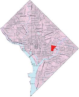
Southeast is the southeastern quadrant of Washington, D.C., the capital of the United States, and is located south of East Capitol Street and east of South Capitol Street. It includes the Capitol Hill and Anacostia neighborhoods, the Navy Yard, the Joint Base Anacostia-Bolling (JBAB), the U.S. Marine Barracks, the Anacostia River waterfront, Eastern Market, the remains of several Civil War-era forts, historic St. Elizabeths Hospital, RFK Stadium, Nationals Park, and the Congressional Cemetery. It also contains a landmark known as "The Big Chair," located on Martin Luther King Jr. Avenue. The quadrant is split by the Anacostia River, with the portion that is west of the river sometimes referred to as "Near Southeast". Geographically, it is the second-smallest quadrant of the city.

Southwest (Washington, D.C.) Southwestern quadrant of Washington, D.C.

Southwest is the southwestern quadrant of Washington, D.C., the capital of the United States, and is located south of the National Mall and west of South Capitol Street. It is the smallest quadrant of the city, and contains a small number of named neighborhoods and districts, including Bellevue, Southwest Federal Center, the Southwest Waterfront, Buzzard Point, and the military installation known as Joint Base Anacostia–Bolling.

Northeast (Washington, D.C.) Place in the United States

Northeast is the northeastern quadrant of Washington, D.C., the capital of the United States. It encompasses the area located north of East Capitol Street and east of North Capitol Street.

Congress Heights Neighborhood in Ward 8, United States

Congress Heights is a residential neighborhood in Southeast Washington, D.C., in the United States. The irregularly shaped neighborhood is bounded by the St. Elizabeths Hospital campus, Lebaum Street SE, 4th Street SE, and Newcomb Street SE on the northeast; Shepard Parkway and South Capitol Street on the west; Atlantic Street SE and 1st Street SE on the south; Oxon Run Parkway on the southeast; and Wheeler Street SE and Alabama Avenue SE on the east. Commercial development is heavy along Martin Luther King, Jr. Avenue and Malcolm X Avenue.

Kingman Park Place in the United States

Kingman Park is a residential neighborhood in the Northeast quadrant of Washington, D.C., the capital city of the United States. Kingman Park's boundaries are 15th Street NE to the west; C Street SE to the south; Benning Road to the north; and Anacostia Park to the east. The neighborhood is composed primarily of two-story brick rowhouses. Kingman Park is named after Brigadier General Dan Christie Kingman, the former head of the United States Army Corps of Engineers.

Barney Circle Neighborhood in the United States

Barney Circle is a small residential neighborhood located between the west bank of the Anacostia River and the eastern edge of Capitol Hill in southeast Washington, D.C., in the United States. The neighborhood is characterized by its sense of community, activism, walkability, and historic feel. The neighborhood's name derives from the eponymous former traffic circle Pennsylvania Avenue SE just before it crosses the John Philip Sousa Bridge over the Anacostia. The traffic circle is named for Commodore Joshua Barney, Commander of the Chesapeake Bay Flotilla in the War of 1812.

Hillcrest (Washington, D.C.) Neighborhood in Ward 7, United States

Hillcrest is a neighborhood in the southeast quadrant of Washington, D.C., United States. Hillcrest is located on the District-Maryland line in Ward 7, east of the Anacostia River.

Barry Farm Place in the United States

Barry Farm is a neighborhood in Southeast Washington, D.C., located east of the Anacostia River and is bounded by the Southeast Freeway to the northwest, Suitland Parkway to the northeast and east, and St. Elizabeths Hospital to the south. The neighborhood was renowned as a significant post-Civil-War settlement of free Blacks and freed slaves established by the Freedmen's Bureau. The streets were named to commemorate the Union generals and Radical Republicans who advanced the rights of black Americans during the Civil War and Reconstruction: Howard Road SE for General Oliver O. Howard; Sumner Road SE for Massachusetts Senator Charles Sumner; Wade Road SE for Ohio Senator Benjamin Wade; Pomeroy Road SE for Kansas Senator Samuel C. Pomeroy; and Stevens Road SE for Pennsylvania Congressman Thaddeus Stevens. The neighborhood name is not a reference to the late former mayor of Washington, D.C., Marion Barry, but coincidentally has the same spelling.

Southwest Waterfront Neighborhood in Washington, D.C., United States

The Southwest Waterfront is a mostly residential neighborhood in Southwest Washington, D.C. The Southwest quadrant is the smallest of Washington's four quadrants, and the Southwest Waterfront is one of only two residential neighborhoods in the quadrant; the other is Bellevue, which, being east of the Anacostia River, is frequently, if mistakenly, regarded as being in Southeast. For that reason, many residents of Southwest Waterfront will refer to themselves as living in "Southwest."

Fairlawn (Washington, D.C.) Neighborhood in Ward 8, United States

Fairlawn is a working class and middle class residential neighborhood in southeast Washington, D.C., United States. It is bounded by Interstate 295, Pennsylvania Avenue SE, Minnesota Avenue SE, Naylor Road SE, and Good Hope Road SE.

Navy Yard (Washington, D.C.) Place in the United States

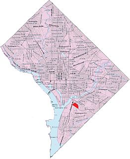
Navy Yard, also known as Near Southeast, is a neighborhood on the Anacostia River in Southeast Washington, D.C. Navy Yard is bounded by Interstate 695 to the north and east, South Capitol Street to the west, and the Anacostia River to the south. Approximately half of its area is occupied by the Washington Navy Yard, which gives the neighborhood its name. The neighborhood is located in D.C.'s Ward 6, currently represented by Charles Allen. It is served by the Navy Yard – Ballpark Metro station on the Green Line.

Greenway (Washington, D.C.) Neighborhood in Ward 7, United States

Greenway is a residential neighborhood in Southeast Washington, D.C., in the United States. The neighborhood is bounded by East Capitol Street to the north, Pennsylvania Avenue SE to the south, Interstate 295 to the west, and Minnesota Avenue to the east.

Kenilworth (Washington, D.C.) Place in the United States

Kenilworth is a residential neighborhood in Northeast Washington, D.C., located on the eastern bank of the Anacostia River and just inside the D.C.-Maryland border. A large public housing complex, Kenilworth Courts, dominates the area. The neighborhood is famous for the Kenilworth Park and Aquatic Gardens, a national park whose centerpiece is a series of ponds carved out of Anacostia River marshland. Visitors come especially during June and July to see the beautiful blooming water lilies and lotus flowers. In 1895 the name “Kenilworth” was first applied to the area by white real estate developer Allen Mallery, who named this neighborhood after Kenilworth Castle in England, the ruins of which can still be seen today in Warwickshire. Kenilworth Park, which includes the Kenilworth-Parkside Recreation Center, also carries the neighborhood name, though most of the park's area is actually located adjacent to the modern neighborhoods of Parkside and Eastland Gardens.

Avondale, Maryland Unincorporated community in Maryland

Avondale is an unincorporated community in Prince George's County Maryland, United States. It is contained between Eastern Avenue NE to the south, Queens Chapel Road (MD-500) to the east, and the Northwest Branch Anacostia River to the north and west.

Anacostia Historic District United States historic place

The Anacostia Historic District is a historic district in the city of Washington, D.C., comprising approximately 20 squares and about 550 buildings built between 1854 and 1930. The Anacostia Historic District was added to the National Register of Historic Places in 1978. "The architectural character of the Anacostia area is unique in Washington. Nowhere else in the District of Columbia does there exist such a collection of late-19th and early-20th century small-scale frame and brick working-class housing."

Four Corners, Maryland Neighborhood in Montgomery County, Maryland, United States

Four Corners is a neighborhood located in Montgomery County, Maryland, United States. Many residents of Four Corners consider the neighborhood to be a part of Silver Spring. The United States Census Bureau defines Four Corners as a distinct census-designated place (CDP). Prior to the 2010 U.S. Census, it was defined as a part of the Silver Spring CDP.

Franklin Knolls (Silver Spring, Maryland) Neighborhood

Franklin Knolls is a residential neighborhood located in Silver Spring, a census-designated place in Montgomery County.

The Douglass Community Land Trust (DCLT) is a land trust to create community-based affordable housing effort in Washington, D.C., was incorporated in September 2019 in conjunction with the proposed 11th Street Bridge Park development along the Anacostia River.

Housing in Washington, D.C. Overview of housing in Washington, D.C.

Housing in Washington, D.C. encompasses a variety of shelter types: apartments, single family homes, condominiums, co-ops, and apartments considered public housing. Washington, D.C. is considered one of the most expensive cities in which to live in the United States — in 2019, it was ranked in the top 10 of American cities with the most expensive homes.

References

  1. "U.S. Census Bureau, Profile of General Population and Housing Characteristics, 2010 Census Summary File 1 for Census Tract 96.04 in Washington, DC". American FactFinder. U.S. Census Bureau, U.S. Department of Commerce. 2010. Archived from the original on February 12, 2020. Retrieved October 15, 2015.
  2. Sturdivant, Christina (February 2015). "River Terrace Loses the Heart of Its Community". East of the River Magazine.
  3. 1 2 Gaines, Patrice (March 5, 1994). "Northeast's River Terrace Puts Emphasis on Activism". Washington Post.
  4. "Low-Cost Housing Project for Capital". Washington Post. June 6, 1937.
  5. 1 2 3 Wheeler, Linda (October 6, 1990). "Northeast's Well-Defined Island Oasis". Washington Post.
  6. 1 2 Wilgoren, Debbi (August 21, 2003). "Deep Roots Hold Steady Alongside Blighted Areas; Troubled Housing Being Transformed As Established Communities Endure". Washington Post.
  7. "River Terrace Built for New D.C. Residents (Advertisement)". Washington Post. September 26, 1937.
  8. 1 2 3 4 5 "Premier Showing Today: River Terrace (Display advertisement)". Washington Post. September 12, 1937.
  9. Cultural Landscapes Inventory, Kenilworth Aquatic Gardens. Washington, DC: National Capital Parks-East, Anacostia Park, U.S. National Park Service. 2010.
  10. "Will Build 14 Homes". Washington Post. June 9, 1938.
  11. 1 2 "Neighbors Held Vital Factor in Choosing Home (Advertisement)". Washington, DC. October 17, 1937.
  12. "Post Display Home Opens in River Terrace (Advertisement)". Washington Post. October 8, 1939.
  13. "Group of 12 in Northeast Ready to Show (Advertisement)". Washington Post. July 21, 1940.
  14. "River Terrace: $4650 (Advertisement)". Washington Post. April 21, 1940.
  15. "100th Home Is Opened at River Terrace (Advertisement)". Washington Post. November 13, 1938.
  16. "River Terrace: $4550 (Advertisement)". Washington Post. January 7, 1940.
  17. "River Terrace: Symbol of Our Growth (Advertisement)". Washington Post. May 5, 1940.
  18. Saperstein, Saundra (April 11, 1987). "River Terrace Hidden From Bustle of Traffic". Washington Post.
  19. 1 2 3 "Stones Greet Negroes Moving Into White Neighborhood Here". Washington Post. April 4, 1949.
  20. "Negro Family in White Area Again Plagued". Washington Post. June 13, 1949.
  21. Hall, Martha (December 31, 1951). "No title. Subject: River Terrace School". Washington Post.
  22. 1 2 Fletcher, Patsy M. (2013). Ward 7 Heritage Guide. Washington, DC: D.C. Historic Preservation Office, DC Office of Planning. p. 11.
  23. 1 2 Payton, F.J. (March 28, 1982). "Close to Home: 32 Years of Civic Pride". Washington Post.
  24. "Police to Probe Stoning of Home". Washington Post. April 5, 1949.
  25. Hall, Martha J. (January 24, 1952). "New Rambler School Found Ready for Use". Washington Post.
  26. 1 2 "Community Organization Publishes Newsletter". On the Terrace. 1 (1). March 1958.
  27. "Officers and Committee Chairmen of River Terrace Community Organization". On the Terrace. 1 (1). March 1958.
  28. 1 2 "Happy New Year". On the Terrace. 4 (1). January 1961.
  29. "Civic Responsibility, A Self-Imposed Trust". On the Terrace. 1 (1). March 1958.
  30. "From the President's Desk, A Thank-You Note". On the Terrace. 6 (2). June 1963.
  31. "We Won!". On the Terrace. 2 (3). June 1959.

Coordinates: 38°53′35″N76°57′31″W / 38.8931572°N 76.9585043°W / 38.8931572; -76.9585043